Salmon, South Fork
South Fork Trailhead to 15-Mile Marker (Upper South Fork Run)
| Difficulty | III |
| Length | 11 mi |
| Avg Gradient | n/a |
| Gauge | Salmon R a Somes Bar Ca |
| Flow Rate as of 24 minutes | 277 cfsbelow recommended |
| Reach Info Last Updated | April 2, 2024 |
This rarely run section of the upper South Fork Salmon flows out of the northern Trinity Alps and has a character and feel that's different than other sections of river in the watershed. Although listed as a boating run in Dick Schwind's classic 1974 guidebook, West Coast River Touring, this run is virtually unknown to modern boaters despite its accessibility, beauty, abundance of rapids, and amenable difficulty level. It goes by the name Upper South Fork Run or the more poetic Caribou Run. The run is constant gradient with few pools for its entire length.
The river has a big mountain feel near the abandoned mining town of Summerville with the snow-capped peaks of the high Trinity Alps as the upstream backdrop. The riverbed here is boulder-dominated, with a vast amount of these boulders having been flushed into the river in the late 1800s when gold miners washed the ancient river bars away with hydraulic cannons. Wood and logjams are common in this section, so be alert from the moment you put in, and check the Salmon River Hazards Map before heading out.
Not far below Summerville the river winds its way into a narrow and sinuous gorge cut through a diversity of bedrock types. Some of the bends in this gorge are fairly tight, and sometimes these bends also collect wood. In particular, a small ledge drop located 1/4 mile downstream of the first bridge you'll paddle beneath has a persistent strainer on river right just below the ledge; this rapid deserves a look but is difficult to identify in advance due to the sharp bends in the river.
The river remains narrow and tight until a little ways upstream of Petersburg, an abandoned town that still hosts a Forest Service fire station. This section is also boulder-dominated and views open up in both upriver and downriver directions.
Although t
...
Park at the well-marked South Fork Trailhead parking area and hike off-trail and down the steep slope to reach the river. There is no developed put-in. This is as easy as it gets: other places you may consider putting in from are more difficult.
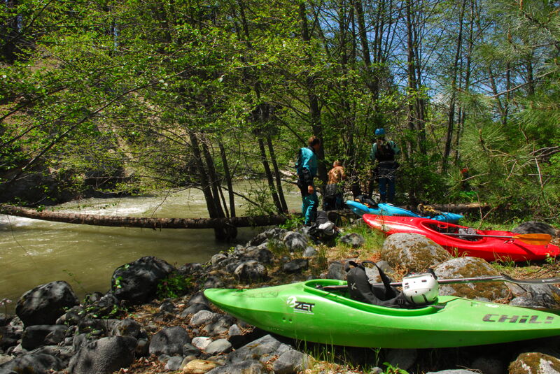
There is no developed put-in for this run, nor is there a trail from the South Fork Trailhead parking area to the river. To reach the put-in from the parking area, walk downhill in the direction of the river, veering to the right (downriver) when mining gullies force you to make route choices.
This is a Class III rapid that can have Class V consequences. Located on a broad left bend, there's a boulder bar on river left that pinches the river against the right bank. There are large boulders on the edge of the bar and the often catch wood, which may extend into the active channel. The river drops over a bouldery ledge and the runout is fast and split by a large boulder. About 70% of the current goes left of the boulder but it is easy to get pushed toward the right where a narrow passage exists between the boulder and the river right cliff wall. This passage is most often blocked by wood, creating a very dangerous strainer. Boaters must maneuver wuckly to avoid gettin gpushed right, and some craft--like small rafts or catarafts, may not have the room needed to turn in time. Scout this drop, but know that it comes up fast and isn't necessarily reconizable from above as something that holds such potential danger.
This undeveloped access point near the confluence of the EF SF and the SF Salmon can be used as a take-out or as a put-in to shorten the run. Access is possible but not easy.
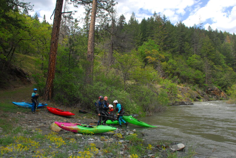
The take-out is on river right immediately upriver of the 15-mile marker on Cecilville Road, also known to some as Lagarde's. This is also the put-in for the South Fork Gorge run (IV/V). All of the river access points upstream of here in the Cecilville area are on private property, so please use this public access to avoid trespassing and a confrontation with landowners. Scout the take-out so you don't paddle past it.
May 14, 2023
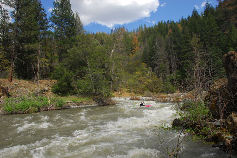
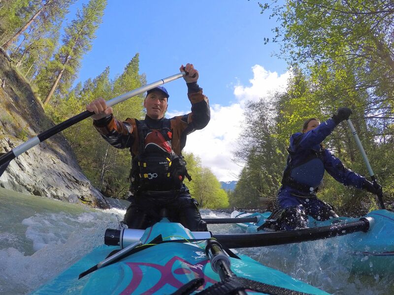
With high flows on the river we decided to head upstream for a Sunday afternoon trip on this section of the South Fork Salmon (note flow reported is for the mainstem at Somes Bar and flows were lower on this upper fork). We encountered a couple channel-spanning pieces of wood at the South Fork Trailhead but otherwise the run was relatively free of wood (a few pieces along the sides were in play). At these flows the rapids were class III but very continuous with small eddies.
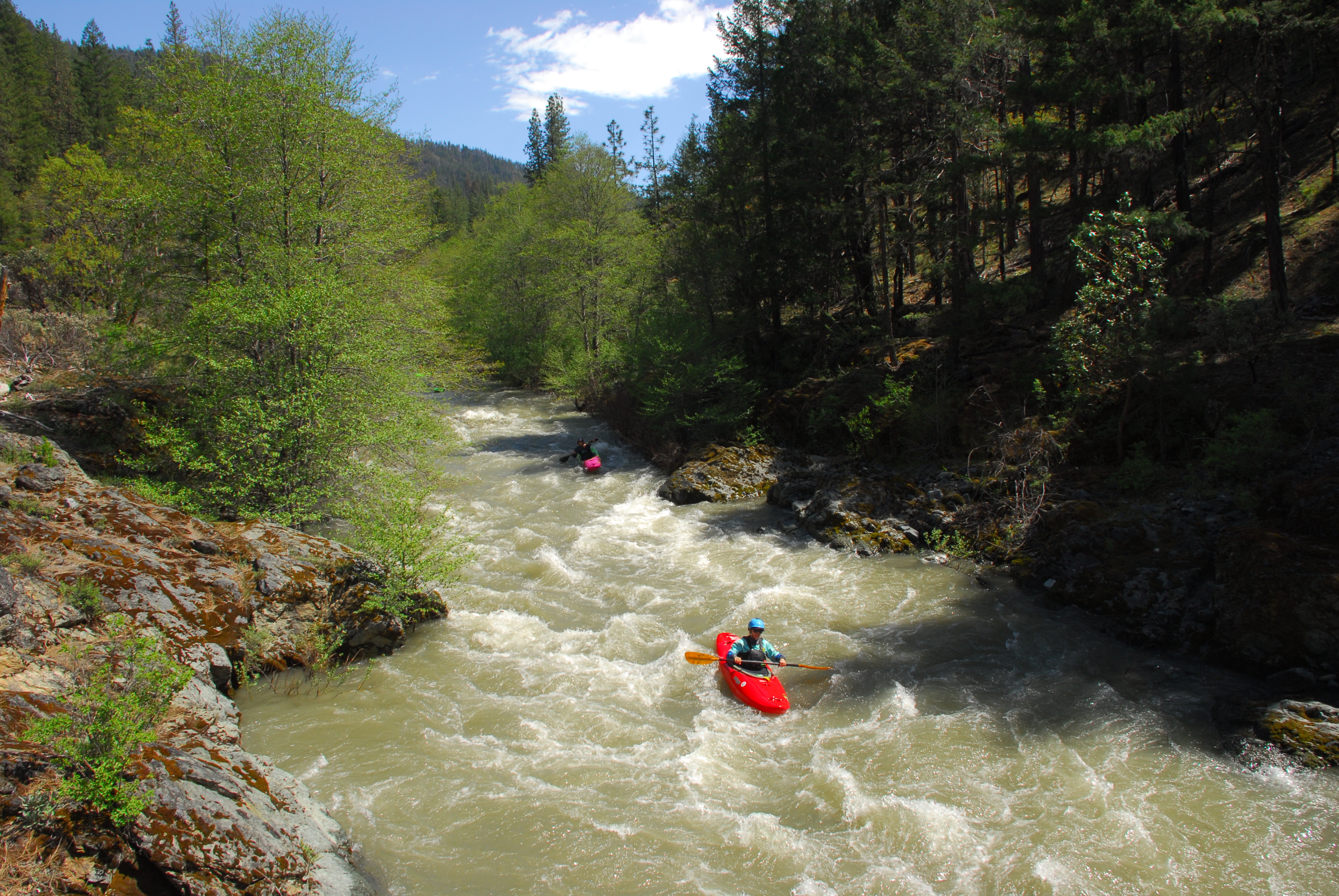
The Ledge Drop below the first bridge and just above the second bridge was the most challenging drop on the run and it came up quick. On this day the right slot was free of wood (one member of the partner flipped and went that way before rolling up).
After the second bridge the run started to open up a bit more and by the time we reached the East Fork of the South Fork, wood was less of a concern with a more open channel and slightly easier whitewater.
The entire run was 2.5 hours of float time with the addition of a short break for lunch. We were able to fill up our gas tank (cash only) and grab a drink at the Salmon River Saloon on one of the rare days it was open.
May 6, 2017
Hard to believe but after almost 20 years of paddling the Salmon River watershed, there's a class III run I've never done just 25 miles from home up the South Fork. So Lyra & I loaded up our cataraft and headed up there to check it out with high snowmelt flows. It was beautiful, fast, and felt a bit wild with 8500-foot snow-covered peaks of the Trinity Alps towering overhead. There's more to explore up there too...I'll definitely go back. This river is endless.
Flows were 7,000 cfs on the Somes Bar gage, dropping from a snowmelt runoff peak of 11,000 cfs a couple days earlier. This is the lower half of a medium flow. The East Fork South Fork adds a considerable amount of water about 4.5 miles into the run.