Little Wolf
A) Wolf River Road to Wall Street (Big Falls) (7.4 miles)

| Difficulty | II(IV) |
| Length | 7.6 mi |
| Avg Gradient | 12 fpm |
| Gauge | Tomorrow River Near Nelsonville, Wi |
| Flow Rate as of 38 minutes | 25 cfsbelow recommended |
| Reach Info Last Updated | March 4, 2025 |
NOTE: the USGS gauge for the Little Wolf went unfunded June, 2020. (We have left our virtual gauge intact just in case the gauge would be reactivated. Oddly, it continues to show the final reading from before the gauge was disabled!) Click here for the NOAA gauge: https://water.noaa.gov/gauges/ROYW3.
The reach as shown is the 'traditional' Little Wolf run. While this is certainly scenic, it does include a fair amount of flat/moving water paddling.
The reach begins with two miles of moving water interspersed with occasional low-grade rapids (class I-II), followed by nearly a mile and a half of fairly continuous class II whitewater, which makes the initial 2-mile access paddle a fair price to pay for the fun.
Those interested primarily in whitewater may wish to abbreviate the run (to just 3.55 miles) by taking out at Cty J.
Below Cty J, the remaining four miles of this reach contains one rapids, the Little Wolf Dells (class II). Rather impressive (relative to the scenery of the rest of the run), the Dells may seem a bit intimidating, with some expectation of challenging rapids. In reality, it is not overly challenging. It has a split channel entrance of perhaps 50-60 yards (either side works but the left seems to carry more water) followed by a constriction between rock walls that can form some sizable waves, relative to flow. This dells is located just above the back-waters of the impoundment of Big Falls dam. Take-out after paddling across the impoundment (about a half mile) to a public boat ramp just above the dam.
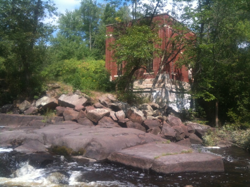
The class IV (in the rating for this reach) refers to a 'bonus' rapid, Big Falls, which is just downstream of the dam. Most boaters will fantasize lines, but be content to secure their boats for another run elsewhere, as this river is often combined with other area runs (various options on the Embarass or the Red).

This one is fairly stretched out (long), but still fairly low-grade.
Not particularly long or difficult, just some bigger rocks.
Not likely much of a rapids, just some big boulders to dodge through. This is followed by a fairly long, fairly continuous stretch of low-grade boulder garden rapids, almost the rest of the way to CTH.J.
A road which comes up from the south toward the river is named Pine Rapids Road, so I gather this must be Pine Rapids. Probably barely ratable as a rapids, just some rocks to dodge. (In my experience, topo maps and other common usage often labeled as 'rapides' any area which might impair free and clear passage of trappers' and traders' fully laden voyager canoes. Thus, quite often, areas of shallows and shoals, or a good peppering of rocks in the river, would be called a rapids, even if no gradient nor significant whitewater features are present.)
It appears there may be a bit of a wave/hole/drop as the river encounters a rock outcropping (primarily on river-right).
Immediately before you pass under McNinch Road, you'll encounter a nice little bit of a rapids. Then, less than a tenth mile downstream, another fine brief rapids. These are the 'warm up' for what lies not far downstream.
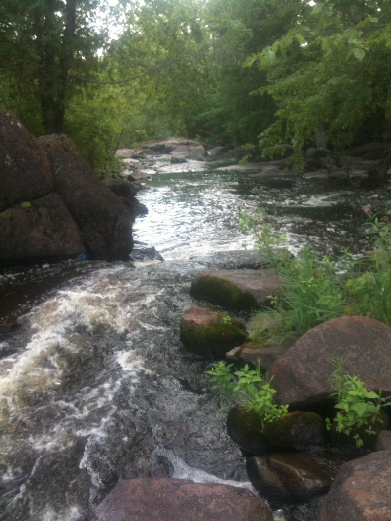
Almost immediately after a quick right-left zig-zag, an island splits the flow leading into a fine little dells. Generally a bit more water tends to go left of the island, but often either side 'works'. The river heads off to the right, passing through this scenic little dells. At most flows, there is not much more than a brief bit of class II (if that) rapids through here, so no reason for concern or alarm . . . just enjoy it, because all that remains is a flatwater paddle to the take-out above the Big Falls Dam.
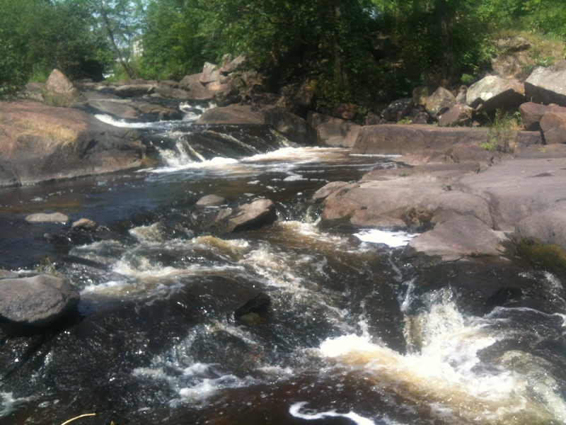
Most folks who are likely to paddle this river will take-out at a landing (with good parking) before the road bridge, and will be content to put their boats on/in the vehicle. Either while setting shuttle, or at the end of their paddle trip, they will 'scout' this drop and theorize the possible lines that could be run, before driving away. More experienced and adventuresome paddlers may be more likely to just drive here to look at the falls and (if flows, boats, skills, and bravado are all aligned) just do it as a 'park-and-huck' of this ~400' of class III+/IV action, skipping the relatively tame run upstream or downstream of this location.
Nov 13, 2016
note the kiddie potty in the boat...november and 60F is a great thing. really only 1 rapid is too low to paddle.
Nov 12, 2016
Ran at 120 cfs with the optimator, 16ft coleman. Really only one rapid that is a problem. lots of bump and thump but overall pretty read and run. The rapid that starts with a house on the left and and right turn.. the house had a play set when we ran it...is the one that forces you right and then goes shallow with lots of riocks and basically pins the 16 ft canoe.
Jul 6, 2016
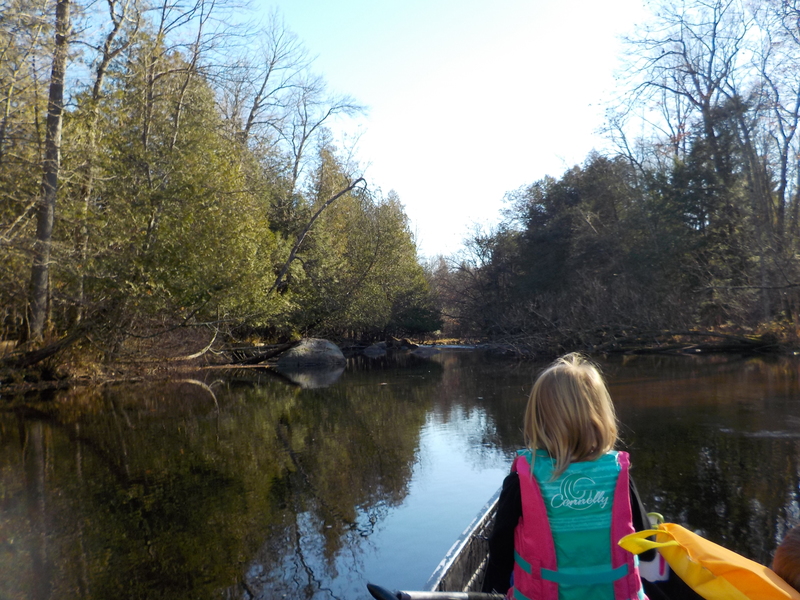
Ran this at 97cfs per virtual gauge, the visual gauge at J is gone now. I canoed it with my 2 kids in a 16ft coleman (forgot the camera). Passed about 12 kayakers who seemed to be having a good 4th of July paddle and I had nor major troubles navigating the rapids at this level with my big boat. The gradient is pretty continuous in the middle and gave me a good workout finding lines and maneuvering the 'Optimator' solo. I do float a little higher with the canoe, but paths through the class II drops were clear. A few of the rock jumble slides were bumpy and didn't have easy lines for me to hit, but only got hung up 2 times. The key to this river is picking solid lines, otherwise you are bump and thump, even at good flows as I recall. The dells section had some tight turns for the 16ft beast, but we managed. All of the snags were cut out from the the wolf river bridge to the pond. Not really any paths in the woods to scout the dells, but their were eddies that allowed for checking for snags. Just be warned that there is a fair amount of flat water at the start and after hwy J. The dells at a good level is worth it though, just point and go over the wave train.
I also ran this section at 2.66' in 2009 that I will post some pictures from. My notes say 'The dells were wavey, nice easy run with lots of flatwater, 36' @ J'. Also ran this at 46' @ J and said it was a 'good ride'. Sorry for the lack of discription, I didn't even know about AW on those trips.