Roaring Creek (Cheat River trib.)
County Rd. 3-12 to Cheat River
| Difficulty | IV |
| Length | 5.7 mi |
| Avg Gradient | 139 fpm |
| Gauge | Big Sandy Creek at Rockville, Wv |
| Flow Rate as of 42 minutes | 3.89 ftbelow recommended |
| Reach Info Last Updated | February 6, 2025 |
Summary:
WARNING: The river left hillside below the putin was recently logged and the wood situation in the top of this creek is significantly more pronounced because of it. The creek needs to be cleaned out as of April, 2006 and it may take time for debris from the logging operation to fully blow through the upper reaches.
The price of admission to this gem of a rhodedendron flush is an impossibly narrow and fairly steep top section that is scrapy Class IV at lower levels and pushy Class IV when some water is poured into it. The mile-by-mile gradient, courtesy of TopoZone, says it all: 220, 155, 85, 150, 140, 100. This creek seems almost too small when you launch near the roadside tire dump off Brandonville Pike. ItÂs not. But it is steep, blind and you can expect to be dealing with wood. Running the first half mile can be a time consuming endeavor. As the gradient suggests, the creek does ease up. But it never gets very wide, has few comfortable eddies and the rapids rarely let up, even in the easier sections. Overhanging rhodedendron is both a blessing  you can grab it to stop - and a curse  it will take your head off if you donÂt duck fast enough.
This creek invites disagreement over difficulty rating. Running it is a serious undertaking, yet it has a softer side. . The IV rating on this page matches the recent edition of A Canoeing and Kayaking Guide to West Virginia by Walbridge, et. al.
The Rapids:
The steep stretch at the top starts right below the putin and itÂs hard to break out the details here. There are usually a couple trees down, though, so be on the ready. When you portage around them, you might as well scout from river left to see whatÂs downstream. Though the drops are steep and wide, the creek is too small to have many lines. Watch for undercut rocks and a river right sieve halfway through this section. The climax up top is a tight, dynamic hard right to left turn
...
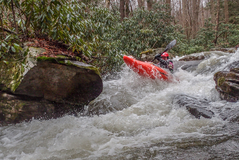
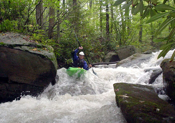
See any eddies? How about some Rhody? There are long stretches like this.

This picture was taken in the middle of a long series of steep drops. Trying to remember your moves here is a challenge
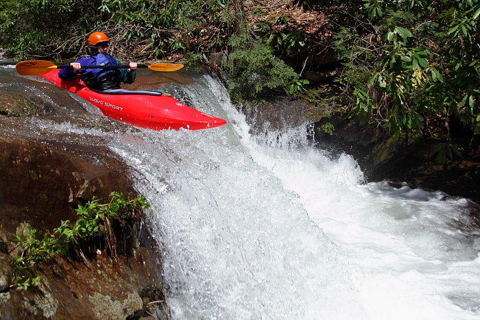
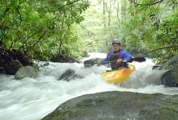
This is one of the smaller ledges in the lower section. Anyone have a picture of the big ones?
Mar 5, 2018
Take out = 39.505296, -79.641818 ...........
Put in 1 = 39.526880, -79.576286 (short hike to avoid some wood as of 2-17-18) ............
Put in 2 = 39.526101, -79.570932 (use this, after the wood is cleared, more parking here;)
Mar 5, 2018
2-17-2018
Helpful hints for running Roaring Creek near Albright, WV.
Using Steve Blade's video from 2-17-18 ............ ( https://www.youtube.com/watch?v=mRksXXWs03o&feature=share )............ & recently posted photos ( https://jeffmacklin.smugmug.com/Whitewater/2018/2018-02-17-Roaring-Creek-Albright-WV/i-vmvNXFn ) , Jim Snyder & I were discussing this run.
Jim Snyder noted some time-marks on this video & commented on photos with some rapid names and pointed out a few hazards
Below are condensed excerpts from our discussion:
New & updated info on 2-28-18, is marked with a “-+”
1:45 -+ important place to go way right if you ever run low flows.
3:36 -+ Pretty sure that is 'Paradise Rhodes'- named for the rhododendron tunnel effect, but the rhodies don't grow over the creek the way they used to
3:45 -+ At lower water, there's a terrible unrunnable trap exactly where you guys ran towards the left there. It is totally unnoticeable at your level. But if you go left there at lower levels, you'll have that trap named after you! There is basically a 3 rock pin, in waiting – unrunnable at low levels!
4:11 - Narrow Bridge, almost to the end of the sub-micro-creeking “upper section” … confluence of Lick Run at 4:40
4:42 - big rock marks entrance to Cyclops.
4:46 - is the top of “Cyclops”. We've called it 'Cyclops' for 20 years.
4:56 - The “Cyclops Sieve” is at the base of the big rock on river right. There's a lot of water going to the rock and a good chunk goes down into a sieve. The boat/camera almost runs over the sieve. It looks a lot worse at lower water.
4:57 -+ additional info from Jim: There's a tiny stick showing the spot. Eight out of ten runs, there's wood hooked up in there. At lower water, yesterday there was nothing at all there. I guess it's not as bad a sieve as I thought, but it's always better to scrounge left and stay safe from everything.
-The 4' ledge that follows waaay down at the bottom is called 'What the Hell' b/c there is a bad pinning rock hiding in the foam just right of center- where all the water goes.
5:27 -+ “What the Hell”, The piton/pinning rock (is under water) is right behind that tiny stick stuck in the top of the ledge, just 4' to the left of Steve's line. If anyone ever hooks up on that rock, expect a tough extraction. Steve's 'run out plan' after the ledge, is correct ... hedge right ... if the right shore is clear of dangerous wood. Lots of wood catches there.
5:35 -+ Is the drop we call 'Left' for obvious reasons- but when I blue angel w/Attila he often uses the right line to try to pass me there.
5:45 -+ And, that next drop is “Right'.
6:04 -+ to 6:12 – Ledge 1, right line. Nice big boof on the left line ... if there is no wood!
6:51 -+ Ledge 2
7:17 -+ “Slide”
7:40 - “Fun Key Hole”, (in video, Steve runs right boof) Jim says, “we run that center route at all levels- very narrow but clean”. Don't take the left slot, because there is a hidden piton and that slot tends to collect wood. If you have enough water, the right flat rock boof is good... clean landing.
Hope this helps for clean & fun runs on Roaring.
Feb 28, 2018
For an easier read ...... read the YouTube AUTHOR's COMMENTS here:...... https://www.youtube.com/watch?v=mRksXXWs03o&feature=share ......... AW's formatting here does NOT work!! ......
Helpful hints for running Roaring Creek near Albright, WV.
.
Using Steve Blade's video from 2-17-18 ( https://www.youtube.com/watch?v=mRksXXWs03o&feature=share ) & recently posted photos ( https://jeffmacklin.smugmug.com/Whitewater/2018/2018-02-17-Roaring-Creek-Albright-WV/i-vmvNXFn ) , Jim Snyder & I were discussing this run.
.
Jim Snyder noted some time-marks on this video & commented on photos with some rapid names and pointed out a few hazards
.
Below are condensed excerpts from our discussion:
(BTW, Steve has this same text in his YouTube author's comments. The time-stamps are hyperlinked to 'that spot' in the video)
1:45 -+ important place to go way right if you ever run low flows.
3:36 -+ Pretty sure that is 'Paradise Rhodes'- named for the rhododendron tunnel effect, but the rhodies don't grow over the creek the way they used to
3:45 -+ At lower water, there's a terrible unrunnable trap exactly where you guys ran, towards the left there. It is totally unnoticeable at your level. If you go left there at lower levels, you'll have that trap named after you! There is basically a 3 rock pin, in waiting – unrunnable at low levels!
4:11 - Narrow Bridge, almost to the end of the sub-micro-creeking “upper section” … confluence of Lick Run at 4:40
4:42 - big rock marks entrance to Cyclops.
4:46 - is the top of “Cyclops”. We've called it 'Cyclops' for 20 years.
4:56 - The “Cyclops Sieve” is at the base of the big rock on river right. There's a lot of water going to the rock and a good chunk goes down into a sieve. The boat/camera almost runs over the sieve. It looks a lot worse at lower water.
4:57 -+ additional info from Jim: There's a tiny stick showing the spot. Eight out of ten runs, there's wood hooked up in there. At lower water, yesterday there was nothing at all there. I guess it's not as bad a sieve as I thought, but it's always better to scrounge left and stay safe from everything.
-The 4' ledge that follows waaay down at the bottom is called 'What the Hell' b/c there is a bad pinning rock hiding in the foam just right of center- where all the water goes.
5:27 -+ “What the Hell”, The piton/pinning rock (is under water) is right behind that tiny stick stuck in the top of the ledge, just 4' to the left of Steve's line. If anyone ever hooks up on that rock, expect a tough extraction. Steve's 'run out plan' after the ledge, is correct ... hedge right ... if the right shore is clear of dangerous wood. Lots of wood catches there.
5:35 -+ Is the drop we call 'Left' for obvious reasons- but when I blue angel with Attila he often uses the right line to try to pass me there.
5:45 -+ And, that next drop is “Right'.
6:04 -+ to 6:12 – Ledge 1, (right line in video). Nice big boof on the left line ... if there is no wood!
6:51 -+ Ledge 2
7:17 -+ “Slide”
7:40 - “Fun Key Hole”, (in video, Steve runs right boof) Jim says, “we run that center route at all levels- very narrow but clean”. Don't take the left slot, because there is a hidden piton and that slot tends to collect wood. If you have enough water, the right flat rock boof is good... clean landing.
Names, So- it's:
Upper Roaring (Steeps), Cyclops, What The Hell, Left, Right, Ledge (looks like a 6' falls), Ledge (ledges are separated by 100 yds.), Slide, Nasty Slot (no photo/video), Fun Keyhole.
That's all the names.
Hope this helps for clean & fun runs on Roaring.
Feb 27, 2018
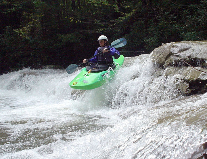
When the river slams in to a huge (river left) rock and diverts 90 degree right, widens and immediately turns left, take the large (river right) eddy that the camera is in. You are about to enter Cyclops. Steve is coming into that staging eddy.
There is a sieve on the right, near the bottom of Cyclops........ Go to this video and read the author's comments:........ https://www.youtube.com/watch?v=mRksXXWs03o&feature=share
Feb 17, 2018
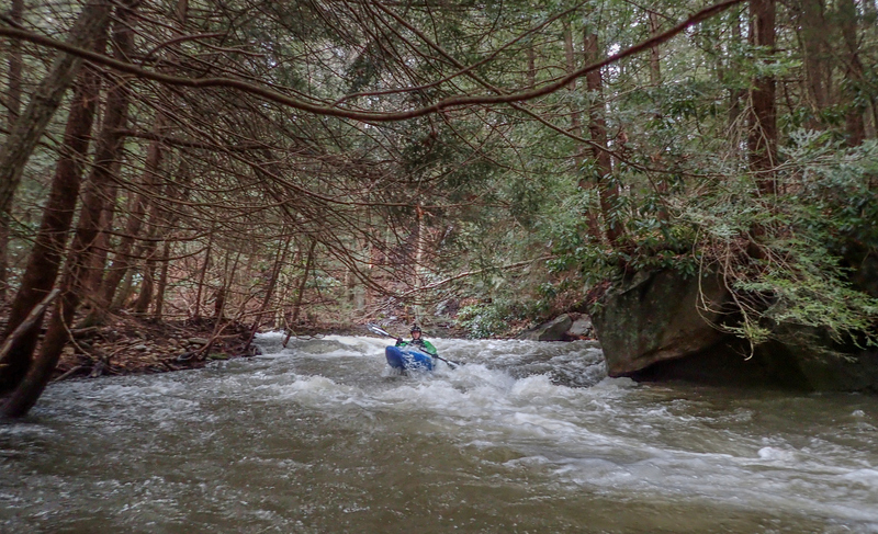
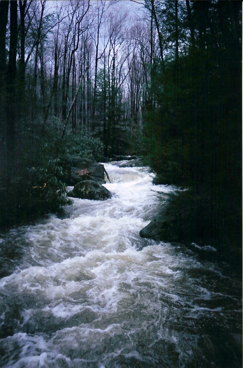
Upper section with a little more water than old 2003 image.
A video by Steve Blades with instructional timestamp comments by Jim Snyder is here: https://www.youtube.com/watch?v=mRksXXWs03o&feature=share
Gauge on Rt 26 bridge for this day/image was 6'+
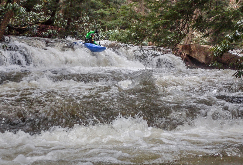
Feb 17, 2018
This is one of the first larger ledges, after the confluence of (Coal) Lick Run and after the boulder rapid Cyclops. Note: There is a sieve on the right, near the bottom of Cyclops........ Go to this video and read the author's comments:........ https://www.youtube.com/watch?v=mRksXXWs03o&feature=share