Roaring Creek (Cheat River trib.)
County Rd. 3-12 to Cheat River
Mar 5, 2018
2-17-2018
Helpful hints for running Roaring Creek near Albright, WV.
Using Steve Blade's video from 2-17-18 ............ ( https://www.youtube.com/watch?v=mRksXXWs03o&feature=share )............ & recently posted photos ( https://jeffmacklin.smugmug.com/Whitewater/2018/2018-02-17-Roaring-Creek-Albright-WV/i-vmvNXFn ) , Jim Snyder & I were discussing this run.
Jim Snyder noted some time-marks on this video & commented on photos with some rapid names and pointed out a few hazards
Below are condensed excerpts from our discussion:
New & updated info on 2-28-18, is marked with a “-+”
1:45 -+ important place to go way right if you ever run low flows.
3:36 -+ Pretty sure that is 'Paradise Rhodes'- named for the rhododendron tunnel effect, but the rhodies don't grow over the creek the way they used to
3:45 -+ At lower water, there's a terrible unrunnable trap exactly where you guys ran towards the left there. It is totally unnoticeable at your level. But if you go left there at lower levels, you'll have that trap named after you! There is basically a 3 rock pin, in waiting – unrunnable at low levels!
4:11 - Narrow Bridge, almost to the end of the sub-micro-creeking “upper section” … confluence of Lick Run at 4:40
4:42 - big rock marks entrance to Cyclops.
4:46 - is the top of “Cyclops”. We've called it 'Cyclops' for 20 years.
4:56 - The “Cyclops Sieve” is at the base of the big rock on river right. There's a lot of water going to the rock and a good chunk goes down into a sieve. The boat/camera almost runs over the sieve. It looks a lot worse at lower water.
4:57 -+ additional info from Jim: There's a tiny stick showing the spot. Eight out of ten runs, there's wood hooked up in there. At lower water, yesterday there was nothing at all there. I guess it's not as bad a sieve as I thought, but it's always better to scrounge left and stay safe from everything.
-The 4' ledge that follows waaay down at the bottom is called 'What the Hell' b/c there is a bad pinning rock hiding in the foam just right of center- where all the water goes.
5:27 -+ “What the Hell”, The piton/pinning rock (is under water) is right behind that tiny stick stuck in the top of the ledge, just 4' to the left of Steve's line. If anyone ever hooks up on that rock, expect a tough extraction. Steve's 'run out plan' after the ledge, is correct ... hedge right ... if the right shore is clear of dangerous wood. Lots of wood catches there.
5:35 -+ Is the drop we call 'Left' for obvious reasons- but when I blue angel w/Attila he often uses the right line to try to pass me there.
5:45 -+ And, that next drop is “Right'.
6:04 -+ to 6:12 – Ledge 1, right line. Nice big boof on the left line ... if there is no wood!
6:51 -+ Ledge 2
7:17 -+ “Slide”
7:40 - “Fun Key Hole”, (in video, Steve runs right boof) Jim says, “we run that center route at all levels- very narrow but clean”. Don't take the left slot, because there is a hidden piton and that slot tends to collect wood. If you have enough water, the right flat rock boof is good... clean landing.
Hope this helps for clean & fun runs on Roaring.
Mar 5, 2018
Take out = 39.505296, -79.641818 ...........
Put in 1 = 39.526880, -79.576286 (short hike to avoid some wood as of 2-17-18) ............
Put in 2 = 39.526101, -79.570932 (use this, after the wood is cleared, more parking here;)
Feb 28, 2018
For an easier read ...... read the YouTube AUTHOR's COMMENTS here:...... https://www.youtube.com/watch?v=mRksXXWs03o&feature=share ......... AW's formatting here does NOT work!! ......
Helpful hints for running Roaring Creek near Albright, WV.
.
Using Steve Blade's video from 2-17-18 ( https://www.youtube.com/watch?v=mRksXXWs03o&feature=share ) & recently posted photos ( https://jeffmacklin.smugmug.com/Whitewater/2018/2018-02-17-Roaring-Creek-Albright-WV/i-vmvNXFn ) , Jim Snyder & I were discussing this run.
.
Jim Snyder noted some time-marks on this video & commented on photos with some rapid names and pointed out a few hazards
.
Below are condensed excerpts from our discussion:
(BTW, Steve has this same text in his YouTube author's comments. The time-stamps are hyperlinked to 'that spot' in the video)
1:45 -+ important place to go way right if you ever run low flows.
3:36 -+ Pretty sure that is 'Paradise Rhodes'- named for the rhododendron tunnel effect, but the rhodies don't grow over the creek the way they used to
3:45 -+ At lower water, there's a terrible unrunnable trap exactly where you guys ran, towards the left there. It is totally unnoticeable at your level. If you go left there at lower levels, you'll have that trap named after you! There is basically a 3 rock pin, in waiting – unrunnable at low levels!
4:11 - Narrow Bridge, almost to the end of the sub-micro-creeking “upper section” … confluence of Lick Run at 4:40
4:42 - big rock marks entrance to Cyclops.
4:46 - is the top of “Cyclops”. We've called it 'Cyclops' for 20 years.
4:56 - The “Cyclops Sieve” is at the base of the big rock on river right. There's a lot of water going to the rock and a good chunk goes down into a sieve. The boat/camera almost runs over the sieve. It looks a lot worse at lower water.
4:57 -+ additional info from Jim: There's a tiny stick showing the spot. Eight out of ten runs, there's wood hooked up in there. At lower water, yesterday there was nothing at all there. I guess it's not as bad a sieve as I thought, but it's always better to scrounge left and stay safe from everything.
-The 4' ledge that follows waaay down at the bottom is called 'What the Hell' b/c there is a bad pinning rock hiding in the foam just right of center- where all the water goes.
5:27 -+ “What the Hell”, The piton/pinning rock (is under water) is right behind that tiny stick stuck in the top of the ledge, just 4' to the left of Steve's line. If anyone ever hooks up on that rock, expect a tough extraction. Steve's 'run out plan' after the ledge, is correct ... hedge right ... if the right shore is clear of dangerous wood. Lots of wood catches there.
5:35 -+ Is the drop we call 'Left' for obvious reasons- but when I blue angel with Attila he often uses the right line to try to pass me there.
5:45 -+ And, that next drop is “Right'.
6:04 -+ to 6:12 – Ledge 1, (right line in video). Nice big boof on the left line ... if there is no wood!
6:51 -+ Ledge 2
7:17 -+ “Slide”
7:40 - “Fun Key Hole”, (in video, Steve runs right boof) Jim says, “we run that center route at all levels- very narrow but clean”. Don't take the left slot, because there is a hidden piton and that slot tends to collect wood. If you have enough water, the right flat rock boof is good... clean landing.
Names, So- it's:
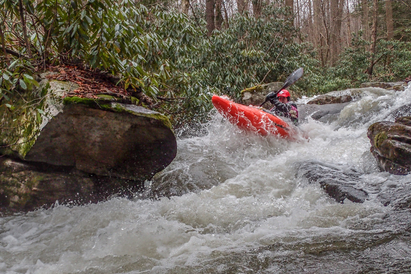
Upper Roaring (Steeps), Cyclops, What The Hell, Left, Right, Ledge (looks like a 6' falls), Ledge (ledges are separated by 100 yds.), Slide, Nasty Slot (no photo/video), Fun Keyhole.
That's all the names.
Hope this helps for clean & fun runs on Roaring.
Feb 27, 2018
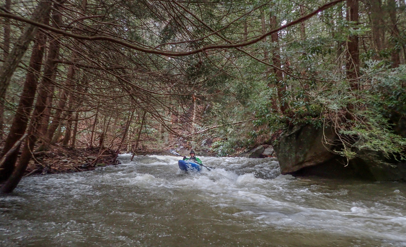
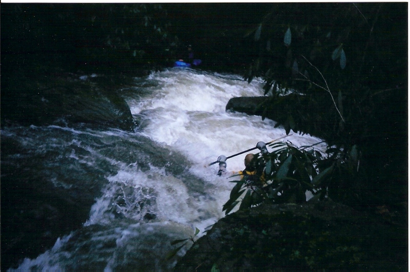
When the river slams in to a huge (river left) rock and diverts 90 degree right, widens and immediately turns left, take the large (river right) eddy that the camera is in. You are about to enter Cyclops. Steve is coming into that staging eddy.
There is a sieve on the right, near the bottom of Cyclops........ Go to this video and read the author's comments:........ https://www.youtube.com/watch?v=mRksXXWs03o&feature=share
Feb 27, 2018
Take out =
39°30'18.3'N 79°38'32.4'W
39.505083, -79.642333
....................
Put in = 39°31'36.6'N 79°34'35.9'
39.5268333, -79.5788276
Feb 17, 2018
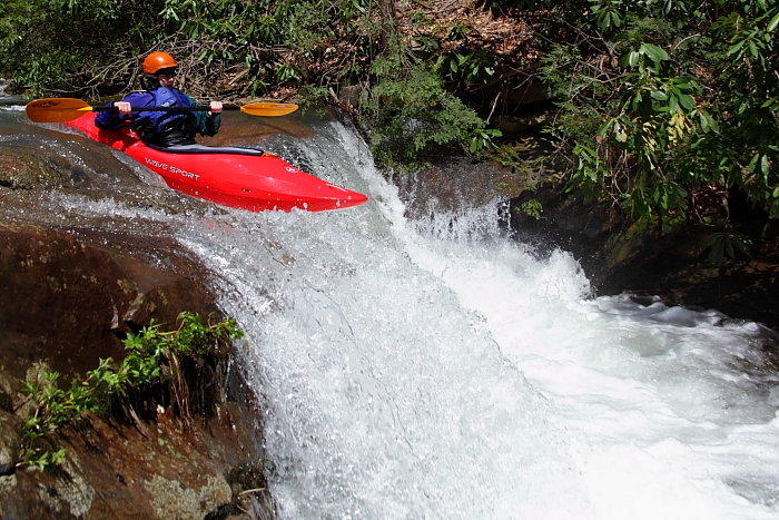
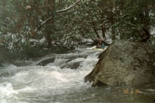
Upper section with a little more water than old 2003 image.
A video by Steve Blades with instructional timestamp comments by Jim Snyder is here: https://www.youtube.com/watch?v=mRksXXWs03o&feature=share
Gauge on Rt 26 bridge for this day/image was 6'+
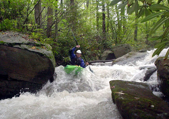
Feb 17, 2018
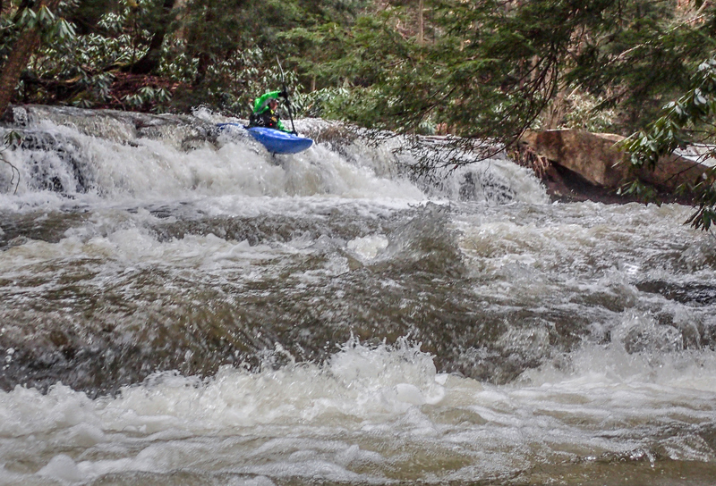
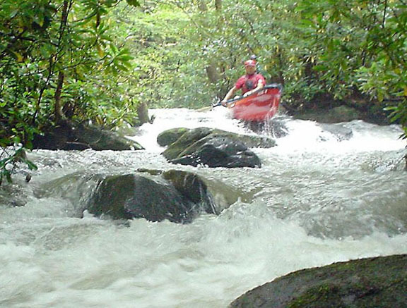
This is one of the first larger ledges, after the confluence of (Coal) Lick Run and after the boulder rapid Cyclops. Note: There is a sieve on the right, near the bottom of Cyclops........ Go to this video and read the author's comments:........ https://www.youtube.com/watch?v=mRksXXWs03o&feature=share
Apr 28, 2011
6' on the rock gauge near the takeout
Jun 5, 2006
I did this by putting in at the confluence with Lick Run. It's not clear from the above description where others put in, but the section above this confluence would require a tremendous amount of water---above here is very tiny.
In 2004, a large tree blocked the entire creek--don't know if it's still there.
I wouldn't call it one of the 50 classics, by any means. The good section was very brief.
Jan 15, 2004
The gauge at the take-out was buried under water. The first mile equated to a semi-controlled flush down the mountain side. Everyone had a good day except for Chris from NY who swam three times and lost his sanity along with his pride. This was one of the most exciting runs I've experienced.
This is a good view of what the upper section of Roaring was like. There were only a few eddys in the first mile and the drops just kept coming. The first mile has a gradient of 220 fpm.
Sep 20, 2003
This wood was easy to see. There are some other twisting rhododendron covered drops where down river visibility is poor and wood could accumulate (especially in the upper section). Be comfortable in catching micro eddies if you choose to boat scout.
Bolder/rocky drops typical of the very tiny & narrow upper section. Some areas are so narrow that a short boat will be wider than the creek!
Mark was able to navigate his Probe 12 down the creek, but I think he left a lot of red paint/plastic on rocks. We needed more water.
This is a very beautiful creek. It does get busy at times, so catch a few eddies and take in the sights.
The lower section is more 'ledgy' in nature with a couple of slides thrown in for fun.
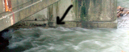
This is what you will see when you are on river right on the down stream side of the bridge. The arrow is pointing to a small step. Make sure the water level is above this step, otherwise you should be arrested for boat abuse :-).
Just a tip, take out a few feet above this bridge,, much poison ivy on the banks below the bridge.
Jan 1, 1900
Nice, cold, wintry day. Teeny, tiny microcreek. After this, we headed over to Friendsville and ran Bear Creek, which was running about 80 cfs.
Jan 1, 1900
This is a good level for a low water run without scraping on too many rocks.