Milwaukee
B) Grafton Dells: Bridge Street to Lime Kiln Park Landing (PnP or 1.2 miles)
| Difficulty | I-II(III) |
| Length | 1.2 mi |
| Avg Gradient | 30 fpm |
| Gauge | Milwaukee River Near Cedarburg, Wi |
| Flow Rate as of 56 minutes | 141 cfsbelow recommended |
| Reach Info Last Updated | August 17, 2025 |
NOTE: Due to problems within the AW system, many 'virtual' gauges are not working correctly. For this section, we normally subtract the flow of Cedar Creek from that of the Milwaukee River Near Cedarburg (downstream of the confluence with Cedar Creek) to roughly approximate flow of Milwaukee River in Grafton.
Note that this does not take into account the lag (difference in time/flow) between the two locations, nor does is take into account that (at the best feature, Lime Kiln Park Wave) the flow is divided by an island, so technically, only something near half the flow is actually passing over the bedrock which forms that wave.
Until AW programmers can bring all virtual gauges back online, this section is reporting the Milwaukee River at Cedarburg flow (after the confluence with Cedar Creek). To compare to past experiences, users will have to look at the flow in Cedar Creek and do the subtraction themselves.
Quick Facts:
Location: Downtown Grafton to south of town.
Put-in: 1357 14th Avenue, Grafton (use street-side parking; do not park in business lots!)
Take-out: 43.3036, -87.9565 (Lime Kiln Park, Grafton, Canoe Landing)
Shuttle Length: 1.3 miles/4 minutes
Put-in is approximately 725' elevation. (Per scan of GoogleEarth data.)
Take-out is just about right at the 690' elevation contour line on topo maps.
Thus elevation change is approximately 35'.
Class/rating is NEVER enough to decide if you should run a river/rapids! Far more important than gradient and class/rating should be other less-quantifiable 'character factors': continuous versus pool/drop, wide-open routes versus constricted technical rapids, wide-channel (with multiple routes) versus narrow channel (with essentially one route), gradual river banks versus rocky shores or steep-walled gorges, et cetera.
...
The dam at Bridge Street (immediately above our listed put-in) has been a point of significant controversy. There is a mandate that all dams must be able to handle a 0.5% chance rain event ('500 year flood'). There was discussion about creating fish passage (as has been done with the dam at Thiensville), but in this instance, it was overridden by concern to keep the dam as a barrier on the Milwaukee River to spreading of VHS (viral hemorrhagic septicemia) and various invasive species. A binding referendum was passed (April 6, 2010) to preserve the Bridge Street dam until at least 2019. The dam has been modified to include a release gate, regulating flow only at times of high water.
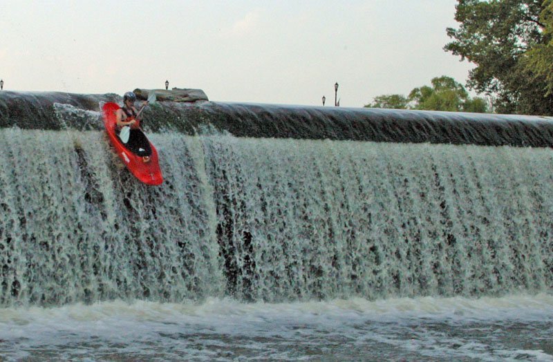
While this dam has been run (as shown in photo), we do not recommend it. At moderate-to-high flows, the boil-line is well out from the dam, and would be difficult to escape. At lower flows (such as pictured), there are reportedly some places where the landing is quite shallow, thus piton potential is problematic.

For those (extremely rare) paddlers coming from further upstream and planning to continue downstream, there is a marked portage around the dam on river-right. Whitewater paddlers generally will ignore the signage directing those boaters to a put-in at the south end of this dead-end stretch of 14th Avenue. Our suggested put-in lies just behind the first building (closest to Bridge Street). A paved area sloping down to a glass-craft studio (on the south end of the building) leads to shore areas convenient to put in from. (The proprietors of that business have been quite genial on the few occasions I have chatted with them.)
From this put-in, you have strong currents to contend with (at least, at good boatable flows). Immediately downstream there is a fair-sized island. More of the flow heads to the left of the island, which is usually the preferred (more interesting) route.
As soon as the large island ends, look for a rock-outcropping on river-left, and catch the eddy behind it. For anyone 'old-school' enough (especially old-school longer boats or squirt boats), this is a great squirt spot. At flows above 800 cfs (perhaps even down to 500 cfs), there is great depth here, and a sharp eddy line for bow-stalls, stern squirts, and whatever other squirt moves your boat and your ability or interests allow.
For beginner boaters, this is a great practice spot. Paddle to the 'top' of the eddy, peel-out into the flow, and charge back into the bottom of the same (river-left) eddy.
There is also a much larger eddy on river-right (with much less-defined eddyline). This allows paddlers to practice ferrying from one eddy to the other. (With bow pointed upstream, trying to move laterally across the flow, losing as little distance downstream as possible! For an added exercise, try doing a 'back ferry': with bow downstream, backpaddling, again trying to move laterally across, losing as little distance as possible!) Another fine practice maneuver is paddling up the eddy, peeling out (angling bow into the current, to then head very briefly downstream), then charging hard for the eddy on the opposite side, paddling up that eddy to do a peel-out and charge back into the original eddy. (I call these 'figure-8's'.)
Each of the above make excellent practice on dealing with currents and eddies, managing boat angle, changing boat lean, and other essential beginner swiftwater/whitewater skills.
As previously mentioned, there is generally very good depth in the main flow here, so it makes a fine spot to practice rolling (intentionally or otherwise) in current. However, anyone missing a roll and ending up swimming may find it will take some distance downstream to be able to get boat and boater ashore. (There is not significant rapids or danger, just strong currents in a relatively wide section of river.)
We highly recommend paddling close to shore in areas of high rock-wall 'dells' (mostly on river-left along this stretch of river), to more fully take in their detail, with little caves, nooks and crannies, ferns, moss, and cliff swallows. (Sometimes scenic beauty is best appreciated from a distance, sometimes best up-close and personal!)
Head over to river-right, charging to right-shore just past a rocky outcropping, to catch an eddy just past a small bit of a wave. Smooth, easy surfs are possible here.
OK, there really are at least a few other spots for squirts and minor surfs (depending upon flows). However, the second more significant one will be at river-right, as you pass another rock outcropping on shore, and encounter a couple decent sized rocks in the river (covered but visible around 800 cfs, obviously visible at lower flows, imperceptable at higher flows). A decent shore-eddy allows staging to paddle up toward the rocks, plow the bow (or stern) in just toward center-stream of them and get vertical. There is good depth immediately adjacent to them for stalls and squirts (and rolling if you have to), but there will be some large rocks if you miss your first or second roll attempt.
Width: 125' Length: 250'
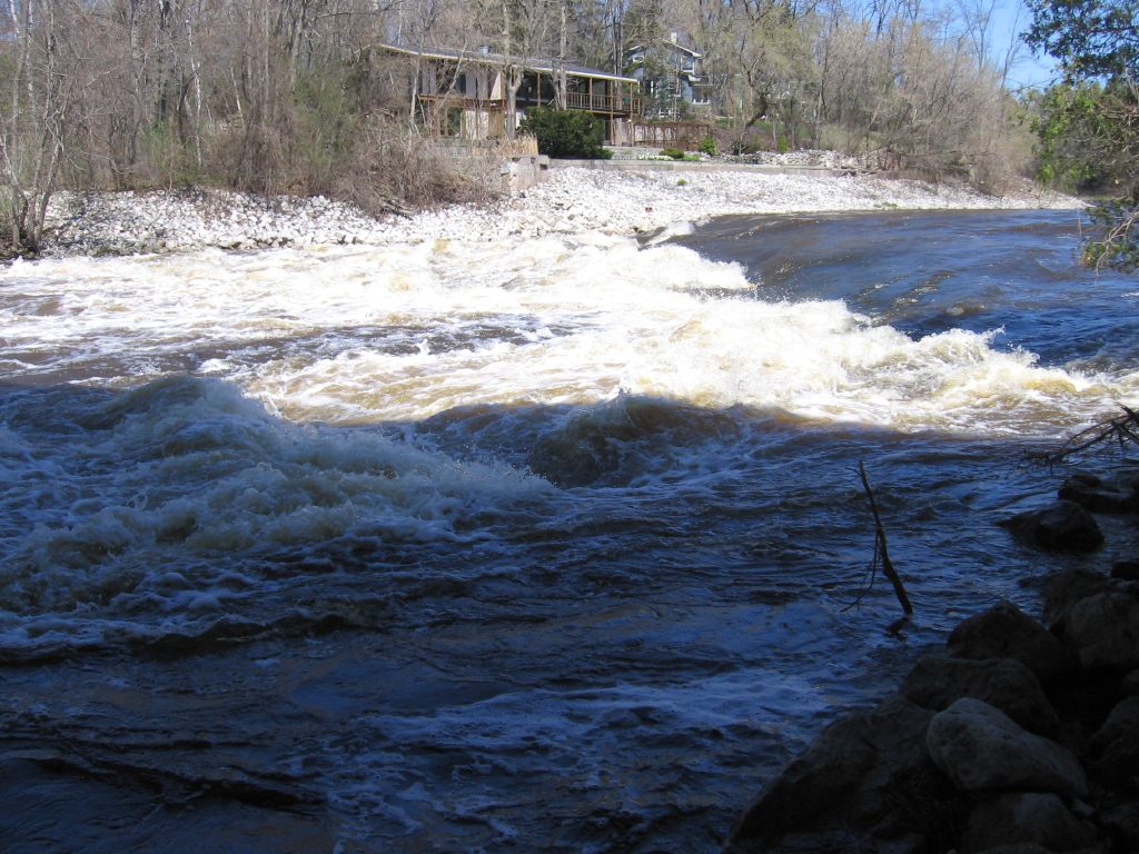
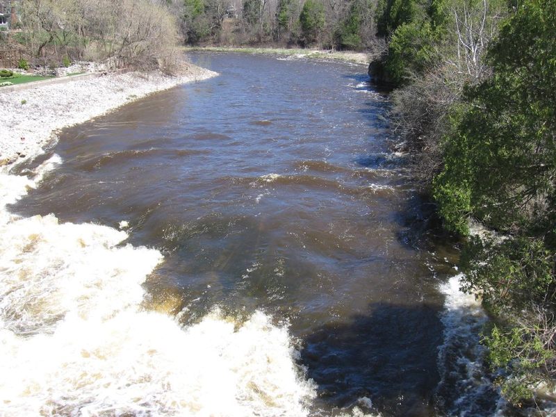
A sloping bedrock ledge provides an exciting/wild ride for novice boaters, but only minor potential for whitewater play. Specifically, there are minor play opportunities at low-to-moderate flows (on the order of 200-600 cfs or so). As levels rise, some play may still be possible, but it becomes tough to get repeat play, as eddies are few and current is pushy.
There are a couple different choices of route down this drop (and it's runnable about anywhere with high enough flows). The most usual routes are fairly well to the right (but about 20-30 feet offshore) or well to the left (about 10-15 feet offshore). Either way, some maneuvering and quick reactions and bracing are likely to be necessary as the currents twist and turn off various bedrock and rock-rubble intrusions into the flow from the base of the main ledge and the runout beneath the bridge.
This feature should be scouted before putting on upstream, to be certain of your comfort with running it (at the water level you have when you are there), since both sides of the river are private residential property with signage against trespass!
If you feel you'll need to portage, you have three options:
A) KEEP YOUR FEET WET! (Not a very good option since there is much rocky rubble (river-right) and slippery bedrock (mainstream and river-left), along with strong currents at best boatable flows.)
NOTE: Many people (both fishermen and boaters) seem unaware that Wisconsin's law was changed many years back to 'keep your feet wet'. If you are on dry land which is not public parkland or officially designated public portage path, you are trespassing!
B) While setting shuttle, knock on the door (either home, river-right or river-left) to ASK permission to (very briefly and most directly) traverse downstream. (If you don't find either owner home to get a 'Yes', then it's a 'NO!')
C) If you won't/don't do either of the above, you need to skip the upper stretch and put-in either here (at the Falls Road bridge, downstream of the main drop) or someplace downstream!
Note: there may be some random remaining rebar (metal rods) and there is definitely much rock rubble in the river at these ledges. Numerous large rocks and bedrock splines lie just beneath the surface (especially in areas closest to either shore) and will be brutal on boaters who flip or swim. If you aren't justifiably confident that you won't flip or swim, it may be best not to run this drop or play on any of the features here!
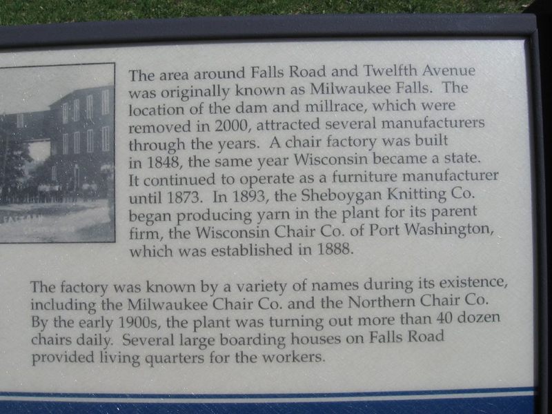
Passing under Falls Road, a quarter-mile paddle (through uneventful 'bobble water' shoals) brings you to Lime Kiln Park, where you'll see a small rocky prominence just prior to the second former dam-site. Removal of this relatively short (but classic 'killer' low-head) dam was completed during winter, 2010/2011.
The river is very deep where the dam was (making it a very popular fishing hole). Again, there may be some very decent eddylines with great depth. (Another fine place for a squirt boat or longer 'old-school' playboat, to do bowstalls and sternsquirts, though realistically, the eddylines and opportunities are better in the two spots previously mentioned.)
Immediately downstream, an island will be encountered (likely with a collection of wood broached at its head). The left channel is minor riffles and rips, leading to a slightly undercut wall as the river is diverted to the right to rejoin the other channel.
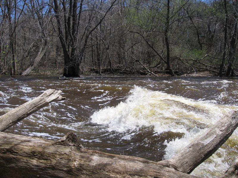
Width: 55' Length: 100'-250'
The right channel (around the aforementioned island) twists right then left, and trips across a short bedrock intrusion ('ledge').
Minor play may be possible as low as perhaps 250 - 1000 cfs, however the river is shallow immediately downstream, and holds many rocks, so any flips or rolls will be brutal in these low ranges. (One local boater suffered a dislocation here and dissuades all he talks with from playboating here!)
As levels head into the 1000-1300 cfs range (on the listed 'virtual gauge') the wave starts to build nicely (though still backed up rather immediately by shallow rock, and the eddy and shape of the wave can make it challenging to regain the wave).
As levels hit the 1300-2000 cfs range (and possibly a bit higher), this is great for fast, powerful surfs (though seldom, if ever, retentive enough for full-out rodeo moves). I'm not sure at what level (on the high end) it disappears or becomes unplayable, though generally it is washed out above 3000 cfs.
Just downstream, where the currents rejoin (at the end of the small island), depth is generally sufficient for bow-stalls and stern-squirts, as well as fine ferrying and eddy practice for beginners. This makes a fine park-and-play spot (even having warm bathrooms for changing out of the elements), though there is really just the one good wave/hole to play here.
Downstream, a pleasant bit of riffles leads to the Lime Kiln Park canoe landing (river-right).
This is the recommended put-in for canoes and for less experienced (non-whitewater) kayakers, and our recommended take-out for experienced whitewater boaters interested in just the best of whitewater on this part of the river.
Downstream of this point, while the river is certainly scenic and enjoyable, there is little more than riffles and rips (class I-I+) at virtually all flows.
Just downstream lies Grafton Dells. This is a fairly scenic and rather popular stretch of river for novice canoe trips. Riffles and rips (depending upon water level) will be found as the river splits around a pair of large (6-7 acre) islands. Wildlife is commonly seen while boating this reach (deer, heron, turtles, etc.). Deadfall and strainers may be a problem in one or more channels.
For those who do proceed downstream, the recommended take-out is at Hwy.T, since the river becomes increasingly flat and slow below there, containing no additional whitewater or swiftwater.
This is the first available landing for those paddling downstream of the main whitewater stretch, doing the Grafton Dells.
CTH.T is approximately 1.5 miles downstream from the canoe launch/landing, and sits at ~673' elevation. Thus, elevation change from LKP Canoe Landing to there is approximately 17' (Gradient just over 10 FPM, versus the 30 FPM on the listed 1.2 mile whitewater section.)
Cedar Creek can be a fine 'companion run'. Those looking for the best whitewater action on it take out where it crosses CTH.T, but it could also be continued down to this confluence (and beyond, to next listed access).
From CTH.T to CTH.C one encounters random rocky shoals interspersed with flat, but well-flowing water.
(For canoeists and recreational kayakers putting in at the Lime Kiln Park launch site, this is 3.3 miles downstream.)
Downstream of CTH.C, the shoals quickly diminish (in length and frequency).
The next access point would be another 3 miles downriver at Highland Road (mile 7.5/6.3). However, this is not recommended as a take-out, due to the lack of good parking.
Not far beyond, one is pretty much in the backwater of the dam in Thiensville, so current quickly subsides and motor boat traffic may be encountered. (I believe the entire stretch of river is a mandated 'Slow, No Wake' zone for them, so you should not encounter water skiers or PWC/'jet skis'.)
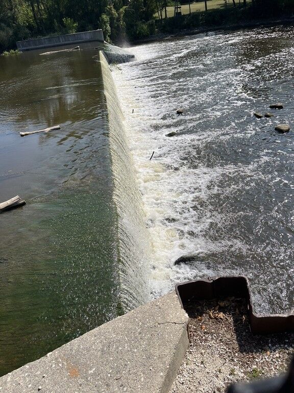
From Highland Road to the launch/landing ramp in Thiensville Village Park is another 3.47 miles of (essentially) lake paddling.
The entire area within 200' of dam is posted as off-limits for boating, swimming or wading. The police/fire station is right at the entrance to the park (within sight of the parking area by the dam), and enforcement is reportedly fairly strict. (Well, other than ... the launch/landing ramp lies within the 200' exclusion area!)
The dam has a fun-looking slide far to river-left, and (at some levels) looks like it could provide some (illegal) entertainment or play.
The center and right part of the dam drop vertically onto shallow rock (at low-to-moderate flow) or into a nasty keeper hydraulic (at moderately high flow).
At super high flows, you'ld never even know the dam was here as water backs up and totally engulfs the dam!
As of November, 2010, a fish ladder exists on river-right. However, an overhead stop-gate limits flow and precludes paddling into the channel. Additionally, a fence and signage indicate that the fish ladder is not open to public access and is NOT part of the park (although it is owned by the village of Thiensville, just as the park is). Just as well, since the fish ladder was constructed so as to lose the elevation of the dam in such a way as to not really create any whitewater features at any allowed flow rates.
Apr 11, 2025
A few photos in the area of the dam in Thiensville.
Apr 28, 2009
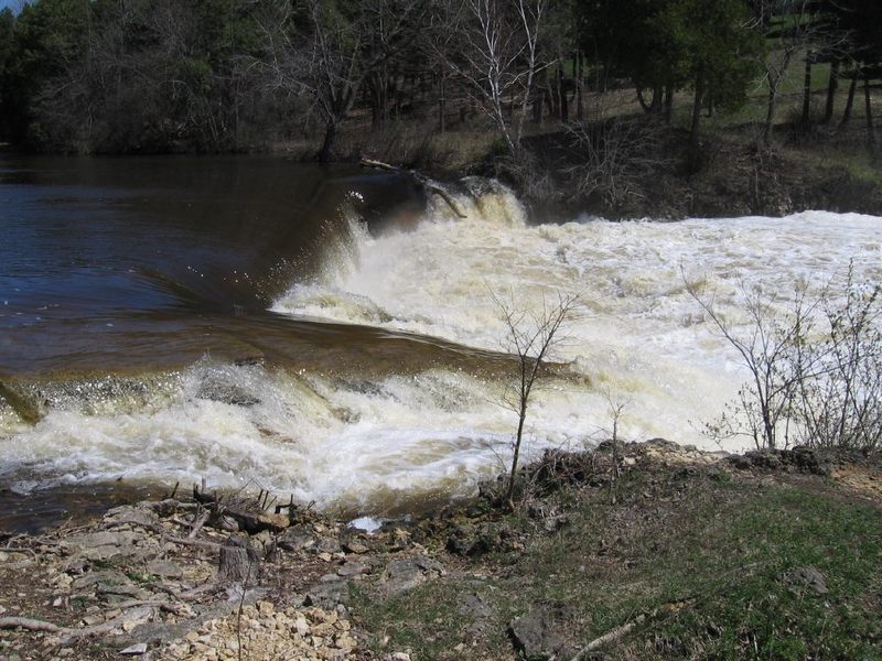
This classic killer 'low head' dam has been removed (winter, 2010/11) so we no longer have to deal with it. For illustrative purposes, note how high and how far downstream the 'boil line' is!
Jan 1, 1900
Cale runs the Grafton dam.
NOTE: THIS IS NOT the 'killer low head dam' (as mentioned in the description of this reach of river) down in Lime Kiln Park. This is the dam at (immediately above) the putin as listed for this reach. Extreme caution is urged for anyone choosing to run this dam. Knowledge and awareness of landing zone depth, and of appropriate flows, and boating tecchniques, are necessary before considering such a stunt. We are not aware of the specific rate of flow in this photo, but suffice to say it was fairly low (summer flows). (Note the log hung up on the brink of the dam just to the left of the boater. Moderate flows would likely flush it off.)
At moderately high water (say, 800-1000 cfs), the reversal at the base of the dam is unlikely to release anything in it's grip.