Glade Creek (Manns Creek tributary)

Babcock State Park to the confluence with Manns Creek

Reach banner
DifficultyV+
Length2.7 mi
Avg Gradientn/a
GaugeMeadow River at Nallen, Wv
Flow Rate as of 43 minutes
169 cfsbelow recommended
Reach Info Last UpdatedDecember 24, 2005

River Description

Named Rapids include:

Gristmill Falls

Gladiator

Pillage & Plunder

Goliath

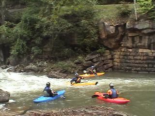
These rapids are above the second footbridge allowing an easy retreat if you find yourself in over your head. There is a road that is access to rental cabins that you can use to walk back to the parking lot.

Shortly afterwards you will hit the main stem of
Manns Creek and continue down to the New River just across from Cunard. Standard takeout these days is at Keeneys creek. Makes for a reasonable shuttle.


River Features

Grist Mill Falls

Class: IVDistance: 0 mi
Waterfall / Large Drop
Grist Mill Falls

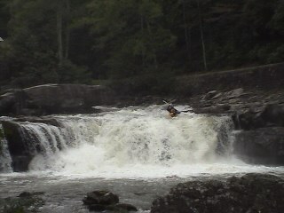
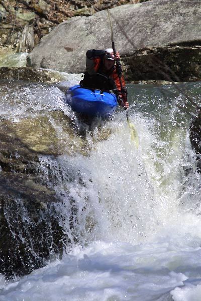
Some people put on below the falls because it can be tricky to run and eazy to get hurt. There is a very clear launch piont in the center of the falls. However what you don't see is the water pushes hard away from the launch pad and toward the left. This is where you don't want to be. There is sort of a V notch/crack in the lip of the drop that wants to flip you then spit you over the lip of the falls. The landing is not very deep.

Spillway

Class: IIIDistance: 0.1 mi
Waterfall / Large Drop
Spillway

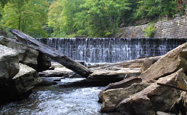
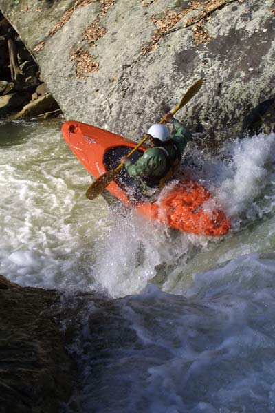
After Grist Mill Falls there is a large pool that is formed by and old spillway. Eazy 10 ft boof. From here the creek goes down hill and fast!

Gladiator

Class: VDistance: 0.6 mi
Rapid
Gladiator

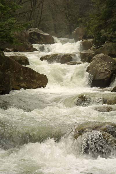
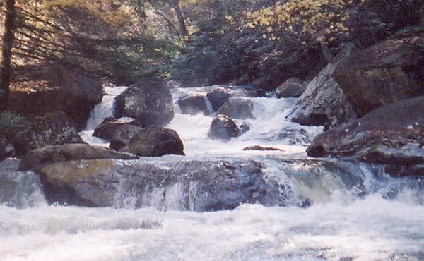
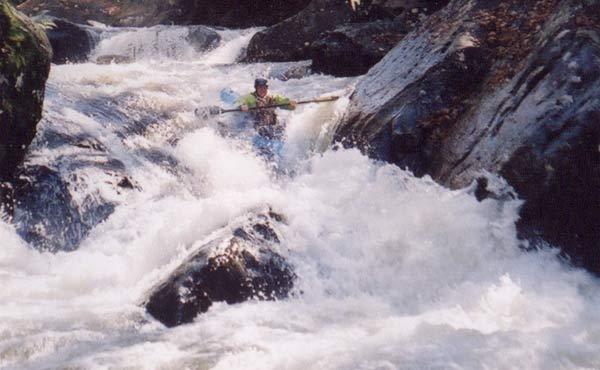
After some fast water you will come to a fast moving, small pool. Take out on the left to scout. This is a three part drop. The first is a 4 ft boof over a large hole into very airated water. Dig in hard to avoid a huge backender. after you pull away from the hole you will see a large curler going around a rock. Brace into it and ride that around. Next will be a horizon line. Boof left off of the 5 ft drop to catch the eddy at the bottom or straight and continue down hill.

Pillage and Plunder

Class: VDistance: 1.2 mi
Rapid

Goliath

Class: VDistance: 1.5 mi
Rapid

Take Out

Distance: 1.9 mi
Take Out

LB
Logan Bockrath

Mar 7, 2011


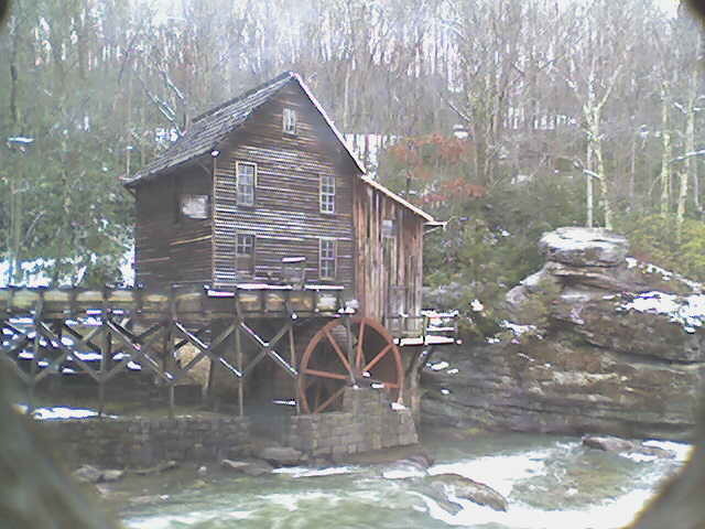
Here is an image captured from the webcam with the gauge at 5'.
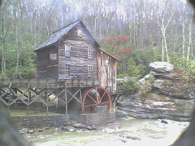
LB
Logan Bockrath

Feb 25, 2011


Recently the park has put up a live webcam image on their website (www.babcocksp.com) of the mill in which you can see enough of the creek to get a decent idea of what it is running. Here is a photo of the gauge at 2'.

JP
John Petretich

Apr 5, 2005


This rapid located directly below On Ramp comes quickly after the second footbridge. It is best scouted from the right and portaged on the left.

JP
John Petretich

Jul 15, 2004


This new rock formation came about as the result of a flood in November 2003, and has surprised numerous boaters (myself included) with it's sudden and in your face existence. It was real bad for a while until the slab cracked forming what you see here. Most of the creek went under it at 2' when I dropped over the spillway for the first time. I think I had to clean out my pants that day.

Brad Roberts
Brad Roberts

Apr 11, 2004


Just wanted to give an update on Manns Creek, West Virginia for the AW page:

MANNS CREEK HAS CHANGED (4/8/04)

About two months ago heavy rains made some significant riverbed changes to Manns creek. First off, the gauge is different (actually that changed a while back when the park people modified the gauge area). Zero is now more of a true

JP
John Petretich

Nov 15, 2003


This rapid has changed since this picture was taken. It doesn't look much different though. It was commonly run down the left at all water levels, but some rocks moved around and now it dishes out beatings on almost every attempt. Higher water runs are possible through the keyhole on the river right side.

Brad Roberts
Brad Roberts

Sep 26, 2003


From Nov. 2002

From Boatertalk:

For those who run Mann's Creek, the river left gauge has changed. They put a bunch of concrete in around the gauge rock, but the gauge still works. We ran it the other day at +8 inches, which seemed to us to be more like +3 inches on the 'old' gauge. Some other people ran it around 0 and said that seemed more like -4. I'd say the gauge actually has changed for the better, with 0 being more of an accurate 'low' level, and 8 inches (the top mark on the gauge) being more of a realistic top end. Most first timers run it around -3 or 4, so now I'd say -1 or 0 would be good low levels.

Jimmy Blakeney

www.prokayaker.tv

Brad Roberts
Brad Roberts

Sep 26, 2003


A huge group ran Mann's the saturday of Gauley fest at +2 inches. Sept 20 2003. Probably the biggest crowd Manns has ever seen.

Bryan Tudor
Bryan Tudor

Aug 31, 2003


This is the put in for Manns Creek. You can run the falls or put in below it.
Justin's leading the way as usual! He da man!

JP
John Petretich

Feb 15, 2003


This is the last major rapid before Glade's confluence with Mann's creek. It runs a lot easier than it looks in the picture. In my experience it is best scouted/portaged on the right.