Glade Creek (Manns Creek tributary)
Babcock State Park to the confluence with Manns Creek
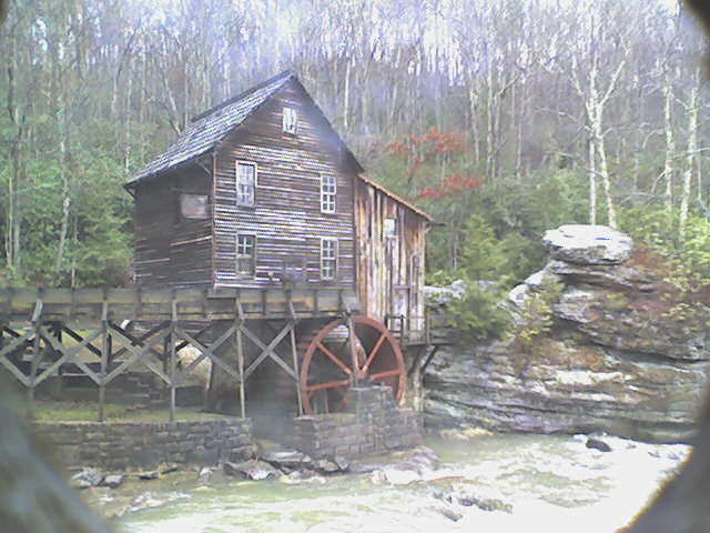
Mar 7, 2011
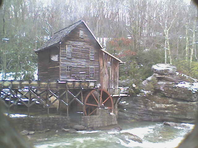
Here is an image captured from the webcam with the gauge at 5'.
Feb 25, 2011
Recently the park has put up a live webcam image on their website (www.babcocksp.com) of the mill in which you can see enough of the creek to get a decent idea of what it is running. Here is a photo of the gauge at 2'.
Apr 5, 2005
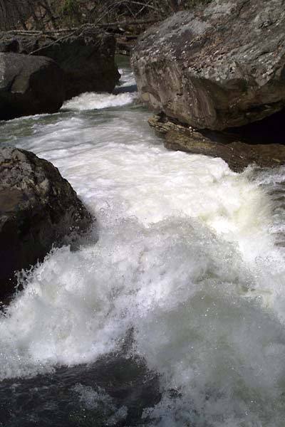
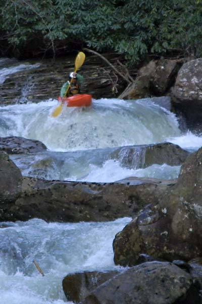
This rapid located directly below On Ramp comes quickly after the second footbridge. It is best scouted from the right and portaged on the left.
Jul 15, 2004
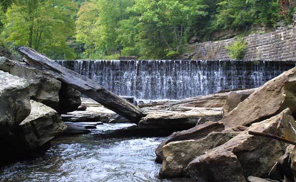
This new rock formation came about as the result of a flood in November 2003, and has surprised numerous boaters (myself included) with it's sudden and in your face existence. It was real bad for a while until the slab cracked forming what you see here. Most of the creek went under it at 2' when I dropped over the spillway for the first time. I think I had to clean out my pants that day.
Apr 11, 2004
Just wanted to give an update on Manns Creek, West Virginia for the AW page:
MANNS CREEK HAS CHANGED (4/8/04)
About two months ago heavy rains made some significant riverbed changes to Manns creek. First off, the gauge is different (actually that changed a while back when the park people modified the gauge area). Zero is now more of a true
Nov 15, 2003
This rapid has changed since this picture was taken. It doesn't look much different though. It was commonly run down the left at all water levels, but some rocks moved around and now it dishes out beatings on almost every attempt. Higher water runs are possible through the keyhole on the river right side.
Sep 26, 2003
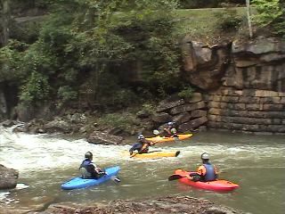
A huge group ran Mann's the saturday of Gauley fest at +2 inches. Sept 20 2003. Probably the biggest crowd Manns has ever seen.
Sep 26, 2003
From Nov. 2002
From Boatertalk:
For those who run Mann's Creek, the river left gauge has changed. They put a bunch of concrete in around the gauge rock, but the gauge still works. We ran it the other day at +8 inches, which seemed to us to be more like +3 inches on the 'old' gauge. Some other people ran it around 0 and said that seemed more like -4. I'd say the gauge actually has changed for the better, with 0 being more of an accurate 'low' level, and 8 inches (the top mark on the gauge) being more of a realistic top end. Most first timers run it around -3 or 4, so now I'd say -1 or 0 would be good low levels.
Jimmy Blakeney
Aug 31, 2003
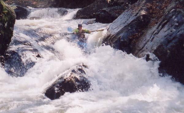
This is the put in for Manns Creek. You can run the falls or put in below it.
Justin's leading the way as usual! He da man!
Feb 15, 2003
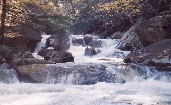
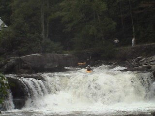
This is the last major rapid before Glade's confluence with Mann's creek. It runs a lot easier than it looks in the picture. In my experience it is best scouted/portaged on the right.
Dec 15, 2002
From Boater Talk:
Date: Dec 15 2002, 01:18
From: jblakeney
Updates for those running Manns:
Level today (Dec14th) was +3.5 inches, a great level, comparable to around zero before the gauge changed. Now zero is a more like a true zero, with -1 being about minimum.
Strainers:
Lunatic Fringe has several trees down across the whole creek just below the drop. You can see them from river left set up eddy, but be careful if you run it. We've been running it but it is possible to be pushed into the trees if you screw up.
You Ain't Gonna Like This has changed. We've been portaging it a lot, only running it when it's higher due to a big sieve opening up (which someone pinned in very badly earlier this year). Scout/walk river left.
A few other trees, but nothing too bad. You can read trip reports of the past three days on the creek at
WWW.PROKAYAKER.TV, go to calendar.
Have fun!
Jimmy Blakeney
Jan 1, 1900
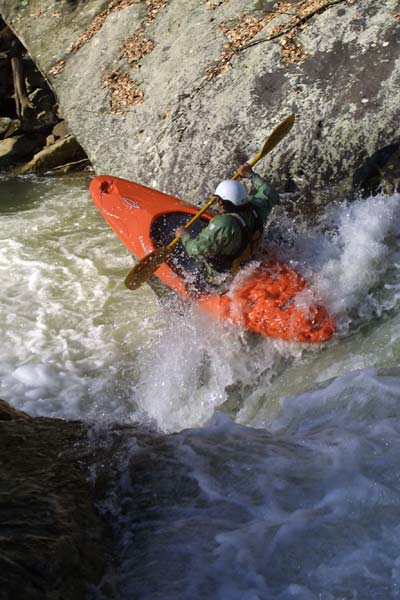
The creek's entire flow squeezes through the gap in the boulders as it drops 8-9 feet. Ride high on the top of the folded flow like Pete...or go DEEP!
Jan 1, 1900
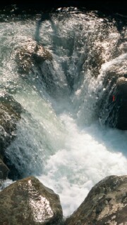
Not a very tall drop but hard to run clean!
Jan 1, 1900
Thanks to Karl Whipp for relaying this photo.