Des Plaines
b) Lockport, Fishnet Rapids: Romeo Rd. to Division St. (0.75 mile or 4.25 mile)
| Difficulty | I-II |
| Length | 4.4 mi |
| Avg Gradient | 7 fpm |
| Gauge | Des Plaines River at Riverside, Il |
| Flow Rate as of 54 minutes | 175 cfsbelow recommended |
| Reach Info Last Updated | October 27, 2022 |
As of Spring, 2021 we have information that Lockport Prairie Nature Preserve (LPNP) is increasing enforcement of regulations which prohibit foot traffic anywhere other than formally designated trails. This means taking out river-right at Division Street is unlawful, since there is not a formally designated boat landing or foot trails there. If access and parking can be found via Powerhouse Road, it may be possible to legally take out river-left. Otherwise, it would be necessary to proceed downriver to Joliet to either Hwy.53/Ruby Street (adding 3.3 miles of flatwater) or to Bridge Street/W.Jackson Street (adding 3.8 miles of flatwater).
Start your trip at Isle la Cache. A museum there (open 10am-4pm Tu-Sa, 12-4 Su) offers information about the history of the area, and has a (no fee) canoe launch. Each year (usually about the second weekend of June) they have an 'Island Rendezvous' in which re-enactors from all over the Midwest come and demonstrate what life was like for Native Americans and French fur traders in the 17th and 18th centuries. Come enjoy the 'feasting, playing, and dancing'. (See their calendar for other events.)
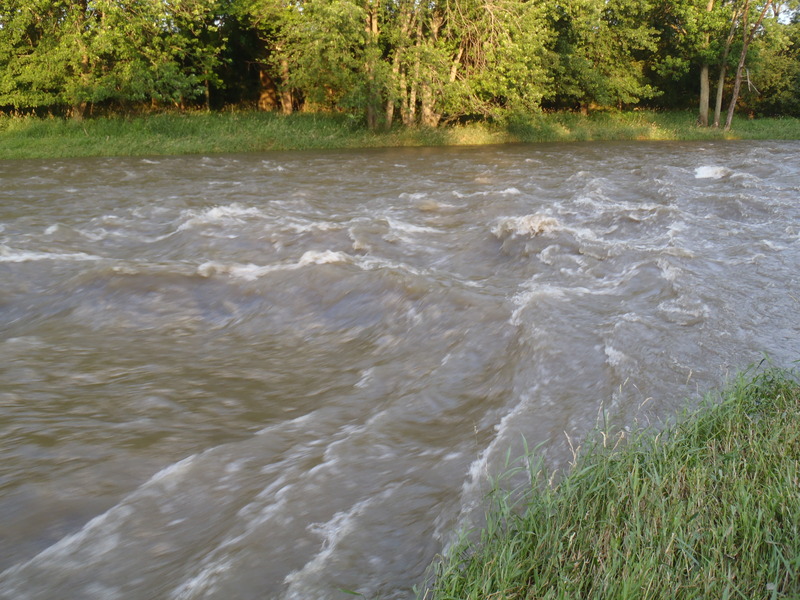
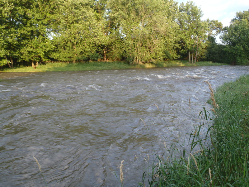
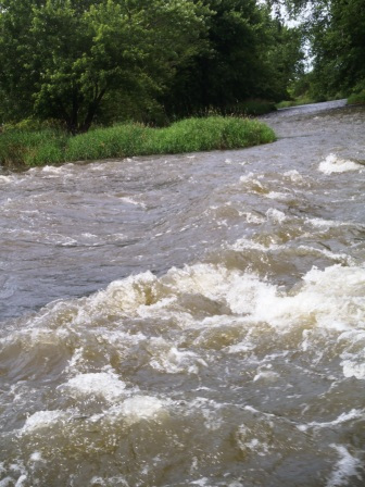
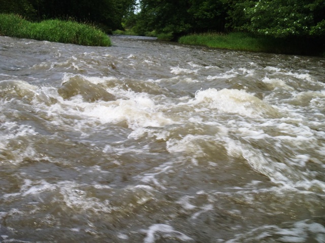
On the river, the steeper gradient (such as it is) lies in the half-mile downstream of the Hwy.7 bridge, so many boaters will just use that location for 'park-and-play' access.
For additional description, see Chicago Area Paddling and Fishing Guide.
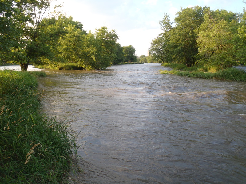
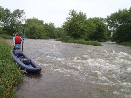
Puting on at Isle a la Cache, you have multiple routes through braided channels. River right is the most common, and there are eddylines by the bridge abutment that are ideal for beginner practice. There is generally good current
...
Drainage area at our listed put-in is approximately 699 sq.mi. (as calculated via USGS StreamStats Beta software).
We are uncertain at this time of the best location for parking and river access, but we understand that boaters use this area to 'park-and-play' the best of the gradient of this reach.
Mar 13, 2021
Bridge Street Not Briggs Street. I believe the description intended to describe the Joliet access as 'Bridge Street', which crosses the Des Plaines River, and NOT 'Briggs Street', which does not. I repeated the error in my previous note. My apologies.
Mar 13, 2021
ACCESS ISSUE: Today, March 1, 2021, a police officer was waiting for me at the Division Street (abandoned bridge) take-out, which is located on Will County (IL) Forest Preserve District property, and is categorized as a Nature Preserve. The officer informed me, as a Nature Preserve, general access is not allowed; one must stay on the designated trail. Thus, this is NOT an access point for the Des Plaines. She did not ticket me, but informed me that 'they' (by whom I assume she meant the IDNR Conservation Police) were cracking down. I interpreted this to mean tickets will start being issued at some point.
There is signage that designates the area a Nature Preserve, but nothing that says 'stay on designated trail' or the like. The closest are a couple of small (9' x 14') yellowed, rusty signs that say the land is owned and managed by Will County Forest preserve District and governed by Forest Preserve Ordinance #124.
I reviewed Ordinance #124. Chapter IV, SECTION 2 states, 'WATERCRAFT. No PERSON shall bring into, attempt to launch or use, or navigate any WATERCRAFT upon the WATERS, except at designated areas' or by obtaining permission. Since the area is NOT designated as a boat launch, it is NOT an authorized access point. The Ordinance also discusses not disturbing the land, plant life and animals, which is what the officer told me: Tromping through the Preserve causes erosion and disturbs the plants and animals there.
I assume this means one will need to paddle the the Joliet Briggs Street access discussed in the description for this river, and should plan accordingly. If I find better/alternate access point I will update this post. Dan