| Difficulty | I-II(III) |
| Length | 14.3 mi |
| Avg Gradient | 17 fpm |
| Reach Info Last Updated | April 29, 2015 |
River Description
Shared reach: First (up to) 8 miles is in Wisconsin, final 5.3 miles is in Minnesota.
Put-in (with decent water) is at the base of Radigan Dam. (Elev.~1130')
Alternate put-in is on Swedish Hwy (Elev.~1073') if water is not sufficient to do upper.
Second alternate put-in is at State Line Road. (Elev.~1017')
Take-out is Markville Rd (CR25) near Markville, MN about one mile inside MN. (Elev.~903')
Radigan Dam to Swedish Highway - 3.0 miles - 19 FPM
Swedish Highway to Stateline Road - 5.0 miles - 11.2 FPM
(Stateline is also labeled Firelane or Fireline Road)
Stateline Road to Markville (CR25) - 5.3 miles - 21.5 FPM
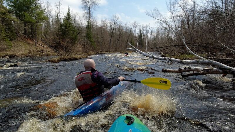
The run is class II, with the first part possibly having some class III.
Note: This is not an upper section of a river named the Tamarack.
The river is the Upper Tamarack!
River Features
Put In: Radigan Dam
Access PointDistance: 0 mi
Drainage: 33 sq.mi.
OtherDistance: 0 mi

(Based on personal measurement via online planimeter and topomaps.)
Alt.Put-in#1: Swedish Highway
Access PointDistance: 3 mi
If the listed put-in is not available, or if flow at that point appears insufficient for a run, it may be possible to put in at this location.
Immediately downstream of this bridge, the Spruce River contributes its ~42 square miles of drainage area, so flows from that point should more-than double.
Take Out: Markville Rd
Access PointDistance: 13.3 mi