Elk River, Back Fork
2. Confluence of Sugar Creek(Skelt) to Big Sycamore(Breece)(Three Falls Section)
| Difficulty | II-IV |
| Length | 4.9 mi |
| Avg Gradient | 55 fpm |
| Gauge | Elk River Below Webster Springs, Wv |
| Flow Rate as of 1 hour | 4.36 ftbelow recommended |
| Reach Info Last Updated | May 19, 2013 |
River Description
Logistics: Take WV 20 north out of Webster Springs, cross the Back
Fork, and bear right on CR 24 (Back Fork Elk River Road). You'll head up
the hill and then after the pavement ends, dip back down along the river.
After about 5 miles you'll reach Sycamore Park. There is good access a
couple hundred yards downstream of a foot bridge. To reach the put-in,
head back to WV 20 and go 11.2 miles north to WV 18 (Holly River Rd.).
Take this road through the town of Jumbo and 3.5 miles from WV 20 bear
right. It's another 2.7 miles down to the put-in where the road first comes
along Sugar Creek which is a tributary of the Back Fork. If If Sugar Creek is
too low, you can turn around on CR 22 and go back up the hill a short
distance until you quickly come to the second dirt road heading
downstream in reference to Sugar Creek. The first dirt road is at creek
level and only goes a short distance down Sugar Creek. The second dirt
road will have a black mailbox on it. It is not a driveway. You can even see
it on any WV Atlas and Gazetteer. Take it and after about 1/2-3/4 mile, you
will come to the Back Fork.
Description:
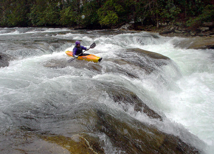
The run starts out with a fun ledge on Sugar Creek and then you quickly
join the Back Fork Elk. The first half of the run is mostly class II and it's a
scenic float through mellow rapids. Just as you're beginning to wonder
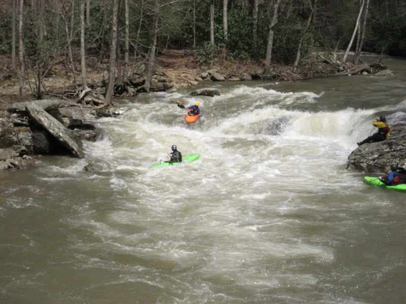
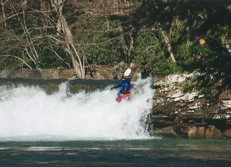
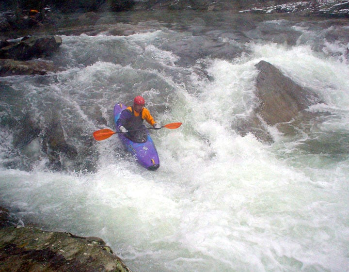
when the action starts, you arrive at the the 'Three Falls' section where
you will find six major (4-12') ledges. At levels below 6.2' the top half of the run will be a little boney and you might scrape a bit over some of the
ledges, but they are still fun.
There are some more fun rapids and then a couple more ledges as
you cross under a road bridge and then the foot bridge to Sycamore Park.
The take-out is on the right.
Lat/longitude coords are approximate, from TopoZone.
River Features
Put In
Take Out
Trip Reports
Log in to add a reportThis is the biggest falls of the run. About 10 feet. At lower levels the river left slot is probably the best.
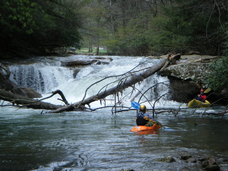
The first drop on sugar creek. couple hundred yards past put in. 4/24/2011
Robert Farmer---We ran this April 5, 2009 at 5.75/1500 at Webster Springs,and our party of 12 (mixed skill levels) passed the aforementioned strainer easily---we limboed under it. This level was quite good---low, but without much scraping, and still great fun. Every rapid was run, but the fourth ledge had no easy routes at this level (except for the hike-and-seal-launch---still fun!); more water makes this one easier. The shuttle can be run up Old Sycamore road. It's shorter, but I don't know whether it's faster---probably is faster for professional rally drivers. From Bergoo Road, take Old Sycamore Road up the hill; when you come to a T, turn Right. At a Y intersection with a church up on the hill, go Left. Go over the hill and down the other side to a little valley with a funky intersection at a paved road. Just go straight, up the dirt road. Later, take a Right at a Y intersection. Soon you come to the paved road that goes to Sugar Creek. (I think the house number is 460.) Turn Right. No high ground clearance required. My DeLorme's Atlas shows this route, albeit in tiny little red lines. I hadn't done this river for about 12 years or so, and it really is an enjoyable section. I remembered that it went by pretty quickly when I soloed it, but taking my time and doing multiple runs of some of the drops with some good people really made a nice day. The drops really are very nice, classic, even great! They can all be run multiple times, except for the third one; although, technically, someone did, with help from above, climb back up the cliff for another run, I think that risking a broken back in a fall from wet, slimy, and probably loose rocks offers a very questionable cost/benefit ratio. As for the shuttle, maybe some 'local' can compare the two shuttle routes and decide which is better/faster; please post the results here.
its been about four years since i have run this sect. but if you haven't run it it is a very beautiful paddle with views around every bend. I would highly suggest paddling this sect and and it is a very easy paddle by the way.
When putting on at Sugar Creek, this is the last ledge before the confluence with the Back Fork of Elk River.
This is a ledge about 70 ft before the only bridge in this section of river. It has low water pinning potential toward river left.
There were half a dozen or so ledges/falls on the Back Fork. This was one of the legdes toward the middle of the run. The river left line looks like it might be fun,, if you stay away from the overhanging rock ledge to Rick's left. A whole lot of water flows under it.
By Sunday morning of Gauley Fest weekend we had sunny skies and the Hurricane Isabel pulse had long passed. Flows dropped quickly but I got talked into a trip on the Back Fork Elk. The water was too low but we still had fun on the ledges and I had an opportunity to meet B Man.
More on the strainer alert:
The strainer that Mike Mullins referred to is still there. We were on the run for the first time and did not know how soon the Three Falls section was coming up. As mentioned, the strainer looks completely passable on the left side. But what looks like water going over the top of the strainer, actually seems to be water pillowing up on a root ball where it looks passable. Three very competent paddlers in our group wound up going under this strainer because they thought the route was open, and two of them wound up swimming. It was possible at that water level (1150cfs Elk R below Webster Springs) to limbo under the far right side of the strainer, but if the water had been any higher, that option would not have been there. As mentioned, the portage is easy.
Also- if you put on at Sugar Creek, there is another strainer to contend with shortly after the 8-10 foot ledge on the creek. There is a fallen tree extending across the river from the river right bank, and another fallen tree just behind it, extending from the river left bank. At the level listed above, it is possible to eddy out to the left of the first strainer and ferry between the two, but it is a tight move. Might be a good idea to portage this, too, if the level is any higher.
Copied from WVWA Message Board
Strainer alert--Backfork of Elk
Posted by Mike Mullins on 3/10/2003
Approximately 200 yards b/4 first drop on 'Three Falls Section of Back Fork' there is a river wide strainer. It looks like it has been there for a while, but the river left side appears to have picked up several limbs in the recent storms. Because river left side is just at water surface, at higher water, river left may be hidden and/or look passable. Its not, and probably won't be anytime soon.
There is an easy portage on river left.
A group of 6 of us ran this on May 1 2002. GAUGE INFO We ran it at 5.8 and falling slowly on the Webster Springs gauge. The book says 5.8 is minimum and we agree. We did it at that level and had a lot of fun. But I would NOT do it at 5.7 or 5.8 and falling fast. I also ran it in the past at 6.1 and found that level to be a lot of fun also. So the guidebook suggestion of 5.8 to 6.2 I agree with on the low side...on the upper end...well that's up to you.
PUTIN. If Sugar Creek is high enough...put in on Sugar Creek. Otherwise turn around on CR 22 and go back up the hill a short distance until you quickly come to the SECOND dirt road heading downstream in reference to Sugar Creek. The first dirt road is at creek level and only goes a short distance down Sugar Creek. The second dirt road will have A BLACK MAILBOX on it. It is not a driveway. You can even see it on any WV Atlas and Gazetteer. Take it and after about 1/2-3/4 mile, you will come to the Back Fork. We drove downstream about 100-200 yards and parked in a wide spot on the road just before a church. No sweat!!
THE RIVER. Delightful to the max!! The guidebook talks about three falls (indeed the section is known as the 'three falls' section. Well, they are all runnable and we ran all 8 of the 3 that we found!! We won't tell you more than that because part of our delight was coming to them and figuring out how to run them. We took at at the the Big Sycamore on river right after parking in the parking area by the footbridge to the Big Sycamore. Unfortunately as of May 2002, the Big Sycamore looks Big Sickandmore.