Mountaintown Creek
Hwy 52w to Hwy 282/76w
| Difficulty | I-II |
| Length | 5.4 mi |
| Avg Gradient | n/a |
| Gauge | Mountaintown Creek at Ga 282, Near Ellijay, Ga |
| Flow Rate as of 46 minutes | 88 cfsbelow recommended |
| Reach Info Last Updated | May 19, 2021 |
To get to the take-out go out of Ellijay from the Dairy Queen on Hwy 76/282 about four miles cross the Mtntown bridge and park on river left between the game room and the yellow building.
The shuttle to the put-in is 11.4 miles. Head back to Ellijay on 76/282 and turn left at the DQ on hwy 5 n. into town @ the square/round-a-bout in Ellijay. Go north on hwy 52/2, when you come to the Mtntown bridge turn left before crossing it. You can park right there and walk down or if no one is already there, you will find a few places to park right down by the trail to the river.
There has been a riverwide log pourover in the river for 6 years and if there is enough water to float over it you are good to go.
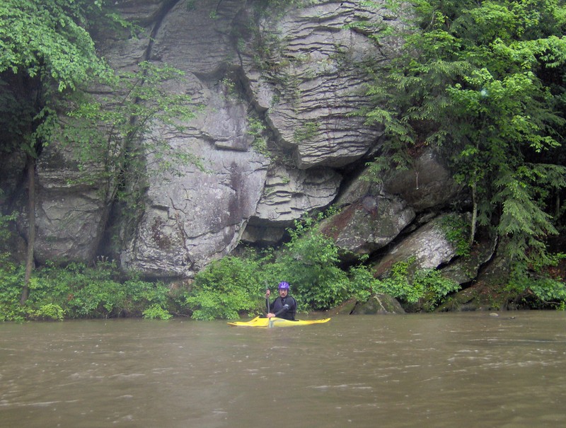
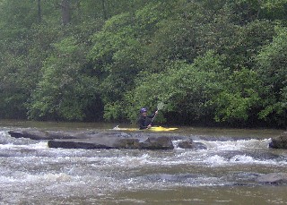
The first mile and a half has quite a few cabins on river left. Then you get into a two mile section of undeveloped woodland. All of this is private property as evidenced by one million 'no tresspassing' signs - talk about litter! This section has some small Class I boulder garden drops and is very pretty, especially in the Spring. When you cross under a small concrete bridge, you begin a 1.5 mile section of mostly moving flatwater thru pasture land. When you come to an S-turn in the riverbed with a cabin in the S, you are approching my favorite park of the run. You will hear the mighty roar of Leonora's Ledges (class II). The main line is on river right. As water gets higher you will find several routes open up. This begins a section of ledges, maybe 1.5 miles long that is fun to play or just run.
As the ledges end you will come again to pastureland on river left first and then also on the right. When you make a sharp right hand turn, you will be at Searcy Bend. Just around this bend if you look closely on river-right you will see the remains of and old cable bridge that was used back in the early 1900's for all the Searcy kids to cross the river to get to the old country school on the top of the ridge on your right. You will be going thru a sect
...Fun little double drop - best run on river right - at higher water has several routes.
Nov 13, 2009
There is a gauge for this river at the 282 bridge now. I ran this 2 weeks ago and holly creek was about 250. The mountaintown gauge was at 195. Creek was fun at this level but would be better a little higher. There are 2 riverwide limbo logs that could become strainers at very high levels.
The next big rain after you paddled took out the limbo log just above the hwy 282 bridge, so now there is only one.
May 7, 2006
Nice and easy!
This place is beautiful!
Just having fun