Chestatee
2 - Town Creek Church Bridge (a/k/a Garnett Bridge) to Copper Mine(Grindle Falls/Grindle Shoals Section)
| Difficulty | II-V |
| Length | 3.8 mi |
| Avg Gradient | 50 fpm |
| Gauge | Chestatee River Near Dahlonega, Ga |
| Flow Rate as of 16 minutes | 168 cfsbelow recommended |
| Reach Info Last Updated | March 3, 2006 |
Sources: S. Welander, B. Sehlinger and D. Otey, A Canoeing & Kayaking Guide to Georgia (2004); B. Sehlinger and D. Otey, Northern Georgia Canoeing (1980).
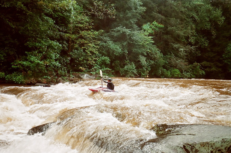
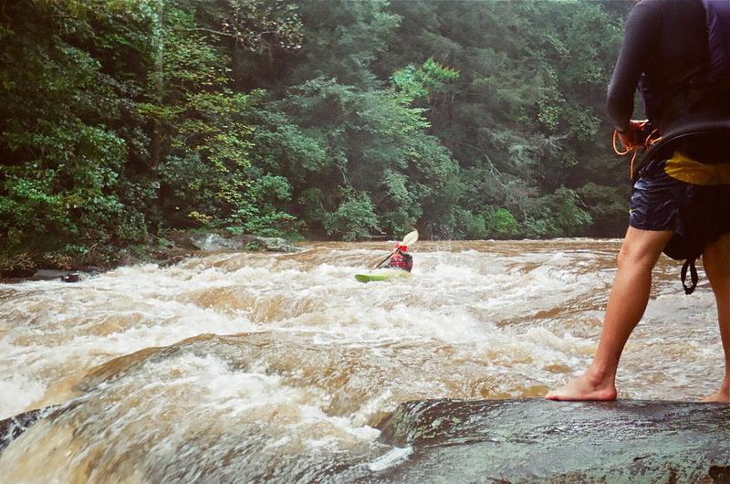
This is the most exciting section of the Chestatee, including Class II-II+ rapids at the put-in and in the first 2+ miles, Class 5.0 Grindle Falls (a/k/a Grindle Shoals)and Class III+ Copper Mine at the take-out. The two miles from shortly below Grindle Falls to shortly above Copper Mine are flatwater.
The put-in at Town Creek Church Bridge (a/k/a Garnett Bridge) includes a parking area sufficient for several cars. The easest way down the steep hill to the river is via the path on the upstream side of the bridge, right at the parking area.
There is an alternative put-in/take-out at Grindle Bridge, 1.8 miles below the put-in. Parking is scarce, however, the land surrounding the bridge is privately owned and the owners are not big fans of boaters. Please use Grindle Bridge as a drop-and-drive put-in/take-out and do not leave vehicles parked there during your run.
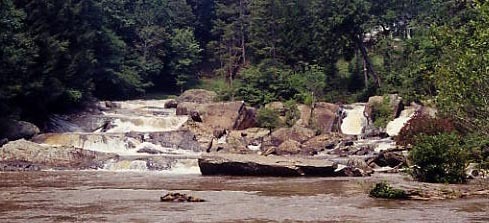
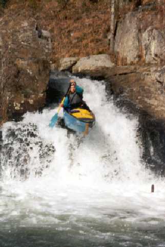
Grindle Falls (a/k/a Grindle Shoals) is a fun series of vertical drops and slides. The falls can be run by going either right or left of the island above them (see comments below): scouting is necessary to make sure the chosen route isn't blocked by trees. In the past there have been access problems with the landowner on the river right bank. Its best to be quick and discreet when scouting from either bank or portaging.
Portaging Grindle Falls is difficult: neither bank is easy, but the left is less difficult. The property on both sides is private, so do not linger. There is no good portgage option other than the banks: the least bad road portgage would be take the road east about a mile to where Tesnatee Creek nearly meets the road, then take Tesnatee Creek back to the Chestatee shortly below Grindle Falls.
Fun factoid: Sehlinger and Otey (1980) considered Grindle Falls to be a mandatory portage. To quote an unide
...Easiest carry down the hill is via the concrete drainage channel starting right at the parking area. Put in either above or below the Class II-II+ rapid beneath the bridge. At higher water levels, the rapid is a small playspot.
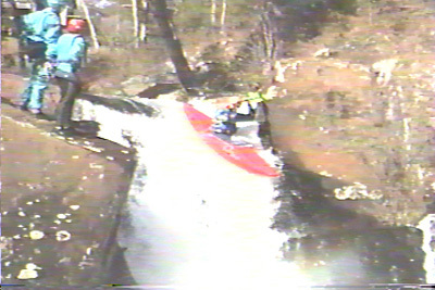
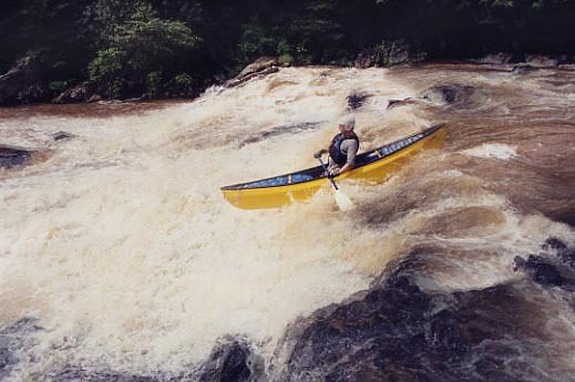
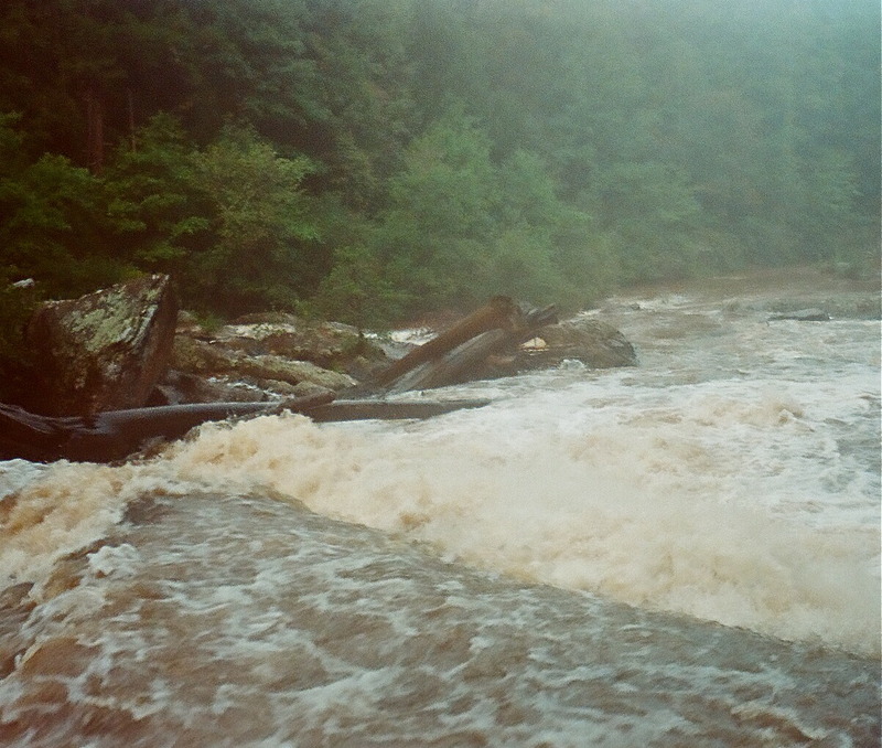
You will know you are at the falls when you see a considerable horizon line. This is a steep rapid where you can choose to either run next to the right bank or the left bank. The left line ends up at the split boulder waterfall. The right line drops over three 7-10 ft. technical slides/ledges before converging with the left line. Then a calm pool for 40 about feet, then a steep rock slide that drops about 15-20 feet (not pictured on the site).
Tesnatee Creek comes in on the left and it is flatwater to Copper Mine.
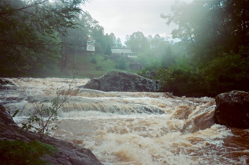
Remnant of an old, collapsed dam, now only about two feet high. Several lines, depending on water level: the largest and easiest is to the left of center.
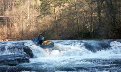
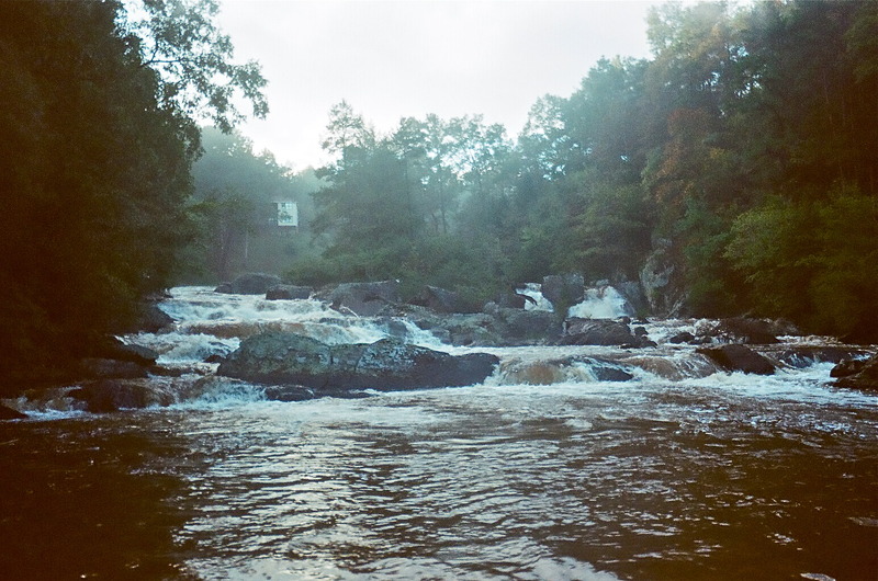
A series of 3 and 4 foot tall ledges. The first is all you have to worry about. Run on the left side of the rock, stay about 10 feet from it and angle left. Going next the the rock would feed you into a nasty pothole. Some enderspots on the last 2 ledges at the right levels.
Apr 15, 2020
Ran on April 14th, 2020. The class 2s on the first 2 miles are surprisingly really fun. You can portage grindle on the left by exiting before the entrance slide and walking along a narrow faint trail and lowering boats down/scrambling down the left side bank by the falls. It isn't a fun portage. Flow was 850 cfs. Run the entrance slide with a left angle to easily catch the current heading for the falls. We ran laps on the left slot double drop of the falls, there is a small tree in the right slot taller single drop. Ran the slide below grindle right of center. Center has a piton rock. Scout copper mine, it had some wood in center. Left side is good to go.
Jan 11, 2006
New Streamkeeper: Rick Bellows, chestateer@yahoo.com.