Chestatee
2 - Town Creek Church Bridge (a/k/a Garnett Bridge) to Copper Mine(Grindle Falls/Grindle Shoals Section)
January 1, 1900
| Reporter | Robert Maxwell |
All the land around Grindle Falls is privately owned. The land owners have never been thrilled with the paddling community, so you'll need to scout from the river bed to avoid a nasty trespassing charge.
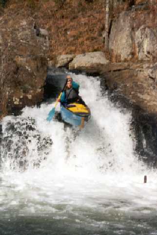
Milt Aitken doing the far left entrance slide to Grindle Falls.
Milt Aitken taking the far left line at Grindle Falls.
This is Grindle Falls from river right.
This is Grindle falls from river left.
Grindle Falls from downstream.
Milt Aitken running the slide just below Grindle Falls. The next 1.5 miles of the Chestatee is flat, until you hit Copper Mine Rapid at the take-out.
Copper Mine Rapid ends under the old bridge.
There are several lines to choose from on Copper Mine Rapid. Here's Milt Aitken running the far right side.