| Difficulty | III-IV+(V) |
| Length | 5.3 mi |
| Avg Gradient | 67 fpm |
| Permit | Permit must be obtained at Green Creek Trail, County Line Trail, or Bull Pen Bridge in NC, Burrell’s Ford Rd (GA side of the river), Warwoman Campground (FR 86) and Overflow Creek in GA, or Hwy 28 boat landing, Low Water Bridge, Earl’s Ford, Sandy Ford, Fall Creek, Thrift’s Ferry, Hwy 76 / Bull Sluice lot, and Woodall Shoals in SC. |
| Gauge | Chattooga River at Burrells Ford, Nr Pine Mtn, Ga |
| Flow Rate as of 1 hour | 69 cfsbelow recommended |
| Reach Info Last Updated | March 24, 2020 |
Projects
Chattooga Headwaters Access (NC)
Table of Contents American Whitewater Chattooga Project Summary Forest Service Process Paddlers’ Litigation Against the Forest Service Overflow Creek Upper Chattooga Timeline American Whitewater Chattooga Project Summary The Chattooga River, which starts in Western North Carolina and flows south to form the border between Georgia and South Carolina, was [...]Read More
River Description
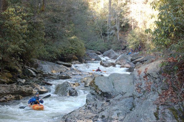
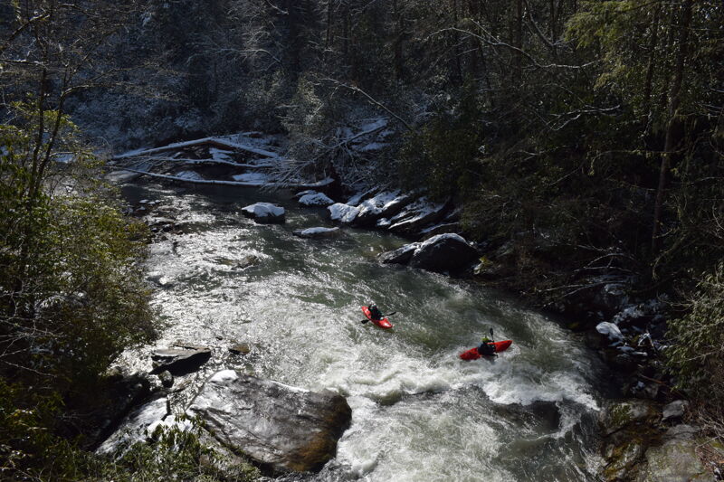
The five mile long Ellicott Rock reach, also known as Section 0, starts with a Class V drop at Bull Pen Bridge that defines the end of the Chattooga Cliffs reach and the beginning of the Ellicott Rock reach. You can put in above or below this rapid, the second hardest on the run. The two or so miles immediately below Bull Pen Bridge to Ellicott Rock are read-and-run, Class IV, with a series of ledge drops and boulder-filled rapids. Approximately 2 miles into the run is Super Corkscrew, the only other Class V rapid on the run. The rapid is a long series of off-set ledge drops with increasingly powerful hydraulics and a shallow, short run out. The rapids below Super Corkscrew extending down to Ellicott Rock are similar to those above Super Corkscrew; the rapids are a combination of Class III-IV ledges and boulder fields. The run requires about 2 hours assuming you move quickly through the last three miles of Class II shoals above Burrell's Ford.
This section does not have the unique scenery found on the Chattooga Cliffs or Rock Gorge reaches in that the views are limited due to the narrowness of the riverbed, however the whitewater is exceptional. It is noteworthy in that it passes through Ellicott Wilderness and has few trails paralleling the river allowing boaters to enjoy the run with little chance of encounters until you reach the Ellicotts Rock trail.
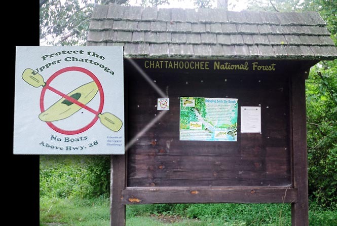
This section (as well as the sections immediately up and downstream) is subject to some draconian limits by the Forest Service.
- Paddling is allowed between December 1 and April 30, on days when flows have hit 350 cfs or higher.
- An on-site permit must be filled out: Bull Pen Bridge or Burrell's Ford (GA side) both have permit stations.
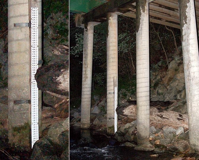
- Strainer removal is prohibited. Please leave wood as you find it, even if it adds a portage. For more information about woody debris in rivers go to Large Woo
River Features
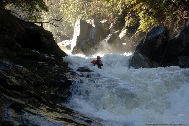
Bull Pen Rapid
RapidClass: VDistance: 0 mi
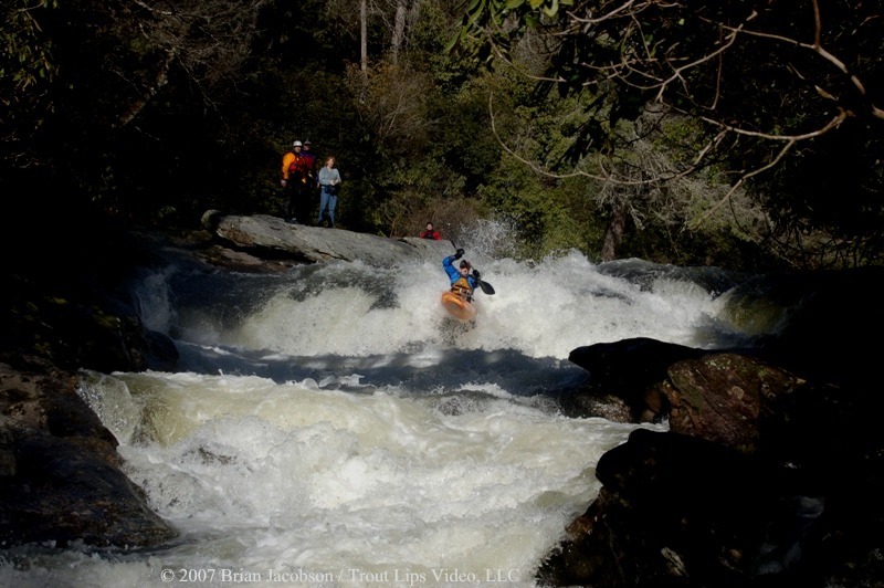
Put in just upstream of the bridge to add the second hardest rapid of the day on your second stroke. This rapid is riddled with potholes and a proper boof is essential. A number of boaters have ended their runs at the bottom of this one.
Entrance Ledges
RapidClass: IIIDistance: 0.4 mi
Two closely spaced 5-6 ft ledges with high water hole potential
Super Corkscrew
RapidClass: V+Distance: 0.8 mi
Multi stage drop consisting of 6 ft ledge into approach, a steep pitch into a large hole that feeds an undercut wall, followed by a steep strong backender hole before another drop and a long shallow slide. Stay upright in this one Low Water
Last Hurrah
RapidClass: III+Distance: 1.4 mi
Start left and cut right behind boulder, read and run, watch for undercut/hole combo at bottom of rapid

Trip Reports
Log in to add a reportKC
Winter Ellicott Rock Run - Kevin Colburn
Feb 9, 2020
Great day enjoying the only bridge-to-bridge section of the Upper Chattooga.
GD
Gary DeBacher
Oct 18, 2014
Link to my '93 account of wading Section 0 at extremely low flow. The coverage down to Ellicotts Rock is good, but after that it is spotty because there is a trail right by the river, down to Burrells Ford. Sorry the link is probably run into this text. Just copy the link and go there.