Rogue, North Fork
1. Natural Bridge to Woodruff Bridge
| Difficulty | III-IV |
| Length | 3.2 mi |
| Avg Gradient | 42 fpm |
| Gauge | Rogue River Above Prospect, or |
| Reach Info Last Updated | February 26, 2026 |
This run is best in summer, when most other runs are too low. The spring-fed water is cold and clear year-round in most years, and the run is generally more enjoyable at lower flows. In winter, you can drag your boat a mile through the snow and launch into icy water, but getting back to the highway from Woodruff Bridge can be challenging.
The run packs a lot into a short distance: a chance to show off before amazed spectators, a legitimate scare, a probable back-flip, a rugged portage, a collapsed lava tube narrow enough to pin a Stubby sideways, and a sweet runnable waterfall. It is short, so make the most of it. Be confident about the portage location. If it is not obvious from the description and map, walk the well-defined trail on river left before putting on.
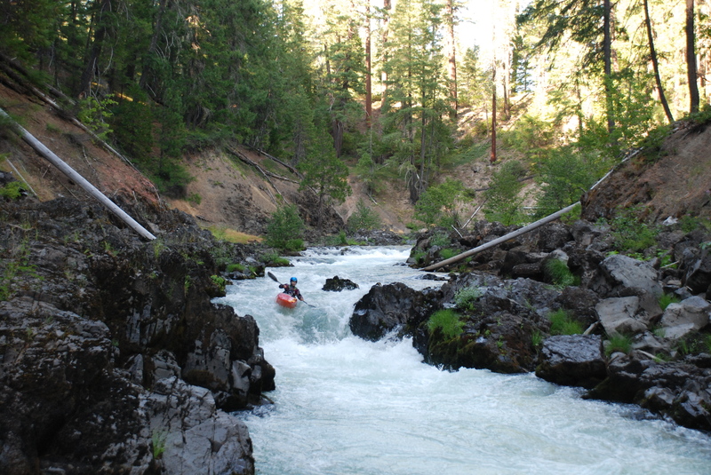
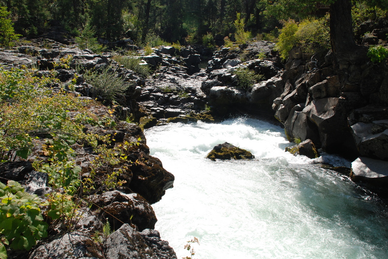
The run begins at Natural Bridge. Because this is a formal access site and a heavily used day-use area, unload quickly and be discreet. The footbridge below Natural Bridge marks the traditional start. The class V rapid above the footbridge has been run, but beware of the cave on river left. Below the footbridge is a class IV- drop, followed by a mile of fun, continuous whitewater. Take a moment to look up at the colorful rock formations and mature forest.
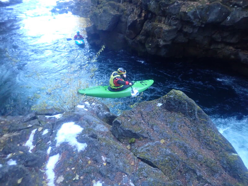
When you reach a short pool at the top of a IV- drop with a couple of moderate-sized boulders, it is time to pay attention. Run this drop and eddy out to scout Karma (class IV).
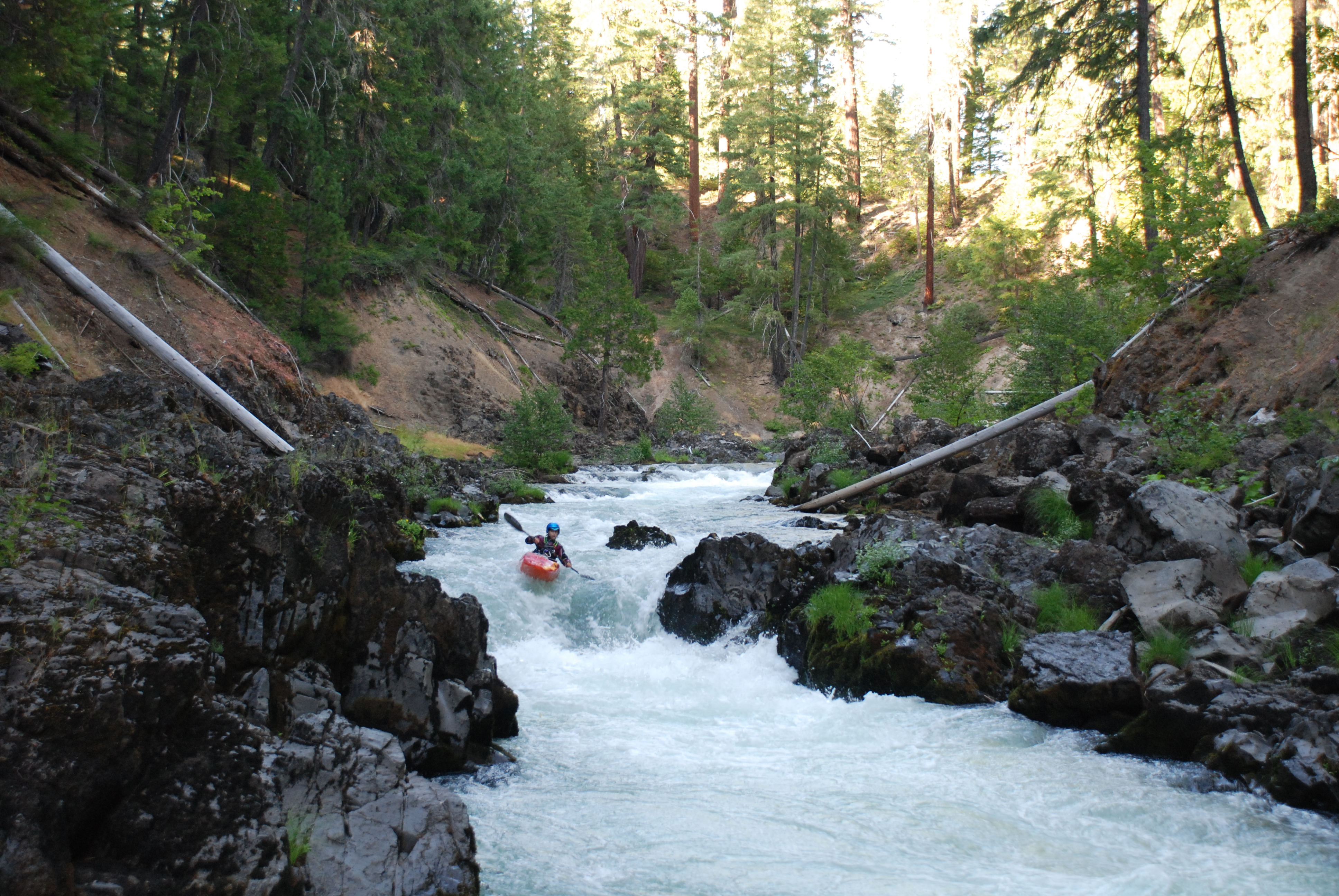
Karma is the crux: a long, steep, rocky rapid that continues around a blind left turn. It should be scouted on the left. Once you commit, there are few, if any, eddies until the bottom. Lines exist on the left, center, and right, each potentially better at certain flows. Below Karma is an easier blind horizon, and then the gradient begins to ease.
Soon after, you enter a pool on a hard right bend, followed by a long left bend. The portage trail for Knob Falls is a short distance around that left bend. On your first lap, consider stopping in the poo
...
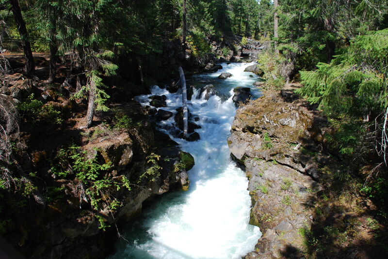
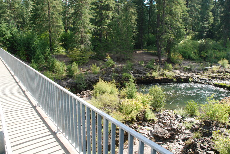
At Highway 62 mile 54.9, turn toward Natural Bridge Campground and follow signs 0.7 mile to the Viewpoint at the day use area. If you have not visited before, it is worth taking time to walk the interpretive path and see the natural bridge—a striking geologic feature where the Rogue River disappears into a roughly 100-foot lava tube. Unload boats in the Natural Bridge Day Use Area parking lot. This is not a designated river access, so unload efficiently and without impacts to other users (don't linger or change clothes in the middle of the parking lot). All routes to the river begin by walking down the paved visitor trail. One option is to cross the footbridge, step over the stone wall, continue downstream through the trees, and scramble down to a put-in on river right. Another is a river-left seal launch beneath the footbridge, though this approach is discouraged when tourists are present.

Karma, is the crux rapid. Karma is a long, steep, rocky rapid that continues around a blind left turn and should be scouted (left). Once you commit there are few/no eddies until you come out the bottom. There are possible lines on the left, center and right, each of which might be better at a certain flow.
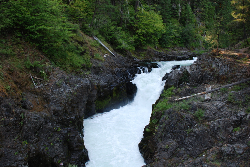
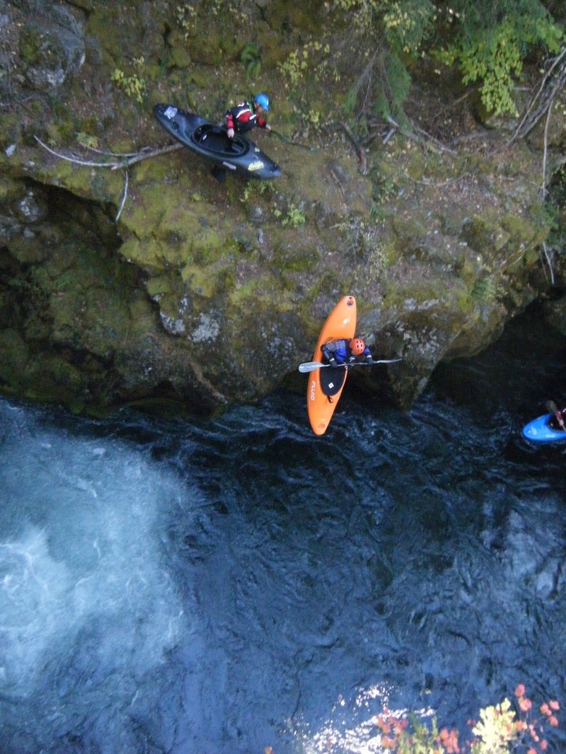
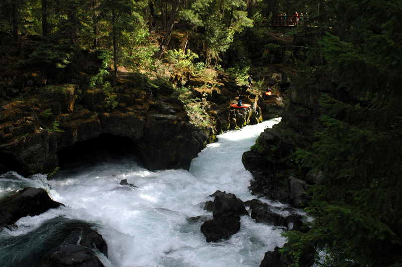
Knob Falls aka Therapy Falls (class V) is typically portaged, and it is located at the apex of the bend back to the left. The portage route is on the left, up a dirt slope with roots for steps and handholds, then down bedrock to a 10' seal launch, or farther over another ridge to a lower launch. The falls has been run but some who used to run it don't anymore. There have been some close calls there, so a good safety net is advisable if folks decide to run it.
The take-out is north of the town of Prospect on Oregon State Highway 62. At Highway 62 mile 51.3 turn left on USFS 68 toward Woodruff Bridge. Go 1.8 miles, cross the bridge and park. Take out on the rock shelf river left underneath Woodruff Bridge. Downstream from this access is a mile of flatwater before the class V Takelma gorge.
Big tree fallen in the middle of the longest flatwater stretch a ways above the final chutes above the take-out. It's clearly visible from a long ways off. There is a sneak route on the far left but it's tight and may not go at higher water (there was room at 500CFS). Definitely scout the drops below the flatwater stretch for wood.