Chocolay
Hwy.41 to Cty Road BH (Green Garden Rd) (5.7 miles)
| Difficulty | I-II(III) |
| Length | 5.2 mi |
| Avg Gradient | 20 fpm |
| Reach Info Last Updated | March 10, 2026 |
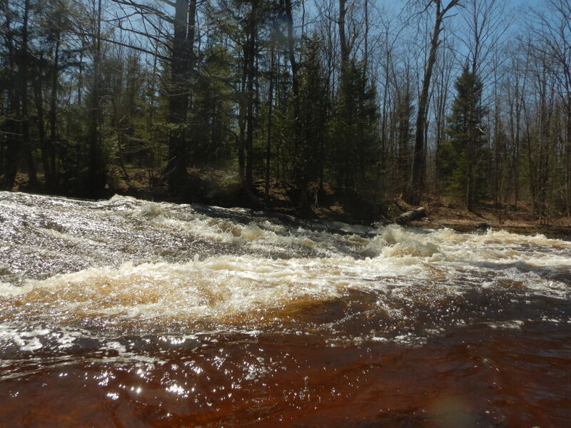
There are no 'big' drops on this reach. Most drops are boat-scoutable at normal levels except for areas of constriction due to wood. The rapids consist of a series of ledges creating waves and holes.
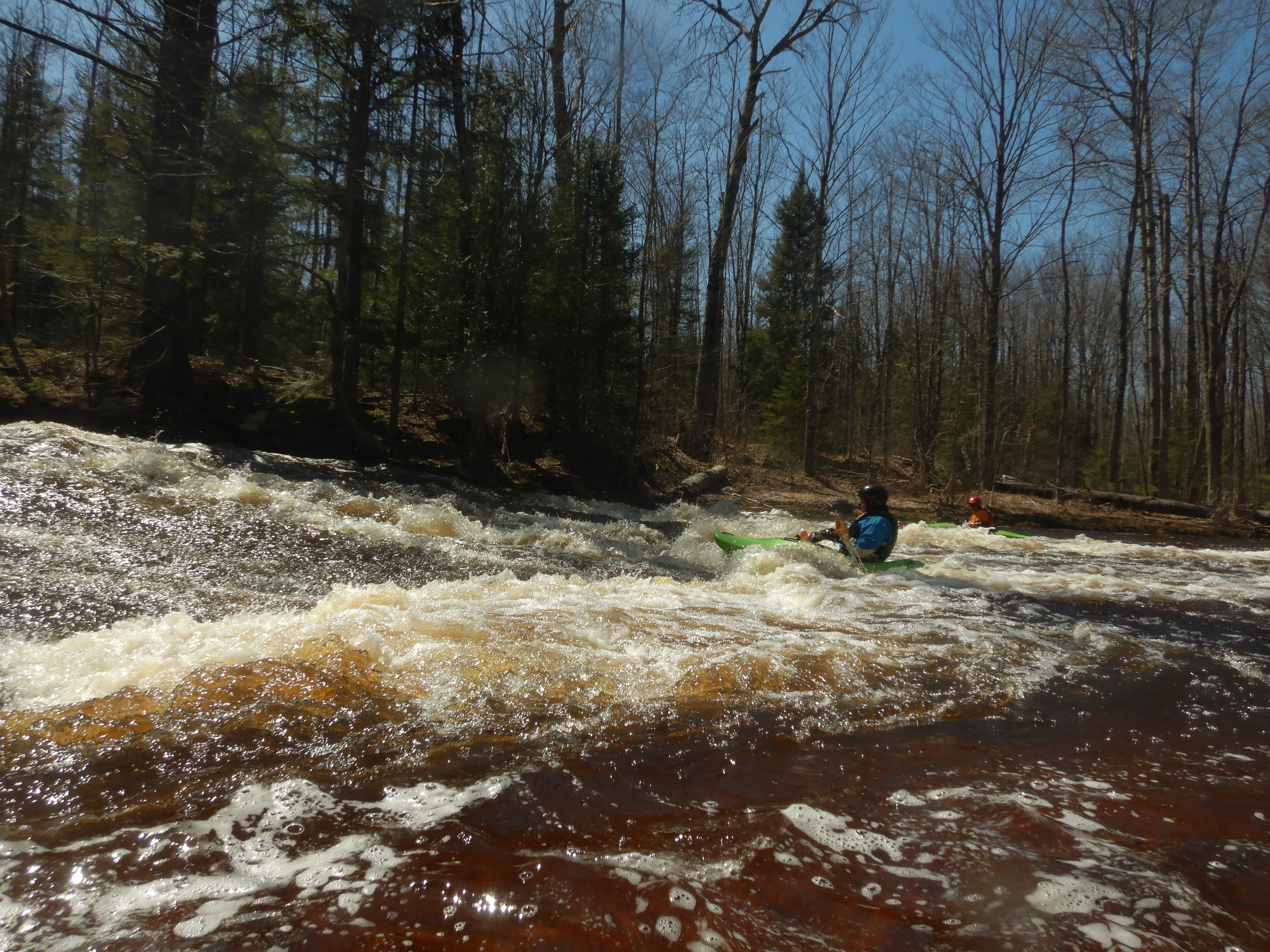
As the river starts to pick up, one will encounter more waves until you reach a series of ledges with a house on river left. There are numerous places to play but no eddies. As one passes the house, there is another river wide hole that can be quite sticky and should not be taken lightly (Class III). It can be punched anywhere but will require you to paddle out of it. It also might offer some play.
From here the river will bend right and you may encounter wood. The river starts to mellow out. There will be some more standing waves and it becomes flatwater. It is about a half mile flawater paddle to the take out at Green Garden Road.
Rescues are difficult because of the lack of eddies and there are two nasty holes that deserve a Class II+/III rating. A significantly obstructed channel (due to wood) after the main rapids makes it deserve a class III rating at high water due to the potential for serious mishap. The wood obstruction makes rescues difficult if a boater should swim in the main rapids near the house. Get swimmers and their gear to shore quickly. Lower water levels will likely be boney because the river is quite shallow in places even at high water/flood stage.
Don't paddle below Green Garden Road. Reports are that the section between Green Garden and M-28 is choked off by wood, e.g. hiking and dragging.
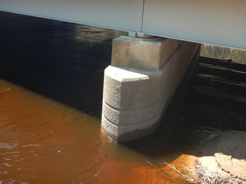
Put in on east side of US 41 South at bridge crossing Chocolay River. Parking for 2 or 3 vehicles. River level can be gauged at bridge abutment on north side. When the water was at 3 lines down from the top, it was paddlable, but I wouldn't go too much below this.
The picture is from the north, looking south, showing the east side of the bridge.
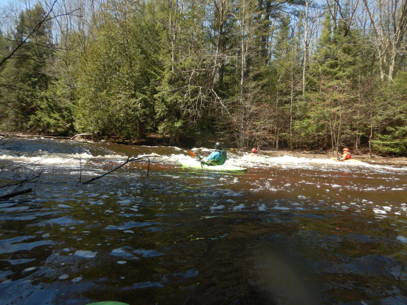
This is the first feature that you come to. A river wide ledge. A good play spot. Take advantage of it.
Second major ledge. It is river wide and as the picture shows, is more of a slide than a drop off. Not a great play spot.
There are two ways to evaluate the water level on the Chocolay.
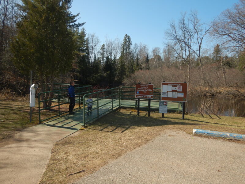
1. Just west of the bridge over the Chocolay on M-28, there is a parking lot with a fishing pier. At one corner of the pier is a guage. It can be paddled at about 6.5'.
2. At the put in bridge on 41 south, look at the north bridge abutment on the east side. There are lines in the concrete of the abutment. It can be paddled when the water is at the 3rd line fown.
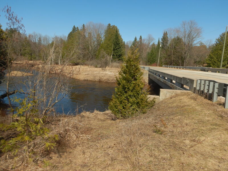
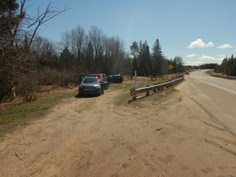
Take out at bridge on Green Garden Road over Chocolay River. Take out on river left after going under the bridge. We found it a bit muddy. Parking is on the side of the road at the bridge. Enough room for a few vehicles.
The picture is from the west, looking east and shows the south side of the bridge.
Apr 26, 2025
The gauge on M-28 showed about 6.5'. On the bridge abutment, the water was at the 3rd line from the top. It was an OK level to paddle. It could have been a little shalower, but not by too much. It certainly could have been higher. We were able to play at the two main ledges. The first is better than the second, so plan to spend your time there. We didn't have any big problems with wood, but did have to get out once and walk around a tree over the river. It is not that wide, so it doesn't take a lot to block off the channel. The Chocolay is a nice warm up trip in the spring.
Apr 17, 2009
I ran this on April 15, 2009. From looking at the topo map and my paddling time, I believe it's longer then 2.2 miles. I took my time, played in one spot for about 45 minutes, and it took about 2 1/2 hours. There is a gauge on the river near M-28 and according to the USGS, the level on the 13th was 4.5'. They only take occassional readings. The level was probably less then this when I ran it. The water was in the banks and up to the grass line and tag alder. I don't think you would want to run it at a much lower level.
The first 1/3 was a pleasant class 1 run in a narrow, winding river. One tree to limbo under and one tree to portage around. You then come to a river wide ledge with a great play spot. Great for surfing, too shallow for any 'tricks', though I don't have any. Plan to play here as this turned out to be the best spot. The next 1/3 of the reach has a number of class 2 river wide ledges. These were getting a little shallow when I went through. This section also included a tree that I dragged over. The last 1/3, the river meanders, splits around islands and has a few rocks. The level was just runnable.
I walked the shuttle and it took about an hour to hike the 4 miles. There is good parking at both ends. At very high water this would/could be a class 3 with the downed trees and river wide ledges.