Warner
Melvin Mills to Warner
| Difficulty | IV |
| Length | 5.4 mi |
| Avg Gradient | 86 fpm |
| Gauge | Warner River at Davisville, Nh |
| Flow Rate as of 1 hour | 48 cfsbelow recommended |
| Reach Info Last Updated | January 7, 2023 |
The Warner is a popular river located in central NH about a 20 minute drive northwest of Concord. It has a huge watershed resulting in a long season that starts in March and can last thru the end of May (or longer). The large wetlands in the headwaters also sometimes delay the effects of rain as well as extending the length of time the river is running. This river is not what you think of in a typical New England whitewater river. It is drop-pool for much of the run with flatwater paddling between each of the major whitewater sections. The water is also darker then typical New England streams since much of the upper parts of the river pass thru wetlands. The geology is likewise a bit different; the rocks are sharp and solid, not the usual collection of loose piles of stones.
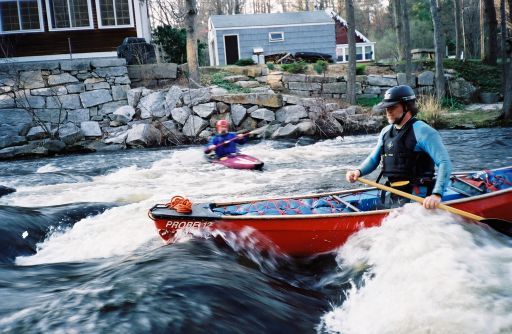
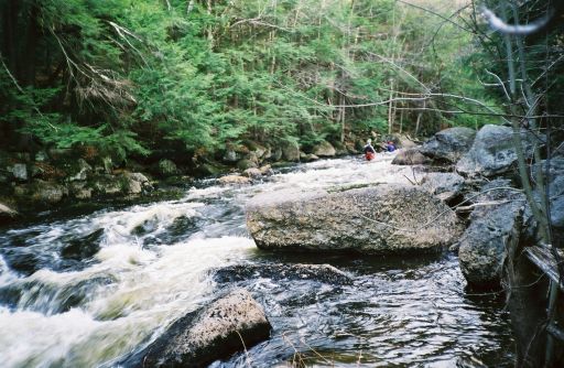
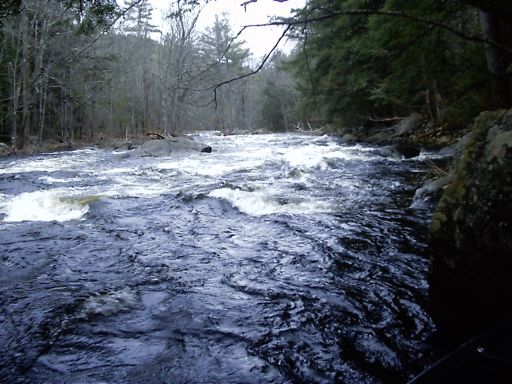
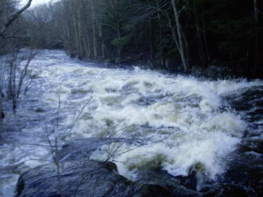
This is a highly technical river, narrow and shallow in the whitewater sections. The upper two-thirds of the run is mostly class III difficulty mixed in with several surfing waves and some class II sections. As you approach the gorge the pace quickens. Pinball Rapid is class IV at medium and higher levels, as are the Sluice Dam and Bridge Abutment sections immediately after. These however are just a warmup for the gorge.
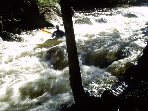
One-and-a-half miles below the put-in is the Warner Gorge. The gorge is a wonderful series of tight drops one-immediately-after-the-other packed into a short-but-intense quarter mile. This section is the main event and the primary reason this river is so popular!!! Scouting is recommended for the first-timer; the gorge is easily reachable from the road. Just park at the Upper Take-out and walk upstream along an old road bed.
Immediately below the gorge is the Upper Takeout, followed by a 15 minute flatwater paddle to a runnable dam (closed boats only, too shallow for open boats), and then more flatwater paddling to reach a long, enjoyable class III rapid just above the middle takeout. [ Note 4/25/07: The cable stret
...
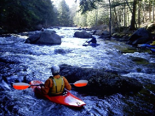
One-half mile below the put in, Melvin Mills starts upstream of a bridge then tumbles past a house built up on the remains of an old mill building. There is a short class III drop here into a large pool. Look out for debris on the river right side of this drop. There are a few more class II-III rapids for the next mile or so.
At the top of the pool a nice surfing wave forms at low and medium levels.
The second class III has a nice ledge in it with a hole on river right.
The third class III begins as the river flows away from the main road again.
There is a nice set of surfing waves in between the Third Class III and Pinball Rapids.
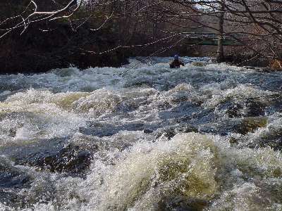
A long technical rapid with lots of rocks and holes to avoid. The rapid starts out mildly just as the river turns away from the road and passes the first set of old bridge abutments.
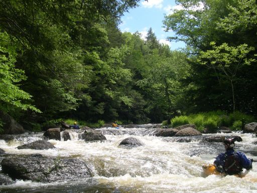
The last bit of Pinball is the most difficult. The route gets steeper and very fast with large rocks in the middle of the fastest channels. At high levels this section becomes very fluid and pushy. Some paddlers however consider it easier at higher levels since you can paddle over the rocks.
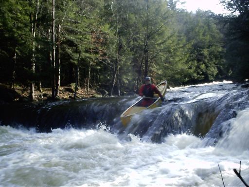
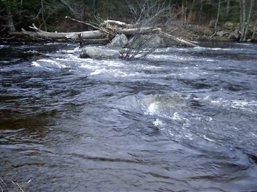
Shortly after Pinball look for a horizon line with a bridge and small buildings on river left. Scout this drop to find the best line. Here, there is the remains of an old mill/dam, there is also evidence here of a newer, yet still abandoned small scale hydro electric project.
(NH Dept Environmental Services
Dam Bureau ID 243.29, owned by Warner River Hydro). There is a concrete bypass on the far left that leads under a culvert then into the small hydro building. There is another steep narrow concrete sluice (4' wide)on the left. If you run the sluice turn your paddle parallel to the boat to avoid loosing it (or your arms) from the vertical concrete sidewalls. The sluice then drops into a hole and a trashy runout.
Note: As of 2005, there is an extra board in the sluice diverting some of the water to the side channel and making the sluice higher and steeper. A run over the dam instead of the sluice is recommended at all except high levels to avoid bottoming out and damaging one's boat. A portage is recommended for open boats and low and medium levels. Update 3/07: The board in the sluice has mostly been worn away by the river, however the board could be replaced by the dam owner at any time.
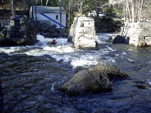
Either channel thru the bridge abutments provides a good run, however the left channel is more turbulant and washes up against a large rock on the bottom and requires quick maneuvering to avoid. Warning 4/22/07: There is a large log blocking both channels; extreme caution is recommended.
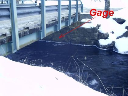
The paddler's gage is painted on the river right abutment of the Laing Bridge Lane bridge.
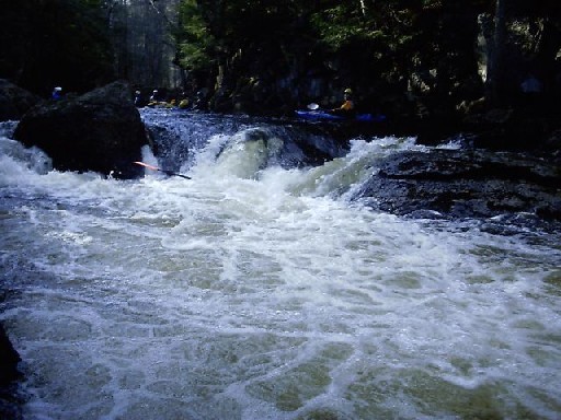
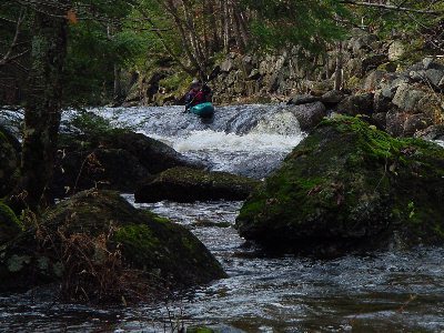
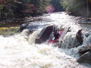
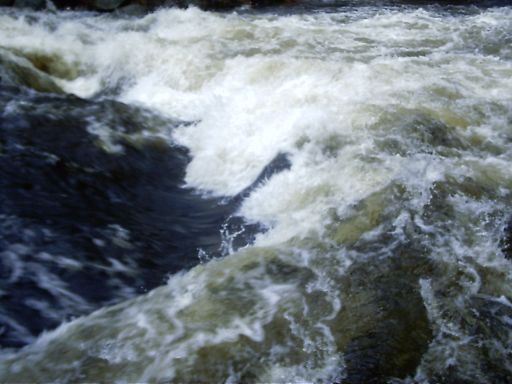
The Gorge is a longish rapid with anywhere from four-to-seven more-or-less distinct drops (depending upon water level and how you count). You can recognize the start of the gorge by the long rock wall on river left that used to be the base of an old and long gone mill building. The first drop is known as the Meltdown Hole, if you hug the right bank by the rock you will dive deep and pop up several feet downstream.
At medium and higher levels this drop can be paddled along the left or center as well. Be aware the center route runs
from left-to-right and tends to flip boats not lined up correctly.
There is a nice large pool/eddy at the bottom of the drop where you can pick up the pieces. The pool immediately leads up to the next drop. Several more drops continue for the next 1/4 mile.
The second major drop in the gorge can easily be boat scouted since it's steepness slows down the upstream current enough to approach the edge, while not being so steep you can't see what you're getting in to.
There is a small eddy along the right just below the initial drop, however it's difficult to enter since the drop curves to the left and momentum brings the boater into the second half (2B) of this section.
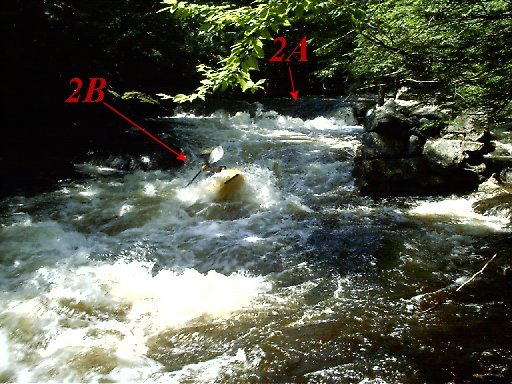
Drop 2B is formed about a dozen yards below 2A where the channel narrows and passes over a ledge. It's not as steep as the prior sections but the speed forms a good set of waves. A large eddy to the right is immediately below the drop where one can stop, pick up the pieces, and scout the next section. At higher levels drop 2B washes out a bit and the
entire 2A/2B section blends together
into one continuous set of waves.
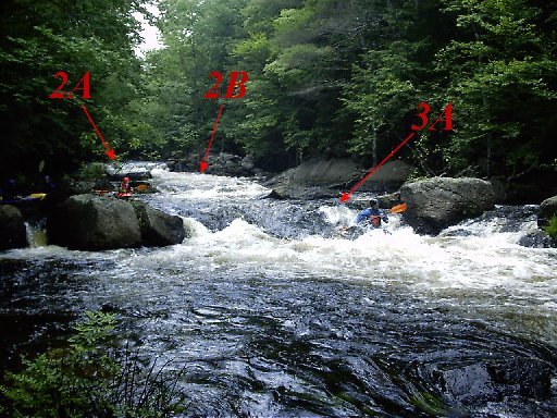
Drop 3A is very similar in character to 2A. An abrupt steep drop that can be easily boat scouted. There is a large eddy to the right below the drop, however at medium and higher levels the area between sections 3A and 3B becomes a continuous set of waves and holes where momentum tends to carry boaters directly from 3A into drop 3B.
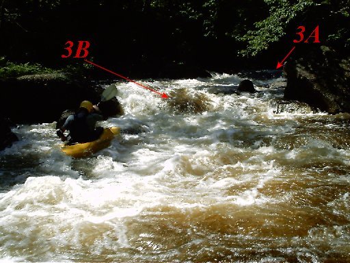
At Drop 3B, the channel curves to the left. The smoothest route is far left however it's difficult to get there since the channel guides the boater to the right side and over the steepest part of the drop. Water volume is not as high since some of the water is diverted thru sieves below the eddy between sections 3A and 3B. Below this drop are eddys on both sides of the channel where once can scout drop 4.
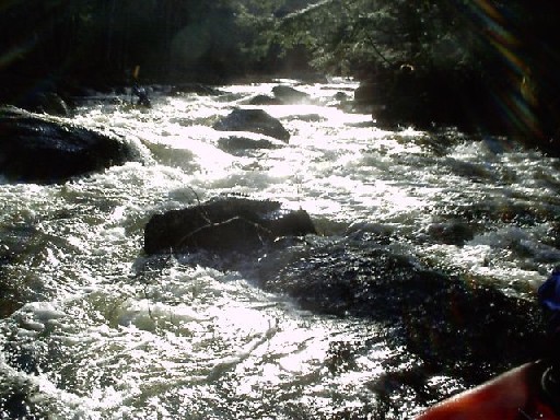
After the first series of abrupt drops the river character changes for the last part of the gorge. Instead of distinct and well-defined drops,
Gorge Drop 4 stretches out as a longish, technical, rocky and pushy rapid that demands superior river reading skills and quick reactions. At lower levels there is a large eddy between the upper and lower halves of this section.
At higher levels the two halves blur into one continuous and quick rapid. Open boats in particular find themselves quickly swept down this rapid teetering on the edge of disaster.
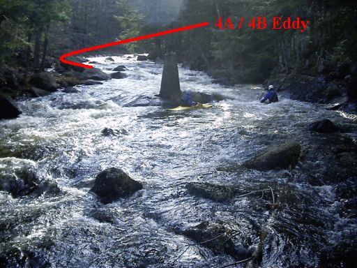
The bottom part of Drop 4 in the gorge is primarily defined by a large bridge abutment in the center of the channel. Either side of the abutment is a fine run, however getting to the right above the abutment is tricky since the channel usually pushes to the left. Below the abutment the left side is full of rocks and river debris so a paddler must quickly move the right.
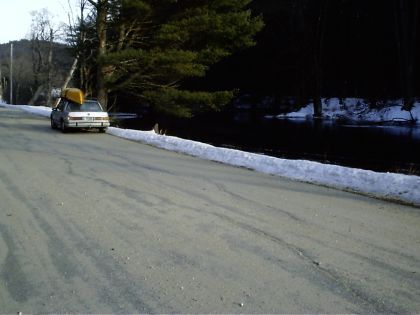
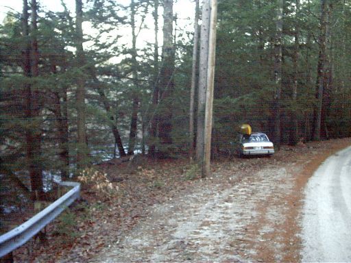
The Upper Take-out is located just below the Gorge. Park anywhere along the flat stretch and paddle almost up to your car.
Halfway between the gorge and the last class III rapid there is an old hydro dam
(NH Dept Environmental Services
Dam Bureau ID 243.07). At medium and higher levels closed boats will enjoy the trip over the edge paddling left of center. Open boats are advised to only paddle this drop at medium or higher levels or risk damage to the boat. The dam can be easily portaged on the right. At high levels closed and open boats can paddle over the rocks along the far right. At very high levels a dangerous hydraulic forms at the base of the dam. Warning: During the warm summer months (the swimming season), a cable will extend across the top of the dam. It is provided by the dam owner as an important safety line for the many people including children who walk across the dam crest to swim and boat there. The cable will normally be taken down after each Labor Day. Since the cable (if
present) extends across at helmet height
it presents a hazard for paddlers At least one paddler snagged her helmet in the cable as she miss-judged the distance when dropping over the lip of the dam.
It is recommended that paddlers take turns with a partner lifting the cable up high out of harms way as one paddles over the dam.
Drawing showing pool below and eroded (now filled) cavity.
This dam, originally built in 1905 has recently been undergoing renovation and restoration. The current owner reinforced the weakened and eroded base of the dam with 250 tons concrete in 2001. It is his intent to maintain the area as a retreat and local summer swimming hole. According to the owner, immediately beyond the base of the dam the river bed drops off in a pool approximately five feet deep before becoming shallower again a short distance downstream of the dam. On the river left edge the old turbine has been recently excavated and is visible just below a new concrete platform. This turbine connected to gears and a shaft that extended up into the small mill building above. When in operation it generated only 50 horsepower.
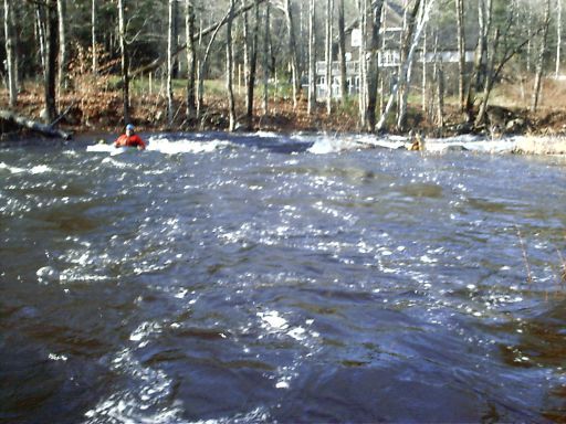
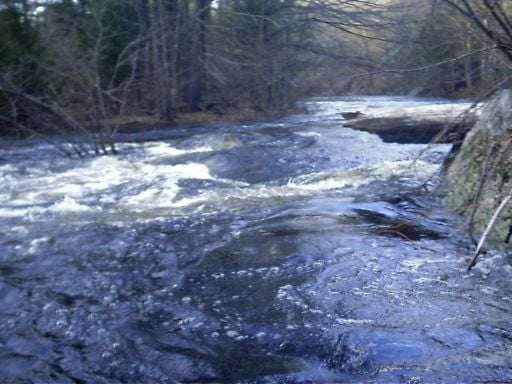
After about a mile-and-a-quarter of flatwater, you'll come to the last Class III which brings you to the second take-out.
The longest on the river (at almost 1/2
mile), the rapid starts just past a curve in the river where it passes under the main road twice. Just above the bottom of the rapid you'll reach an old railroad bridge and the middle takeout. At medium and higher levels this rapid is a blast and well worth the long flatwater paddle to reach.
Near the bottom of the last class III (immediately above the bridge and take-out), be on the lookout for a hidden hole that extends almost completely across the river. Stay river-left for the cleanest route. The Middle Takeout is located here.
The middle take-out is by an old bridge found near the end of the last class III rapid (and immediately below the hole). Road access is easy from either side of the river, however the only parking is on the side road on river left. The class III rapids continue for another hundred yards or so beyond the takeout.
In between the middle and lower takeouts
is a 30 minute paddle thru flatwater, quickwater, and a couple class I rapids.
Portaging and/or dragging over a tree or two is usually required since the current flow is never strong enough to wash away strainers. At medium and higher levels the few class I rapids in this section wash out.
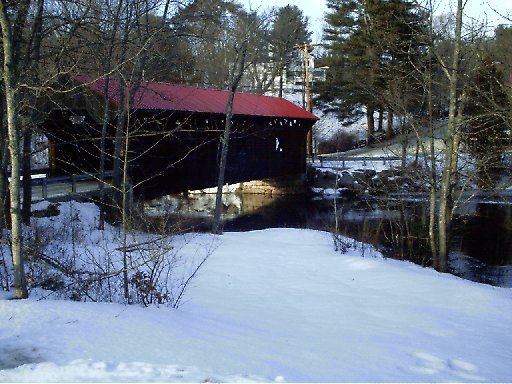
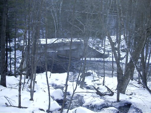
The Waterloo Take-out is by a covered bridge. Take-out on river left along the old railroad bed.
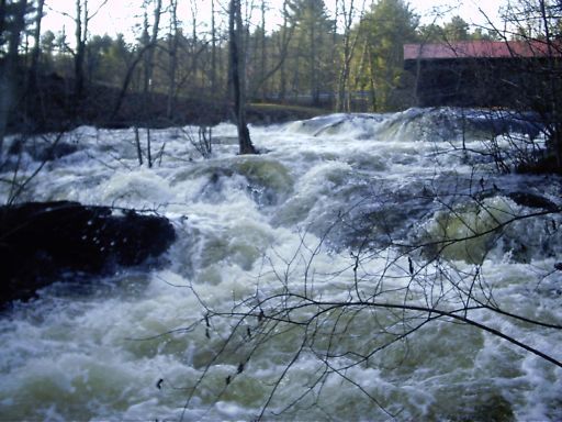
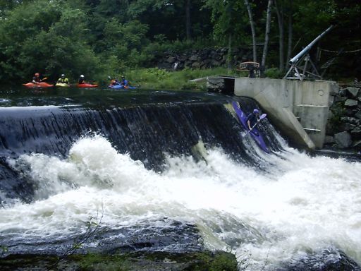
Just below the covered bridge at the Waterloo Takeout is the remains of another old mill dam plus one more difficult rapid. The falls are abrupt and full of debris from the mill so take care. The cleanest route is along the right. At high water hydraulics form at the base of the dam as well. Stay well away from the channel along the left edge as this flows into the remains of an old hydro building (with no safety grate). The falls can be easily portaged from the island in the middle of the channel.
At the base of Waterloo Falls is a longish class IV rapid. Run the falls along the right; the rapid is pushy at technical at lower levels. At high levels big waves and holes form.
Take out just below the Bottom Class IV along river-right. It is a steap 8 foot climb up the bank to the edge of the road.
Apr 4, 2021
We ran from Melvin Mills to the Gorge at 5.3 on USGS Davisville guage. It's a bit scrapy but definitely runnable.
Also adding some navigation info:
Warner Put in: Melvin Mills Rd near Rt 103
43.268739109108786
-71.91295523811262
Warner Take out immediately below gorge. West Roby District Road at corner of Route 103.
43.28086433892445
-71.89720530674172
Sep 8, 2008
09/08/2008 - River Wide strainer. Big pine tree down somewhere between the Put in and the Sluice Dam. The level was about 2 on the boater's gauge and a portage was required. The strainer is fairly easy to spot and there is a reasonable amount of time to get out above it. Not in the middle of a big rapid but there is a fair amount of current flowing into the strainer.
Also many smaller strainers were scattered throughout the run. All were fairly avoidable. We took out right after the gorge so not sure about the wood situation below.
Update: 4/07/2015 - This has been cleared. -C. Begley
Nov 7, 2006
The approach to the third class III starts with a ledge-hole.
The play hole between the third class III and pinball starts to wash out at higher levels.
At higher levels, there is a clean run over the dam close to the sluice.
At higher water the meltdown hole becomes nasty; however there is a clean route down the left edge.
Gorge drop #2A starts to wash out a bit at higher levels.
The hole at the very bottom of the last class III become huge in high water.
During high water, the few class I rapids on the lower section mostly wash out.
During high water, Waterloo falls becomes a dangerous section washing thru the woods.
The bottom class IV starts immediately below Waterloo Falls.
The bottom is next to the river up a steep bank.
Jan 5, 2005
The upper takeout is located along the road. Park and take out anywhere close to the river.
The paddlers gage is located under a bridge above the gorge.
The last class III rapid is the longest on the river, however one must brave a long flatwater paddle to reach it.
The middle takeout is located below the last class III rapid. Takeout on either
side of the river, although river-right provides more privacy for changing.
The rapid, below the lower takeout, has never been run as far as we know. First decent claims naming rights.
The lower takeout is located by a covered bridge.
Nov 1, 2003
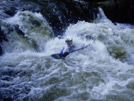
First drop of the Warner Gorge, this one is known as the meltdown hole.
This is the normal route through the dam dropping into a strong hole at the bottom. Make sure you angle your paddle parallel with the sluice way or you could lose it, or your shoulders, when the blades get caught on top.
Just below the Dam Sluice the river drops between old bridge abutements. The left drop is more turbulant.