Warner
Melvin Mills to Warner
Apr 4, 2021
We ran from Melvin Mills to the Gorge at 5.3 on USGS Davisville guage. It's a bit scrapy but definitely runnable.
Also adding some navigation info:
Warner Put in: Melvin Mills Rd near Rt 103
43.268739109108786
-71.91295523811262
Warner Take out immediately below gorge. West Roby District Road at corner of Route 103.
43.28086433892445
-71.89720530674172
Apr 7, 2015
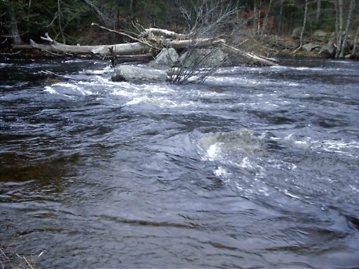
At Bridge Abutment (mile 1.5) the right channel is completely blocked with downed trees. The left channel is partially blocked but still runnable at the far left.
Updated 4/07/2015
This has been cleared - C. Begley
Sep 8, 2008
09/08/2008 - River Wide strainer. Big pine tree down somewhere between the Put in and the Sluice Dam. The level was about 2 on the boater's gauge and a portage was required. The strainer is fairly easy to spot and there is a reasonable amount of time to get out above it. Not in the middle of a big rapid but there is a fair amount of current flowing into the strainer.
Also many smaller strainers were scattered throughout the run. All were fairly avoidable. We took out right after the gorge so not sure about the wood situation below.
Update: 4/07/2015 - This has been cleared. -C. Begley
Mar 23, 2008
03/22/2008
Paddled Warner and no trees in bridge abutment or sluice dam. Also rest of river clear of wood, except for some in the flatwater section - no portage necessary.
Nov 7, 2006
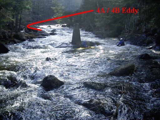
The approach to the third class III starts with a ledge-hole.
The play hole between the third class III and pinball starts to wash out at higher levels.
At higher levels, there is a clean run over the dam close to the sluice.
At higher water the meltdown hole becomes nasty; however there is a clean route down the left edge.
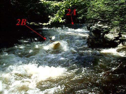
Gorge drop #2A starts to wash out a bit at higher levels.
The hole at the very bottom of the last class III become huge in high water.
During high water, the few class I rapids on the lower section mostly wash out.
During high water, Waterloo falls becomes a dangerous section washing thru the woods.
The bottom class IV starts immediately below Waterloo Falls.
The bottom is next to the river up a steep bank.
Jul 4, 2006
An unusual mid-July run on the Warner at medium levels due to a very high water table remaining after the incredible spring 2006.
Joe plays in the hole below drop 3B.
Nov 3, 2005
At medium and higher levels the class I rapids on the lower section mostly wash out.
Jan 5, 2005
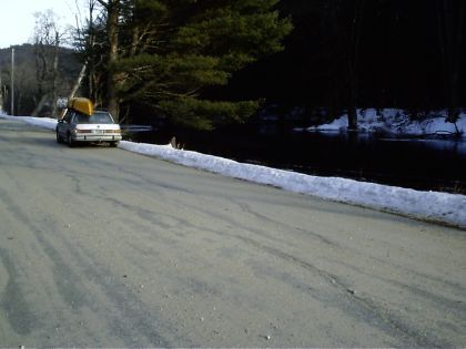
The upper takeout is located along the road. Park and take out anywhere close to the river.
The paddlers gage is located under a bridge above the gorge.
The last class III rapid is the longest on the river, however one must brave a long flatwater paddle to reach it.
The middle takeout is located below the last class III rapid. Takeout on either
side of the river, although river-right provides more privacy for changing.
The rapid, below the lower takeout, has never been run as far as we know. First decent claims naming rights.
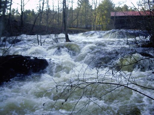
The lower takeout is located by a covered bridge.
Nov 1, 2003
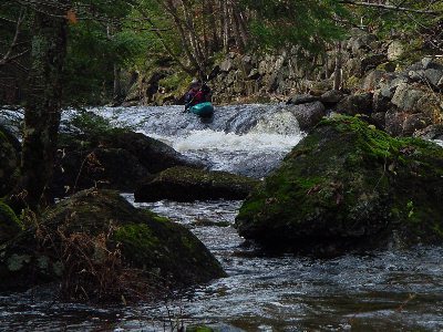
First drop of the Warner Gorge, this one is known as the meltdown hole.
This is the normal route through the dam dropping into a strong hole at the bottom. Make sure you angle your paddle parallel with the sluice way or you could lose it, or your shoulders, when the blades get caught on top.
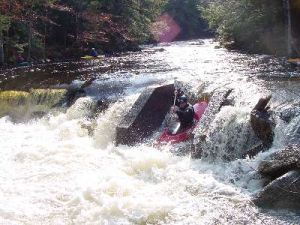
Just below the Dam Sluice the river drops between old bridge abutements. The left drop is more turbulant.