Cache Creek
2) Bear Creek Confluence to Rumsey(Rowboat Rapid/Rumsey Run)
| Difficulty | III |
| Length | 8.4 mi |
| Avg Gradient | 25 fpm |
| Gauge | Cache Creek at Rumsey Bridge |
| Flow Rate as of 29 days | 642 cfsstale data |
| Reach Info Last Updated | November 6, 2023 |
This is the standard Cache Creek run. On any given summer weekend thousands of people float this stretch in inner tubes or 'Kamakazee Rafts' (So called because they are manned by people with little or no training who seem bent on running over YOU.)
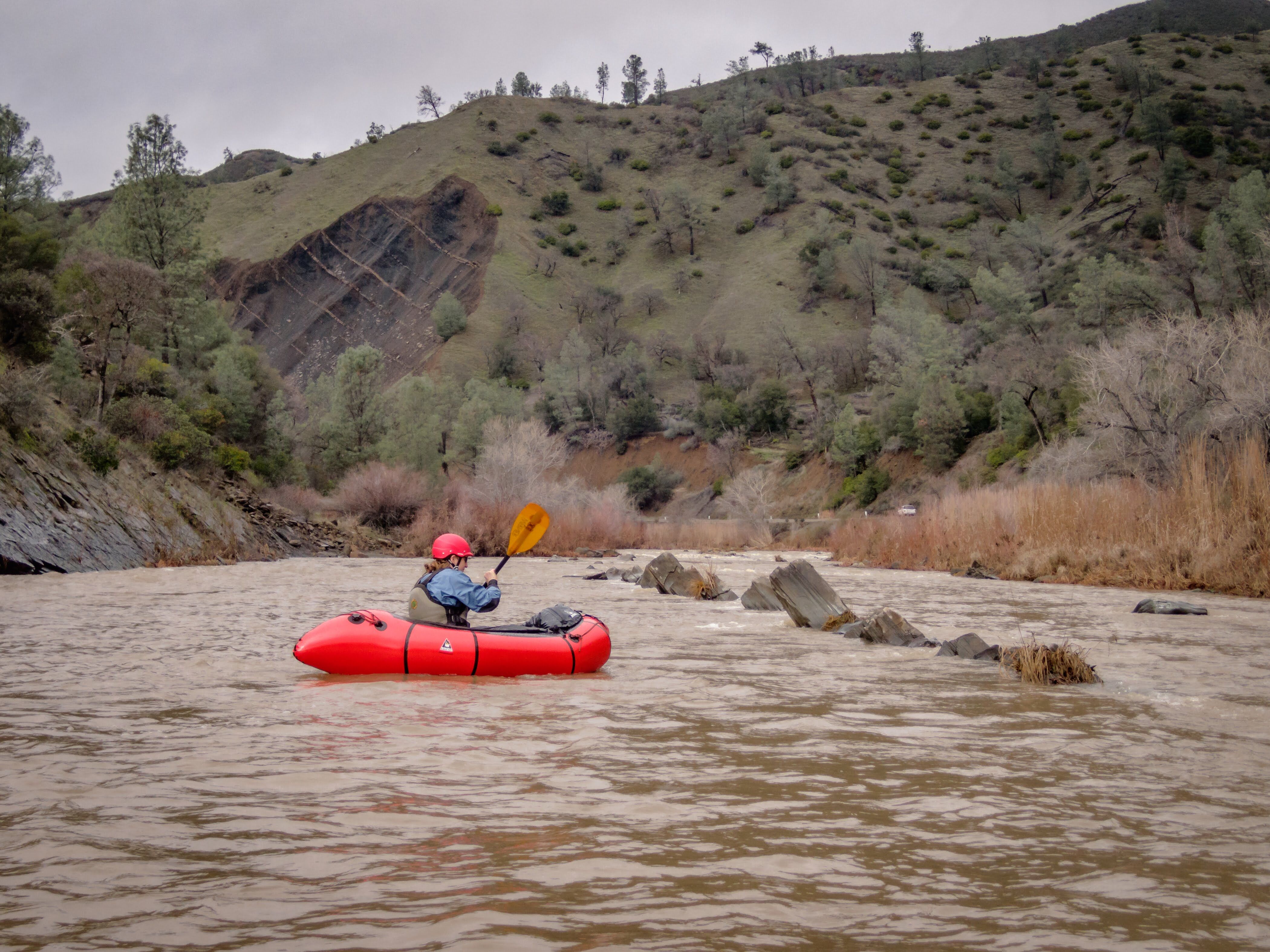
During the spring or on weekdays, this is a very pleasant run. The crowds are pretty much absent and the water is still playful.
The big advantage of this run is that it often has water when almost nothing else does. The water is released to meet the needs of farmers in the Sacramento River Delta. You can expect reliable flows during much of the late spring and into August and usually September.
The water can come from two places. The North Fork water flows out of Indian Valley Reservoir (see the description of the 'Wilderness' run) and is clear and cold while the water from 'Clear' Lake is warm, cloudy, and often, smelly. Generally, the water is a mix of the two and the water quality is acceptable.
There are several possible put-ins and take-outs. All of the land bordering the first 6 miles of this run is open to the public. The most common run puts in at the 'Bear Creek Confluence' (a.k.a. The 'Rusty Truck') and takes out at 'Camp Haswell' (a.k.a. The 'Boy Scout Camp') - This puts you in above the first and takes you out below the second class III rapid. You can also take out below Camp Haswell at a bridge in Rumsey.
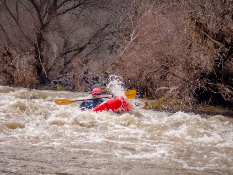
While this run has many fun rapids, only two are Class III. The first is called 'County Line' as it straddles the line between Colusa and Yolo Counties. It is the second rapid below the put in. It involves a sharp drop through a hole and a left facing 90 degree turn. Fun stuff.
The second Class III drop is called 'Rowboat Rapid' although the local outfitters call it 'Mother.' It was named 'Rowboat' because a boat was lodged in it for years that had been carried down from Clear Lake. The boat finally disappeared for good about 7 - 10 years ago. This is the rapid below t
...
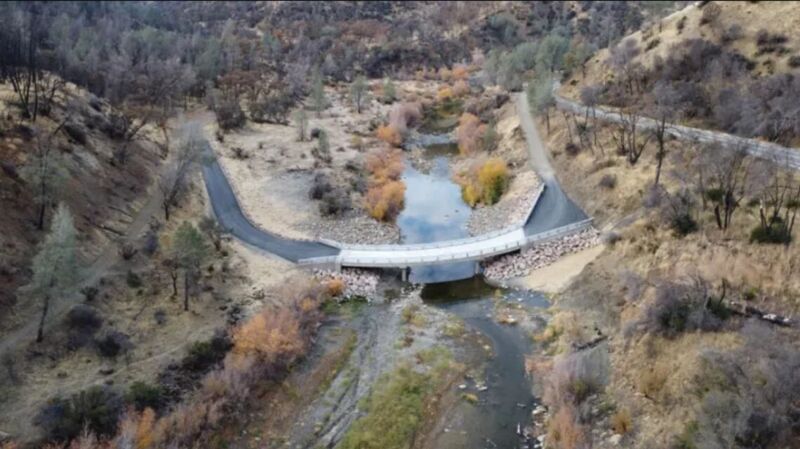
Take out on river left and follow the trail on the upstream side of the bridge. There is limited parking on the upstream side of the road. When that is full, park back on highway 16. Do not park on the other side of the road or the other side of the bridge.
In 2010, this traditional take out was blocked and posted no trespassing by the landowner. In 2012 the take out was reopened and a formal trail was constructed to the river on the upstream river left side of the bridge. This was largely due to the ongoing efforts of a number of boaters to talk with the land owner and negotiate an understanding.
Jul 21, 2026
Was planning on taking out at the Rumsey bridge and was suprised that they're in the middle of building a new bridge. The access trail is gone and I didn't see any access options so we went back up to Camp Haswell and set up shuttle. I'm assuming an access trail will be built after the project is done but wanted to make sure people are aware of the current situation.
Nov 30, 2022
On November 30, 2022 Yolo County held a formal Ribbon Cutting for the replacement bridge at County Road 40, commonly referred to as 'The Low Water Bridge' in many other guidebooks. The previous instream hazard has been removed and replaced with a high-clearance engineered bridge that should not pose a hazard.