Little Suncook
Northwood to Gossville
| Difficulty | III+(IV) |
| Length | 3.3 mi |
| Avg Gradient | 49 fpm |
| Reach Info Last Updated | October 21, 2022 |
Typcially 400 cubic feet per second (cfs) will be released into the Little Suncook River from the Northwood Lake Dam off Rt 4 in Epsom. Remember that dam releases are not guaranteed, check the NHDES site for updated information.
This release will start at or near 8 AM on a date specified by DES and will be reduced to near normal levels by 4 PM that same day. It is best to allow a full 2 hours for the rising water to flush debris all the way to the bottom take-out. The pond in the middle of the run has to swell before the flow is adequately high after the dam. DES reminds people that canoeing and kayaking have inherent risks, and paddling the state’s lakes and rivers is at the paddler’s own risk.
The Little Suncook is located in south-central New Hampshire, flowing into the Suncook River east of Concord. This small exciting creek starts at a dam forming the outlet of Northwood Lake in Northwood. There are three distinct boatable sections. The upper two separated by Bixby Pond halfway between Northwood Lake and the lower takeout in Gossville at the Cumberland Farms convenience store and gas station. Be courteous and only park in allowable public places that do not infringe on private property. Carpooling is encouraged!
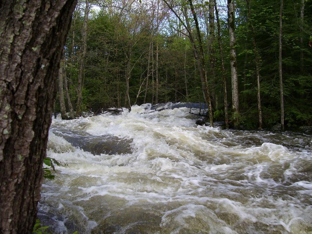
This river is runable during the spring runoff, after periods of heavy rain, and occasionally in the fall during the annual drawdown of Northwood Lake. It is difficult to catch the river at a runnable level; too little water and it can't be run, a little too high and the water extends into the trees with no eddys available for stopping or scouting. It is also extremely narrow for it's entire length. Boaters must be constantly on their toes due the constant twists and turns. Strainers are always a hazard here, additionally open boaters are constantly having to duck to avoid the low hanging trees and branches.
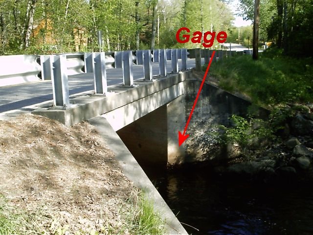
Put in by the bridge where the gage is. The first rapid is a short distance downstream, take the left fork in the channel for the best route.
The class IV rapid starts with an abrupt drop over a ledge into a shallow, steep, rocky channel.
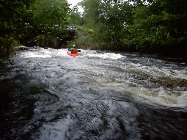
Immediately after departing the lower put-in the river is a string of janky class III rapids. Go sharp RIGHT as you come to the first blind corner. The river splits around a small island...go RIGHT around the island as the left is an impassible channel thru some large rocks. Be prepared to dodge rocks, holes, and trees! The river is narrow, sometimes only 15 ft across at times.
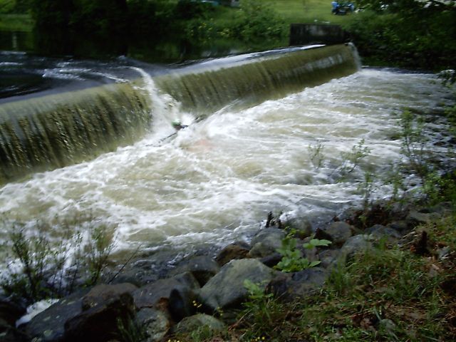
The dam at the outflow of Bixby Pond is only runnable at very low levels. At any level above low a dangerous hydraulic forms at base of the dam. This boater was fortunate and was washed out the left side after a short while. STAY ON FAR RIVER LEFT and boof the drop and you will proceed downstream with lettle trouble. Of course, check for wood -- never enter a blind section of a river without laying eyes on it or follwoing someone who has laid eyes on it.
About 1/4 mile after the dam drop, there is an island split - STAY LEFT - it is relatively easy to see the correct route. Things get steep as you approach the rejoining of the river and you need to push strongly to the right through a narrow 6-ft slot between boulders on center-right. Immediately after this is another river-wide drop and then a large fallen pine in the water on river left, which can be a dangerous strainer for a swimmer here. Fortunately, the narrows typically spits you out on river right and that is the opposite side of the pine, but if a paddler swims above the narrows, it could result in a hard pin getting pushed into the pine, so proceed with caution.
The second class III is the longest on the river.
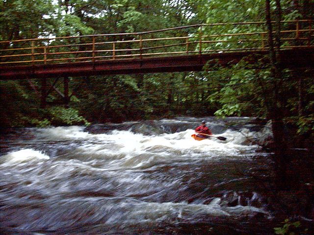
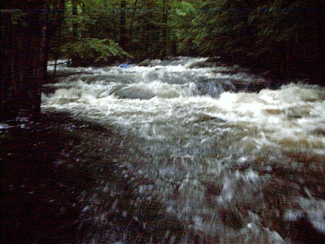
The third class III develops some large holes and waves at higher levels.
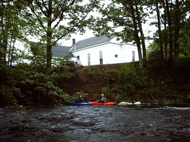
Take out at the Black Hall Road bridge behind the Cumberland Farms store and gas station. (The church was moved up the road in Fall 2007).
Jun 5, 2024
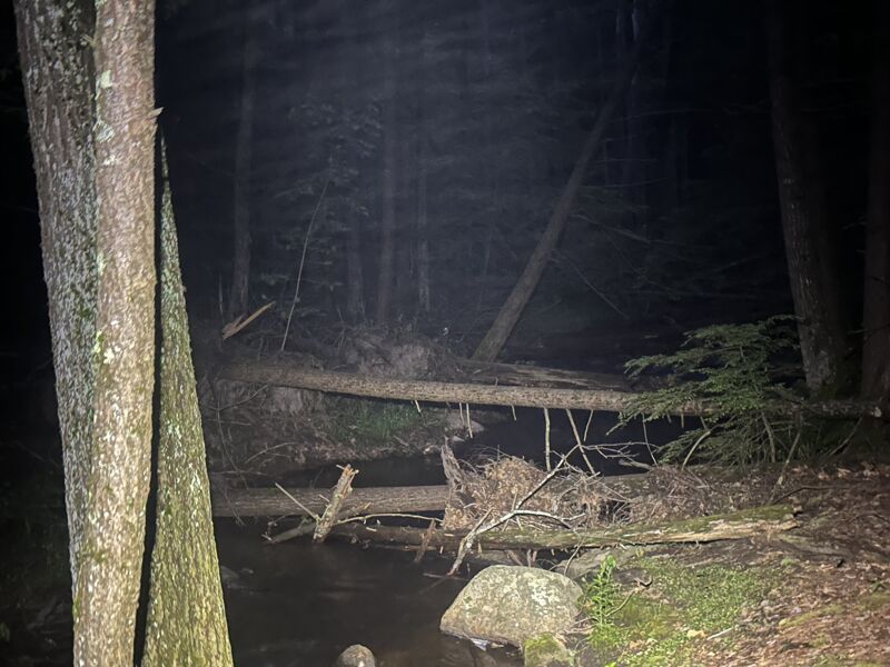
There is A LOT of wood currently in the river. Large, river-wide strainers every 20ft or so. Without a SIGNIFICANT clean up effort it probably will not be runnable this fall...
included photos that are representative of the narrow section of the run before the dam, but the entire run appears to be in a similar state.
Oct 2, 2014
I edited the difficulty for this reach from a solid IV to III+ (IV)
I realize this may be up for debate, so please comment if you disagree with this change.
I believe the previous IV rating applied to the presence of both IV drops on the run. Since only one IV rapid exists on this run, I believe the change now more accurately reflects the true nature of the run.
Mar 2, 2010
Ran the Upper Section down to just above the dam 2/27/2010. There was some wood but nothing river wide. With decent paddling skill everything was avoidable and we were able to paddle around everything.