Murder Creek
Stanfordville to Lake Sinclair
| Difficulty | I-II(III) |
| Length | 4.1 mi |
| Avg Gradient | 15 fpm |
| Gauge | Murder Creek Below Eatonton, Ga |
| Flow Rate as of 32 minutes | 68 cfsbelow recommended |
| Reach Info Last Updated | December 28, 2015 |
Murder Creek is an easy Class I-II float at lower levels. The rapids are caused by a series of shear lines that cross the river. The three rapids are relatively easy until the flow starts going over 800cfs then they start becoming pushier. The last ledge should be scouted above 500 cfs due to the hydraulic action at the drop. When the lake is on drawdown for maintenance the ledge becomes a higher drop.
There are a couple of small ledges at the put in. You can ferry out to the middle and run the tongue or put in at the eddy right below.
A fun warmup rapid at higher flows. At lower flows the left line is a better choice.
This rapid is comprised of a series of boulders and ledges. The low water line is on the left side. At higher flows multiple routes are available, just check for wood. It is very fun at 500cfs and higher. There is nice surf potential throughout. Really nice surf wave at the 'city limits' at the end of the rapid. Nice recovery pool afterwards
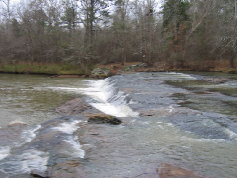
Lake Ledge is the last drop and the largest ledge on the creek. You will know you are almost there by the powerlines crossing the river just upstream. The normal line is run the ledge about 25 feet off the right bank. The left wall after the drop is undercut.
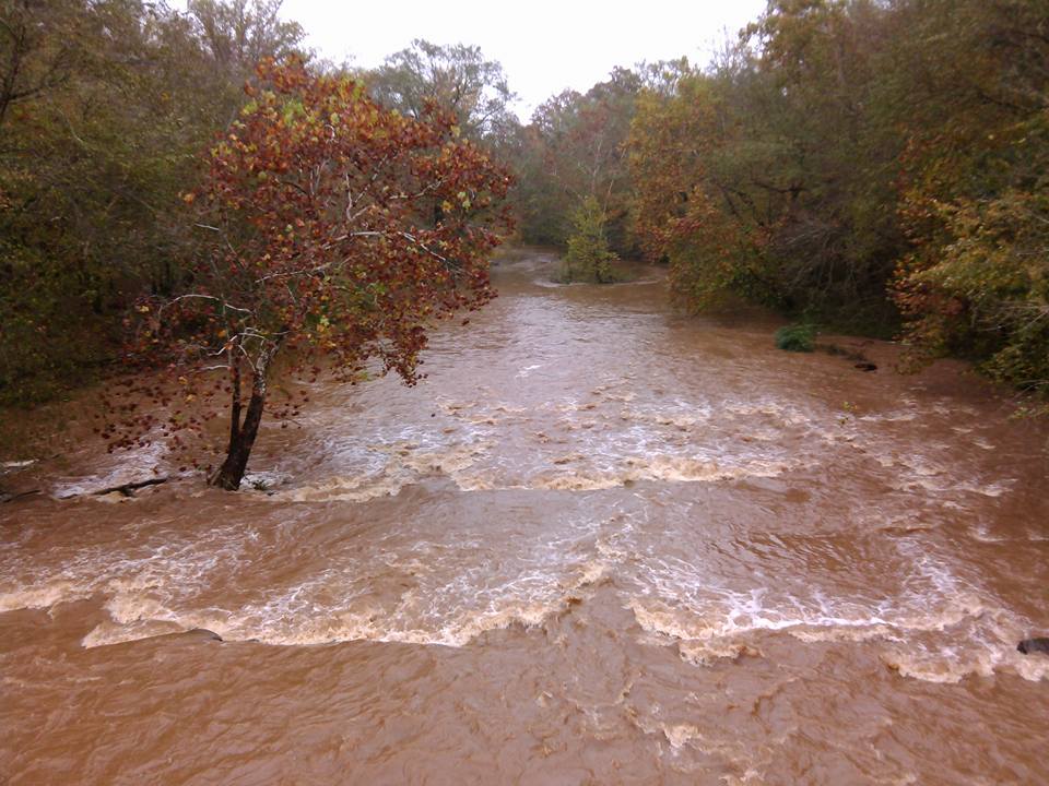
Nov 11, 2015
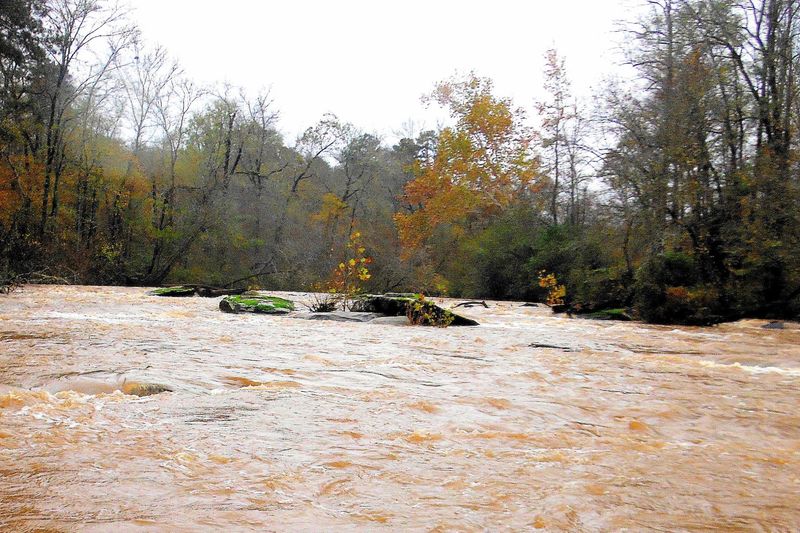
If the river looks like this from the bridge, it's going to be a great level!
Jul 20, 2008
Does anyone know how Murder Creek got it's name? Please dont tell me because someone was murdered there. Something more specific is requested. Thanks in advance. alvoss06@yahoo.com
Apr 3, 2006
just went down there a two weekends ago to get some bouldering done at the top of the last rapid, and the gate was open making this a good park and 'run' (not really playful water) for those that have never gone down a creek and want to get a good idea of what a drop feels like. It's safe and all ... I had to laugh however, who was out of place in the following situation : me and 3 friends and an infant, rock shoes, chalk and kayak gear, or the 2-tooth beer drinking teenager and his uhm... 'brother'?
the level of the water was decent however. Happy paddling
Mar 2, 2006
just an update on that road he mentioned, it is now labled the 'FRED WOOLEN' road and they have laid down some nice thick gravel so no more puddles. How ever the gravel they choice is about the size of half a baseball. Still might need that 4wd. So far i have yet to go down there where the gate at the top has been unlocked and I am still waiting on a response from the USFS about when they will open it. It's about a mile from the gate to the rapid. The nice thing about this little area at the end with the final rapid is that it's also spotted with some decent bouldering on river left. So if you want to change it up a little.. bring some rock shoes and chalk.
There is also a trail along the river left side that goes underneath/in front of the boulders, it is possible to portage back up along this trail if you want to run mutltiple times, but due to the size of the rapid, it's hardly worth it.
Happy Paddling!
Dec 31, 2005
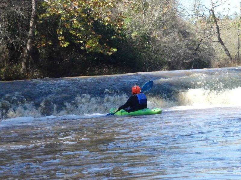
this is the last rapid on Murder Creek, leading up to are some minor class I shoals and low ledges, at high water this is a class II-II+ ledge (about 3.5 - 4 feet)
Another shot of the final ledge on murder creek.
Jul 24, 2005
This time caught it in July at 280cfs. Also I ran the extra approximately 2.5 miles from Hillsboro Road down to the gauge location. It is pleasantly kinky and forested, but showing no rapids at this water level and with some soggy trees to force over.
At 280 cfs, the rapid just below the gauge and the bridge runs cleaner, as does the next rapid about half a mile down. The third rapid, opposite Baker Branch is still hard to thread but better cushioned. Bear off left from center to do it. The approach to the diagonal chute at the final ledge was easier. If you want to 'spectate' the final ledge, usfs 1108 can be found just a bit west of the paved road to Note. (Look hard, it is poorly marked.) The USFS road looks awful, but the puddles have solid bottoms, and we got all the way in using our Accord. At the end is a fenced overlook, plus trails down to the ledge. If you have 4wd, you might carry boats up here after running the ledge, and save the flatwater mile down to hwy 129.
May 15, 2005
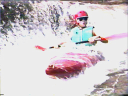
I recommend 200 cfs for a minimally good run. It takes that much to cushion the rocks of the second ledge system, and to cover the shallow rocks on the approach to the chute shown in Will's picture of the third ledge. Blessed with 194 cfs and cursed with a tailwind, I was blown backwards trying to get to the chute and instead ran backwards down next to the river left bank.
The actual distance from the put-in bridge to the hwy 44/129 is four miles. There you will find a boat ramp, a parking lot, and a $3 pay box.