Dolores
07. Gateway to Colorado River (UT)
| Difficulty | II+(IV) |
| Length | 31 mi |
| Avg Gradient | 14 fpm |
| Permit | Permits are required year around and available starting January 1st for the year. |
| Gauge | Dolores River Near Cisco, Ut |
| Flow Rate as of 29 minutes | 34 cfsbelow recommended |
| Reach Info Last Updated | January 13, 2026 |
The Colorado River has been over-allocated and mismanaged for more than a century. Known as the hardest working river in the western US, the Colorado River flows from Rocky Mountain National Park in Colorado to Mexico where it gets sucked dry before reaching its mouth in the Sea of [...]Read More
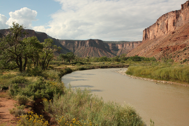
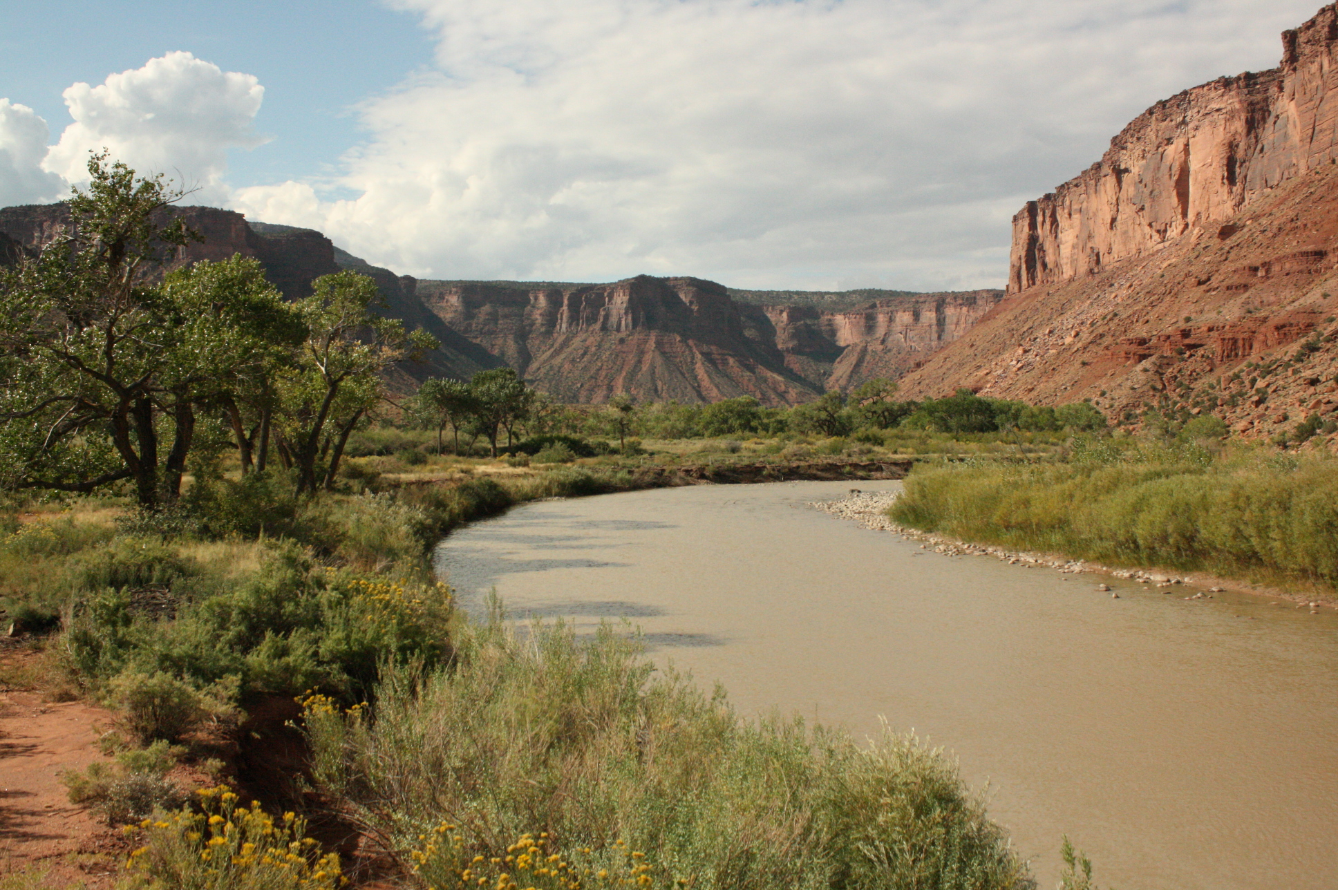
The Dolores River contains an impressive diversity of landscapes, from its pristine high-altitude headwaters in the Lizard Head Wilderness to the red sandstone canyons at the confluence with the Colorado River 230 miles downstream. The basin sustains rare riverside habitats, plant communities, and native fish and wildlife. Historically, the [...]Read More
SEASON: April to early June depending on snowpack and release from McPhee Dam and inflow from the San Miguel River.
ISSUES: Recreational users have traditionally been the last to be considered in the management plan for McPhee Dam. American Whitewater has become a leader in policy discussions around Reservoir management, and restoring flows below McPhee for the benefit of recreation and native fish. Follow the links to the right, for more information.
LOGISTICS: It's a long shuttle via Grand Junction but that also means this section receives somewhat reduced use. The put-in is on the upstream river right side of the Highway 141 Bridge in Gateway. The take-out is at Dewey Bridge across the Colorado just downstream of the confluence with the Dolores. In spring, snow can block the short-cut shuttle through Castle Valley. Inquire locally to see if you can find someone willing to run your shuttle.
DESCRIPTION:
This river sees somewhat limited use compared to nearby desert runs. The shuttle can be long (when the mountain shortcut is blocked by snow), the action is mellow except for Stateline which can be too much action for some, and there's a bit of ranch and mining 'history' that detracts a bit from the scenery. But if you're looking to avoid the crowds, this is a trip worth checking out and with supplemental flows from the San Miguel it can be a possibility when McPhee Dam holds back the spring melt and the upper sections on the Dolores are too low. In some years your only opportunity for paddling the Dolores is to paddle the sections below the confluence of the San Miguel and this one contains the most whitewater. The Dolores is managed by the BLM and they maintain a web page with information on the river. Although permits are not currently required in Colorado, once you cross into Utah, a permit is needed. Permit infor
...
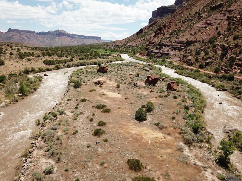
The first significant rapid from the Gateway launch. Most people choose to run this one far left to avoid some of the metal obtrusions sticking out on river right.
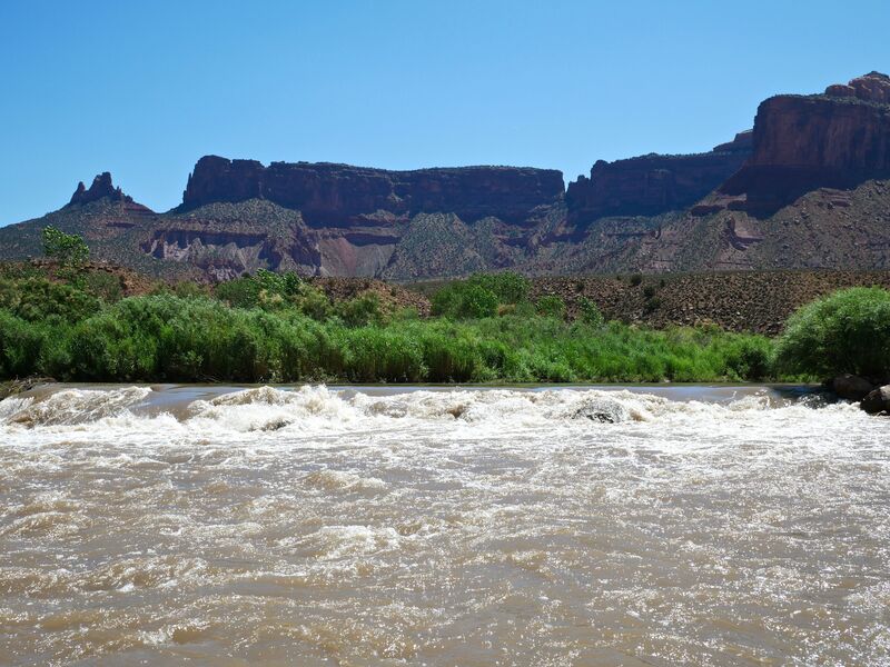
One of the biggest rapids on the Gateway to Dewey stretch. The rapid can be broken down into 3 sections. 1. The entrance bend with the largest waves before the diversion intake on the right. 2. The island with choice of left or right channel. 3. The remaining class II waves below where the channels merge.

At flows above 2000 cfs this rapid offers a challenge to larger craft dodging the large boulders in the Rock Slide. Rock Slide is located just below Beaver Creek entering from river left.
Rapid at Fisher Canyon that comes in on river left with a good hike.
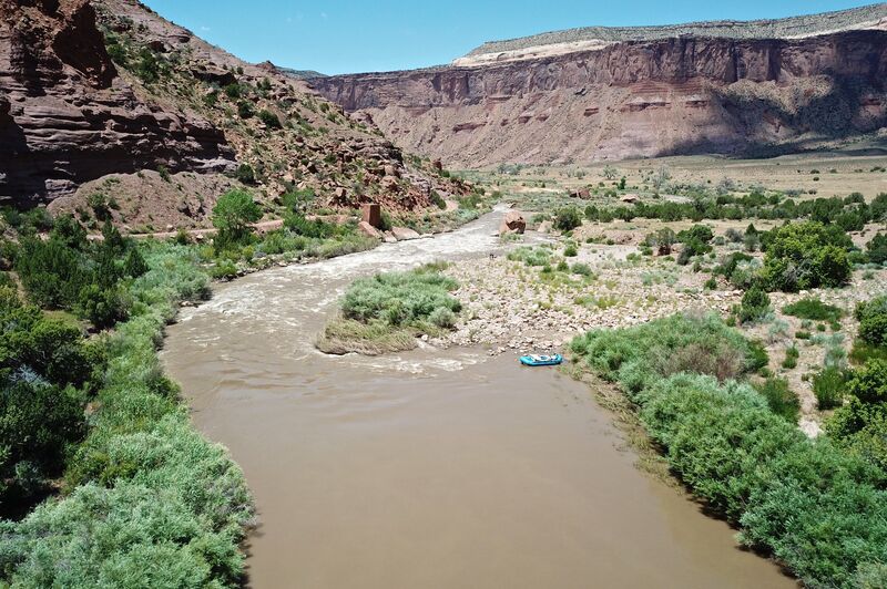
Take out on river left two miles downstream of the confluence on the Colorado River after passing the Dewey Bridge.
Jan 11, 2012
Stateline rapid has changed due to a flash flood spring 2010. At flows from 750-1900 water no longer flows around the upper island at the top of the rapid. After the upper island the majority of the water diverts to the right and goes over the dam. The river left has many more rocks in it and has a narrow run river left. At flows higher then 2000 this may open up more. portage can be done by lining boats over dam on the right.