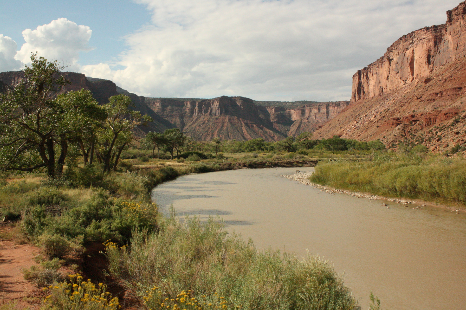
Dolores
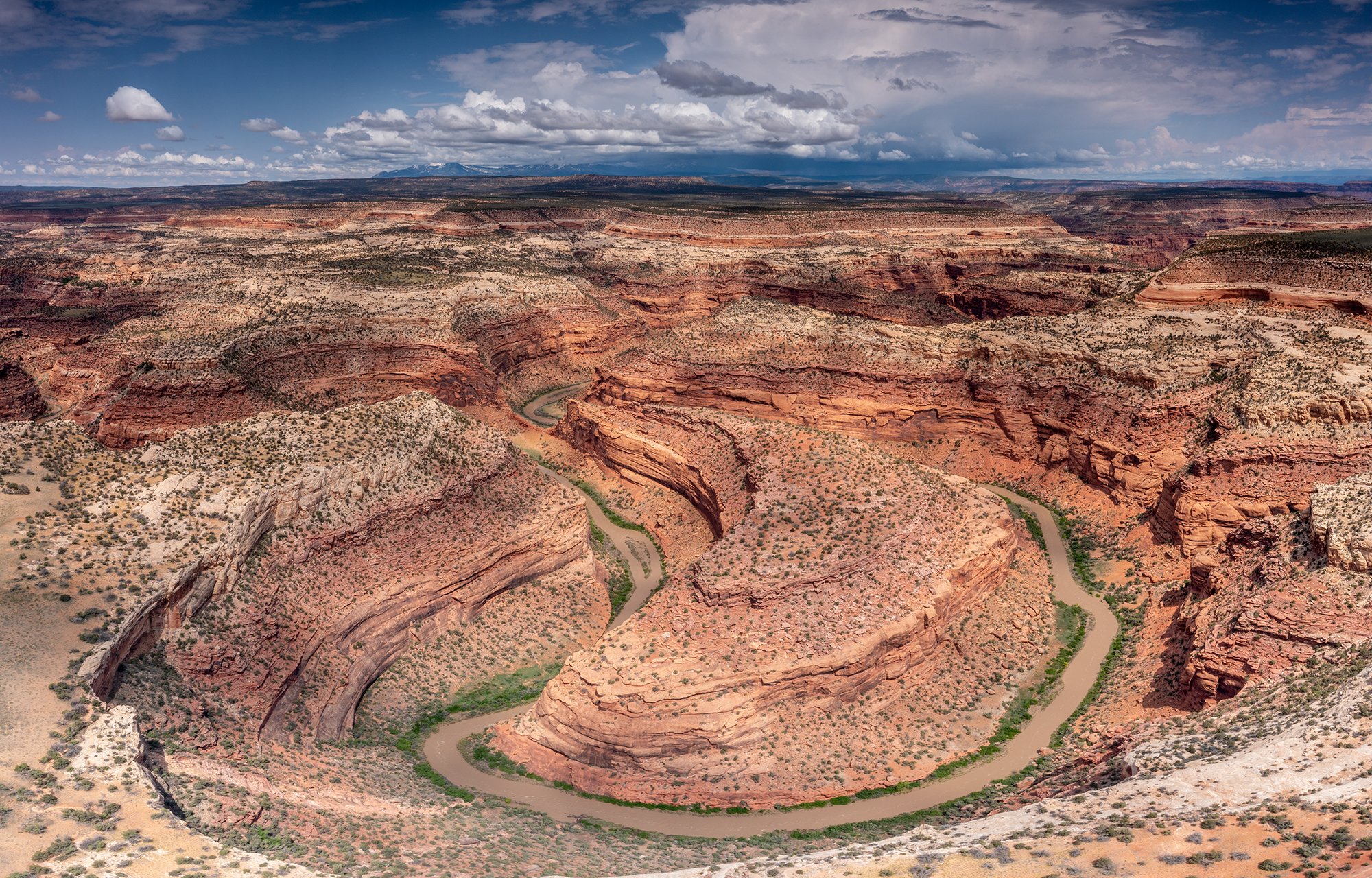
07. Gateway to Colorado River (UT)
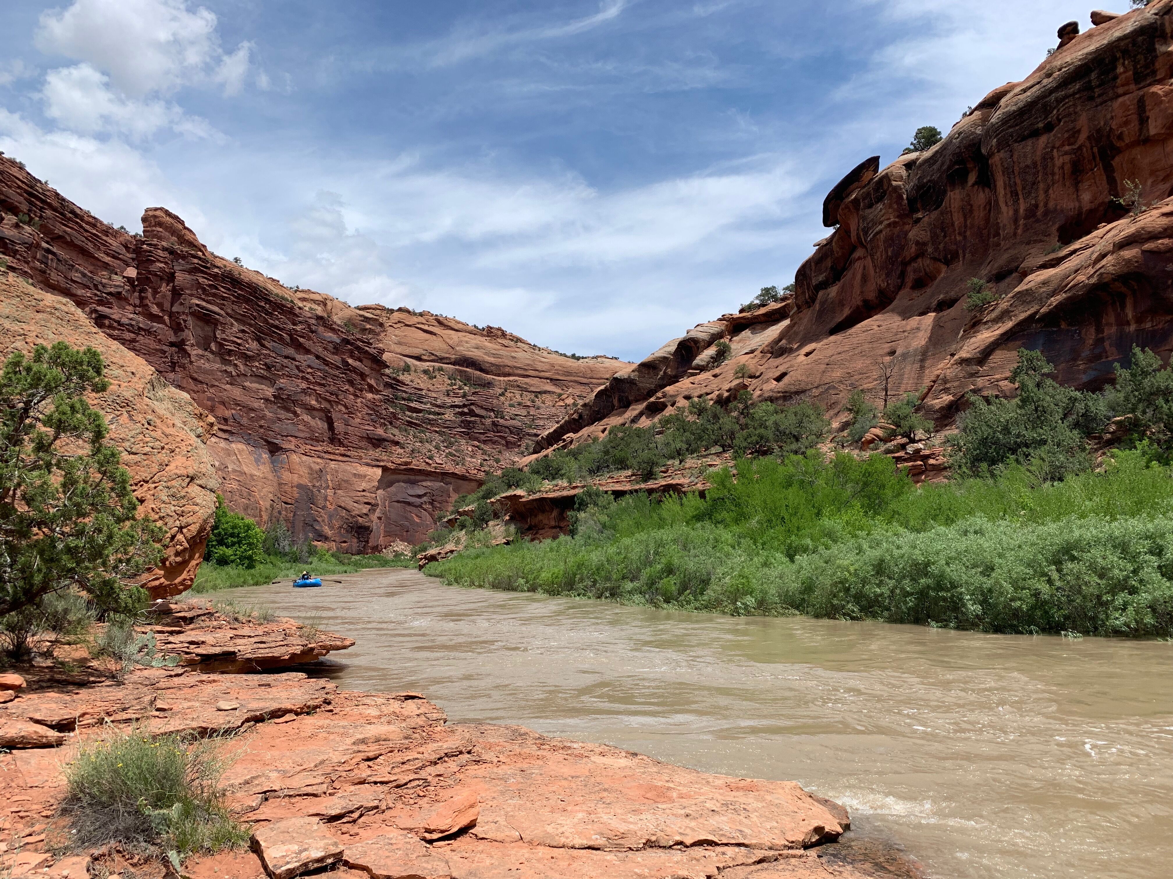
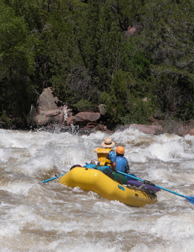
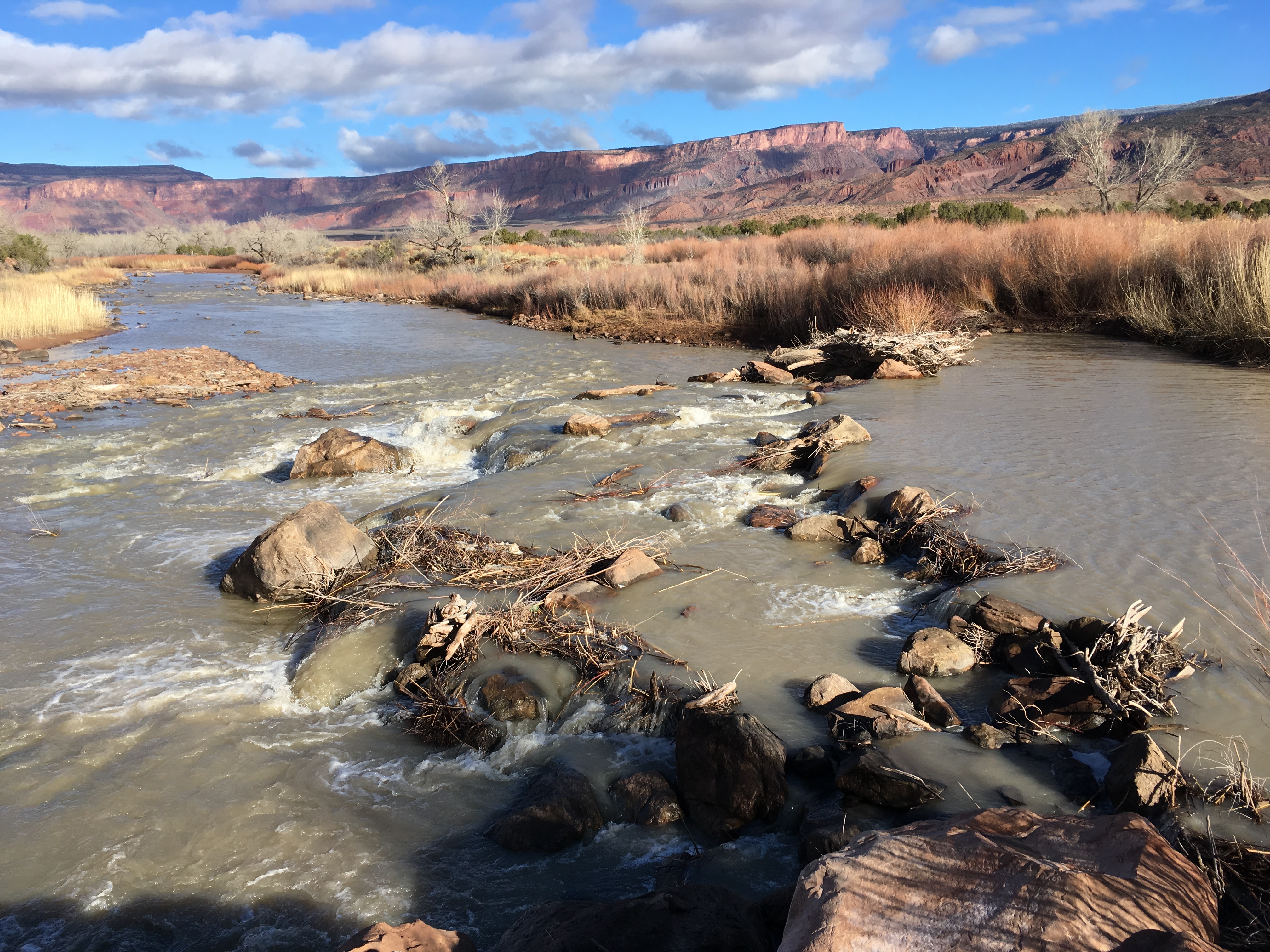
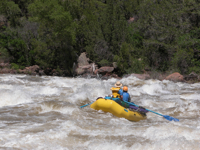
Dolores River Rapids Overview: Gateway to Dewey Bridge 1. Low-Head Dam (Approx. Mile 4.1) Class: II (Hazard) Description: An old, partially destroyed low-head dam presents a navigational hazard. Best Line: Scout the dam beforehand. Small crafts can portage on river left. For a 14' raft, assess the flow conditions carefully; at lower flows, portaging may be the safest option. 2. Stateline Rapid (Approx. Mile 8.3) Class: III at lower flows; can escalate to IV- at higher flows Description: A long, continuous rapid stretching over a mile, featuring a series of rock gardens and tight channels. Best Line: Scout from river right before entering. The traditional line is on river right, requiring a hard right turn around an island to avoid the shallow left side. At higher flows, the rapid becomes more challenging, and precise maneuvering is essential. 3. Rock Slide Rapid (Approx. Mile 11.9) Class: III Description: Characterized by a collection of large boulders obstructing the river, creating a technical passage. Best Line: Scout the rapid, especially at flows over 2,000 cfs, where water pushes hard into the boulders. Navigate carefully to avoid pinning. 4. Diversion Rapid Class: III Description: A rapid formed by a diversion dam upstream of Stateline Rapid. Best Line: Scout the rapid to determine the safest passage, as conditions can vary with water levels. 5. Beaver Creek Rapid Class: III Description: A moderate rapid offering some excitement amidst the calmer sections. Best Line: Follow the main channel, staying alert for any obstacles. 6. Fisher Canyon Rapid Class: II Description: A straightforward rapid with minor waves and obstacles. Best Line: Stay center and follow the current. 7. Hayden Rapid Class: III Description: Features a series of waves and potential holes, depending on flow. Best Line: Scout if unfamiliar; otherwise, follow the main flow, adjusting for visible obstacles. 8. King Rapid Class: II Description: A mild rapid suitable for all skill levels. Best Line: Stay in the main channel, avoiding any shallow areas. 9. Wheeler Rapid Class: II Description: Another gentle rapid offering a pleasant ride. Best Line: Maintain a central line, watching for any submerged rocks.
Please visit http://doloreswater.com/releases/ for full release info. That page is regularly updated on Tuesdays and Thursdays. McPhee is currently releasing 1,200 CFS downstream, and is full. McPhee is poised to begin following the inflows hourly at any time; however, we’re holding at approximately 1,200 CFS for the time being to balance the raised inflows. Currently, we expect daily average releases to be about 1,100-1,300 CFS, through Thursday, June 22nd. Downstream releases are expected to be about 600-800 CFS on average this weekend, June 24th & 25th, with diurnal changes above and below that range. Afterwards releases are expected to continue to decrease daily until the spill has ended. Check back Thursday for an update on this weekend. When following the inflows, releases will mimic the pattern of inflows into the reservoir minus diversions (predicted to be about 700 CFS over the next week), and will vary throughout the day, typically higher in the early mornings, and lower in the afternoons. Flows may be more or less than 800 CFS and are expected to decrease on average over a period of about 10 days until downstream releases reach the planned base flow of 75 CFS.
McPhee is currently releasing 800 CFS downstream. Tomorrow, June 9th, releases will increase to 1,200 CFS. Releases are expected to remain above 1,000 CFS until Sunday, June 11th, when releases will drop down again. After Sunday, releases are expected to remain at 800 CFS to accommodate fishery surveys on Wednesday, June 14th, then will drop as low as necessary to finish filling McPhee.
McPhee is currently at 6922.6 FT water surface elevation. When McPhee is near full (6924 FT), releases will mimic the pattern of inflows into the reservoir minus diversions (predicted to be about 700 CFS) in order to keep the water surface elevation stable. This means releases will start following a less consistent, diurnal pattern similar to inflows where flows will vary throughout the day. Downstream releases could be more or less than 800 CFS during that time, will be determined based on inflows, and are expected to decrease on average until downstream releases reach the planned base flow of 75 CFS.
As always, the forecast can change, and the remaining length of the spill is unknown. Particularly this late into the spill, releases below McPhee can change at any time. Check this page as well as the river gages before making plans downstream.
McPhee is currently releasing 1,200 CFS downstream. Releases are scheduled to stay at 1,200 CFS through at least Thursday, June 1st for fishery sampling below Slickrock. Afterwards, flows are expected to remain at 1,200 CFS through the weekend and into next week as McPhee fills the last five feet or so to 6924 FT water surface elevation. When McPhee is full, releases will begin mimicking the pattern of inflow into the reservoir minus diversions (which are predicted to be about 700 CFS) in order to keep the water surface elevation stable. This means the releases will start following a less consistent, diurnal pattern that can vary in discharge by up to 1,000 CFS or more within a 24 hour period. During this phase, releases should start out at raftable levels, but the lower the river above McPhee gets, the greater the risk that releases can drop below 1,200 CFS during this time — particularly in the late afternoon when inflows are at their diurnal minimum. Cool weather or cloud cover over the McPhee drainage may also reduce flows temporarily.
The duration of raftable flows after June 2nd is unknown, but for planning purposes, raftable flows (1,200 CFS or more) are expected to continue for approximately 10 days, and may extend longer.
Be aware, this is a forecast, and the true length and volume of the spill remain unknown. Releases below McPhee can change at any time, though operators will endeavor to minimize unannounced changes. As usual, we will continue to monitor conditions and will update this page as the spill progresses.
American Whitewater has asked us to post a link to their online rafter survey at https://www.surveymonkey.com/r/DoloresBoaters2023.
Please visit http://doloreswater.com/releases/ for full release information. That page is updated weekly on Tuesdays and Thursdays.
McPhee is releasing approximately 4,000 CFS, which is where releases are expected to remain until Thursday, May 25th.
Currently, we are planning to reduce releases for Memorial Day weekend. Based on the current runoff forecast, we expect to begin ramping down to 3,400 CFS on Thursday, May 25th.
One of the ecological goals for this year’s release is to run some lower raftable flows to accommodate a fishery sampling run by CPW in late May. For this, the plan is to get releases down to 1,200 CFS by Tuesday, May 30th and hold there until Friday, June 2nd. To reach that rate, releases will ramp down at a rate of approximately 100 CFS every 3 hours starting Sunday, May 28th, reaching 1,200 CFS the morning of the 30th.
On June 2nd, releases are expected to quickly ramp back up to a flow that stabilizes the reservoir elevation, possibly to 2,000 CFS or higher. The duration of raftable flows after June 2nd is unknown.
For planning purposes, raftable flows (1,200 CFS or more) are expected to continue through the first week of June and may extend longer. Be aware, this is a forecast, and the true length and volume of the spill remain unknown. Releases below McPhee can change at any time, though operators will endeavor to minimize unannounced changes.
Jul 10, 2024
Flows in the Dolores River below McPhee Dam depend on how its dam and irrigation infrastructure are operated. Since the construction of the dam, boatable flows are only available in […]
Jul 12, 2019
Releases from McPhee Reservoir into the lower Dolores River have come to an end for the 2019 season. American Whitewater is collecting feedback from paddlers who got out on the […]
Apr 10, 2018
Gateway, CO – This week, a Colorado water court approved instream flow water rights for the lower Dolores River, protecting up to 900cfs during spring peak flows as well as […]
Jun 30, 2017
American Whitewater is conducting a survey to directly gather information from paddlers that experienced the Dolores River during the 2017 Boating Release from McPhee Dam. The feedback you provide us, […]
Feb 17, 2017
Cortez, Colorado – Every spring, American Whitewater and local interests in Dolores Water sit down with the latest data on snowpack, water supply, and McPhee Reservoir storage, to determine how […]
Feb 6, 2017
Gateway, Colorado – American Whitewater and our partners have begun a multi-phase project to reconstruct the Wines Ditch No. 1 Diversion Structure located on the Dolores River near Gateway, Colorado. […]
Mar 2, 2016
The Dolores River was named the "River of Sorrows" by early Spanish explorers, though they never could have guessed how fitting that name would become. The water of the Dolores […]
Oct 25, 2011
Colorado River Basin – American Whitewater is asking for paddler input on flows and recreation quality for rivers across the Southwestern United States. Whether you live in Boston or Jensen, […]
Apr 8, 2011
Colorado – In order to advance our goals in the Dolores basin, American Whitewater has hired a Dolores River Stewardship Assistant. We are happy to announce that Jay Lochert has […]
Feb 7, 2011
American Whitewater is working with a coalition of conservation groups to establish legal and policy structures that meet defined flow needs for the Dolores River. In order to advance our […]
Sep 30, 2010
Colorado – American Whitewater has recently brought our expertise to bear on Dolores River Management and is actively working to restore instream flows to the Dolores Canyons. Our staff […]
Aug 31, 2010
American Whitewater is wrapping up it’s assessment of preferred boating flows for the main stem and tributaries of the Dolores River below and above McPhee Reservoir in southwestern, Colorado. We […]
Apr 3, 2008
2008 Forecasted Spill Dolores River Below McPhee Reservoir (updated 3-31-08) No change to the seasonal forecast below, though new inflow forecast due later this week. Releases this week, March 31 […]
Apr 3, 2008
2008 Forecasted Spill Dolores River Below McPhee Reservoir (updated 3-31-08) No change to the seasonal forecast below, though new inflow forecast due later this week. Releases this week, March 31 […]
Feb 13, 2008
Help Preserve Whitewater & Paddling Throughout the Deserts and Mountains of the West Reforming the 1872 Mining Law will, finally, give recreation values a voice on how our federal […]
Feb 13, 2008
Help Preserve Whitewater & Paddling Throughout the Deserts and Mountains of the West Reforming the 1872 Mining Law will, finally, give recreation values a voice on how our federal […]
Feb 9, 2001
Sign the Russell Fork Summer Release Petition Today! The Russell Fork is one of the most stunning whitewater streams in the south east US with three outstanding whitewater sections accomodating […]
Dec 8, 2000
A tragic kayaking accident occurred on the La Grande Canyon of theNisqually on December 2, 2000. Chris Ringsven became pinned in hisboat in a rapid referred to as Hammer Slammer. […]