Floyds Fork of the Salt River
Hwy.1526 to Hwy.61/Salt River (Shepherdsville) (9.6 miles)
Oct 19, 2011
The aforementioned stainers at theTaylorsville Road bridge have been removed in full. That being said, this small stream still captures and holds a fair amount of woody debris after rain events so always be on the look out for trouble around bends.
A new creek access site is now open on Cane Run - go to www.theparklands.org for direction and information. The new access is about 4.5 miles downstream from the Fisherville access park.
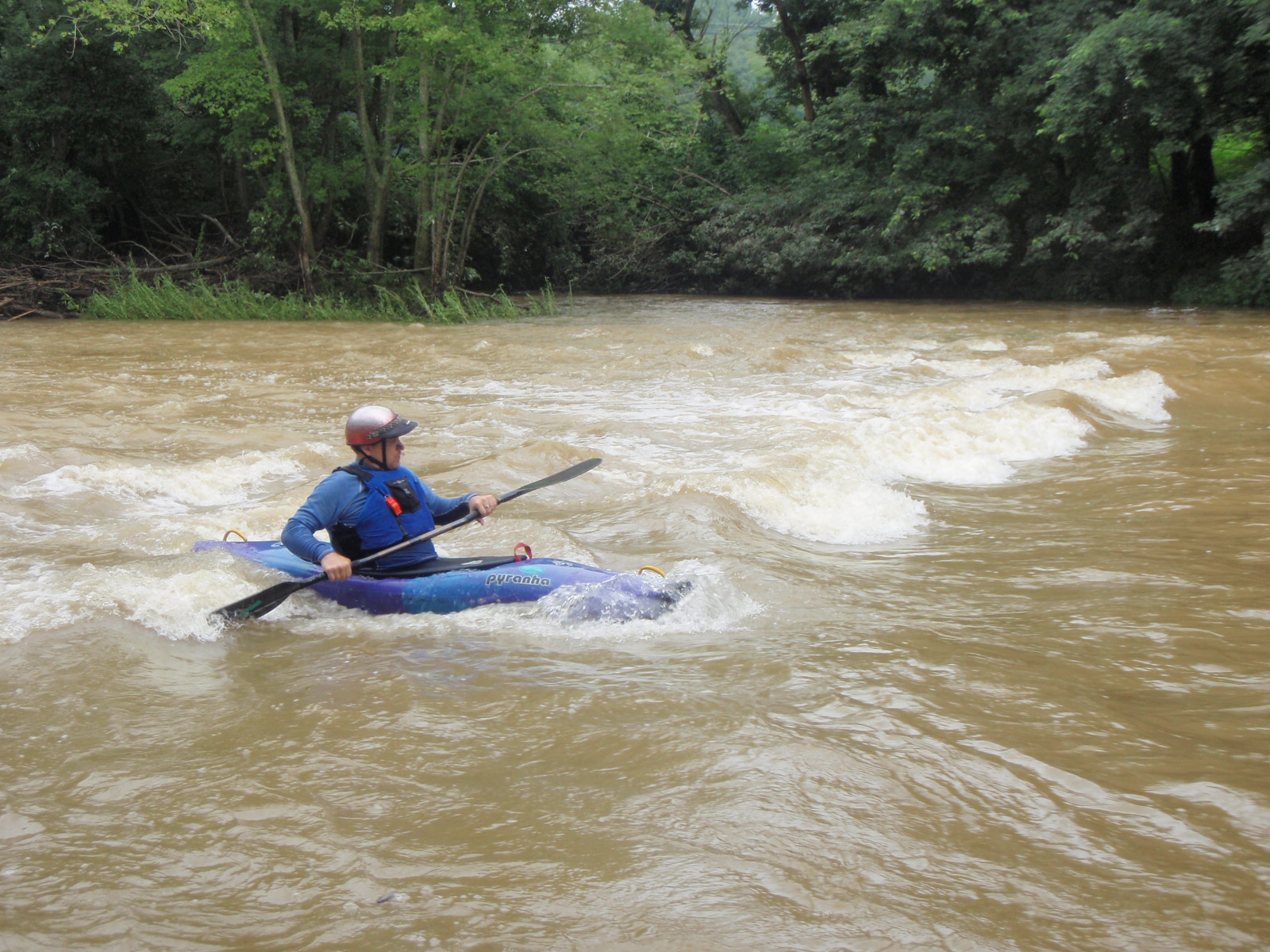
Oct 24, 2009
It's between Aiken Roan and Shelbyville Road. The photo was taken with the PeeWee Valley gauge at 500 CFS.
Oct 24, 2009
I did a great trip from Aiken Road to Shelbyville Road at 500 CFS. The only flat water we ran in to at this level was the last mile of the trip, so 500 CFS is a pretty good level for this run. There was a SURF WAVE there, and I have some great footage of it!!! The end of the video has a bunch of pics that I took throughout the trip. Parking information is in the description of the video, enjoy: http://www.youtube.com/watch?v=-yjXkS7uY6Y
Wow the Peewee Valley gauge I use for this run even has water temperature now: http://waterdata.usgs.gov/usa/nwis/uv?site\_no=03297900
Apr 21, 2008
Just Ran the section of Floyd's Fork from Miles Park to Fisherville Canoe Access...Ran it at about 110 cfs and did a little dragging. it was a nice run though for the recreational kayakers we are. Lots of paddeling. Saw raptors, mink, turtles. I would highly suggest this run for anyone just wanting to relax.
Dec 8, 2007
4/23/06
Ran Floyds starting at the 1526 bridge to the 44 bridge, and at 8 feet on the dot; it is solid flatwater. We only encountered 2 rapids, both tiny, and disappointing. The scenery though was amazing thanks to the fact that you’re in a deep valley with gorge walls on top of the creek's upper bank for almost the entire trip. I have seen lots of rapids in this section using http://terraserver-usa.com which uses satellite taken photo's, but I guess at 8 feet they all wash out. Here is a good floyds fork trip: Putin at Factory Aiken Rd(from 265 go east on Shelbyville rd, north on Piercy Mill Rd.(next 2 Thortons), turn right on to Aiken, B 4 the bridge turn right on abandoned road, park left at the very end) Takeout at 60 aka Shelbyville Road.(Exit 19 off of 265 go east) Both the puttin and takeout have absolutely amazing parking places. Aiken road has a side road right next to the bridge that has been abandoned, park there. Shelbyville road next to the bridge has a dirt road right next to the creek and you can park there. This run includes a gorge section that doesn't last very long, but it is really fun at high levels, and I have even had to crash through a 3 foot standing wave after a slide with a slight gradient. You also go through Valhalla Golf Course on this trip, and under a cool train trestle. At the beginning of the trip in the woods there's a fork, and we stay left because the right is always a dead end, but be careful because right after this part there is a big logjam. It’s runnable, and I have fun doing it, it's about a 1 foot drop over a log, but at low levels you might need to portage it depending on what it looks like. I recommend running this section anywhere around 1000 CFS. Use the PEWEE VALLEY gauge located at this URL address: http://waterdata.usgs.gov/usa/nwis/uv?site\_no=03297900
