Saint Vrain Creek, North
01. Peak to Peak Hwy to Buttonrock Preserve(Upper NSV)

| Difficulty | V+ |
| Length | 11.1 mi |
| Avg Gradient | 196 fpm |
| Reach Info Last Updated | December 10, 2018 |
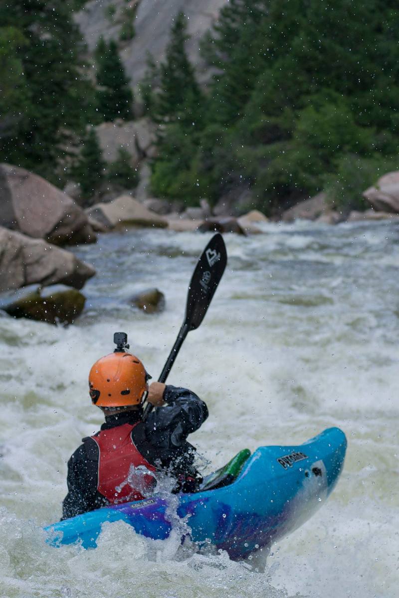
Upper North Saint Vrain Creek is the the only major canyon in the Front Range that hasn't had a highway or railroad blasted up it. It is quite a long day with 10+ log portages and numerous Class V and V+ rapids. Not for the meek, it has been said that UNSV is a place to take your enemies, not your friends!
Be on a constant look out for wood, running blind corners is not a good idea. When in doubt, scout.
There are 3 distinct sections with markedly different personalities as you work your way toward Buttonrock Preserve.
The first zone is the Murkwood Section; manky Class V with an abudnace of wood through out. Although the rocks are nice and round, the pinball nature of the rapids combined with the wood make this upper section a difficult place for some to enjoy. If this happens to be the case with you, walking back out here, as the car is still very close, can be a good idea..
Cascade #1(V) starts off about 50 yards below the put-in. It's not so much unrunnable as it is ugly, manky, and un-fun-able. I usually portage (river left past the no tresspassing signs) straight from my car to just below the last ugly drop. The run-out of Cascade #1 is actually a lot of fun. About a ½ mile downstream is Cascade #2, which is a pretty sweet boulder choked rapid. The Murkwood section continues on for about 3 more miles, the gradient gradually petering out. There is a lot of wood in here, and it moves around a lot at high water. Runs before and after the peak will have wood portages in different rapids.
This second section is a 4 or 5 miles Class III strech, through some very dramatic terrain, you will see huge ridges of rock coming down from the top of the canyon to river level. Your instincts tell you that there is going to be a huge rapid where the river and the ridge meet, but there isn't.
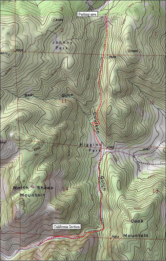
The third and final zone is called the California Section.
The rapids transition from manky broken rock to smooth granite bedrock. You'll kn
...Put-in and run some bony Class IV with the intention of getting out real soon, or just start a stealthy portage down river left...
Long and technical, about half as steep as the first cascade. Still not to be taken lightly.
Rock Creek comes in on river right, this is about the end of the Murkwood Zone. Expect less wood and mellow Class III for several miles.
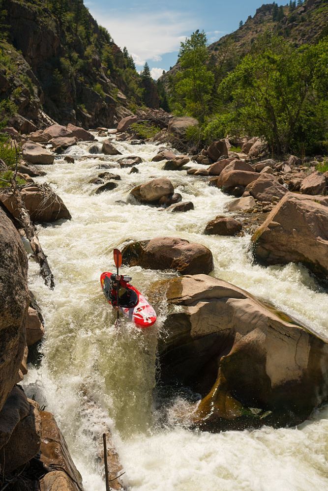
The river character transitions to smooth bedrock and the gradient starts to pick up progressively.
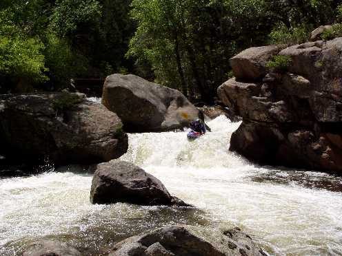
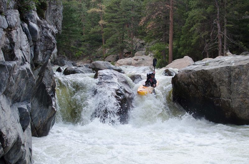
The most steep and burly part of the California section, big rocks and big holes with clean lines. This is the signature drop of the California Section.
At the bottom of the 'steep and burly' bit you need to eddy out upstream of the bridge. Just below is Clam Shack, a short but big V+ with undercuts.
Worthy of a scout. Below Clam Shack are some great rapids and stout holes. When you come to a big horizon line scout on the right. The rest is read and run until the next bridge.

Fairly easy line, but very nasty consequences. Scout from the right,portage on the left. The rapid is marked by a very sharp right hand bend in the river.
There is a left slot and a right slot, avoid the right slot...
If you manage to get past the rangers carry down the left side of the dam, not the sluice - which is further to the left. The outlet of the dam shoots water out Gauley style, big 40 foot roostertails where it hits the water.
After one and 1/2 miles of fun Class III/IV portage the dam on the right.
Jun 11, 2014
Rolf and I did the hike in/hike out option on upper NSV. The gate to the hike in was closed so it added about 20 minutes to that hike.
The river got hammered in the floods. Completely new and not for the better. Gravel bars and eroded banks make up the first part of the run. We portaged 2 trees, both fully blocking the river and obvious (snuck past many others). There is a new waterfall we ran far left. Nothing special. Sharp rock slide. 6' high in total.
This drop is no longer on the river.
http://www.americanwhitewater.org/content/Photo/detail/photoid/5100/
The entrance to the Cali section was recognizable due to an increase in gradient and that was about it. Then surprisingly it was familiar again, though the biggest drop in the section that was run left is now different and we ran it on the left side of the right channel.
The big left eddy is still there at the base of the drop. The next section that led to the first bridge, your sign to portage the junk rapid below, is now mostly gone. This section is remarkably clean and similar.
The section below the bridge lost its class. Its still juicy, but not for the better. I looked at the picture of it on AW and it doesn't look like this at all. Much dirtier.
http://www.americanwhitewater.org/content/Photo/detail/photoid/5101/
The final rapid after the second bridge (also gone) is mostly the same and runnable via the far right line due to wood in the main channel which would otherwise go.
You have about 100 yards until you find trees blocking the river. Starts out mellow and gets worse. The third log clump is about where the hike out trail is and the hike out spot looks the same if the trees magically disappeared and you happened to float by.
I would say paddling out would be a tough option. I would expect many more trees to block your path. We spoke to some neighbors who live near the reservoir and they told us the ranger lives on the reservoir and can see it from his window so a paddle out would be tough until the Button Rock reservoir/preserve re-opens in 2015. I'd love to know what happened to the slot drop and the ledge hole below. I probably won't be back this year to find out.
Level wise we had preceding days of low 70s then 60's and it was 53 degrees and overcast/sprinkling when we put in. Clear creek at Golden was at 1500 ish cfs. This gave us about 300 cfs in the river which was perfect. They key to the good flow was really a giant snow pack with preceding hot days, then cooling, then cold. Also considering this run typically reaches 250cfs 1 day in a sub 100% snow pack year it seemed to reasonable to this if everything is running high and it gets cold, it would be in.
Hope someone finds this helpful. I wouldn't say tear this run out of the guide book, but this used to be my favorite front range run due to its remoteness, beauty, no blast rock, no road and it was kind of a mission. It lost a lot of its beauty. I hope nature finds a way to bring it back to what it was, even if it is for the next generation of kayakers.
Jason
Jan 1, 1900
See more pictures of Colorado, including a larger-sized copy of this one, at http://www.alexjharvey.com/CO.htm.
Alex warns: 'This is the 9.5 mile section of N. St Vrain with hwy 7 as putin and Button Rock Reservoir as take-out. Class V+ to VI-. The next time I run this I will be arrested according to the authorities as it is illegal to paddle across the reservoir, last time I checked (June, 1998).'