Frogtown Creek
US 19/129 to US 19/129 at Turners Corner
| Difficulty | III-V(V+) |
| Length | 2.9 mi |
| Avg Gradient | 135 fpm |
| Gauge | Chestatee River Near Dahlonega, Ga |
| Flow Rate as of 1 hour | 171 cfsbelow recommended |
| Reach Info Last Updated | December 11, 2016 |
**********DO NOT attempt to scout Cannon falls unless you are boating on the creek. All trails surrounding the area are private property and should not be used by boaters! Failure to do this could result in losing access to the wonderful creek!****\\\********
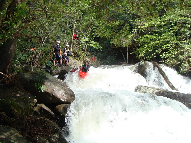
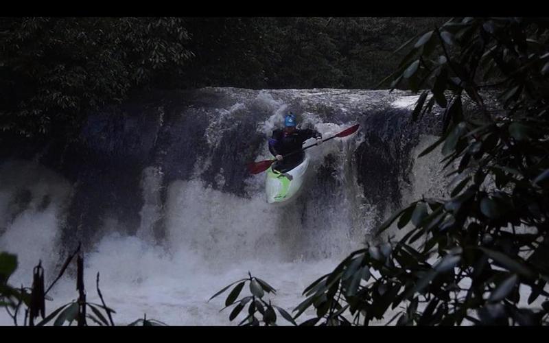
Frogtown Creek is a waterfall laden steep creek. At least one of the falls was run back in the late 80's and Neil Frost, who lives along the river, says all have been run.
The creek starts and ends on US 19/129 as the road curves up Blood Mountain through the Blue Ridge range of the southern Appalachians. The takeout is at Turner's Corner on the Chestatee River.
Be careful of the three rather large drops on this run and please note that much of Frogtown Ceek is on private property. Many of the property owners do not care for boaters, especially those who trespass on their property.
There are three possible put-ins:
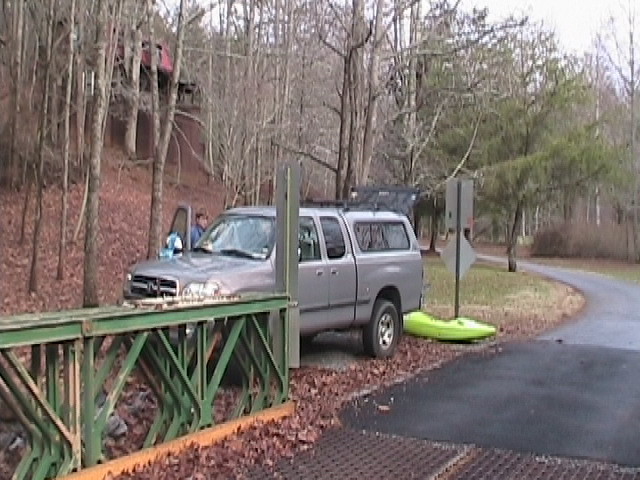
1. The best option is a very short road off Highway 19/129 2.5 miles north of Turner's Corner. There is parking on the short dirt road and along the highway, the carry is short and the bank is minimal.
2. There is an alternate put-in at a small, primitive campground accessed via a short road from Highway 19/129 1.65 miles north of Turner's Corner. The road is passable only to high-clearance 4WD vehicles, the carry from the highway is a couple of hundred yards and parking along the highway is minimal.
3. The bridge on Edwards Parkway (turn left off Highway 19/129 1.5 miles north of Turner's Corner and go 0.4 mile to the bridge) can be used for a drop-and-drive access, but do not leave a vehicle parked: there is no parking area and the surrounding property is all private.
4. Here is a link to a video that walks through the largest rapids on the river

This rapid starts in a low angled slide and ends in an unique cross flow boof. Where you boof from one flow into a strong current going to opposite direction. Start left and drive right.
A set of slides ending in 5 foot ledge type boof. Eddy on right at bottem to get out and scout Boulder drop.
This is the trickiest move on the run. Start left and drive right, but not too right or you will end up in the rhodo below. After this double boof there is a slide that ends is a hole that can be sticky a certain levels.
This rapid goes directly into Hallway.
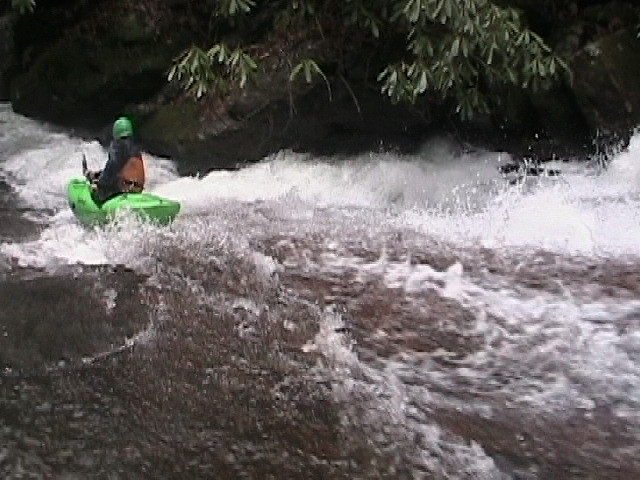
This rapid is my personal favorite. It starts where the boulder drop ends. It consists of a three tiered slide with several holes and eddies throughout. This is a fast one. At the end get left.
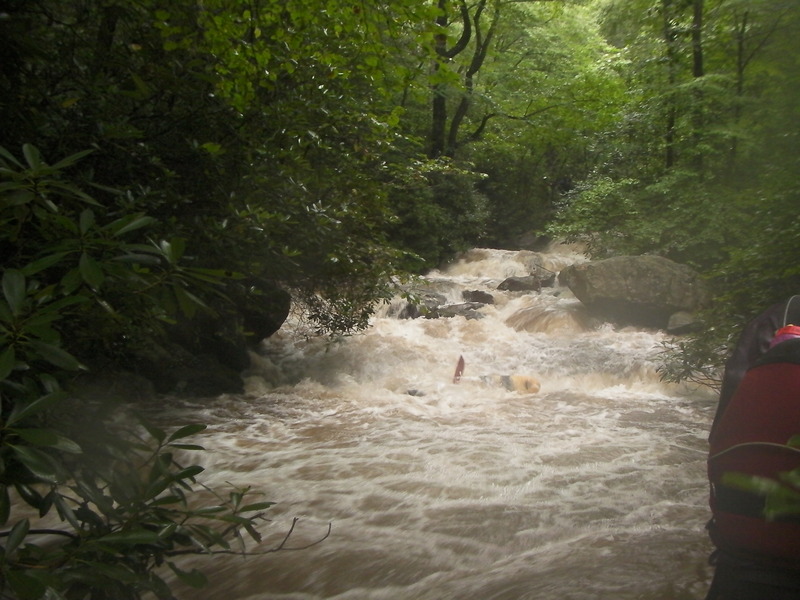
This rapid is a long boulder garden. The best way I have found to run it is to start on the right near the top and slowly work left, and then back to the right at the end. This rapid used to have a metal walking bridge which made it a mandatory portage, but this hazard has since been removed and this rapid is now runnable. Wood tends to build up in this rapid so just be cautious.
This is a mile long section of fast moving slack water in between the two gorges. Watch out for a rope that is strung across the river at waist height.
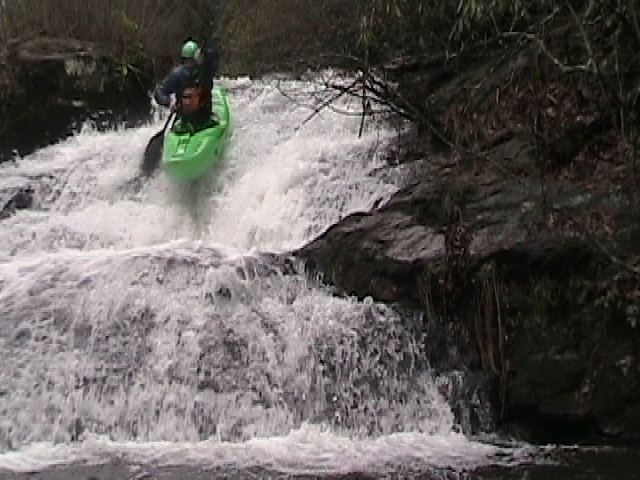
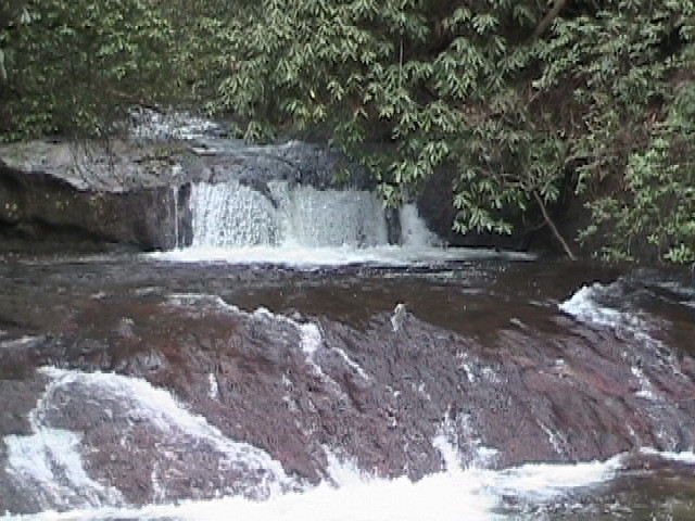
This rapid has two lines, The left side is a low angled slide into a steep 10 foot slide with a piton in the center.
This line starts on the low angled slide and then drops off a 10 foot drop, which can be boofed. (this boof is located on the left side of this photo)
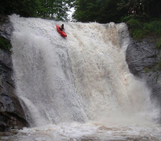
This is a 12 foot drop directly above the 40 foot cannon falls. This one can be run anywhere but beware the hole at higher levels.
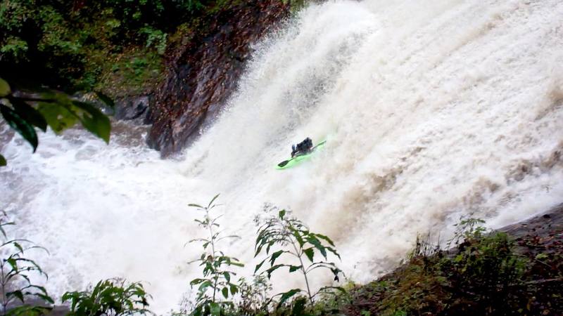
This is the signature drop of the run. It's about 40 feet tall with a gently graded slope at the top to ease you into vertical. A little bit of California on the east coast.
Dec 11, 2016
Photo Cred Ky Hart