Chippewa
B) Jim Falls (Pnp or up to 1.1 mile)
| Difficulty | II-III |
| Length | 1.1 mi |
| Avg Gradient | 30 fpm |
| Next Release | Sat, August 22, 2026 |
| Reach Info Last Updated | March 17, 2020 |
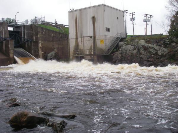
The Jim Falls Hydroelectric Project (FERC P-2491) provides whitewater releases during the summer months for recreation. While the original license that was issued on July 24, 1984 ( 28 FERC ¶ 62,097 ) did not include these recreational flows, it was amended as part of the The Lower Chippewa [...]Read More
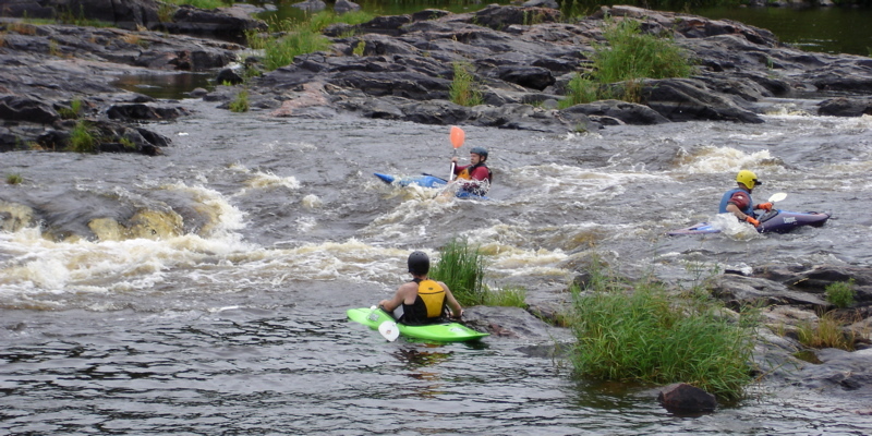
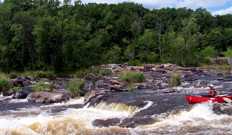
Located about 8 miles northwest of Chippewa Falls, at the junction of County Highway Y and Highway 178, this short reach of river is class II and class III pool-drop rapids, requiring intermediate to advanced skill level.
Releases into the original river channel (otherwise substantially dewatered between the dam and Xcel Energy's Jim Falls Hydro Plant) take place for two full months in spring (from April 1st to May 31st, for Sturgeon spawning) when this reach should run a constant 850 cfs, while summer releases (three weekends annually in July and August) will be 650 cfs.
Some boaters will put in by the dam to have a little 'warm-up' before the main action. However, this upper portion of the reach contains little more than rocks and current, so most paddlers will prefer to put-in at an old bridge midway down the channel where the first real rapids start.
Below the bridge, a mix of rocks and chutes provide a few spots for minor play. There are plenty of 'stealth rocks' (both in the flow and in some eddies) just to keep you on your guard. Reportedly, the summer release flows are somewhat 'thin', so best play may be at the spring levels, when more of these rocks may be more covered.
Please be sure to sign in at the put-in location and include any comments you might have. These sheets will be used to evaluate participation and help make informed decision regarding future flow releases.
Access:
The put-in location is Old Abe Wayside Park on State Highway 178 on the west side of the river about a half-mile upstream of the County Y bridge. An access trail leads from the parking area to the water. The take-out site is located approximately 250 yards downstream from the County Y bridge on the east side of the river. The take-out point provides for the easy removal of boats from the river, and includes a foot trail to a parking area on Xcel Energy property.
A restroom is located immediately upstream of the main spillway section of
...
There is an area for free tent camping, located along Hwy.178 about two blocks north of the dam, right next to the lake. It has room for several small tents, and has one picnic table and a fire ring. There is a separate Men's/Women's rest room 100' away at the public access. (Make sure to bring your own TP, as it is not always provided).
There is parking alongside the dam for those wishing to do the full (most extended) run of this reach, putting in just below the dam.
Those using this parking/access should stop at the sign-in location to show that you're using this resource in order to continue recreational releases for the future.
The usual Put-in parking lot when group shuttling. Follow the trail down to the river.
Glenn Felske provided (2004-11-22):
A better put in spot is 500 feet north on 178 past the old bridge. A historical marker and picnic area provides a parking lot and easy access to the river. The river is very shallow and a short walk up river is required during normal level. This put in allows you to get lined up on the river left chute below the bridge. This is a narrow chute that starts with a left turn into a gradual slope downstream. During normal levels, there are 2 rocks at the end of the chute. A hard right is required, although I have managed to canoe through them.
Those using this parking/access should stop at the sign-in location to show that you're using this resource in order to continue recreational releases for the future.
This is the put-in most used for the main action (the 'lower' run) or for park-and-play. From the NW corner of the parking lot where the sign up sheet is kept, look for the trail and carry down to a backwater/eddy to put in. The first 3 rapids are accessible from this point, allowing a park and play. It is easy to carry up 'Big Drop' and the 2nd rapids, run the flat water between them, and paddle back to the bridge where you can carry back up to the parking lot.
Almost back-to-back ledges occur on river-right, just upstream of the bridge.
The negotiated releases will be periodically reviewed.
Make sure to sign in to show that you're using this wonderful resource in order to continue these releases in the future.
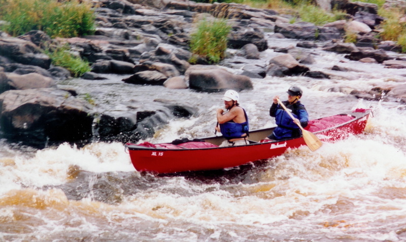
Two big holes and an offset ledge.
You have some options on how to run this:
Run down the middle and punch the big hole at the bottom.
Run the ledge to river-right of the hole.
Run down the middle, and shoot the gap between the upper hole on river left, and the center hole at the bottom.
It is recommended to run through the center of the hole or to river-left of it, due to shallow rebar on the right side under the bridge.
USGS lists a sampling site below the powerplant with drainage area of 4,870 square miles.
Drive down a short hill and park on the grass near the river. Watch out for a rock at the bottom that has ruined more than one oil pan. Avoid it!
If it is wet and slippery, you may want to park along the top edge of the road.
Jul 27, 2010
Is there a rough way to gauge the level based on the capacity of Jim Falls and the flow at Chippewa falls? With the rain this summer I have been wondering if Jim falls is running after some of the small stuff has settled out.