Mill Creek (Lewis County)
West Lowville to Lowville
| Difficulty | IV-V |
| Length | 3.7 mi |
| Avg Gradient | 100 fpm |
| Gauge | Independence River at Donnattsburg Ny |
| Flow Rate as of 23 minutes | 18 cfsbelow recommended |
| Reach Info Last Updated | February 12, 2023 |
Click here for a Video Guide with all the beta you need.
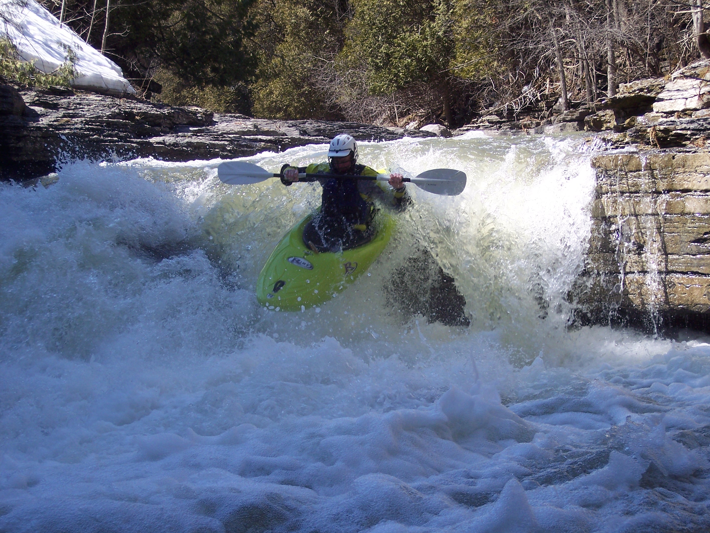
One of the best, and most fun creeks in the east. The run is fast and shallow with endless slides. The difficulty of this run rises with the water level. At high water there are some bad holes and the chances of being pushed into drops blind (already pretty good)becomes a certainty. At higher water expect partial strainers.
The section under Rte. 12 has a hole that becomes retentive at high water. Swims on this creek do not end well and the rapid will appear without warning so be sure to scout from the bridge on your way to the put in. Same goes for the section in town.
Scouting once you are on the river is often impossible and is usually dangerous. Keep alert for trees. **If you can't easily scout a drop it is usually best to charge down the center.**This is no place for someone who can't reliably roll and punch big holes. Swimming would be a brutal experience, likely to include lost gear and possibly a trip to the ER in Lowville.
The waterfall in town is run down the center. If there isn't enough water to run the center of the town drop then the run is lower runnable or unrunnable.
Watertown Area Reaches:
Black River (Rt. 3 Wave) Black River (Watertown to Brownville)
Black Creek Deer River (Section 1)
Deer River (Section 2) Roaring Brook (Brokeback Gorge)
...Mar 21, 2011
Before you put in, scout the crux rapid from the highway bridge. I would call it solid Class 5, not 4-5, but it has been a while since I was there. Also scout the final waterfall just downstream of the final (State St?) bridge before putting in. You may have to climb up on a wall to see it. It's a double-boof to the right. Once you put in, there's not much point in trying to stop. I remember running an enormous (30-50 feet?) slide without scouting, because stopping was impossible. Fortunately, it was wide and clean. A great, if brief, run!
Oct 18, 2010
ran it on 10-18-10... totally clean of wood, which of course can change. great run though
Jun 12, 2009
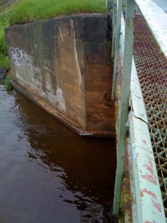
The new visual gauge for Mill Creek is visible in at the bottom of the bridge abutment in this photo. When the water is at or above this white line, Mill Creek is runnable. The Line designates what I believe to be the minimum flow.
May 18, 2009
I have painted a line at the Gordan Road put in bridge. At minimum flows, a white line is visible at water level on the downstream river right corner of the bridge. Contact eadsit1@yahoo.com with any questions or for a visual.