Mill Creek (Lewis County)
West Lowville to Lowville
Mar 21, 2011
Before you put in, scout the crux rapid from the highway bridge. I would call it solid Class 5, not 4-5, but it has been a while since I was there. Also scout the final waterfall just downstream of the final (State St?) bridge before putting in. You may have to climb up on a wall to see it. It's a double-boof to the right. Once you put in, there's not much point in trying to stop. I remember running an enormous (30-50 feet?) slide without scouting, because stopping was impossible. Fortunately, it was wide and clean. A great, if brief, run!
Oct 18, 2010
ran it on 10-18-10... totally clean of wood, which of course can change. great run though
Jun 12, 2009
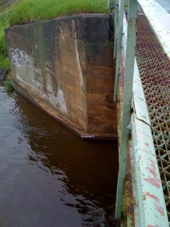
The new visual gauge for Mill Creek is visible in at the bottom of the bridge abutment in this photo. When the water is at or above this white line, Mill Creek is runnable. The Line designates what I believe to be the minimum flow.
May 18, 2009
I have painted a line at the Gordan Road put in bridge. At minimum flows, a white line is visible at water level on the downstream river right corner of the bridge. Contact eadsit1@yahoo.com with any questions or for a visual.
Dec 18, 2008
team mm ran the falls in town last week.. if u run it left ur getting flipped into the wall..nicest line was center of first boof ledge, then work ur way center left.. if u dont there is a ledge that sticks out about 2 feet. and it will catch ur stern,, have fun
Apr 6, 2008
The put-in is up in the cow pastures.
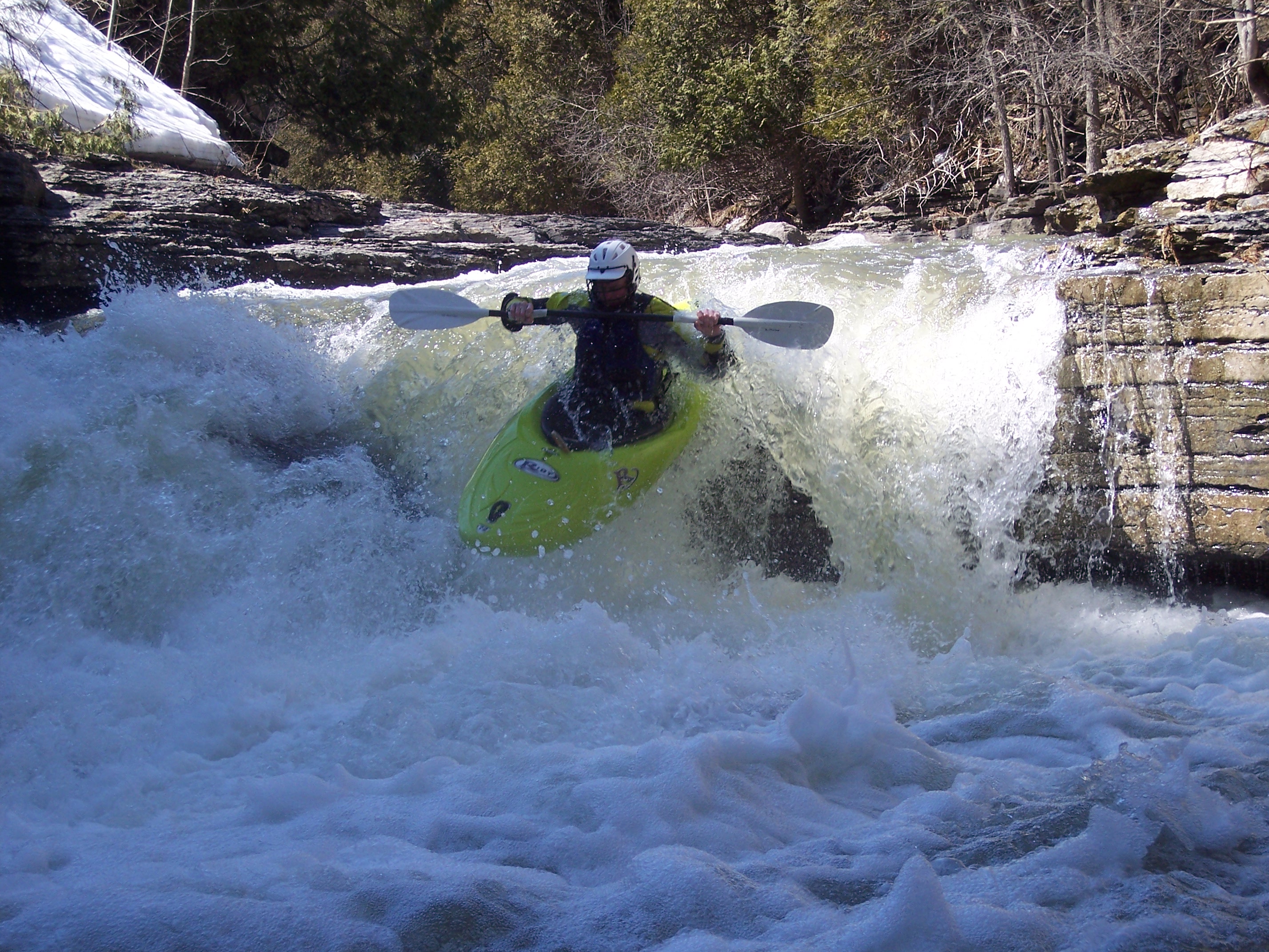
One of several slides on this run.
A small boof onto some mank into a slide. Ron ran it well.
Ron on the slide after the small boof.
So many slides I don't remember them all.
This is right under RT 12 and in the middle of the steepest section
Nov 11, 2006
!!! WARNING !!!! The tributary to the south coming down off of tug hill and coming into the main flow after the big drop by the cemetery now has THREE SEPARATE STRANDS of barbed wire crossing it. The first is approximately 15 feet past the second bridge. Another 40-60 past that is the second strand. The third strand is where the 'original' strand (listed below) is: ~50 feet past the old steel bridge (past 2nd bridge). All are roughly at head height at medium flow levels. Be careful so they don't catch you by surprise. Questions, call: 315-767-1628. MH
Apr 9, 2005
!!WARNING!! The tributary to the south coming down off of tug hill and coming into the main flow after the big drop by the cemetery has barbed wire strung across it. It is located just after the 2nd bridge. There is an old steel bridge just past the 2nd road bridge and it is ~50 feet past that and 2' above the water at medium to high flow. It can still be run, but caution is required. Call me for more info.
Ziggy
(315) 543-7130