Arkansas
06. Stone Bridge to Salida(Salida Town)
| Difficulty | II-III |
| Length | 9.5 mi |
| Avg Gradient | n/a |
| Gauge | Arkansas River at Salida, Co. |
| Flow Rate as of 1 day | 184 cfsstale data |
| Reach Info Last Updated | July 9, 2017 |
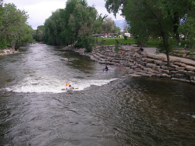
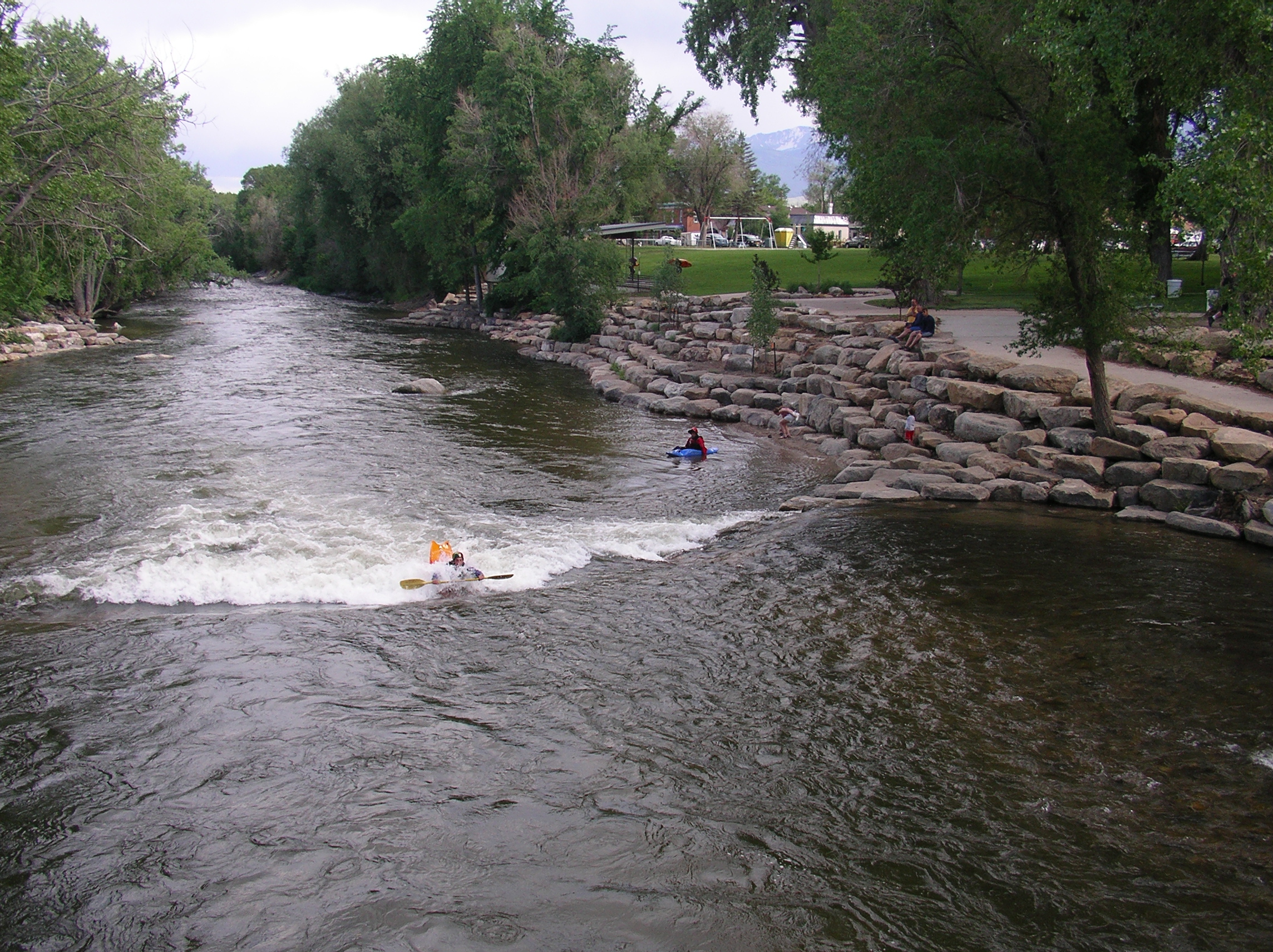
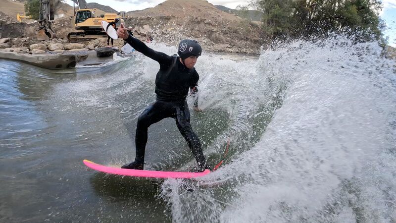
Most of the action on this stretch occurs in the town of Salida at the F Street Bridge.
It's a great place to hook up with local paddlers or get in some quick park and play. In
recent years this section of river has been significantly cleaned up and enhanced. It's the
site of a slalom course, play features, and a great beginner training site. This is also the
site of FIBArk, the nation's longest running whitewater festival.
For additional information on the background behind these projects check out the Arkansas River Trust website.
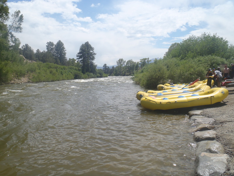
Logistics: The section from Stone Bridge to Rincon is not typically run as a single trip,
as there a few different access points that allow you to customize your trip. The Stone
Bridge is located at the north end of Highway 291 just before its junction with
US 285. The access is on river right on the upstream side of the Highway 291 Bridge. Big
Bend is an access 3.1 miles downstream on river right and can be reached off US
285. The Salida F Street Bridge access is located where Highway 291 crosses F Street in
the middle of town. From this intersection follow F Street a couple blocks towards the
river. This access is 9.3 miles downstream from Stone Bridge. Salida East access makes
a good alternative for a beginner trip starting in Salida. Spend some time warming up at
the bridge and continue 2.5 miles to this access on river right. This access is off Highway
50 downstream of the intersection with Highway 291. The Rincon access is at Highway
50 mile 231.1 and 18.7 miles downstream from the Stone Bridge and a short distance
upstream of the Howard Creek confluence.
See Colorado Rivers and Creeks II, by Banks and Eckardt (The Bible), for
info on this and most of the other kewl runs of Colorado.
Lat/longitude coords are approximate, from TopoZone.
See also
...At Hwy 285 mile 133.9 turn east onto Hwy 291. Before you cross the river, turn left onto County Hwy 191 and follow it to the Stone Bridge public access. The access is on river right on the upstream side of the Highway 291 Bridge.
2022 Fall from Mike Harvey: Scout Wave 2.0 – I wanted to clear up some facts around flows on the Arkansas and what we expect as it relates to performance of the Scout Wave. I have been getting a lot of questions and just thought maybe I'd post here so there was one resource.
The gauge to use is the DWR gauge in Salida: https://dwr.state.co.us/Tools/Stations/ARKSALCO...
The Arkansas is the major conduit on the east side of the divide to move west slope water to the front range. Water from the Roaring Fork, Fryingpan and Eagle drainages travels down the Arkansas to Pueblo and John Martin Reservoir. This water is referred to as project water. In general they move project water from 11/15-3/15 and during runoff up to August 15th. The period after runoff ends is called the voluntary flow program where 700 cfs is maintained at the Wellsville gauge (when there is enough project water to do so). The lowest flow they try to maintain at any time of year is 250cfs. All bets are off on a really bad snow year, what I am describing is a typical year. They keep the flows as low as possible between 8/15-11/15 for Brown Trout spawning and again from 3/15 until runoff starts for Rainbow Trout spawning. Winter flows (on a typical year) are very often between 500-600.
The goal of the design was for the wave to perform at the lower end of flows. We don't know exactly what it will do across the range of flows until we see it. So far the higher end (+400cfs) of what we have seen has been better than the lower end (around 300cfs). It's currently 297.
I hope that helps. Glad to see folks out enjoying it and stoked to have met many of you in the past week. 🤙
Riverside Park is in downtown Salida on the downstream river right side of the F Street Bridge.
May 18, 2018
The only III with this flow from Stone Bridge to the F Street takeout was the boat chute at the dam! This was my first time through and I was expecting to have to portage. The chute was a very pleasant surprise and was very enjoyable. My only suggestion is to keep right in the chute to avoid the little back eddies at the drops.
Apr 14, 2014
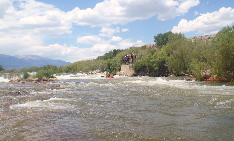
~3000cfs. There is a boat chute on river left with three consecutive drops with a nice sized eddy at the bottom. *Do not* run the dam itself!
Apr 14, 2014
Stone Bridge put in