Alcovy
1- US 29 to Alcovy Rd.(Upper Alcovy)
Aug 11, 2021
The flood in July 2009 knocked this gauge's readings down by almost 2 feet. In 2010, cfs is no longer reported for this gauge. A level of 1.7 feet corresponded to the old 200 cfs recommended level after the shift.
Jun 5, 2010
The gauge is definitely way off now. I'm not positive yet but I think minimum may be more like 6'. I went by and looked at the dam today. It looked pretty high at 2'.
Jun 3, 2010
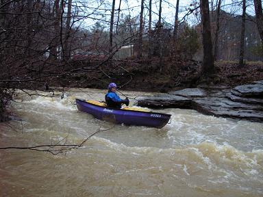
A friend and I ran this earlier in the week and it seemed to have great potential. The level was pretty low and we had to scoot our boats and push ourselves down every rapid. There were 4 river-wide strainers (2 we portaged and 2 we could squeeze under the downed tree). There were many interesting looking rapids along the way that would be great at high water. I suggest, as a general rule, if you can't clear the 1st rapid without scraping, wait until the level is higher. This short stretch took us over 2 hours to run at this scrapy level. Overall a neat river and one that I want to do again.
Dec 31, 2006
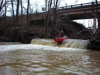
at 3.2 feet, we were able to run the dam. Two tree portages, but about 6 others requiring some limbo moves, and maybe three you could boof over. I'l still like a little more water, say 3.5 and up. Alcovy is not as flashy as rottenwood or sope. Smaller rapids than those two as well.
Feb 25, 2006
At 2.9 to 3 feet there are 2 strainers that must be walked. At higher flows some of the strainers might become more dangerous.
Feb 5, 2006
Several nice waterfalls drop into the Upper Alcovy. Most are probably too tiny and painfully shallow to run.