Tenmile
South Dover NY to Gaylordsville CT(10 Mile)
| Difficulty | I-II(III) |
| Length | 5 mi |
| Avg Gradient | n/a |
| Gauge | Tenmile River Near Gaylordsville, Ct |
| Flow Rate as of 1 hour | 0.89 ftbelow recommended |
| Reach Info Last Updated | May 16, 2018 |
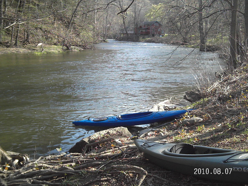
The put-in is off Route 55 (Riverview Road) at a spot where there is room for a few cars to pull in and park. The first couple of miles are a mixture of flat water and Class I whitewater, making this a nice introduction for novice boaters. The first rapid of note is State Line, at the NY/CT border. This is a nice bouncy Class II drop with a large eddy behind a boulder river left at the bottom. After State Line there's a bit more flat water and a couple of easy Class II- rapids. At the confluence with the Housatonic River, you pass under a footbridge that is on the Appalachian Trail. There is a long slope on the broad stretch of the Housy here with scattered boulders, some surf waves and squirt lines on river left, and a more fluid line on river right. After some flat water and another Class II slope there's a pleasant surf wave with a friendly eddy on river right. From here, rounding the corner sharply to the right you come to George's, a popular play spot for boaters running Bulls Bridge. For beginner boaters, George's can be run to river right with minimal problems. A bouncier wave train forms the center line. To river left of the main channel a grippy hole forms. George's offers excellent surfing opportunities. A smaller hole is on river left, at the bottom of a minor channel over the drop, but it's quite shallow. After passing the hydro power plant on river left (which is the site of the Bulls Bridge takeout) there's a short stretch of flat water before a decent-sized Class II rapid. There are lots of lines here, the easiest of which is river left, eddying out behind the big boulder there. There's a 2ft high ledge river center that can form a hole at certain levels. The final bit of fun on the river is right by the take-out at Gaylord Bridge, where Route 7 crosses over the Housy. The easy line here is river right, straight shot to the take-out. The paddle takes two to three h
...
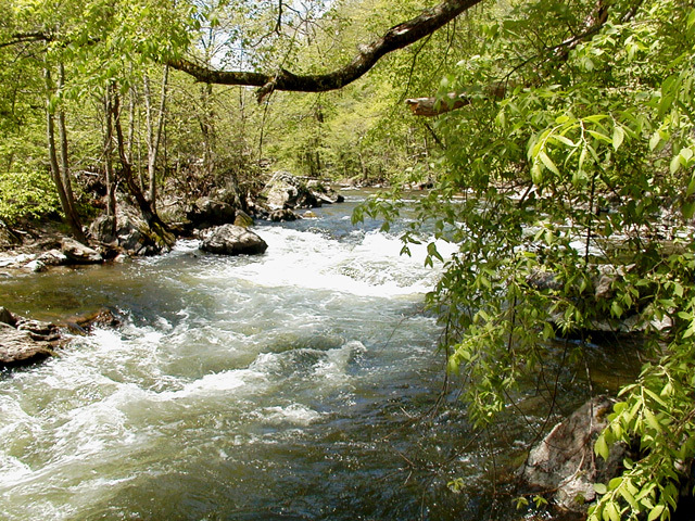
Nice bouncy Class II drop with a large eddy behind a boulder river left at the bottom.
George's is a popular surf spot for boaters running Bulls Bridge. There's an easy line river right, a bouncy wave train river center, and a grippy hole on river left of the main channel.
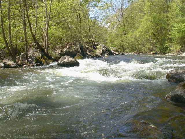
Decent-sized Class II rapid. The easiest line is river left, eddying out behind the big ledge there.
The final bit of fun on the river. The easy line is river right, straight shot to the take-out.
Mar 30, 2025
!! Trees fallen on river left of State Line rapid, blocking route with very dangerous strainer. These are new trunks from the ones previously present on river right.
Difficult to see upriver given the obstructed view/elevation difference, and may be covered under higher flow. Scouting/portage will be necessary.
Ran at ~2.26 ft, 03/30/2025. No further anomalies to report.
Jul 8, 2015
Apr 11, 2010
There is a spot on the right of Dogtail Corners rd, just off rt 55, that has a place for a couple cars to park and put in. Paddled upstream for a bit than floated back down. Current was moving fairly fast, gps clocked the max speed (coming back down) at around 6 mph. USGS data suggests for Tenmile 472 cfs, and gauge 2.6 ft. The water was high enough that only the largest boulders in the river were an issue. Wouldn't say there was much whitewater. The best part was all of 20 seconds right after the bridge at Dogtails Corner, but still quite mild. 4-5 people were fishing on the river.