Ocmulgee
1. Lloyd Shoals Dam to Wise Creek(Seven Islands)
October 30, 2005
| Reporter | Gary DeBacher |
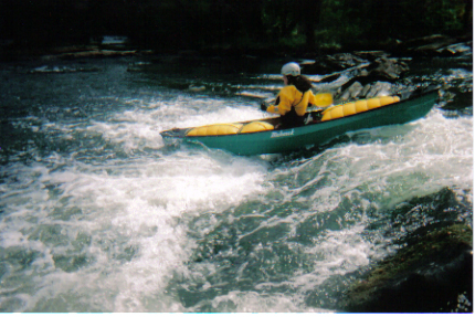
Having hiked along the leftside channel behind Forty Acre Island, I really do not recommend it. It is a real snag catcher, and also can be littered with trash. The open rightside route has many interesting options and can be run at all levels (maybe even the 9000cfs they released last week) including minimal release periods. The best route I've found is to work down the ledges on the left, and as you pass the end of the large island on the left, work off toward the right, scooping in under a tiny island with trees, and then cutting hard left down a chute to the left of a large rock. Probably you are running about the same route discussed in the other notes. At low levels, this may be the only clean route, though it is tight, technical, and may upset beginners and tandem intermediates.
There is a walking shuttle covering just the good rapids, back from the Wise Creek take out to the short-run put-in where the USFS road comes near the river. You can either walk up the Wise Creek trail and then back to your car on the road, or you can wade Wise Creek, after which it's fairly easy to walk back to your car along the river. Takes less than an hour either way.
NOTE: Maybe I've been lucky, but I have never had trouble leaving my shuttle vehicle where the gravel road runs along the river for the 'short' run. The 'posted' signs in the past were intended to keep non-members out of woods leased by a hunting club.