Chattooga
Section 4 - Route 76 Bridge to Tugaloo Lake Boat Ramp(Section 4)
| Difficulty | II-IV+ |
| Length | 8.4 mi |
| Avg Gradient | 34 fpm |
| Permit | Be sure to sign in at the putin. |
| Gauge | Chattooga River Near Clayton, Ga |
| Flow Rate as of 1 hour | 1.24 ftlow runnable |
| Reach Info Last Updated | November 27, 2024 |
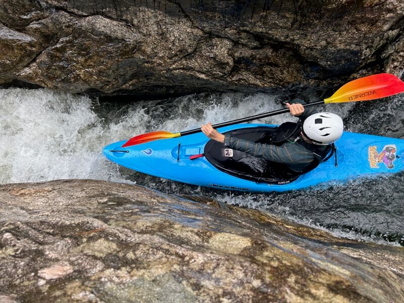
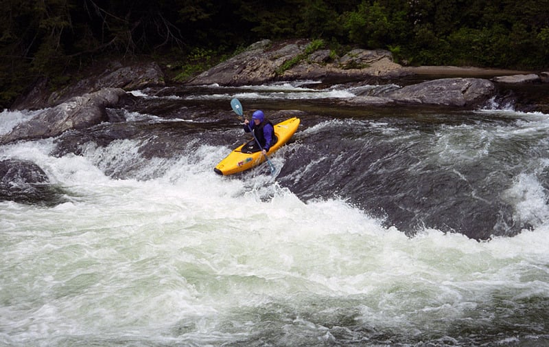
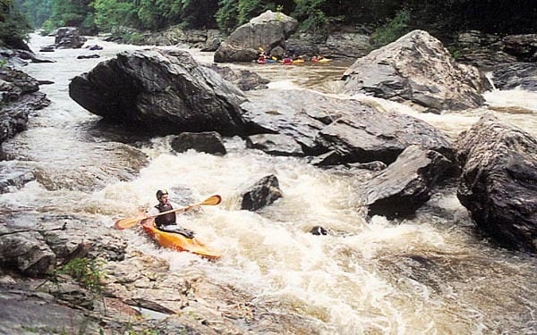
This is the Southeastern Classic! More legends exist about Five Falls of the Chattooga than almost any other set of rapids. Taken individually any of the 5 rapids of Five Falls would be significant named drops on any typical Southeastern river. They are far from the hair found on steep creeks and the legendary danger associated with these rapids arises in part from the long history of boating the Chattooga (40+ years). That said, approach these rapids with caution as they have killed and injured plenty of boaters.
This is the river where a portion of the classic 1972 movie Deliverance was filmed.
The Chattooga became a National Wild and Scenic River on May 10, 1974.
Gauge Description: NOTE: The online gauge above reads differently than the paddler's gauge on the US 76 Bridge. Most paddlers refer to the bridge gauge. The online gauge reads about .15 higher than the bridge gauge at 2 feet, about .25 higher below two feet and the same at about 2.8 feet. It can be run down to .5 or even lower but is very scrapy. Above 2.0' Five Falls starts to bump up to class 5. It can certainly be run above 2.2', but only by experienced Section 4 paddlers. The Five Falls section gets much more difficult and dangerous at high water. The highest known run was August 17, 1994 at something between 9 and 10 feet from below Woodall to the Lake. According to USGS the river peaked at 17,500 cfs. Participants included Russ Kulmar, John Lesan, 'Snuffy' Hall, Kent Wiginton, and Richard Oldenquist.
An Important note about Crack in the Rock rapid:
Most of the existing guidebooks in print still recommend right crack as the prefered route. This is no longer the case. A flood back around 1998 blew the original log out of the crack. Since then right crack has become an undercut boulder sieve. Boats and boaters have washed under the logs and rocks in right crack. On November 9, 2003 it
...
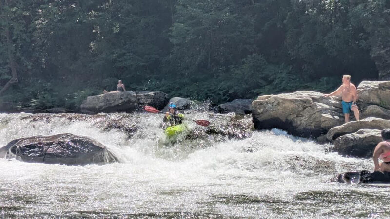
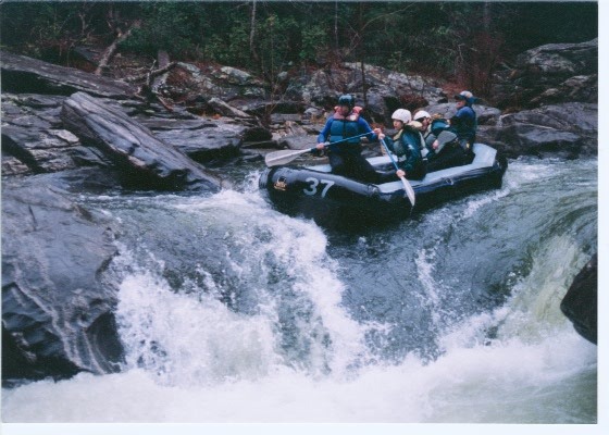
Bull Sluice is a Chattooga Classic. It is right at the Highway 76 access and marks the end of section 3 and the putin for section 4. The entrance is class III-III+ into the eddy on the SC side (river left) above the main drop.
There are many variations from this point. There are three main lines, the double drop on the right(IV), the single drop in the middle, and a high water Creek line on the far left.Beware of potholes and entrapment hazards.
There will be a large crowd to cheer your run on most Summer weekends.
Forest Service put in. Remember to fill out a permit.
Usually run on river right. Surf Rapid is one of the better playspots on the river, allowing both cartwheels and enders. There is a big recovery eddy on river right. During the summer the raft companies swim customers thru the rapid.
There are multiple routes thru this rapid, the standard one being start river right, go over the first three foot ledge, then start working back to the left to avoid some rocks. The advanced move is to run the toaster slot. This is a slot move thrust a three foot wide crack, under an overhanging rock. At flows above 5 feet this rapid develops a nearly riverwide hole that should be paddled around on the left. Around 2 feet on the gauge the left side grows a nice cartwheel hole. Below this there are several class II-II+ rapids
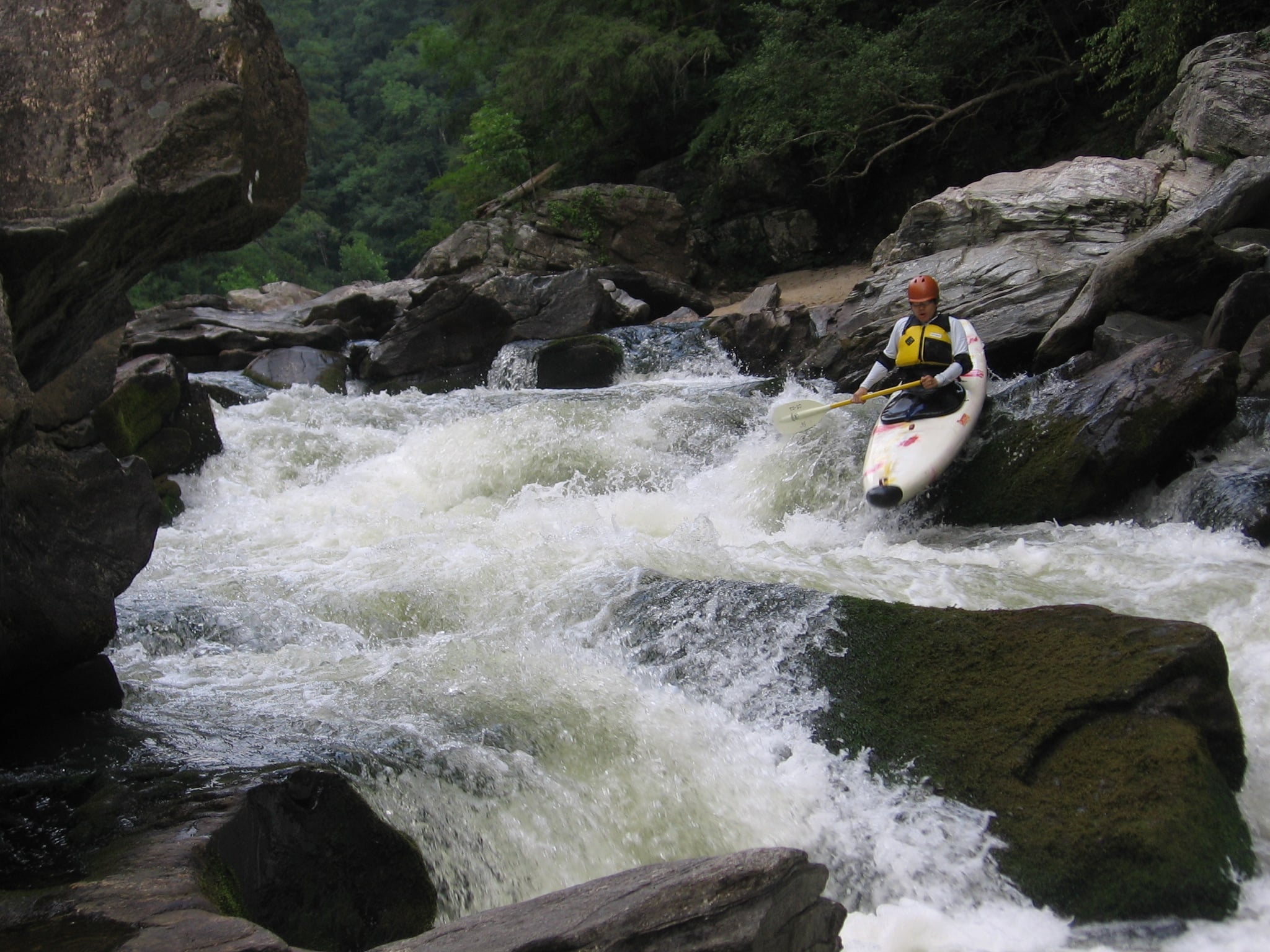
Rock Jumble is about a 10 foot high sloping ledge. It can be run just about anywhere, depending on the water level. The best place to scout is on the right. The hero lines are the two slot moves on river left.
Somewhere above 4 feet rock jumble creats a beautiful surfing wave.
There is vertical pin potenial when running the far river left line in a short boat at low water. At the bottom of the move, aim for the middle of the channel which looks shallower, but doesn't land on rocks.
Woodall Shoals is a nice class 3+ rapid with a very dangerous, but not that impressive looking Class 5+ hole right in the top middle. If you are running the hole you don't need me to tell you how.
The standard route for those not messing with the hole is to hug the river right bank. This will lead you to a slide that's about 10 feet tall. Bang down the slide and from there choose one of the many routes down the rest of the rapid. The slide dries up at levels below about 1.1. At levels over 3 feet the hole at the base of the slide starts to get really mean, but another route opens up.
At levels above 3 feet the slide on river left at Woodall starts to open up. This is a great ride!! At levels below two feet this channel is totally dry. The channel is to the left of the center rock shelf most people scout Woodall from. On river left at Woodall is a trail to a Forest Service parking lot.
Below Woodall are a couple of class 2-3 rapids that start getting bigger and bigger as the banks start to close in.
The final one is a nice riverwide ledge hole with eddies on both sides. This is one of the better playspots on the river!
Run the right side of the fold in the current. Stay out of the mildly undercut river left wall. If you run the left tongue you may find alligator rock....a known boat breaker.
A small rapid with some nice waves and a big boulder in the middle. The right notch is undercut, but good practice for tight creek moves. The left side has a nice wave up against a minor undercut.
You'll be able to see Stekoa Creek coming in below this rapid on the right.
A long shoal type rapid with multiple routes. Most people start by running down river right over a small slide, then heading back toward river left. There are some good surf waves toward the bottom of the rapid
Just below long creek falls on river right is a nice playhole.
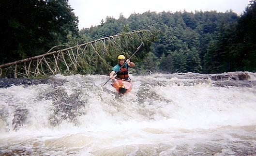
Most people start from the top right, then eddy hop down. The river will eventually go around the left side of a house sized rock. The left side of the rock is mildly undercut. This rapid was seen several times in the film Deliverance. Every time the river goes over 6 feet a new tree gets deposited on top (20 feet up) of the rock. At flows above 4 feet one of the strongest holes on the river is found here.
Another playspot. This one is best above 1.7
Start about 3 feet off the left bank and go around the outside of the curler taking a hard right turn. Bang down the slide and eddy out at the bottom.
There is a dangerous undercut in the middle of the ledge. A swimmer drowned in the undercut near the center boof line.
Two boulders laying against each other that you can paddle under. There is a class 3 minus rapid just below this.
Nice wave on the right, a boof in the middle, and a boof on the left. The left boof has been known to pin and eat boats.
Slot move on the left, a slide on right and a really sticky hole in the middle. The hole doesn't look like much until you are trying to claw your way out of it. There is a great eddy line below the hole, its deep enough for slalom kayaks to do vertical stern squirts.
If things are going bad there is an access point on river right where Camp Creek comes in. The trail to the parking area is similar in steepness to the trail at Woodall. Below Camp Creek is a moderate sized wave train before the river goes around a right hand bend leading into Five Falls.
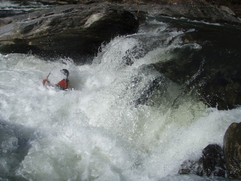
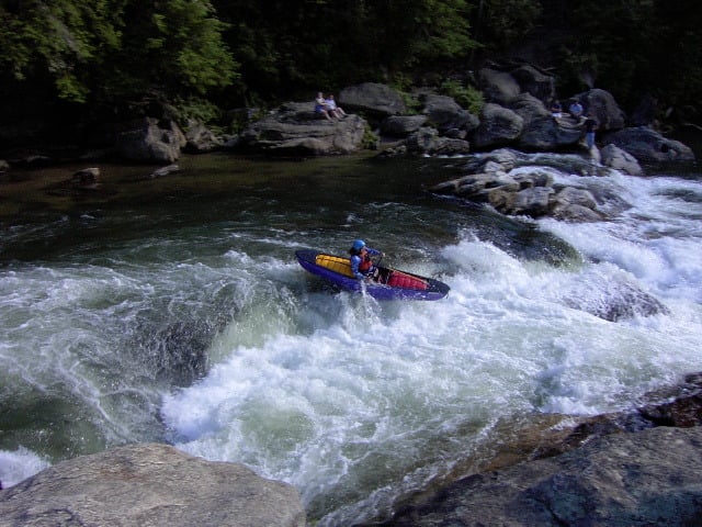
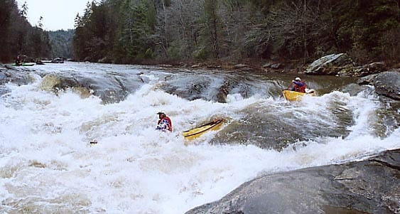
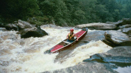
Five Falls includes the rapids of Entrance, Corkscrew, Crack in the Rock, Jawbone and Sock-em-Dog. Coming around the corner from Camp Creek the gradient is going to pick up to close to 100 fpm for the next half mile. At flows above 2 feet the pools between these drops start getting small. Entrance and Corkscrew start to become one drop, same thing with Jawbone and the Dog.
All the midstream rocks are undercut, in particular those in Crack, Jawbone and the Dog. Being out of control is a bad idea, being out of your boat is worse. So be careful.
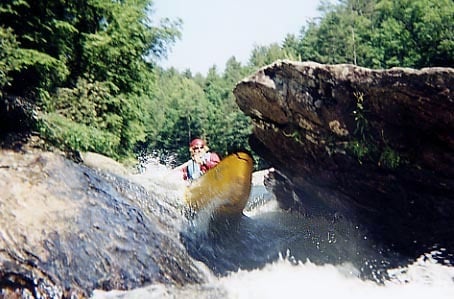
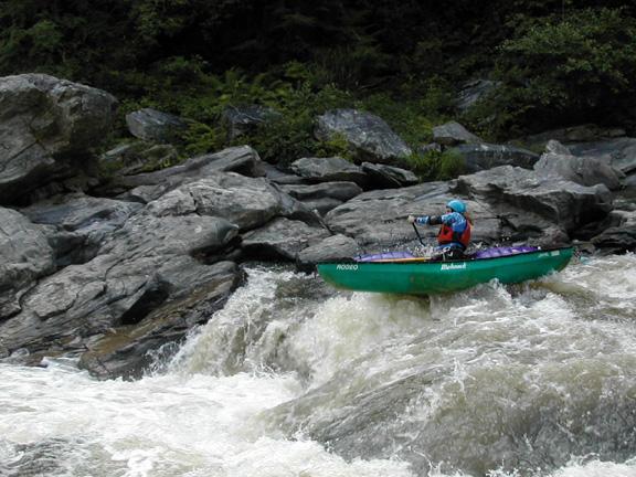
The first of the Five Falls. The standard route is start in the eddy at the top on river left, then work down middle to river right through bumpy shoals to an eddy on river right above a 10 foot wide slot. From there peel out and run the slot angled to the right to stay out of minor undercut, and punch the hole at the bottom. Corkscrew is about 25 yards below.
This is one of about 4 different ways to run this rapid. There are also a left line and two middle lines.
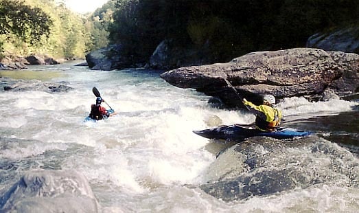
At moderate flows enter from the center of the river, as things get higher there is a sneak entrance slot on river left. After that go around the holes on the left. The bottom hole likes to play with decked boats in the 1.2 to 1.9 range. After that try not to get plastered on the river left wall. Get swimmers to shore quickly due to Crack being just downstream. Set up safety ideally on river right if you are worried about a potential swim.
Strangly enough, Corkscrew gets a little easier as it gets higher. Its most ornry about 1.7.
An Important note about Crack in the Rock rapid.
Crack is one of the few rapids that changes on a regular basis because logs and rocks shift around in the sieve that forms this rapid and can massively change the height of the pool.
All of the existing guidebooks in print still recommend right crack as the prefered route. This is no longer the case. A flood back around 1998 blew the original log out of the crack. Since then right crack has become an undercut boulder sieve. Boats and boaters have washed under the logs and rocks in right crack.
Right crack can still be run but look at the drop before a blind run.
Left crack has killed numerous swimmers, right crack has had many close calls and one fatality.
Most boaters run thru middle crack. Left crack does get run on occasion, but is usually avoided.
The good news is that the rapid can be portaged on both banks.
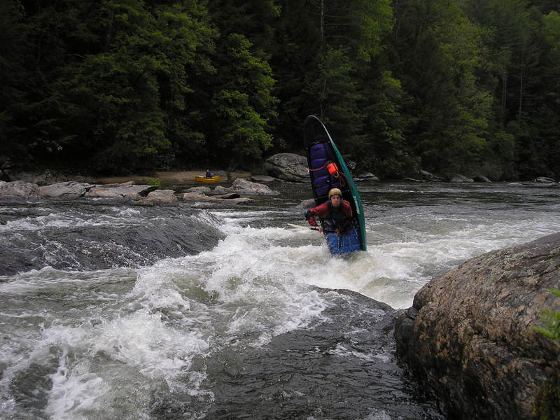
At flows below 1.8 start river right and punch into the eddy on river left. At flows above 1.8 you have a back door entrance down river left into the eddy. Peel out into the high part of the curler from the big river left eddy, it should put you right on line to the left of decap rock (undercut right of the curler), & left of Hydroelectric Rock further down. You can either eddy out above Hydroelectric Rock (also undercut) or continue on around it. There is a hole before Hydro Rock that you have to punch at medium-high levels. There is also a hole just past Hydro to the left. Beware of Sock em Dog below.
Jawbone is kinda scary with all the undercuts. Keep in mind that if you eddy out above Hydroelectric Rock you need to aggressively cross the eddy line before running the left side drop of Hydro. Blowing this move can lead to being sucked in to Hydro.
About a 7 or 8 foot boof over a chunky hole. Pretty forgiving between about 1.2 and 1.5, pretty unforgiving above 1.8. Its been said that many modern rodeo moves were unintentionally invented in the hole at soc-em-dog. Above 1.9 the left side Puppy chute opens up. In the mid 2 foot range, the large undercut rock in the middle gets covered with water. Supposedly the hole washes out around 5.5 feet. Many swimmers have gone so deep they don't see light. But they usually pop out.
If you are swimming from Jawbone, do not swim up to the middle rock. It's severely undercut.
After the pool at sock-em-dog work back to river left. Shoulderbone rock will be be blocking the right side of the pool. Standard route is on the left side of the rock from left to right. The hole halfway down is pretty stiff above 1.6.
Running the slot on the right side of shoulderbone rock has been done but its a bad idea. The slot is undercut and usually full of wood. There are potholes or sieves in the base of the drop that have swallowed boats and boaters for uncomfortably long periods of time.
2 miles of flatwater to this public take-out. The colder the air temp, the harder the head wind. Be aware that the lake has been known to ice over in the winter. If this is the case, turn around and hike out at shoulderbone.
Jun 28, 2026
A classic low water Chattooga day. It was very hot but we rectified that with some snorkeling in the current below 7'. Sammy found a swim through that was pretty cool.
Sep 11, 2025
Ran (R2 RMR Storm) at 1.2 on bridge gauge, about 1.55 digital if I remember right. Scrapy at Stekoa Creek Rapid and a few exposed gate rocks in Entrance. Other than that, feels like a good level for a first descent. Highly recommend against taking the right line at Entrance in a raft at this level - very bony and that's only if you make it.
Jul 2, 2025
Fun day on Section 4. Online was reading 1.59ft & bridge was showing 1.4ft. All rapids were clean down to the lake.