Chattooga
Section 2 - Highway 28 Putin to Earl's Ford
Jun 8, 2026
Regarding the strainer mentioned in the previous comment, it is now passable against the right bank. Just wide enough for an NRS slipstream to get through. Level 1.55ft.
May 31, 2026
Near 2 ft on the online gauge. May 30th. River wide strainer 1/2 mile downstream of big shoals. We had to portage over the logs and chose river left, near the bank. Multiple logs with branches across river. Beautiful trip otherwise.
Jul 17, 2022
4.5 hour inner tube trip from low water bridge road to earl's ford. Water level seemed a little low with us dragging bottom a good bit. We didn't stop anywhere except to portage one rapid (a big rock the size of the river)
Apr 2, 2022
Ran on 4-2-22. Gauge was at 2.44ft. I found that to be a good level. Nothing was bony. Not really any significant rapids on this section. Ran the right side at big shoals. Saw a few limbs and small trees in the river along the way down. None were in the main lines and all were easily avoidable.
Mar 14, 2018
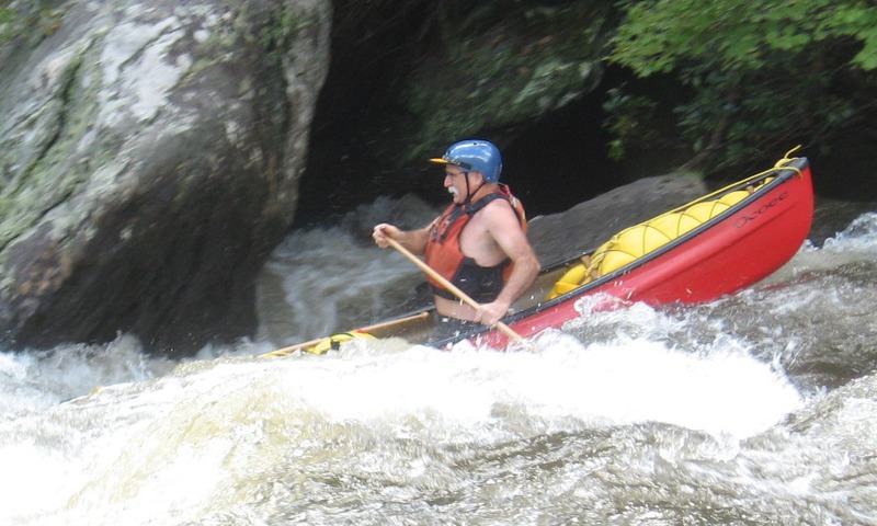
Dennis Simpkins and Gary Kyle negotiating Turn Hole Rapid, Section 3, Chattooga
Apr 25, 2016
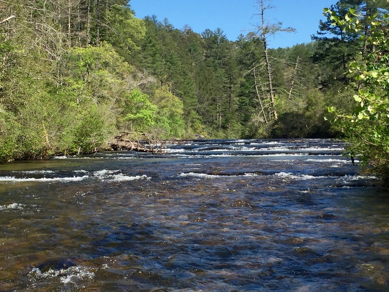
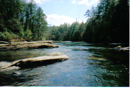
One of the first rapid sections on Section 2. ~1.67 ft April 2016
Apr 25, 2016
Rapid toward the end of Section 2. ~1.67 ft. April 2016
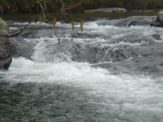
Apr 25, 2016
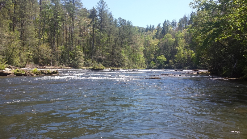
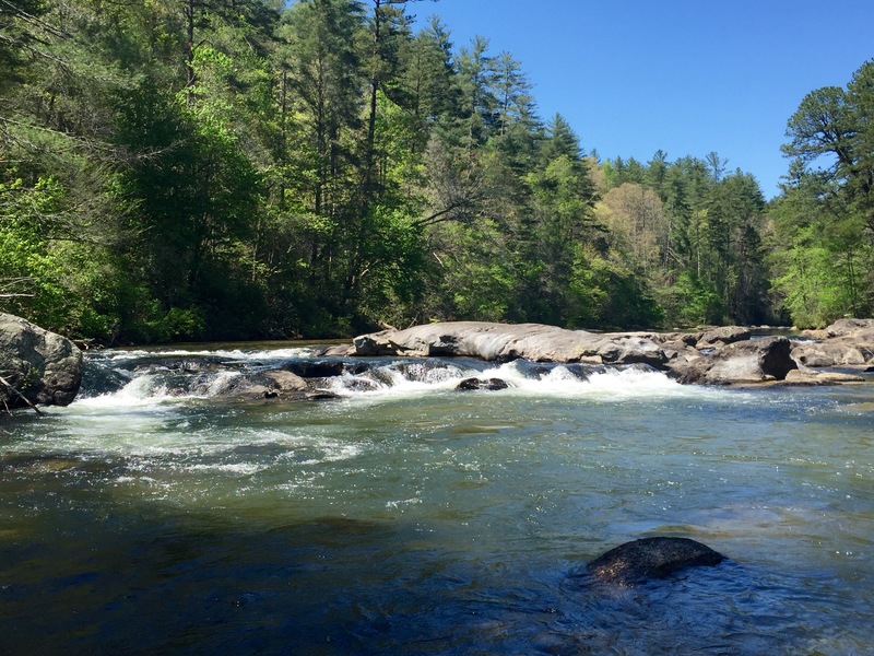
Big Shoal @ ~1.67 ft. April 2016.
Feb 17, 2014
Paddled Sec 2 on 01/16/2014 @ 1.97 and very clear water. Nice level, not scrapey. We ran the river left chute at Big Shoals after scouting both sides.
Jul 21, 2013
After the early July 2013 high-water sets where the Chattooga hit 5 feet or higher inside of several days, section 2 is clear of meaningful strainers. There is a big pile-up of wood at the center-left of Big Shoals rapid, but it adds no additional hazard or difficulty to that rapid. It was a treat having good water level in mid-Summer on this section; at 2.3 feet the runs pushes through a bit faster, of course, while still providing the beginner-intermediate paddler with the lovely Chattooga scenery.
Sep 19, 2012
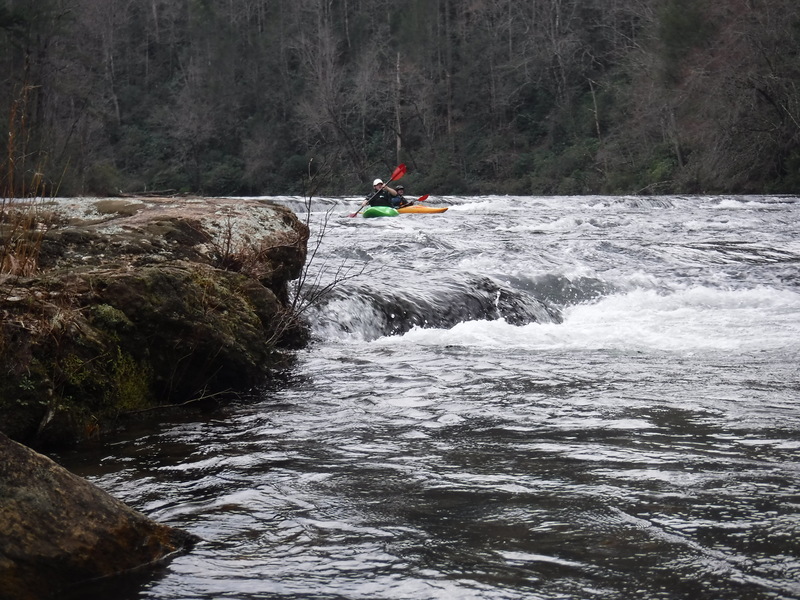
Stuart Ledford and I ran this starting at Hwy 28 at 1:00 PM on Sept. 19, 2012. Estimate of 2.30 on the Hwy 76 gauge, as it had shown as 2.56 at 7 AM and was down to 2.13 at 7 AM the following morning. Picture is at 3:00 PM of Vince from somewhere in Georgia, whom we met on the river. He's obviously going down the far Right side. His friend Carl also went down the not quite so far Right. Also in an Ocoee canoe. Water was fine also at left of the island, and seemed fine through the middle for a play boat.
Apr 11, 2011
section is strainer free. ran at slightly over 2.0 and it was not bony. and had a few decent waves to play in. tree at big shoals on river left is cut back and no problem when running shoot..
Mar 18, 2011
Paddled section 2 today...18 March 2011. It was 85F today (1 degree under the record high of 86 at GSP airport), and no clouds in the sky..The level was 2.2, which was perfect for kayaks. Paddled with someone who had not kayaked before, and he did great in a recreational kayak. The water was very cold. We did not wear any cold weather gear, and we are glad we did not take any swims...it would have been a shock to the system. I think the run took approx 3.5 hours..we stopped quite few times to trade kayaks, eat/drink, scout big shoals, etc.
Jan 20, 2007
I wouldn't run Section II at less than 2.2 on the hwy 76 bridge gauge. There are too many spread-out junk shallow shoals. Especially, if you are taking newbies, give them a water level that allows them to enjoy this section.
Nov 6, 2006
Ran Sec2 on 11/5 at @1.28 ft. Tediously scrapey in shoals. Did a LOT of knuckle walking - made a long day. Big Shoals was dry except for the chutes at either end of the ledge. The river-right chute looked dangerous, all the water dumped down into a rock sieve. The left line was OK if you missed the overhang but directly below was a lot of exposed rock that would have been another knucklewalker, so we portaged down the normal middle line. I would recommend the lower limit for this run be jacked up to maybe 1.4 or 1.5 ....
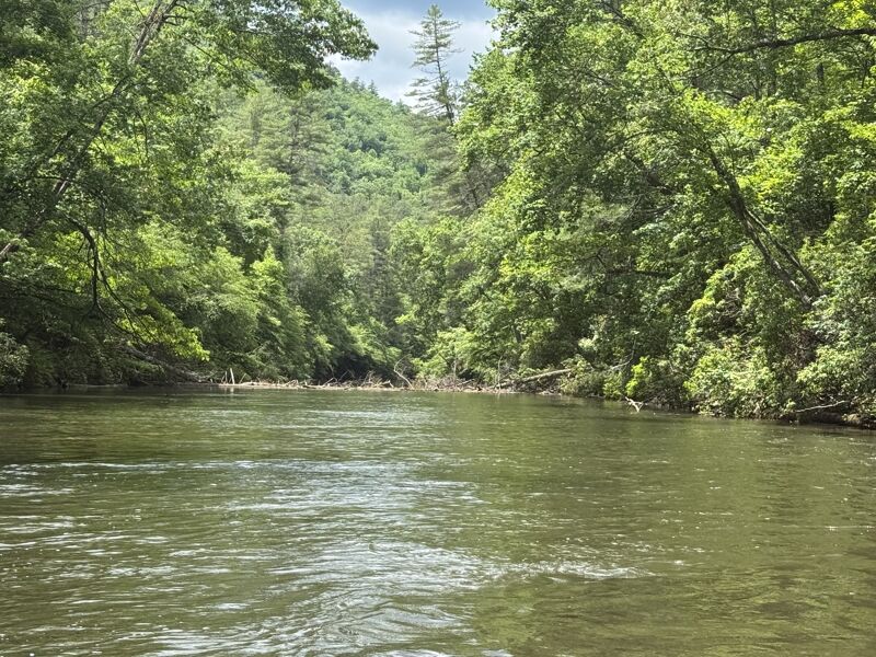
This is a longish trip (7 miles?) with a lot of flatwater. It's beautiful and wild though and we had it all to ourselves. Water was very cold and clear, saw a HUGE school of big brown trout in one place. You can spot the Earl's Ford takeout pretty easily by the presence of a big sand beach on the left with wooden stairs leading to the trail up to the parking lot, a small campground and a side creek on river right. If you parked in the Earl's Ford parking lot on the SC side, make sure you take the southernmost or right-hand trail, which can be recognized by it being relatively flat, gradual and wide enough to drive a vehicle. The northern or left trail (steeper, narrower and covered in horse manure and hoof prints) will get you lost in the woods. Also: I strongly recommend shuttling on the SC side (12 miles each way) because the road on the GA side is incredibly twisty - it'll take longer and be more dangerous to drive. However, you can apparently drive right down to the river on that side, something to think about if you aren't up to the 'Chattooga Carry'.
Mar 25, 2006
the small curler at the top took its claim
Jan 1, 1900
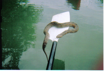
Here is one of the MANY paddlesnakes lurking beneath the surface of your favorite rapid