Conasauga
Chicken Coop Gap to East Cowpen Road - Upper(Upper Conasauga)
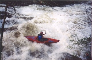
January 18, 2006
| Reporter | Robert Maxwell |
The paddler's gage for this run is on the East Cowpen Road bridge. Its on the upstream river left bridge support. The bridge is 2 miles downstream of the take-out. 4' is probably minimum. My guess is that 1 foot is medium and 1'6' is probably high. I've heard of a group running it as low as 0', but that would be an ELF run (Extrememly Low Flow.
A good way to gage if the Conasauga is running is to check 02385800 HOLLY CREEK NEAR CHATSWORTH, GA. If it is over 300 cfs the upper is probably running.
P.S: the old Elbow Tree has finally rotted and fallen into the river. Its now useless as a gage for the river.