Tatshenshini
2. Dalton Post to Alsek (Dry Bay)
| Difficulty | III |
| Length | 130 mi |
| Avg Gradient | 19 fpm |
| Permit | Send in application to get on waitlist for preferred dates. |
| Gauge | Tatshenshini River Near Dalton Post-yukon Territory |
| Flow Rate as of 2 hours | 17 cfs |
| Reach Info Last Updated | September 20, 2022 |
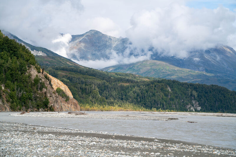
The Tatshenshini River is located within the boundaries of Canada, but because it ends with a paddle out on the lower Alsek, with a take-out on Dry Bay in Alaska, the run is typically included in guides to both Alaskan and Yukon whitewater. The run from Dalton Post to Dry Bay is generally an approximately 36-hour float, but is best stretched out over 8 to 10 days. Many consider this one of the finest wilderness river runs in North America. Be prepared for a wide range of weather conditions. The heat and bugs in the upper reaches usually contrast the fog and glacial chill of the lower half of this mighty wild river.
The Tatshenshini-Alsek Park is bordered by the adjacent national parks of Kluane in the Yukon and Glacier Bay and Wrangell-St Elias in Alaska, creating a 97,000 square kilometer ecological unit and bi-national World Heritage Site. Situated in the extremely rugged northwest corner of British Columbia, in 1993 it became the fourth component in the largest international protected area in the world. Half the landscape is permanently covered in snow and ice–the other half fosters forests and tundra and stable populations of wildlife untouched but for a historic aboriginal presence. To ensure the preservation of the entire ecosystem, the Tatshenshini and Alsek are completely protected from headwater to source, creating the only large river drainage in North America that is completely safeguarded.
The whitewater on this run comes at the start, a few miles from the put-in below Dalton Post. Here the river enters a short canyon section with class-III whitewater, making day one unique from the rest of the trip. Below this point there are rapids but generally the river is characterized by strong currents and eddy lines as the river grows to an impressive size. The hydraulics associated with these features can surprise those not paying attention. When you reach the confl
...
The put in is located a few miles down a muddy dirt road off of Haines Highway.
The river enters a narrower canyon with orange cliffs. The speed picks up, but the rapids are only class 1 or 2. Then the cliffs change to a dark color and really good class 3 rapids start. There can be numerous rocks and pour overs to avoid, but usually plenty of room to do so. The rapids continue for quite a ways.

The take out used to be at an airstrip on a side channel. The entrance to that side channel is now completely filled in, so take out where the side channel used to start. The locals will hang markers of some sort to signal where to stop. A road leads from the take out to the air strip, a few miles away. A local, Brent, provides a shuttle service via ATV towed trailers from the take out back to the airstrip. He charged about $37 per person and per boat, as of 2022.
Sep 20, 2022
Launched Aug 24 and took out Sept 5. Laid over almost every other day. Rained periodically almost every day. Temperature was relatively warm near the start, but quite cold as we got into the areas with lots of glaciers. We had bad upriver winds a few times but for relativel short periods. A party that caught up with us said they fought winds every day.
The rapids on the first day were really good quality and fun rapids. Rowing this river is a lot of work as you must continually avoid shallows and it is hard to read which way the current is taking you. The water is opaque with glacial silt and choppy from wind and current. It helps to stick a paddle down in the water to feel which way the current is moving past the raft.
The scenery is spectacular, but hiking opportunities are somewhat limited by the thick woods and the fear of Grizzly bears. You need to hike in groups because of possibly running into a bear. There aren't many trails and going through the woods is slow, though interresting. There is a big variety of fungi to be seen.
Hiking up side streams is open, but involves endless gravel bar walking. Eventually you will have to cross braids and you may get blocked by channels too deep to safely cross. With the speed of the water, a six inch deep channel could be too dangerous to cross. I waded out a few places like that and nobody else was foolish enough to follow me. Since the water was opaque you don't know how deep it is until you put your foot down. Treking poles help a lot.
We saw Bear tracks and Moose tracks at all of our camps, but never saw moose. Saw one grizzley far across the river and that was close enough. Saw tracks of a solitary wolf at one camp. Saw beaver chewed logs everywhere but never saw beaver. I saw mouse like creatures at Alsek Lake and one other camp. We saw no other mammals at all. We saw Bald Eagles multiple times per day. We saw grouse and various other birds, including swans. We saw migrating Sandhill Cranes on our last day near Dry Bay.