Croton
Croton Dam to Hudson River - Island Rapids

| Difficulty | II-III(IV) |
| Length | 7.1 mi |
| Avg Gradient | n/a |
| Gauge | Croton R at New Croton Dam Nr Croton-on-hudson Ny |
| Flow Rate as of 1 hour | 2.18 ftbelow recommended |
| Reach Info Last Updated | November 18, 2024 |
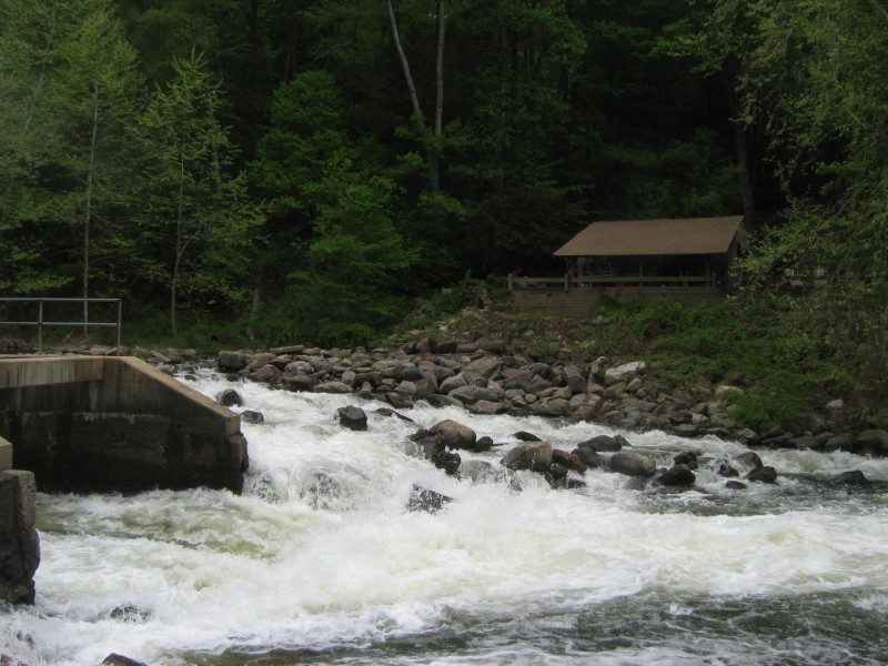
The Croton isn't something most folks would travel far for, though doing it once and launching at the dam is pretty impressive. It's one of the largest masonary structures in the world. But if you don't have to travel far, it runs often and holds well. Croton resevior is NYC's back up water in case one of the 2 water tunnels fail, so it's normally kept full and even a half an inch or rain will push it up for a few days. A good soaking will keep it up for weeks.
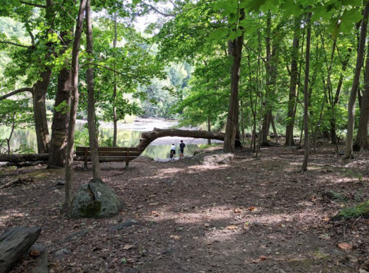
Log crosses diversion canal at right of low-dam (first dam on run) at water department. It's visable if you peak down the canal, and avoidable but lots of flow going under it and a trapped log away from being a death trap. Dam can be boofed or portaged at river right.
Access:
Normal start is Croton Dam Park is owned by Westchester County; you may have to pay on nice weekends before about 4 PM. (Note we were told by Parks Maintenence we couldn't launch from the park spring of 2022, so recommend speed and descretion).
Starting at Black Rock you just miss some eddies next to the road (and the amazing view of the dam).
Do not park in Black Rock Park at Quaker Bridge for the surfwave. They ticket nonresidents. You can park at a pull-off another 100 feet from the bridge or on non-posted side streets further up the road (drop at park and then park).
Attaining from Silver Lake to Quaker Bridge is pretty easy (1 portage above about 2.8 feet) and Silver Lake has legal parking.
Normal takeout is Mayo's Landing or at the RR station (pay for parking).
River sequence Croton Dam to Hudson River:
Pumping station dam,
Rock Slide at Black Rock Park Dam above Quaker Bridge Dam: class II ish with class IV consequences, 8 feet high 30 ft long: Run the rock slide at river left or portage right If you flip, you will get scraped up. Do not run next to the sluice as there
...
Put on below Croton dam. Best launch if from the furthest parking lot. Trail leads to gauging station.
Nice wave under bridge at higher levels though you usually have to carry to get to it.
Class I section, trees and blow-downs in the river are only hazards. Can go either side of various islands.
Rangers and maintenence people aren't all to keen on paddlers and the mile below the dam to Black Rock is class 1 next to a busy road, so during nicer weather especially on weekends launch further down. You won't miss any good whitewater.
That being said, the dam is spectacular.
Nice eddy shear lines just above dam.
First dam 2 feet. Debris collects below dam. Route and flow bypasses dam on river right. Nice elevator move eddy at top.
As of 2022, log crosses diversion canal at right of low-dam (first dam on run) at water department. It's visable if you peak down the canal, and avoidable but lots of flow going under it and a trapped log away from being a death trap.
Dam can be boofed or portaged at river right. You can look over the lip at normal levels to pick a spot with few rocks or recirc by grabbing the concrete abutment at right.
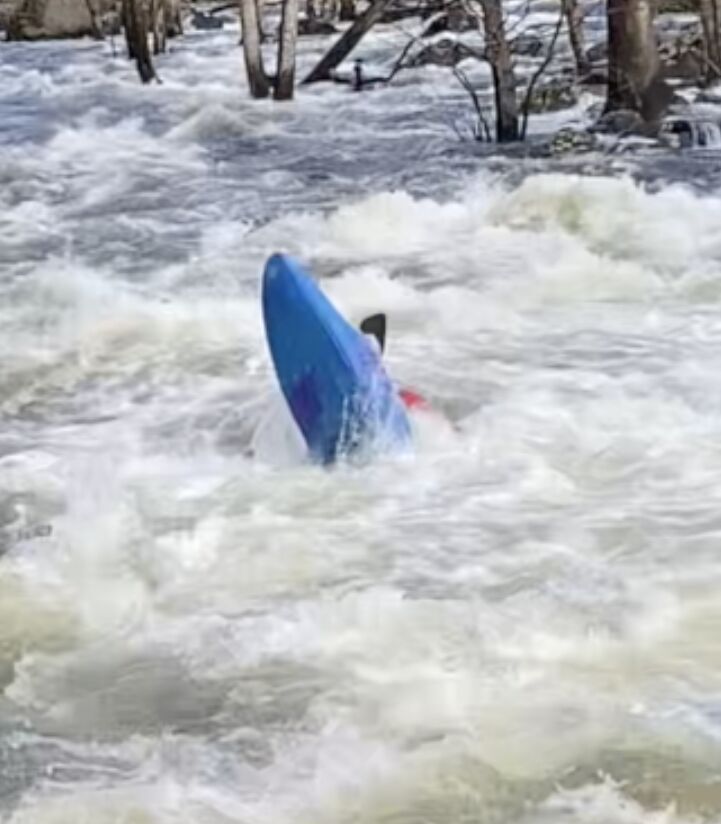
class II+ with class 4 consequences. Portage if you don't have faith in your brace. 8 feet high 60 ft long: Run the rock slide at river left, start at middle of left half of river, get shot left, stay 4 ft from bank. Not much maneuvering here, somewhat a crapshoot whether you bump anything. If you flip, you will get scraped up. Do not run next to the sluice as there is rebar. Below 3 feet it's too shallow, but if you don't mind boat abuse boucing down can beat getting out.
Below ~3.5 ft, you can take out on top of the dam near river right and carry right; At higher water, take out 100 feet before the dam on right and take the path behind the dog park
Rocks are slicker in the summer.
Jets and big-waterish swirlies below dam.
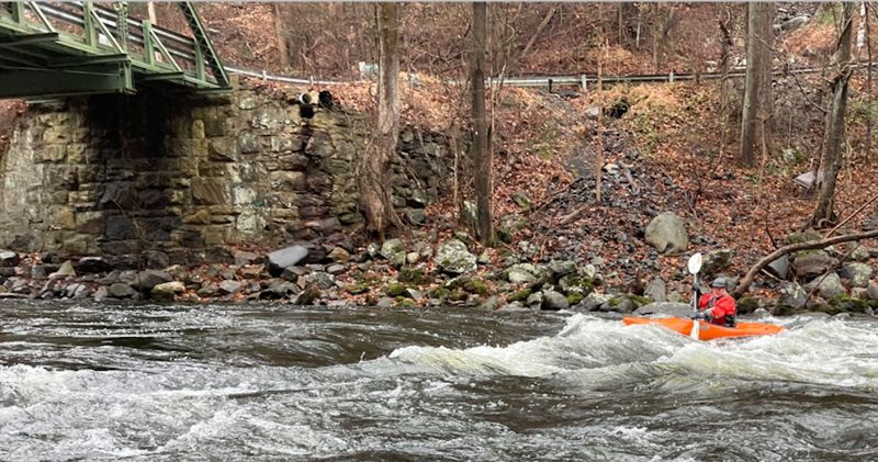
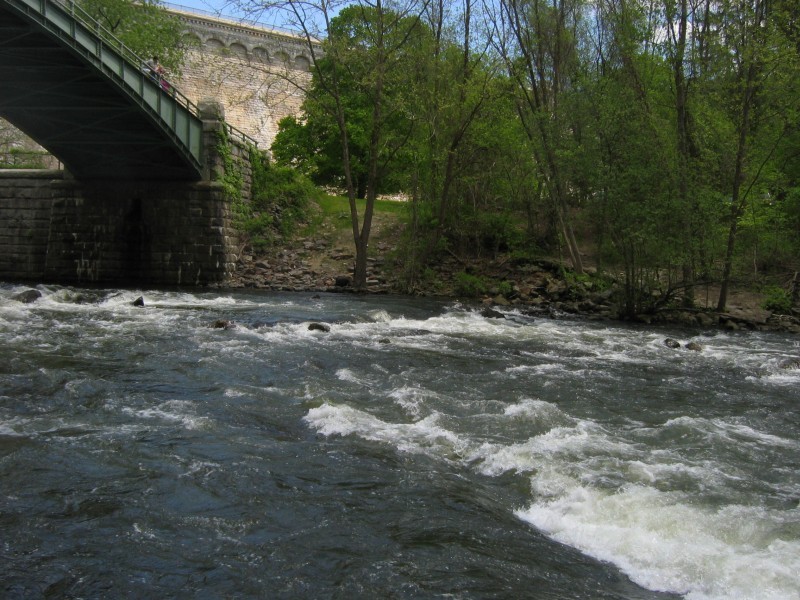
Short rapid with good surf wave with eddy service just below bridge. You need a Croton parking pass to park at Black Rock Park for park and play though hard to say how often they check. Easy carry up left.
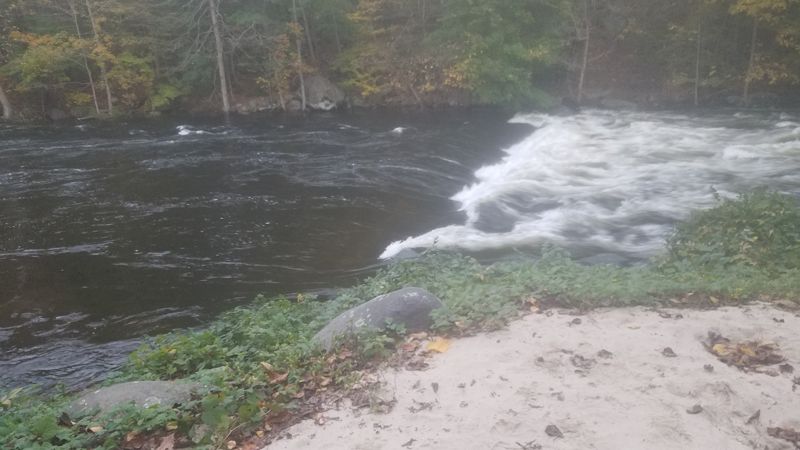
Surf wave below Quaker Bridge. Nice eddy. Gentle hole below 3 ft, wave like above. Can be very nice. It pulses around 4.5 ft-4.6 ft but is surfable, but loses eddy service around 3.7 feet, though some strategically moved rocks might fix that.
Full on lowhead with huge boil line at mid-high water (3.5-6').
Scout and sneak right. Retentive in the center. At low water - 3 feet or so - the sneak is kind of rocky. If you prefer, boof moving left to right as close to the left of the inch thick smooth curved peice of steel about 30' from the right side which marks the edge of the deeper pour over.
There have been issues with life gaurds making folks portage (gaurds are there late June-August).
The signature rapid on the Croton.
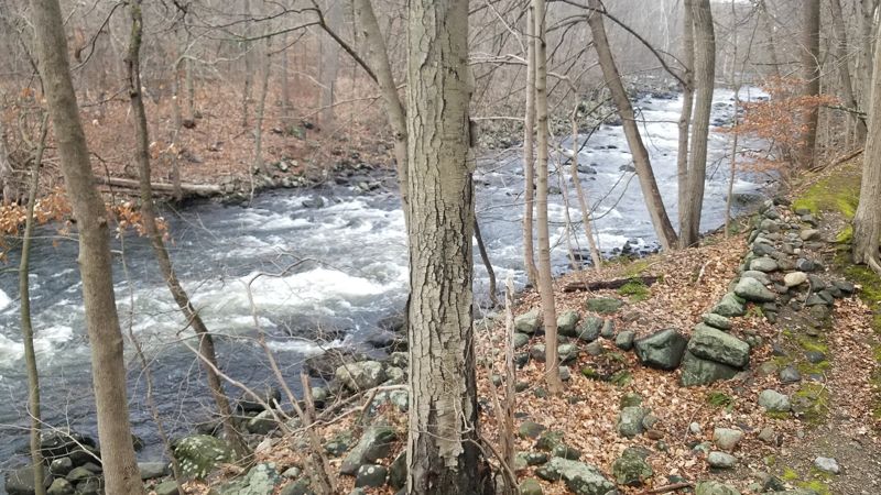
Left of island: Scouting on river left recommended for blow-downs. At 2-3 feet bumpy and technical (II and up with level) with a fairly straightforward center line thru the steepest part then following the flow left as it flattens out. Hitting eddies, surfing and ferrying can make for exciting moves. At higher water pretty fast and technical 100 yds. Above 4 ft you probably won't be able to eddy out.
Right of Island: Needs a bit more water, but at lower levels is a bit more challenging as there isn't a straight line. Easier route than left at high water. Can have too many overhanging branches to run. Scout from island or river right hiking down from the dam. Can run laps by pulling out near a nearly horizontal tree coming out from the bank on river right as the rapid starts to flatten.
Carry up the center of the Island for laps on river left. If you want to go back to right it's easist to launch above just above the tree mentioned above and ferry across. (Further up you have to carry accoss cobles).
Take-out on river right just before river turns left around island after the last of a string of houses perched on the cliffs (and countless no trespassing signs). Limitted parking on Nordica Drive except summer weekends (Mem day - Labor Day. Then go to take out at the RR station just before bridge. Legal paid parking at all times ).
Steep and often muddy slope about 100' carry 20' feet vertical.
Nearly a mile of flatwater below Mayo's landing. Mentioning this as parking is essentially unlimitted, there's summer kayak rentals and it's certainly a pretty section marred by busy road.
Mar 27, 2024
Put in at Silver Lake Beach. Running of right and left channels of Island Rapids.
River runner and creek boat handled the rapid well. Playboat got pushed around.
More information on the Croton River at the facebook site for Croton River Whitewater Paddlers. Videos of features at various levels on the gauge. Trip reports.
May 10, 2009
The put in is just downstream of the bridge leading into the park.
The first wave/ hole is just a bit downstream of the put in, on the opposite side. There's no eddy service, but you can walk back up from an eddy a few yards downstream.
There is no slide in the rock slide. It's really a jumble a rocks with gradient and water. A bit more water may make it faster, but the rocks could use the extra padding.
A short distance above the put in. Above the put in, and immediately downstream of this there are also 3 waterfalls that are each about 20 feet high, and a fast 30 feet apart, probably with shallow landings.