Sweetwater Creek
Sweetwater Creek State Park to Chattahoochee River
| Difficulty | III-IV(V) |
| Length | 3.9 mi |
| Avg Gradient | 50 fpm |
| Gauge | Sweetwater Creek Near Austell, Ga |
| Flow Rate as of 1 hour | 1.90 ftrunnable |
| Reach Info Last Updated | May 3, 2019 |
Gauge Description: Class III at low flows below 4 feet. Class IV above 5 feet on the gauge.
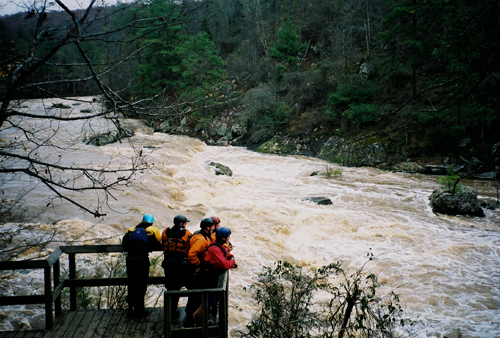
The falls are Class IV+. At 7 feet the falls are a Class V drop.
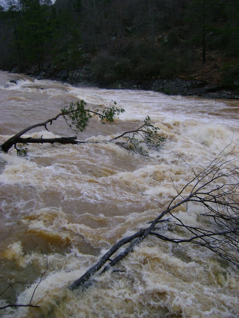
The river has been run a few times over 10 feet and possibly as high as 13. Floodstage Class 5 at these flows. LOCATION.--Lat 33°46'22', long 84°36'53', Douglas County, Hydrologic Unit 03130002, on right bank 100 ft upstream from bridge on Interstate Highway 20, 400 ft upstream from Blair Bridge, 3 mi southeast of Austell, and 5.5 mi upstream from mouth. More gauge info in text below. Sweetwater's drainage area is nearly 250 square miles, so it usually holds its water for a couple of days after a heavy rain.
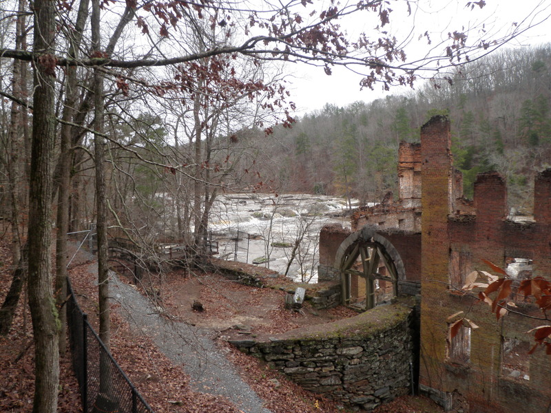
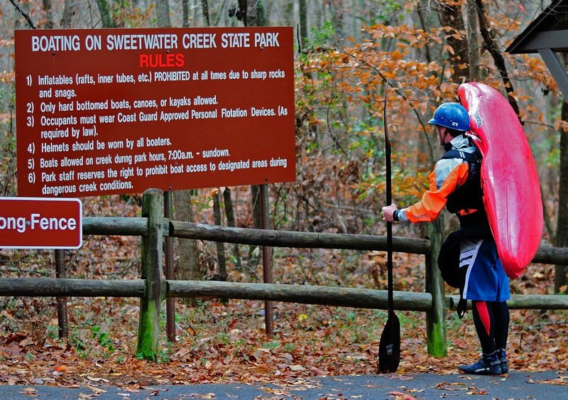
Description: The Put-in for this run is in Sweetwater Creek State Park. There is a parking fee $5 for the day or $50 for the Annual pass. Once inside the park drive straight back to the interpretive center and park. Walk down the nature trail until you hit water.
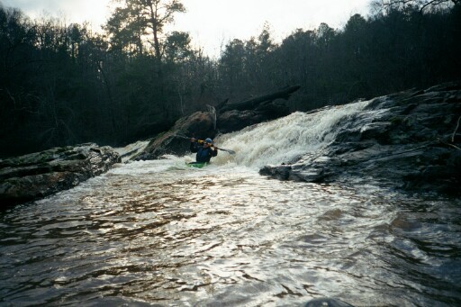
A general rule of thumb is run down the left side channels from the first ledge until you get to the falls, but there are also other fun lines on the right but tend to collect wood. just scout as you go.
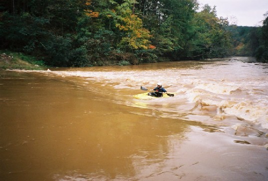
Below the put-in the river goes around a bend to the left. Just around the bend is a small riverwide ledge with some good surfing potential. Below this little wave hole is an island. Run to the left side of the island. Just past the island the gradient will start to pick up and the river will drop over more small bedrock ledges.
Take out on the left above the obvious horizon line.
The first major drop encountered is a riverwide ten foot tall sloping ledge. This is generally scouted and run on river left.
There is also a route on river right. Its a good idea to scout this ledge as wood tends to gather at its base.
At higher flows a nasty low head dam type hole develops on this ledge in the center of the river.
In October 1995 a pair of novice boaters swam out of th
...Where one gets in the river. Most of the descriptions below are for water levels in the 5 to 6 foot range.
A nice little river wide surfing ledge. Short boats can get cartwheels, long boats can 360 spin. There is an island below, run left of it.
A sloping 10 foot tall ledge. It might be class 3 at low flows. At flows above 4.5 feet the middle part of the ledge makes a nasty low head dam type keeper hole. Best place to scout and run is on the left. This one should definately be scouted before you run it. The logs in this drop move every time the water comes up.
The sneak is just below the island on the left that is immediately above the drop. Be aware this sneak turns into a nasty hole above 7.6 feet.
There is also a far right line, but it is hard to scout and ends in a log pile. At flows above 8 feet consider the channel by the jogging trail on the river right bank.
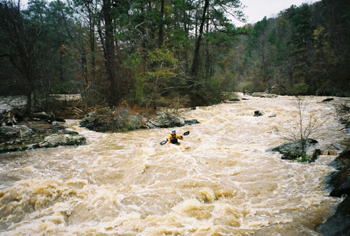
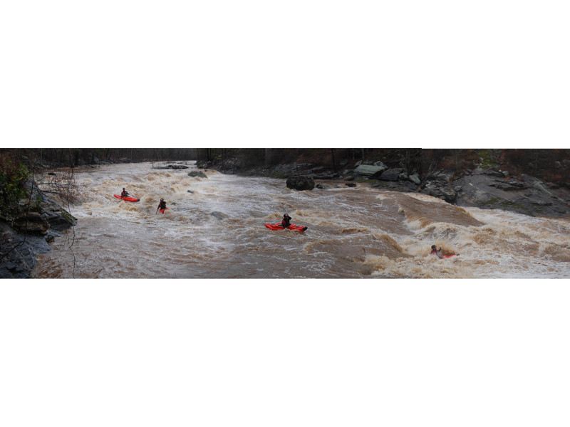
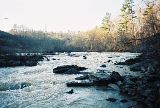
From the first ledge to the falls is nearly a mile continious class 3 plus or 4 rapids depending on the water level. Above 5.5 feet its one sweet long rapid. Normally run to the left of the islands, but there are also right and center lines. There is always badly placed and hard to see wood in the drops.
Big riverwide ledge with multiple routes, depending on the water level.
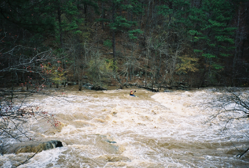
Being out of control thru the falls at high flows means you are going into the meat of this beast. There is a tongue around the left, and a sneak on the right.
Fun narrow creek around the right side of the island. Fun waves on the left.
Good waves on the right of the island, not so good waves on the left.
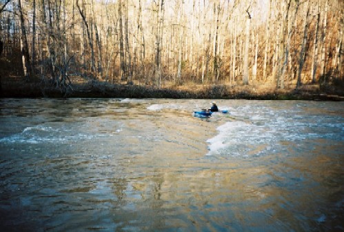
Nice riverwide surf wave/hole at some levels. Higher flows make for a better hole. There is a huge eddy river right under the rope swing that feeds you back onto the wave.
This one is best in the 5 foot range. It starts to wash out about 7.5 feet.
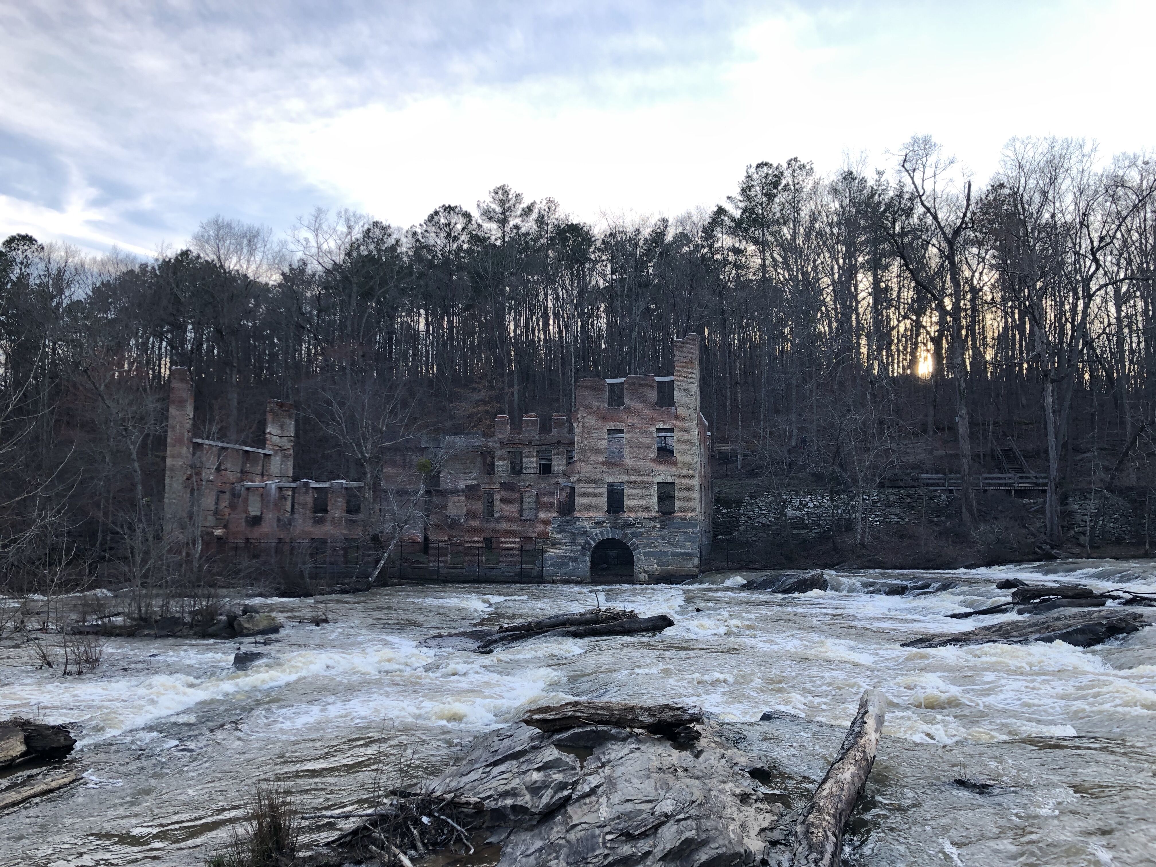
More open on the left, but with some big holes. The right side of the island has some cool routes, but usually has some badly placed wood in it. Look before you leap. At the bottom left of the rapid are more old Civil War era ruins.
During the summer of 2006 the dam at the pumping station was rebuilt. It is now a dangerous low head dam. The left side is particularly deadly. There was a sneak around the hole up against the river right bank.
Pre 2006 description:
The wave, or hole, or ledge at the pumping station is a whole lot of different rapids depending on how high the hooch is and how far it is backing up into sweetwater and how much water sweetwater is sending downstream.
If the hooch is really high, it backs up and covers the entire rapid.
The take-out is a pain in the neck. The normal take-out is on the right, under the bridge. The bank is slippery. The mud is nasty, and there is some re-bar waiting for someone to impale themselves on it.
Just above the bridge on the left is a cement culvert. At higher flows the culvert makes for a much better take-out. From there, carry up the trail to the road. Watch for snakes, poison ivey & broken glass.
Feb 18, 2023
I asked on the Facebook Georgia Canoe Assn page about early runs of Rottenwood. Michael B Terryran it in flood in spring of 1973 with Mark Reimer. They were in fiberglass kayaks. They also ran Sweetwater Creek on that day.
Dec 23, 2012
12/22/12 - Right side of island just below the power lines there is a tree down around the blind turn. Beware as we had 4 paddlers get trapped by it. All ended up okay. Two flipped and went under it. One got his body stuck for a bit on it then flushed out under it and then one boat had to be z-dragged off of it. We will try to get in and cut it out. Also at the Falls, a tree is blocking the middle right and far right lines. The park rangers said they will cut this out. We removed a lot of wood and opened up some routes that have been blocked since the flood in 2009.
Oct 30, 2010
The Sweetwater Creek Guage is right around 1 foot off. 1.4 on the new guage put up after the flood of Sept. 2009 is ~ the the same level as the old guage at 2.4 which is barely runnable. I went down Oct. 30th 2010 to verify and it is just barely runnable at 1.4 on the new guage. The information on the river description page needs to be adjusted down 1 foot for both Too Low and Too High to Paddle.