Sweetwater Creek
Sweetwater Creek State Park to Chattahoochee River
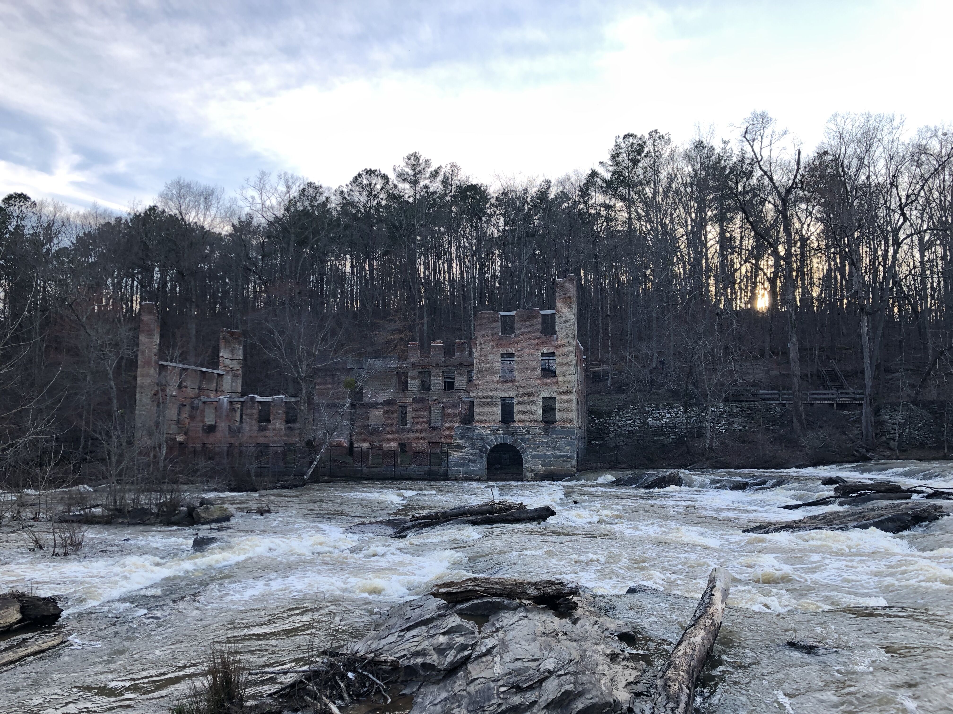
Feb 18, 2023
I asked on the Facebook Georgia Canoe Assn page about early runs of Rottenwood. Michael B Terryran it in flood in spring of 1973 with Mark Reimer. They were in fiberglass kayaks. They also ran Sweetwater Creek on that day.
Dec 23, 2012
12/22/12 - Right side of island just below the power lines there is a tree down around the blind turn. Beware as we had 4 paddlers get trapped by it. All ended up okay. Two flipped and went under it. One got his body stuck for a bit on it then flushed out under it and then one boat had to be z-dragged off of it. We will try to get in and cut it out. Also at the Falls, a tree is blocking the middle right and far right lines. The park rangers said they will cut this out. We removed a lot of wood and opened up some routes that have been blocked since the flood in 2009.
Apr 27, 2012
The gauge has been updated to reflect the level changes since the floods of 2009 took out the old gauge and the new one was put in a downstream location.
Nov 24, 2011
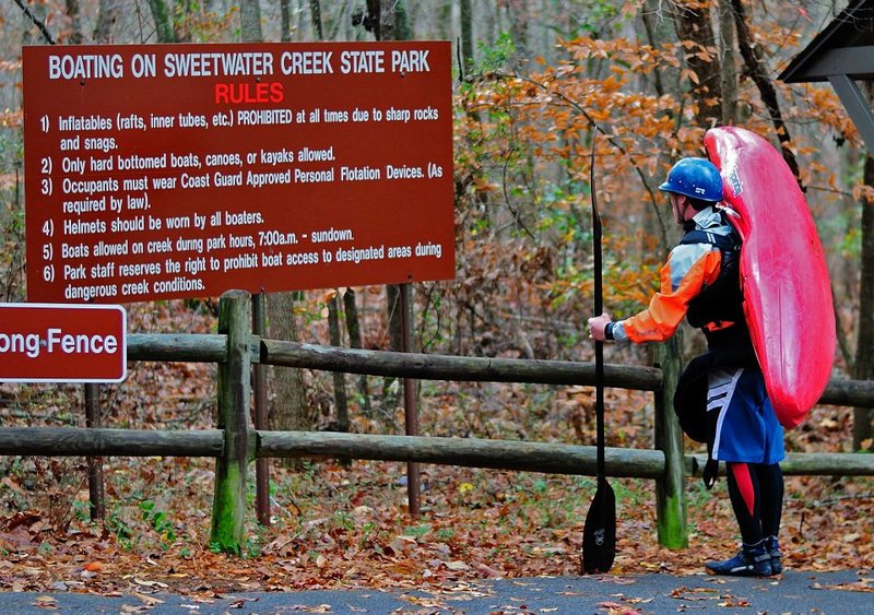
The rules of Sweetwater. I heard rumors that cobb county is now taking a lot of water from the creek and that's why it doesn't run as often as it used to. Not sure if the rumors are true though.
Nov 24, 2011
The rules of Sweetwater. I heard a rumor that Cobb County is now taking a large amount of water out of the creek and that is why it doesn't run as often as it used to.
Feb 6, 2011
The right-of-island line at Powerline Rapid is blocked by a tree completely across the channel. Still there on Feb. 6, 2011.
Oct 30, 2010
The Sweetwater Creek Guage is right around 1 foot off. 1.4 on the new guage put up after the flood of Sept. 2009 is ~ the the same level as the old guage at 2.4 which is barely runnable. I went down Oct. 30th 2010 to verify and it is just barely runnable at 1.4 on the new guage. The information on the river description page needs to be adjusted down 1 foot for both Too Low and Too High to Paddle.
Oct 17, 2009
Just ran Sweetwater and Hiked out the Blue Trail after running the falls. The trail is in decent shape except for the staircase down at the river. The steps were ripped away so you have to climb up beside the first platform to get up there. Also the water level is way off. The new guage read about 3 foot but the water level was more like what it was when it read 4 foot or even a little higher. I noticed this a week or so ago as well when the guage read 4.3 but it seemed more like 5 foot. The rapids have had rocks move around in them and seem to be cleaner actually.
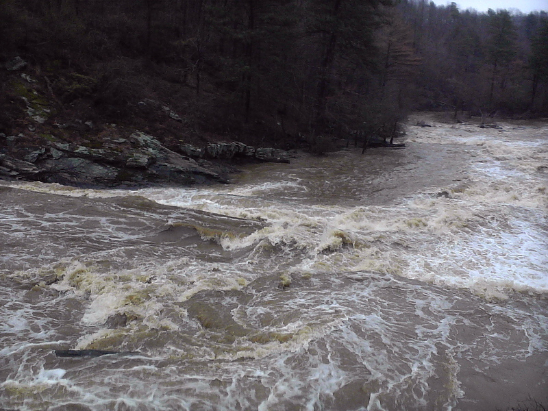
Oct 7, 2009
the red trail is open to hike down to the water.we made a run on 10-6-09. the flood washed out almost all the islands in the river. lots of big rocks have been moved around.at the time there were no trees in any of the rapids we scouted.the red trail was washed away along with several foot bridges and the overlook deck at the falls, it looks pretty bad. there was a tree down on river right just below powerlines blocking the right channel.
Sep 30, 2009
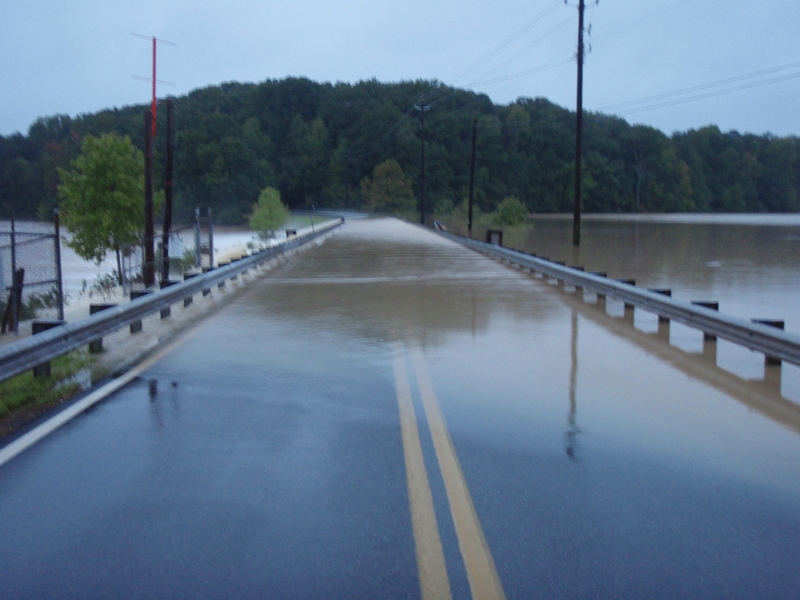
All of the access roads to the put in have been closed since the flood. To run it right now you have to put in somewhere besides the state park
Sep 22, 2009
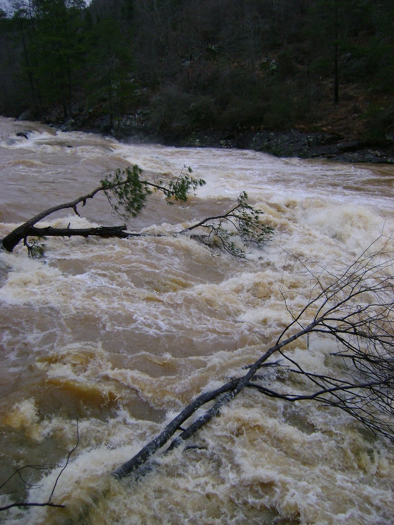
around 11am was the last reading from the gauge it was at 18' and climbing fast,this day it rained hard all day.Park rangers would not allow anyone to hike to see the falls. they closed the park. the lake spilled over the road at the park entrance.on 9/22/09 sweetwatercreek flooded i-20, if the gauge was working i would guess it to close to 25'
Sep 21, 2009
that low head damn thing isn't there at levels between 25 and 30 ft. Don't know below.
May 15, 2006
Trails at Sweetwater Creek State Park
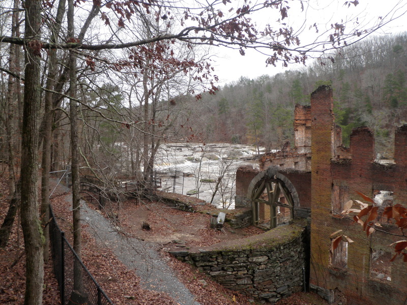
Factory Ruins Trail: 1.2 miles one way. Blazed red. Rated moderately difficult. The toughest part is downhill to the creek; the rest of the trail is easy. Trail follows Sweetwater Creek past the 1840s mill ruins to the falls (a large rapid). After the falls, pick up the Blue or White trail to return. A trail guide is available at the Visitor Center, in the brochure box in front of the building.
Blue Trail: 2 miles one way. Blazed blue. Rated easy to moderate, with one steep climb down to the falls deck. Visits ruins and then the falls (a large rapid) via a trail up the ridge side rather than along the creek. At the falls, return via the red-blazed Factory Ruins Trail or Blue Trail
White Trail: 3 miles one way. Blazed white. Connects the ends of the Red and Blue trails back to the parking area. Remember to add the 3 miles to the distance already traveled on Red or Blue trails. Follows Sweetwater Creek downstream, turns up into the hills past a small lake, then up through an area of early 20th century farm fields.
Yellow Trail: 3-mile loop. Blazed yellow. Rated easy to difficult. Follows Sweetwater Creek to Ferguson's Crossing, crosses the creek on a metal frame bridge, climbs the ridge on the east side to the top of the ridge, then loops back to the bridge leading back to the parking area.
Mar 21, 2006
this drop is a solid class 4+ rapid at this level with a class 5 keeper hole at the bottom of this drop that would stick a 16ft. raft easily!!!
Jun 2, 2005
We ran sweetwater yesterday, 6/1/05 when the guage said it was around 2.6 ft. Our visual check on the painted gauge was 4 ft. Is this acurate? Any one having info on this please post here. Thanks, Shayne
Jul 15, 2004
This hole can be played for hours and hours. Above 4ft exit is tricky, below 3ft it gets weak.
It's SO much bigger than this picture makes it look.
I always think I'm gonna blow over the top of this wave but it NEVER happens. You can see the 2nd drop/slide in the bkgd.
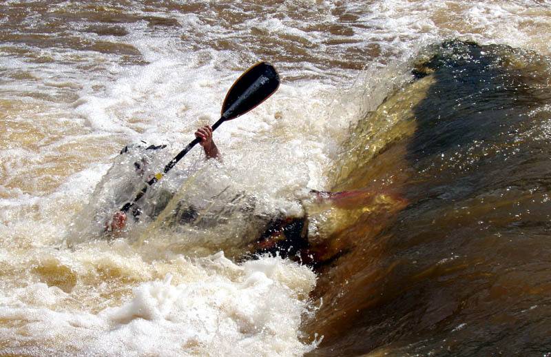
What happens when you don't hit your 1st roll after being ejected from the river right hole below the falls.
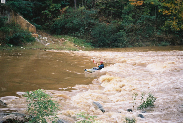
This picture really let's you see how nasty and brown this water is. It is definitley NOT sweet. Just ask Dale, he just got a mouthfull... and HRA.
Great view of the hole on River Right below the falls. 360's for days.
Nov 20, 2003
When the Hooch has more than 10,000 cfs the last rapid is completely underwater. The good news is that you can take out really easily on the left where the culvert comes in.
Nov 9, 2003
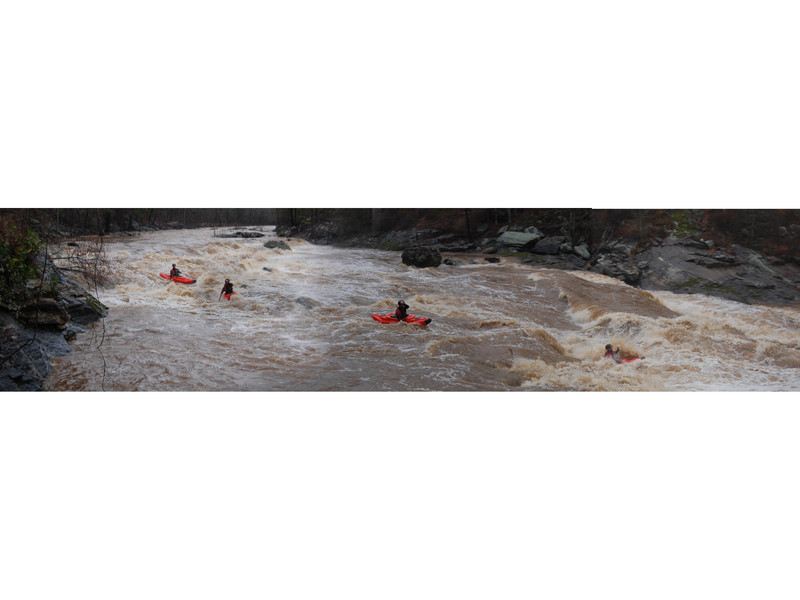
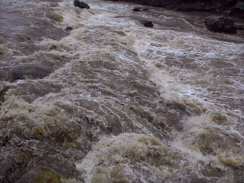
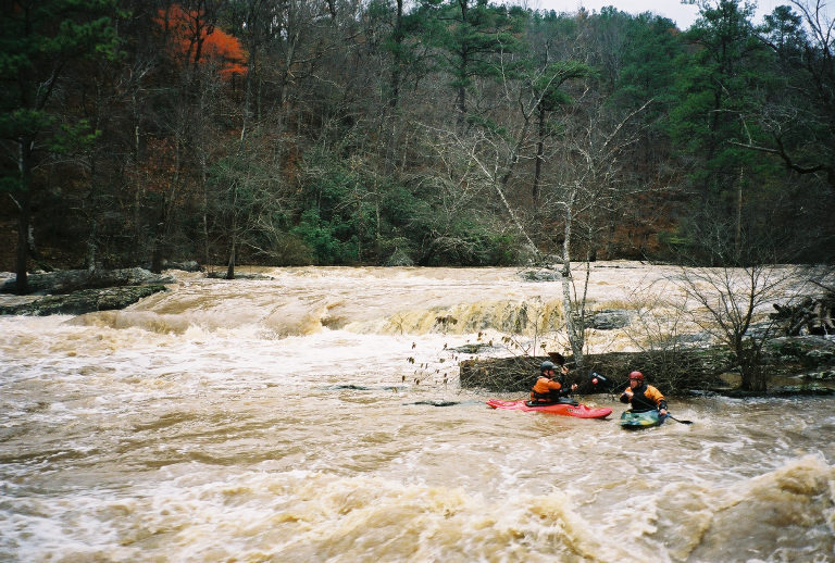
This is the bottom part of the left side of the shoals. Always be on the lookout for new wood & strainers in this stretch. One boater in our group found something to pin on and took a swim at the top of this stretch.
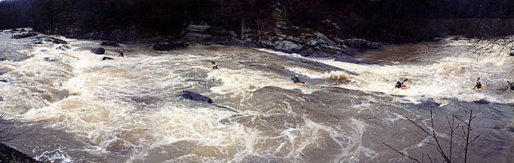
This is past the last island but above the falls. At this level there are some really large hidden holes in the wavetrains. We were passed by a couple of 10 foot long logs in this stretch.
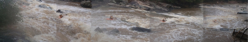
Jim going for the tongue around the left side of the hole.
Ted getting a little tossed in the hole at the top of the falls. From here, bust left to right across the curler above the huge hole into the eddy. Be careful not to get caught in the eddy fence.
Gnarly ledge full of pinning rocks, with a bad hole, and some blind strainers. So we usually run left of it.
Nov 9, 2003
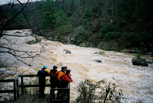
The river right scout of the falls. Its also the portage trail. Standard line is to start river left and ferry across the holes to river right. The photo only shows the approach moves, the two rather large holes downstream are what the boys are staring at.
Jul 24, 2003
At levels of about 3.5 and lower there are 2 awesome holes right below the falls. The best being the one that is kind of on the falls, it is an extremely shallow L shaped hole at the bottom of the slide. It is a really fun surf, And the next one is right below it, it is really good for 360's and maybe cartwheels.
Mar 15, 2003
This is a really low level for this feature. About 4.5 feet it becomes a riverwide hole that can hold 3 or 4 boats. It gets better as it gets higher.
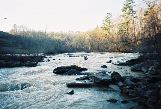
Pretty easy at this level. At higher flows around 5 feet this rapid grows two huge holes. There are also lines on the other side of the island.
This little channel is just below the falls on river right. Nothing too hard, just an alternate route.
Mar 12, 2003
METRO AND GEORGIA IN BRIEF
Two kayakers stranded in Sweetwater Creek
Author: From staff and news services Date: October 8, 1995 Publication: The Atlanta Journal and The Atlanta Constitution Page Number: F/2 Word Count: 628
Two experienced kayakers were stranded on a small island on Sweetwater Creek inside Sweetwater Creek State Park in Lithia Springs for more than 24 hours after their small craft was swept away. Robbie Martin and Scott Dalton, both of Lithia Springs, huddled together all of Friday night and most of Saturday as they waited for rescuers. Rescue attempts were thwarted several times because Douglas County firefighters and volunteers could not get across the rain-swollen creek to the small island
Feb 23, 2003
The takeout road is no longer called lower river road. I am not sure what the name of it is now but i believe it is somthing to the tune of riverside pkwy? There is a sign that says this and points to it. Sorry about not knowing the exact name
Oct 29, 2002
At 5.5 feet on sweetwater, and 4000 cfs in the hooch, the wave at the pumping station was unbelieveable. 4 feet tall, 15 feet wide, good eddy access, it was incredible!!!! Unfortunately the river was dropping fast and the wave dissappeared as the river dropped below 5 feet.
Oct 9, 2002
8 years of paddling this river and I have never seen this wave form like this. It was AWESOME. Big eddy on the right.
Jan 15, 2002
This is the middle sneak line between two really large holes on the first major drop at Sweetwater Creek. Below this the action was non-stop til the falls. This was the last big eddy we found.
Looking up at the bottom of the falls at Sweetwater Creek, just below the big hole at the bottom.
Jan 1, 1900
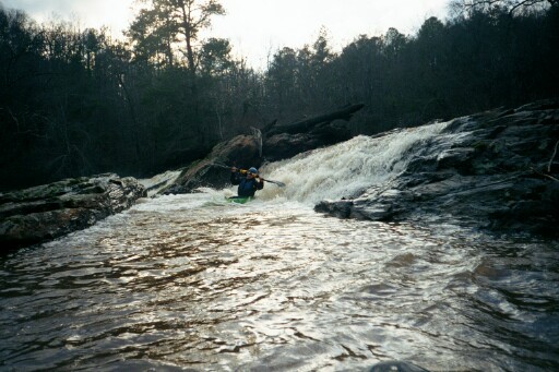
Will Reeves running the center line of the falls at moderate water. The high water sneak is to boof the falls against the river right shore, seen in the photo.
Jan 1, 1900
Duncan Cottrell and Shannon Herford running the far right side of the first ledgs.
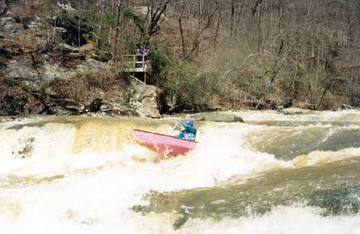
Shannon Herford running the left to right line at Sweetwater Creek Falls. This shot was taken from the observation deck overlooking the falls.
Duncan Cottrell taking the left to right line through Sweetwater Creek falls.