Tallulah
2 - Tate Branch Campground to Coleman River(Upper Tallulah)
| Difficulty | IV-V |
| Length | 1.4 mi |
| Avg Gradient | 150 fpm |
| Gauge | Tallulah River Near Clayton, Ga |
| Flow Rate as of 16 minutes | 78 cfsbelow recommended |
| Reach Info Last Updated | April 26, 2023 |
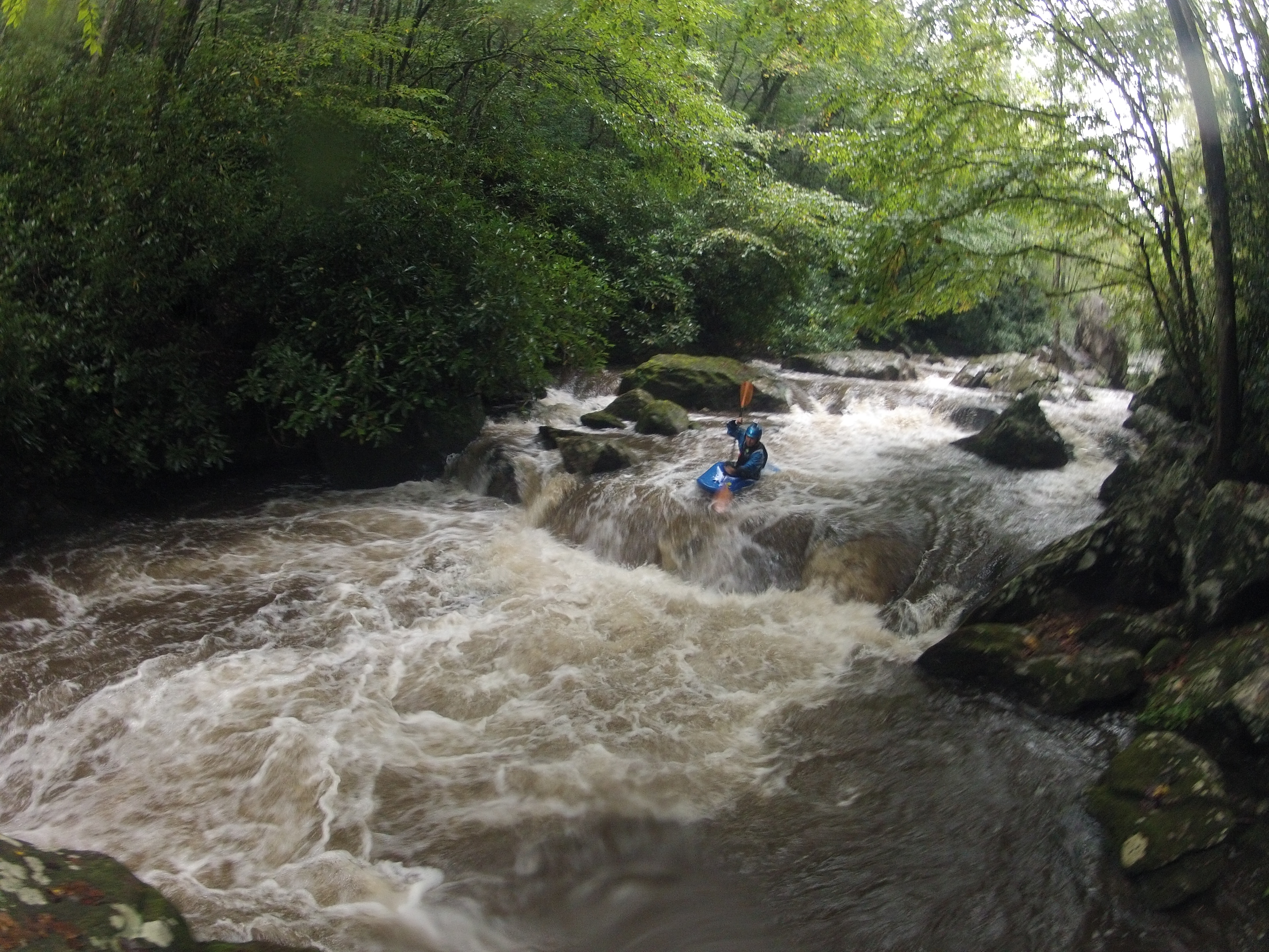
The upper Tallulah is an excellent run despite being largely overlooked over the years. The run is just over a mile of continuous class IV/V whitewater with plenty of cool boofs and slot moves, all within feet of a small gravel road that allows easy access without interfering with the scenery too much. The entire river is located along tallulah river road and you can choose however much or little of it you want to run, but the best section is the mile from the 3rd bridge over the river to the 1st (in the order you will cross them driving upstream). The best part is this run holds water very well, requiring only a small rain to get going and holding water a day or two after everything else has dropped out from a bigger rain.
Directions:
From Clayton go west on US 76. Take a right (North) on Persimmon Road. Go a few miles then take a left (west) on Tallulah River Road. The best takeout option is the first bridge over the river. Drive up as far as you want to put in, scouting on your way up.
Despite all the hype and arm waving on this run it is not the killer creek that people keep making it out to be. We used to clean the trees out and it is hard and dangerous like any other class V but it is not any worse.
Here is one account circa January of 1999. The names have been changed to protect the guilty.
'Figured you'll hear about it soon enough, so I thought I'd put in in writing so everyone gets the same story...
Rusty, Clint, Kevin, and I were paddling the upper Talullah with Rodwell's friend Chad and Chad's friend Jason. We were scouting most rapids, as the water was fairly high and the lines were getting more difficult as we worked our way toward the takeout. We scouted a long continuous stretch of 4ish stuff that was starting to look 5ish in some places because of the narrow lines, pushy water, lodged logs, sieves, and undercut rocks (just about runs the gamut of undesirable elements).
W
...You can put in here for a quick warm up. theres a small gorge rapid just below the 4th bridge, other than that its a quarter mile of flat down to the third bridge.
Put in here if you want to get right into the action, there are no major rapids upstream
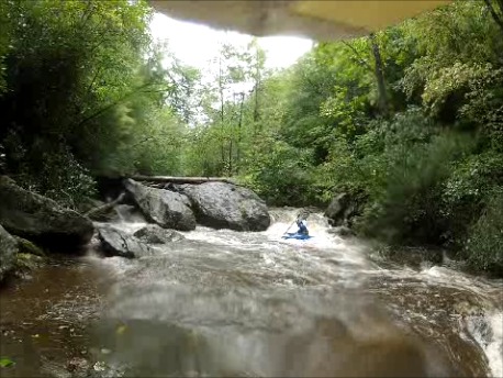
The first section between the 3rd and 2nd bridges is made up of a number of fun class IV rapids, mostly slot moves and small boofs
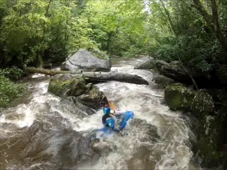
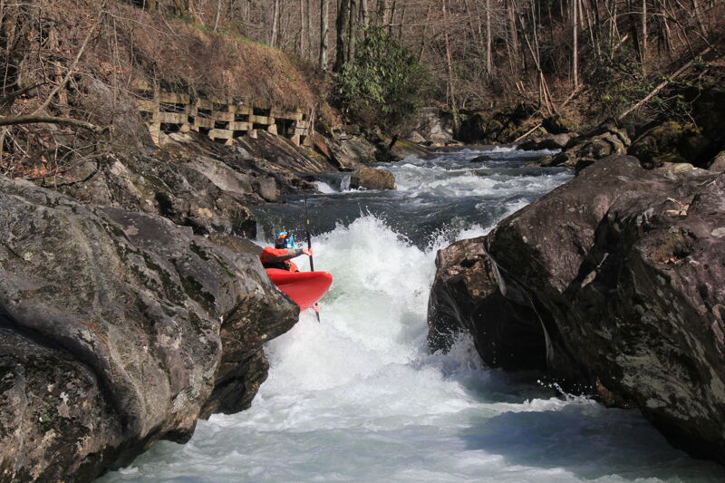
The hardest rapid on the run is just below the second bridge. A late drive right through a slot saves you from getting splatted onto your head by the big rock on the left. The wall on the right is kinda scary looking too.
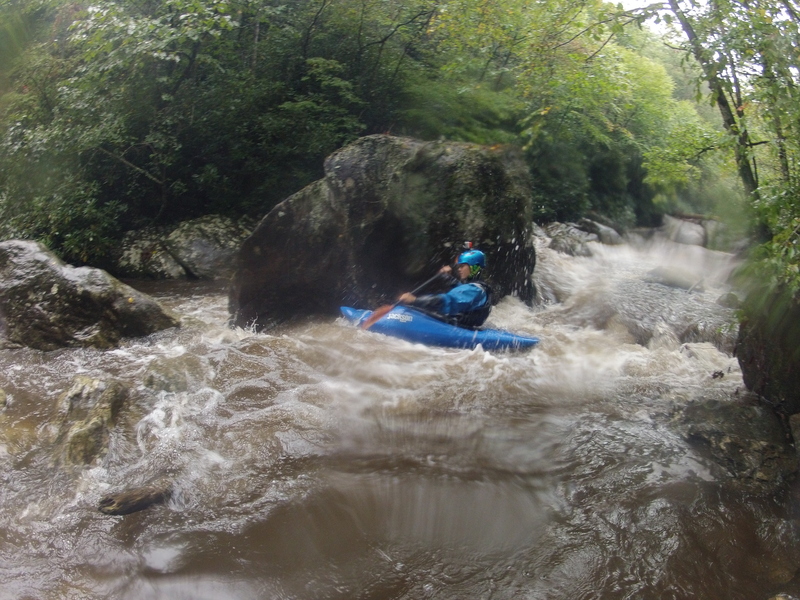
Boof right off the first drop driving left to avoid getting smacked in the face by the overhang on the right. Its not a cave and won't swallow you but still not a pleasant experience to go under it.
after another boogie rapid the river funnels down into a less-than boat length slot with a boof on the right that is way better than it looks.
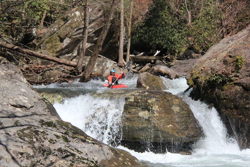
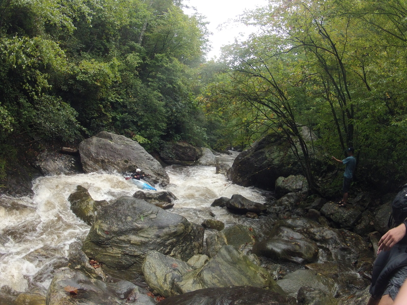
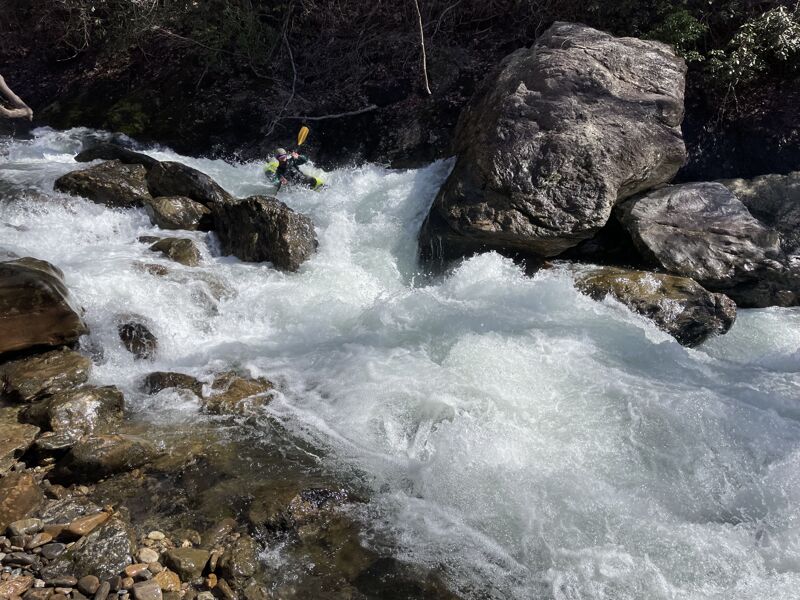
three fun smaller rapids lead to asscrack, a riverwide ledge with cracks on either side. At decent flows (~425 or above) goes fine with a strong drive left of center off the ledge, but at lower levels it is not possible to drive over the ledge, and you have to drop into the crack, best to take out above here at those levels
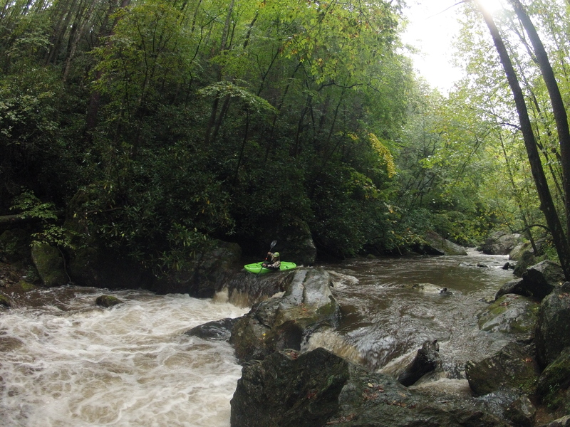
The last big drop on the run, enter through a tight slot then drive left.
Best takeout option if you're trying to maximize the whitewater/flatwater ratio. Theres one small drop between here and the coleman river campground
Oct 21, 2012
We shot some video of the top half of this run in the summer of 2012
http://www.youtube.com/watch?v=68AeVKPeWlM&feature=plcp
Sep 20, 2012
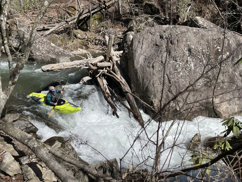
One of many logs that you can boat under
Dec 22, 2006
We ran this today, Dec 22, at about 600 cfs on the on-line gauge. Good level. Two runs of Flume of Doom (some funny water at the landing) and the rapid that is almost completely sieved-out. Definitely 'manky' in there, but a fun run when Overflow is too high. Need to go in with a bowsaw and cut a few logs.
Feb 1, 2003
Brad,
Here is my beta from the Upper T, in case you can use any of it on its SK
page, especially with gauge levels. I'm not sure there's been a decent
correlation between what amount of water the run needs in relation to the
USGS reading. I'd call 4:30 yesterday a somewhat decent minimum for the run,
which registered around 240 cfs on the online gauge, though it could
definitely use more water to fill in a few more of the undercuts and sieves
and open up some cleaner lines. I thought at the time it was around 200 cfs
or so.
The gauge is a bit downstream:
http://waterdata.usgs.gov/ga/nwis/uv?02178400
Gauge location:
http://www.topozone.com/map.asp?lat=34.890277777777776&lon=-83.5305555555555
5
Versus the takeout of short whitewater section:
http://www.topozone.com/map.asp?z=17&n=3868479&e=267287&s=25
I wasn't expecting it to be running yesterday, but it was, albeit on the low
side. The Coleman had a little bit of water, but it was still too low and
definitely not very clean.
Sutton