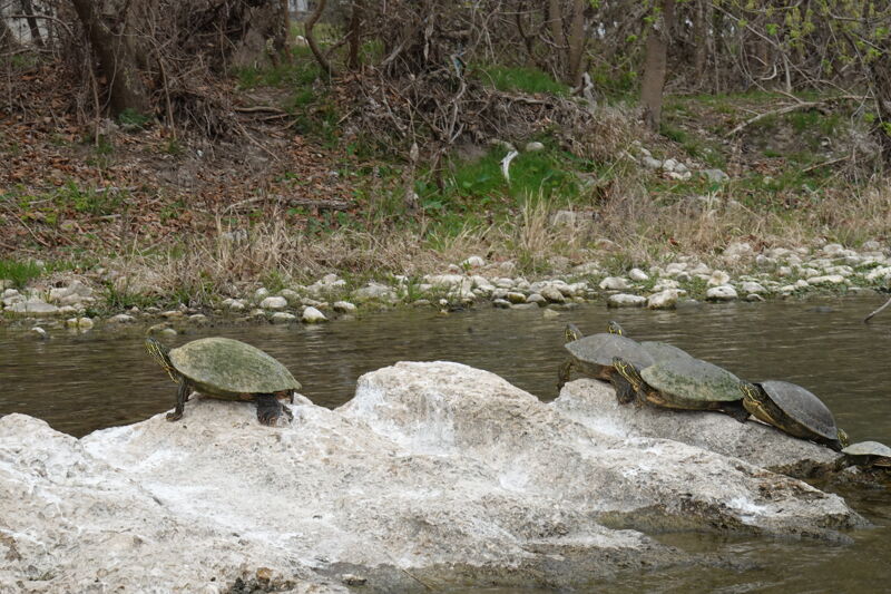
Guadalupe
5. First Crossing to Common St. (6 miles)

| Difficulty | II+(III) |
| Length | 6.2 mi |
| Avg Gradient | 12 fpm |
| Gauge | Guadalupe Rv Abv Comal Rv at New Braunfels, Tx |
| Flow Rate as of 24 minutes | 282 cfslow runnable |
| Reach Info Last Updated | March 4, 2023 |
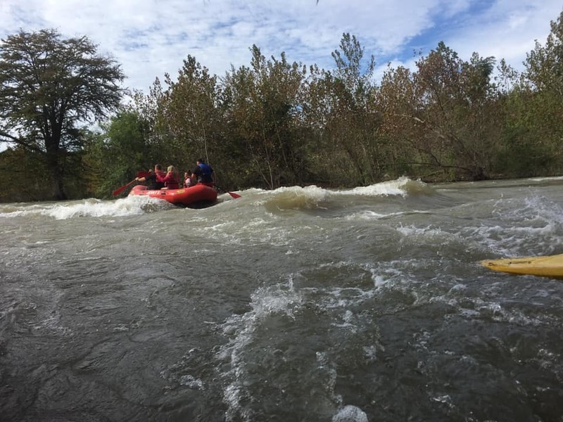
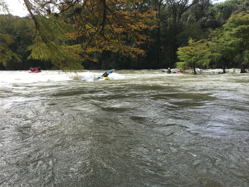
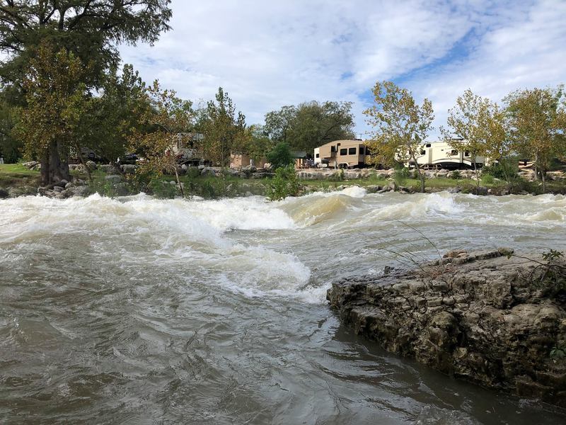
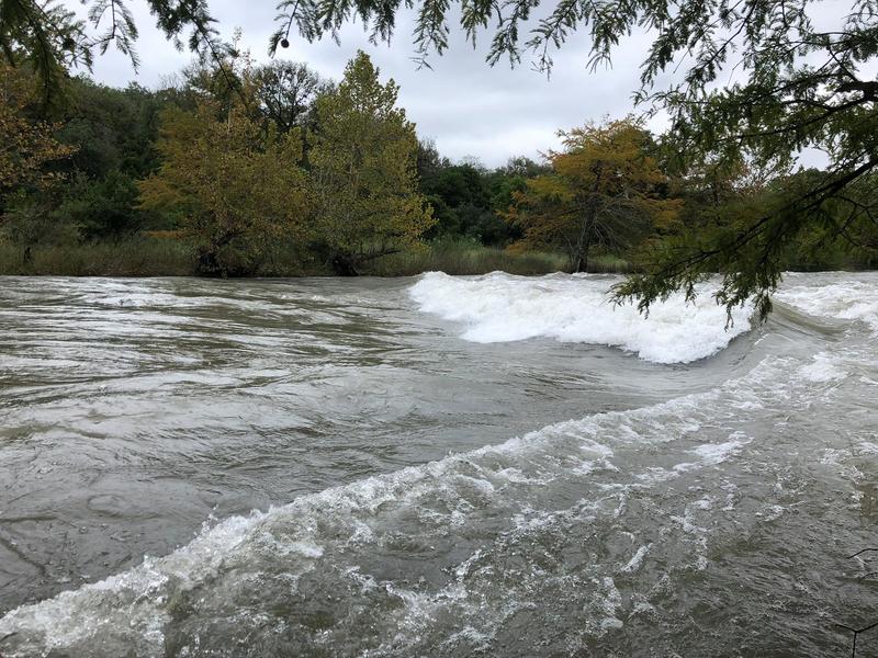
The Lower Guadalupe is fed from a bottom-release dam ( Canyon Dam), and thus it almost always runs relatively clear and cold (60 degrees at the dam.) During the summer months, if the dam release is at 'recreational' levels (< 750 cfs), the river will be clogged with tubers. Referring to this article, The Guadalupe-Blanco River Authority controls the releases from Canyon Dam whenever the lake level is 909' or below, and when this is the case, typically the releases will be geared toward tubing (no more than 750 cfs, and usually much lower) during the summer months. During periods of drought, the GBRA will release only the minimum necessary to maintain the health of the Matagorda Bay estuary and fulfill downstream water contracts (about 50-75 cfs.) When floods occur on the Upper Guadalupe and the lake gets above 909', the Army Corps of Engineers takes control. If the lake level gets too high, then they will attempt to lower it to 909' as quickly as they can, which usually results in days or weeks of 3000-5500 cfs releases downstream (5500 cfs is the maximum dam release.) However, the Army Corps must also ensure that the release, when combined with natural flows, does not exceed 12,000 cfs at Cuero, Gonzales, and Victoria. During big dam releases, the Lower Guadalupe becomes a playground for rafters and whitewater kayakers, but unfortunately this only tends to happen every few years, and extended multi-week big releases only tend to happen once or twice every decade.
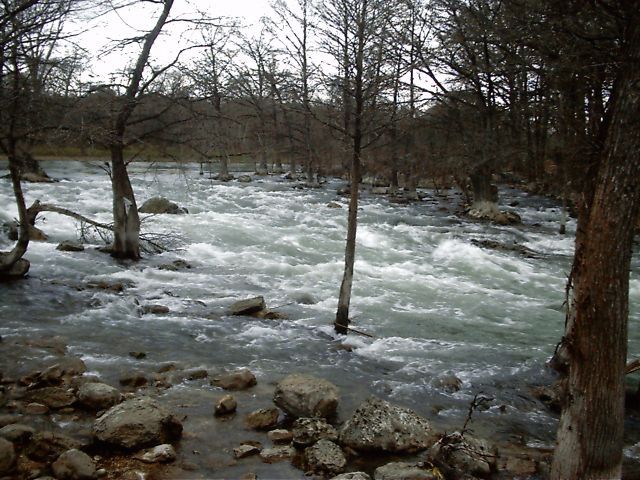
First Crossing to Common St. is the most continuous stretch of the Guadalupe (although 'continuous' is a relative term here-- there are still a lot of big pools.) That fact, combined with the fact that the Lower Guadalupe is the only dam-controlled whitewater river in Central Texas, makes this stretch very popular with all types of river users. At lower levels (up to 1200 cfs),
...
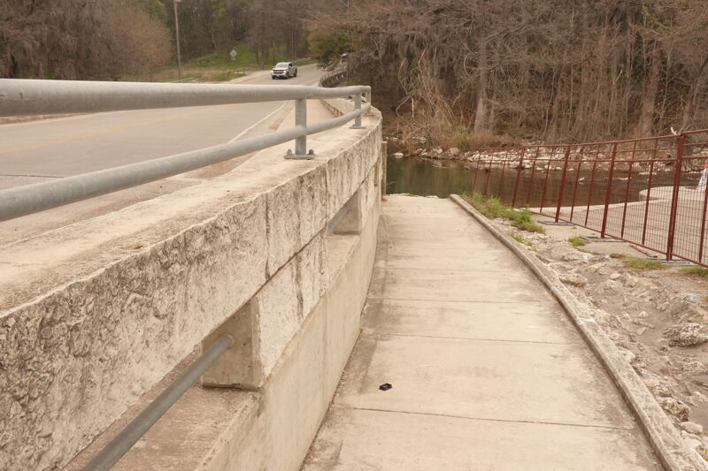
If you put in above the 1st Crossing bridge, be cautious of the pilings from the old bridge, which are located just downstream of the current bridge. These form about 20 slots across the river. At high dam releases (thousands of cfs), some of these slots can form grabby hydraulics and/or collect large debris (tree limbs, etc.) Generally the second slot from the left is the best one to take, assuming it isn't clogged with debris. The river left side of the bridge also has the most vertical clearance.
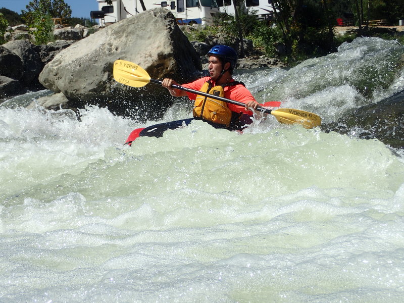
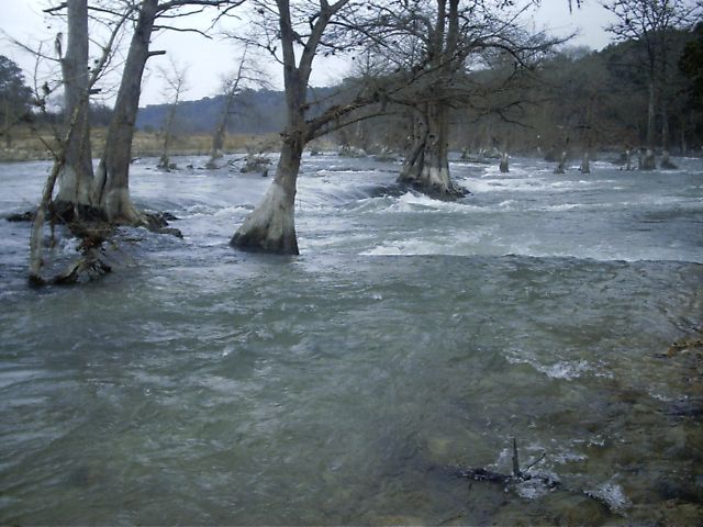
Hueco Falls is really the only named rapid on the Guadalupe that merits a Class III rating. Paddlers generally run river left to avoid the large boulder at river right. At lower flows (<= 1000 cfs), the rapid as a whole is more of a Class II+/III-. Enter near the center of the river and work left, S-turning down a couple of shallow ledges. At higher flows, a wave train forms at river left, and the line becomes more straightforward. At 3000-5000 cfs, the river left wave train becomes large and irregular, and the river right boulder forms a nasty hole. The hole is grabbiest at around 3000-3500 cfs, when water is just barely over the rock (at least one expert whitewater kayaker is known to have received a proper beat-down and taken a swim here as the result of a failed boof attempt.) At the same level, a large reactionary wave forms between the hole and the wave train, and it can ender a playboat or swamp an open boat that ventures too far right. Make no mistake-- the Hueco hole is a feature worthy of a Class IV rapid, and it will give you a Class IV beat-down, but you would first have to miss the entire half of the river where the hole isn't.
At around 1000-1200 cfs, a sneak line opens up to the right of the boulder (between the boulder and the rock garden, which is mostly submerged and adorned with saplings in the above photo.) However, inexperienced paddlers (particularly those in open boats) should not attempt this line, as the boulder has high pin potential (make a fist, Christopher.) At higher flows (example: 3000-3500 cfs), when the hole is in, this line becomes a one-boat-wide Class IV hero line that requires paddling over the shoulder of the hole. Paddlers without solid Class IV+ river running and hole extrication skills should never attempt this line when the hole is in, and setting safety is recommended.
At very high flows (multiple thousands of cfs), a Class II sneak line opens up at far river right (hugging the right bank, to the right of the rock garden that is to the right of the boulder/hole.) This line is known to be in when a full dam release (5000+ cfs) is occurring.
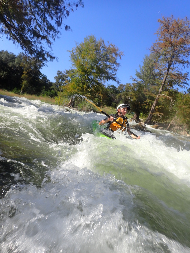
At around 500 cfs, a shallow side-surf spot opens up at river left behind the drop. As the flow increases, the wave-hole becomes deeper and turns into more of a proper play wave, reaching its ideal level at somewhere between 2500-4000 cfs. At 2500-3500 cfs, it is a very bouncy front-surfable irregular wave that can give up other tricks to those with good playboating skills, but generally it it not very retentive. At higher flows, the wave becomes bigger but harder to catch.
At 2500-3500 cfs (and possibly lower levels), the ledge above the main wave also becomes playable. Boaters can catch this ledge on the fly or portage up from the eddy next to the main wave.
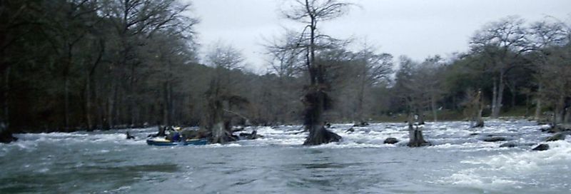
The river jogs right through the trees, confluences with a creek, then jogs left again. The line is straightforward, but the creek that enters at river right (Elm Creek) can sometimes make the eddies a bit squirrelly, depending on how much water is coming out of Hueco Springs into the creek. There used to be a ledge above the creek confluence (remnants of an old dam) that was surfable at low flows, but a very localized flood on June 9, 2010 dumped 15,000 cfs into the river near this point, and the debris from that flood buried the ledge. Past the confluence of the creek, there is a small wave train at river right. At thousands of cfs, a larger wave train forms several hundred yards downstream of Slumber Falls, and this wave train is known to give up wave wheels.
At higher flows (thousands of cfs), the trees in and around Slumber Falls form strong eddies that are great for practicing attainments and ferries.
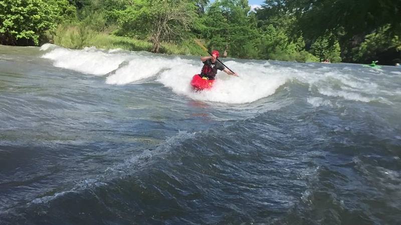
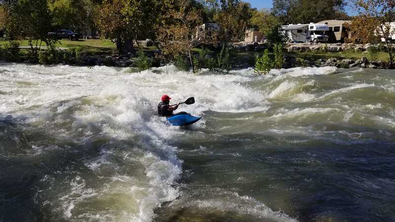
There are two channels at Slant, separated by a small island (Ant Island.) The river left channel forms a shallow, river-wide surf wave at around 1200 cfs, and as the flow increases, this wave gets deeper and more optimal. It is usually prime at around 3000 cfs on the Common St. gauge (2000-2500 cfs release.) At higher levels, water flows over the entire island, the wave starts constricting and becoming more green, and the eddy line becomes faster and harder to cross. At 5000 cfs, it is a one-boat-wide, green, fast front-surf wave. This green wave is also fun, but getting into it requires squeezing through the narrow passage between the top two trees on the island and then paddling as hard as you can to ferry across the eddy line. At 5000 cfs, when the primary wave is narrow and green, a surfable secondary wave also forms downstream of the primary, and the secondary wave is much easier to get into.
The river right channel forms an irregular wave train at high flows. Some of these waves are front-surfable at 3000-3500 cfs, particularly in longer boats.
Enter the rapid at river left and then follow the water as it flows left to right over a rock pile between the trees. At low levels, these rocks are exposed and can flip a hard boat, and the shallow nature of the rapid makes for a very unpleasant upside-down ride or swim. At higher levels, it becomes more of a wave train, although a small hole does form at river left behind a large rock. This hole is most prominent at about 3000 cfs and starts washing out at levels above that.
At around 2500-3500 cfs, there is a small catch-on-the-fly surf wave at the top of the rapid.
At higher flows (thousands of cfs), the trees in this rapid form strong eddies, and experienced boaters can use them for practicing advanced attainments and ferries. Use caution, however, because if no floods have occurred in recent years, smaller trees may have grown up in the river bed and closed off any lines right of the main one.
At 'recreational' flows (< 800 cfs), Gruene is generally an easy and inconsequential rapid. There is a small hole at river right that can be easily punched at lower levels, but at higher levels (2000+), the hole can cause hard boats to catch an edge and flip. At those same high levels, the low bridge at Gruene becomes a major hazard (see below) and must be portaged. At these levels, paddlers generally start left, bypass left of the hole, work their way right below the hole, then jump into the large eddy at river right to portage the bridge. Despite the relatively easy nature of Gruene Rapid, the bridge makes it such that a swim here could be potentially deadly at high water. Take out at river right in the large pool above the rapid and portage both the rapid and the bridge if you have any doubts. Patrons of the former biker bar at river right (Bubba's Big Deck) used to cheer on kayakers as they ran this rapid, but the flood of October 2015 wiped out the bar, and it closed permanently. The same flood also wiped out the retaining wall upstream of the bar, so the river now partially flows through the former site of the building during full dam releases.
At levels up to 2000 cfs, Gruene Bridge is generally passable on far river left. Between 2000 and 3000 cfs, whitewater kayakers can generally still get through on that side by kissing the deck, but larger boats should portage. Always check for debris under the bridge before attempting to go under it. There is an eddy at river left that you can use for boat scouting.
At levels above 3000 cfs, the bridge is a must-portage death trap. At around 3500 cfs, the clearance under the bridge disappears, and at 5000 cfs, the water piles up and forms a potentially deadly hydraulic. Multiple boaters have lost boats underneath the bridge at 3000-5000 cfs, and those boats stayed there until the level dropped. There is a sidewalk at river right on both sides of the bridge, making it easy to take out and put in without encroaching on private property. At high levels, if you are not confident that you can run Gruene Rapid without swimming, then take out at river right in the pool above Gruene Rapid and portage both it and the bridge.
A play spot opens up at river right about 1/2 mile below Gruene at high levels (thousands of cfs.) At around 3000-3500 cfs, it is a playable hole, generally trashy and deep at surfer's right and shallow at surfer's left. There is a small eddy at surfer's left that can be caught only if you flush out of that side of the hole. At 5000 cfs, Backyard Hole is a non-retentive wave train. At high flows, the wave/hole creates some unavoidable irregular eddy lines and whirlpools at river left.
This rapid is formed from cypress trees growing in the river bed. A few of these trees are very close together and form a sieve at high water levels (thousands of cfs), but it is very easy to avoid.
A small tube chute in the middle of this low-head dam funnels the water toward the middle of the river, which is the usual line for running the rapid.
The dam forms a surfable wave at flows as low as 400-450 cfs, with a small pool deep enough to roll in. However, the riverbed just downstream of the pool is very shallow at that level, so you need a quick roll in order to avoid hitting your head if you flip over. As the flow increases toward about 800-850 cfs, the wave becomes narrower but taller and without the downstream headache potential. It washes out at flows above this and does not reform until the flow reaches thousands of cfs.
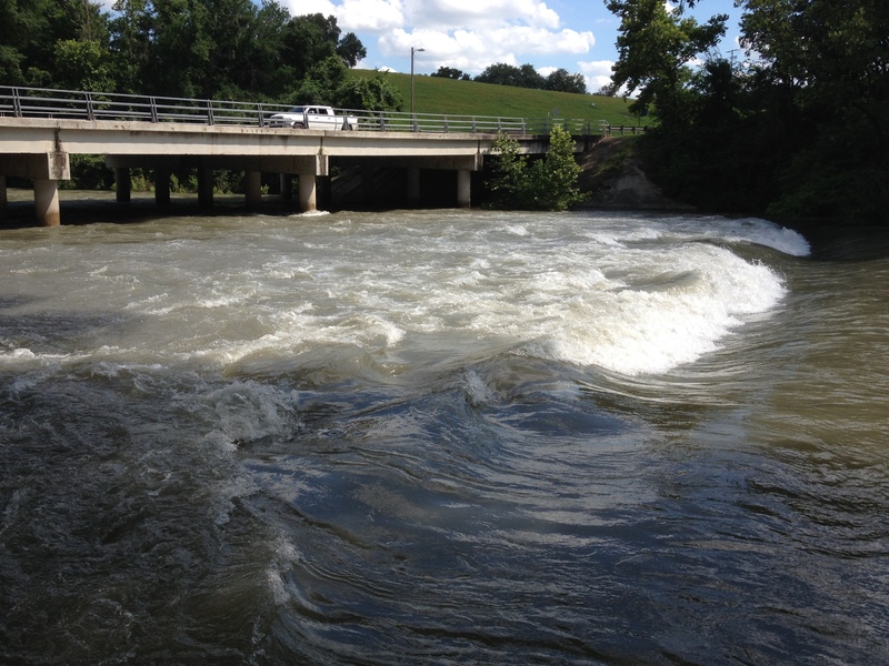
At thousands of cfs, Common St. Dam forms a ledge hole at river right. At 3000-3500 cfs, this hole is very grabby, with significant recirculation on the downstream side-- not a very friendly place to play. At 4000-4500 cfs, it is still grabby but much more friendly, and at that level, it is a prime place to practice loops and other vertical tricks. At 5000-6000 cfs, the river right ledge hole becomes more of a friendly wave-hole that is mostly front-surfable. It still gives up loops, but not as easily as at lower levels. At high flows, the river right eddy service is excellent. At above 5k, the eddy at far river right actually extends above the feature.
At 5000-6000 cfs, a large wave-hole forms at river left, wide enough for five boats to surf simultaneously. River left eddy service at these levels is tricky at best.
Since the bridge pilings are only about 60' downstream of the dam, a solid roll is strongly recommended if you plan to play here.
Technically the park at river left before the bridge is private (apparently part of the subdivision), so don't hang out there for too long unless you're in the water. The park at river left on the downstream side of the bridge is public.
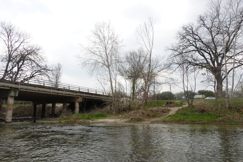
Public park below the Common St. bridge. Park your takeout vehicle here and take out on river left. Portable toilets are usually available during the summer months.
NOTE: In recent years, the City of New Braunfels has begun 'closing' the Guadalupe River at 3000+ cfs to all users except 'guided rafting trips.' Local whitewater boaters assert that they are obeying the spirit of that regulation, which is to prevent anyone without appropriate whitewater gear and skill from accessing the river at high flows. However, you may still be harassed by city employees for taking out at River Acres Park when the river is running at 3000+ cfs. If that occurs, then please explain politely that (a) your equipment is rated for Class IV-V, whereas the Lower Guad is never more than Class III, (b) you (or your teammates) have paddled the river before at the current level, or you've paddled more difficult rivers, and (c) your crew is proficient in self-rescue and team rescue techniques, so effectively you're self-guided. If you cannot make all three statements truthfully, then do not paddle the river at 3000+ cfs. Please be as discreet as possible and do not create a scene at the takeout, as the park may be crowded during summer months.
Access point serving as a take-out on river right at the city park with good low bank access.
Mar 1, 2023
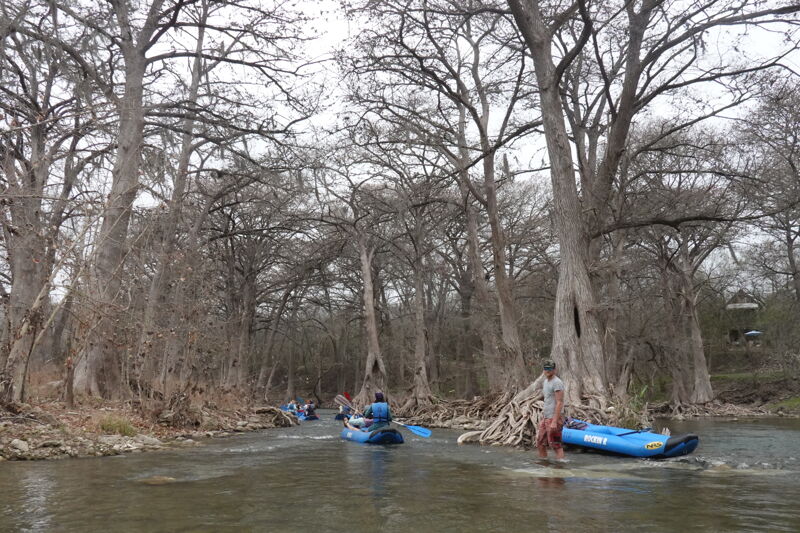
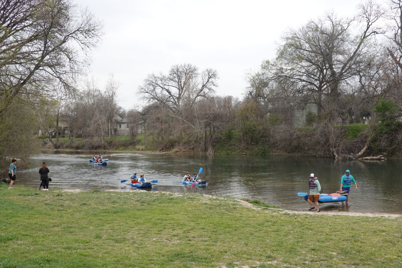
The River Management Society held its conference in San Antonio and spent a day out on the Guadalupe River learning about management of a high-use urban river. The group was hosted by Rockin' R River Rides and included lunch along the way on a run from Gruene Bridge to Cypress Bend Park. The flow was low but we had enough water to get down and the river was warm enough for swimming.
Oct 28, 2018
Surfing Hueco Falls
Oct 28, 2018
Class II wave train that forms about 1/2 mile above Slant at certain levels (referred to by some local paddlers as 'Spool', because there was once a giant spool in it)