Jarbidge
Jarbidge Forks to Bruneau River (Indian Hot Springs)
| Difficulty | II-V |
| Length | 30.4 mi |
| Avg Gradient | 35 fpm |
| Permit | Self issue permit can be downloaded from BLM website, and are available at self registration stations at the put in and take out. |
| Gauge | Bruneau River Nr Hot Spring Id |
| Flow Rate as of 25 minutes | 32 cfsbelow recommended |
| Reach Info Last Updated | January 13, 2026 |
SEASON: Late April early May, but flows are highly variable and difficult to predict.
PERMIT: Self issue permit required, register at the put in or take out.
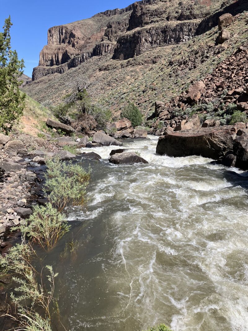
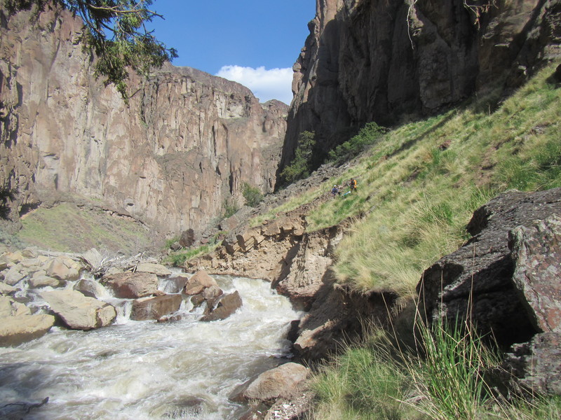
HAZARDS: Frequent log jams, mandatory portages, remote, vertically-walled gorge with limited exits and access.
LOGISTICS: Due to difficult access, it is highly recommened to run the complete Jarbidge and Bruneau rivers, allowing for at least 2 days on the Jarbidge and 3 days on the Bruneau.
To get to the Bruneau River take out, head Southeast from the town of Bruneau for 8 miles on Hot Springs Road. Where the road veers left and climbs, watch for a gravel road that continues straight along the river (note that the name also changes here on the map from Hot Springs Road to Clover Three Creek Road). Follow it 1/2 mile to the take out (private land). There is a dangerous low head dam immedeately below the take out that is difficult to see from river level.
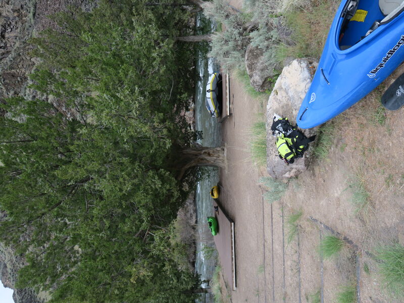
To get to the put in, return to the main road and continue approximately 60 miles (gravel) to the junction with Rodgerson hiway (aka Three Creek Road). Take a right and continue 10 miles, passing throug the town of Murphy Hot Springs, to the put in at the confluence of the East and West Forks of the Jarbidge. There is improved camping, boat ramps and an outhouse at the put in. The Clover Three Creek Road is suitable for 2 wheel drive vehicles, though it can be quite muddy and rutted at certain times of the year.
To run only the Jarbidge section requires taking out at at Indian Hot Springs, near the confluence of the Jarbidge and West Fork Bruneau rivers. This is a class V shuttle that requires a capable 4x4 vehicle with good all-terrain tires and an experienced off-road driver. Two spares tires and a high lift jack are recommended for travel in the Buneau backcountry. Drivi
...
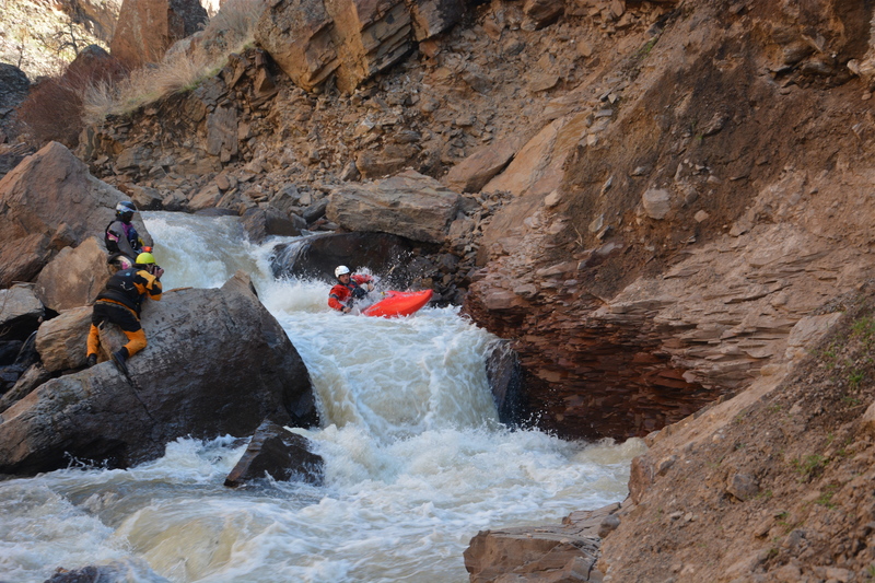
While a few may choose to run this mess, most will portage over the sharp boulders on river right.
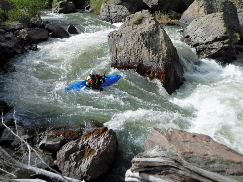
This rapid often collects wood. Do not run without scouting.
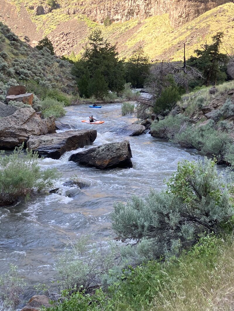
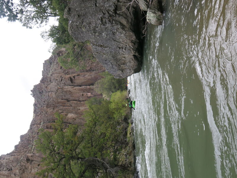
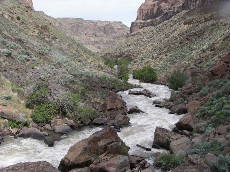
Busy class IV section a short distance above Jarbidge Falls
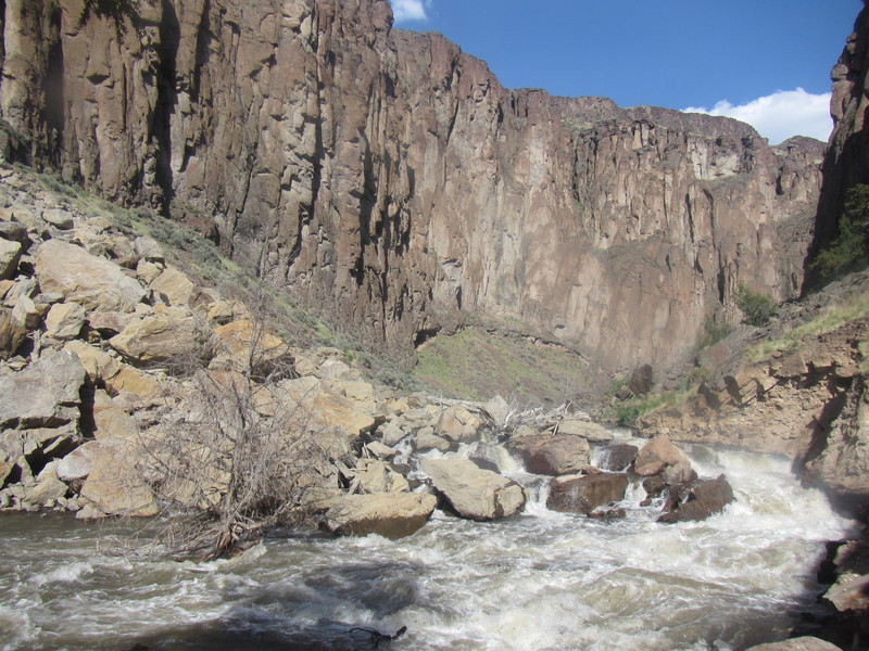
Jarbidge falls is a stout rapid that is easy to stumble into. Look for a large boulder in the center of the river. There is a last eddy to the left of that boulder that will make your portage much easier. Just don't miss the eddy.
While it would be possible to take out here, no one does. Contunuing down the Bruneau is the better answer rather than shuttling down the Class V 4WD road to the confluence.
May 28, 2025
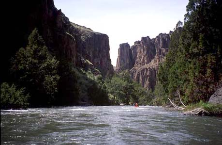
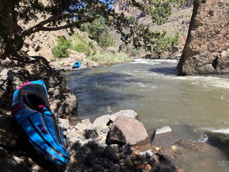
When we put in it was 180 cfs at the Jarbidge gauge. We did 2 nights above the confluence which was plenty of time, and 2 nights below (and could have easily added another night or 2). The first campsite was 7 or so miles down, and the rest of the river has small to medium sized campsites relatively regularly. The river is continuous, with all of the bigger rapids being easily boat scoutable from a small craft (it would be tight but definitely doable for rafts at these flows). The two portages can be easily identified by large rock slides coming off of the hill from the right. The first portage (of Barker Falls aka Grey Skull) is done on river right at river level. The rocks are big and chunky but the distance is short. Portage Jarbidge Falls on river left, there is a trail visible. The portage becomes significantly easier if you paddle down through a couple rocks to the first significant horizon line and catch the eddy on the left (easy catch and 2-3 kayak sized at our flow). Walk on the trail around the rapid and put back in to run the bottom of the rapid! We took out at 816cfs on the Bruneau hotsprings gauge. These canyons are remote, gorgeous, and a real treat. We used Barker expeditions for our shuttle. The canyon can be quite chilly since the sun comes late and leaves early, and the water (snowmelt) can be chilly. The run could easily hold more water than the flows we had, and be run a bit lower too (although this would start getting challenging in a raft).
May 14, 2020
We put on with about 900 cfs but flows dropped to 700 cfs at take out. Flow on the Jarbidge was fine but definitely the bottom end of runnable for rafts on the Bruneau.