Lochsa
2 - Indian Grave Creek to Wilderness Gateway Bridge(Upper Lochsa)
Jul 22, 2024
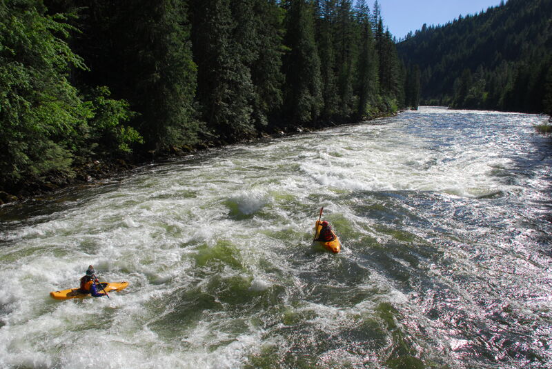
Fun trip on the Upper Lochsa. It's at the lower end of the range but still plenty of water and a lot of fun. Mostly class III but with several rapids that are still class IV. The trip from White Pine to Wilderness Gateway was just under 3.5 hours on the water with a few stops along the way; we could have done it in less than 3 hours with no stops.
Mar 1, 2024
A highway construction project will reduce traffic to one lane with delays up to 30 minutes through summer 2024. The Lochsa Ranger Station to Holly Creek Project is anticipated to begin March 4th and to close by mid October. The project begins at milepost 121.4 (approximately a mile upstream of Fish Creek access) and ends at milepost 130.3 (approximately a mile upstream of Nine Mile access on U.S. Highway 12. Wilderness Gateway Campground is at mile 122.7.
Oct 25, 2014
On the low end of best-flow comments, observations of flows around 1200. Doesn't look like enough for certain super-boney rapids to not be a mandatory pin-fest / preferred walk. It is enough for certain other rapids / the trip in general to appear at least worthwhile given other regional options when flows here are at these levels. It is the author's limited opinion that one is not likely to find any local or experienced partners for boating this section at these flows without at least minimal grovelling / arm twisting / bribery. ;)
Jun 22, 2014
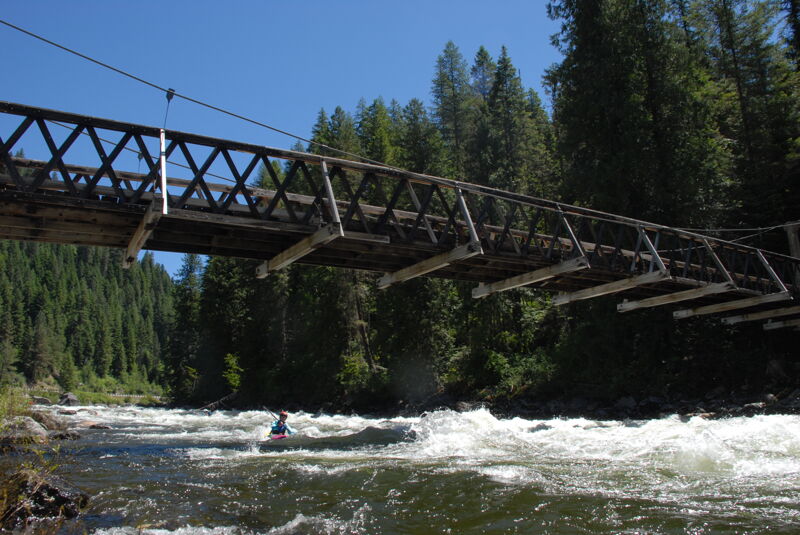
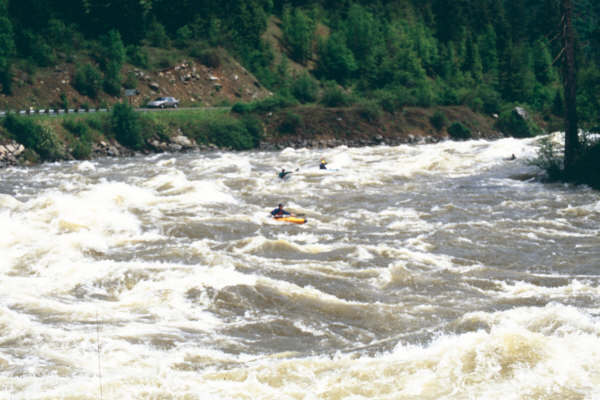
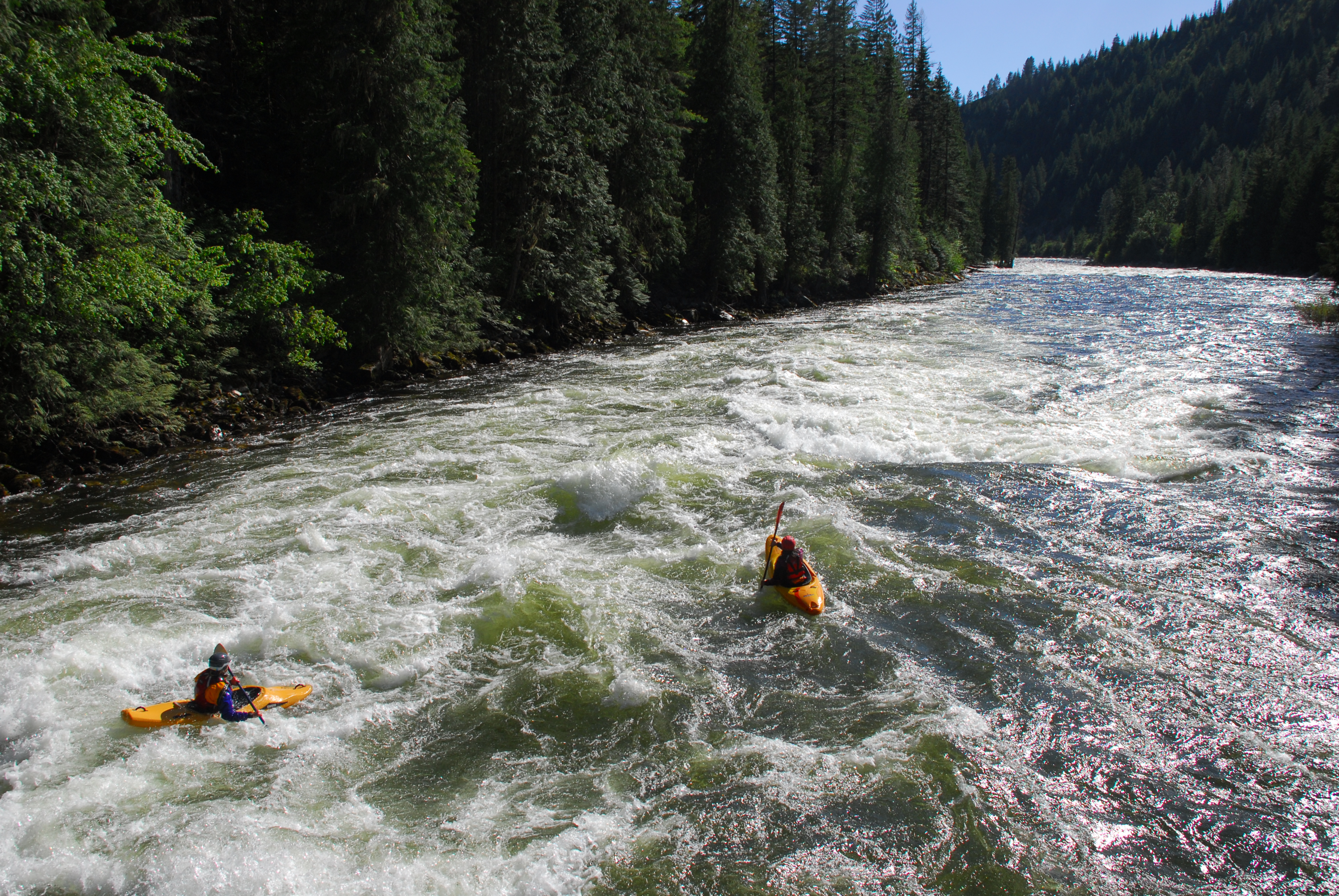
We were with a large group of families who ran from Colgate to White Pine, but Megi and Paul continued on down to Wilderness Gateway. After loading up boats at White Pine I caught up with them at the Eagle Mountain Pack Bridge and got a couple photos from the bridge on a beautiful Idaho evening in June.
May 7, 2014
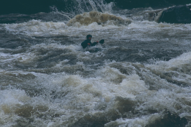
It was big. I was small
May 7, 2014
Ran this at 11 ft. on the gauge long ago and it's definitely pushy and big but a blast! Watch out for logs/trees. Coupling the upper with wilderness gateway to split creek at high water is an amazing, big water endurance/adrenaline experience!
Jun 19, 2013
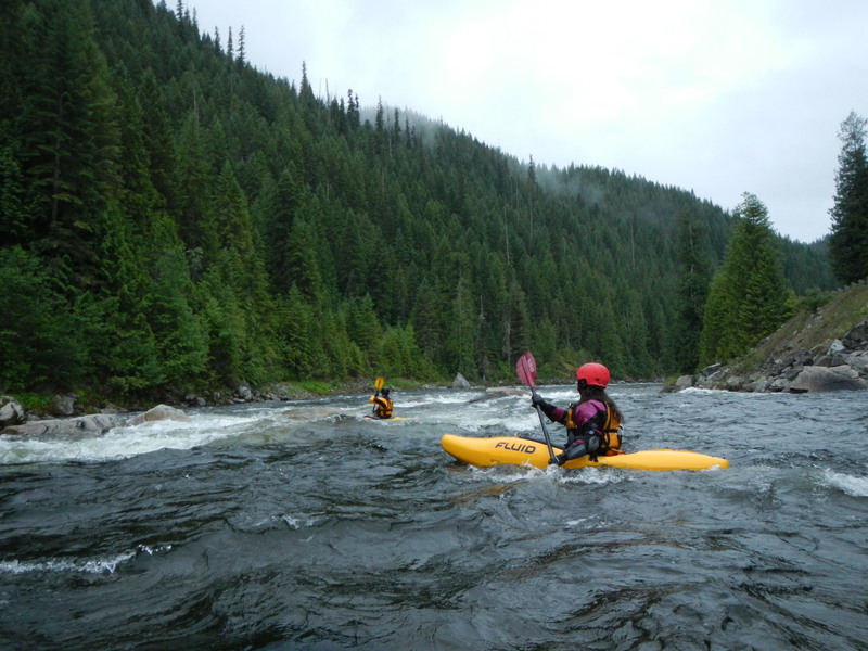
Still lots of fun to be had on the Upper Lochsa. An early morning run.
Apr 11, 2012
new online whitewater guide for idaho and montana area paddling - check it out! www.montanaeddyhop.blogspot.com http://www.fs.fed.us/rl/clearwater/VisitorInfo/Assets/pdfs/Lochsa\_River\_Guide.pdf
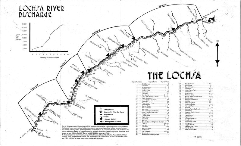
Upper Lochsa whitewater rapids:
MP 139.5 White Pine River Access
MP 139.3 Class II-III
MP 138.5 Class II-III
MP 137.4 Eye Opener Class II+-III+
MP 136.3 Lost Creek Class III+-IV+
MP 135.5 Eagle Mountain Class III+-IV+
MP 135.4 Eagle Mountain Pack Bridge
MP 135.3 Lower Eagle Mountain Class III-IV
MP 135.1 Class II-IV
MP 134.5 Fake Onno's Class III-IV
MP 134.0 Keep Moving Class III+-IV
MP 133.5 Stanley Creek Class III-IV+
MP 132.9 Mile 133 Class III-IV
MP 132.6 Mile Long Class III+-IV
MP 132.0 No Sweat Class III-IV
MP 131.6 Lone Pine Class III+-IV
MP 131.3 Holly Creek Class III-IV
MP 131.2 Castle CreekClass III+-IV
MP 130.3 Triple Hole Class III+-IV
MP 129.4 Class II-III
MP 129.0 Mile 129 Class III-IV
MP 129 Ninemile River Access
MP 128.5 County Corner (Highway Station) Class III+-IV
MP 127.9 Class V - Class III+-IV+
MP 126.7 Log Jam Class III+-IV+
MP 125.5 Pass Creek Class II-III+
MP 125.0 Mile 125 Class II+-IV
MP 124.7 No See Um Class II-IV
MP 124.1 Tenpin Alley Class III+-IV+
MP 123.5 Class II-III
MP 123 Turnoff to Wilderness Gateway Campground
MP 122.6 Wilderness Gateway Bridge
MP 122.0 Boulder Creek Rapid - Class III-III+
MP 120.3 Fish Creek - Class III+
MP 120.1 Fish Creek River Access
May 8, 2007
Just an FYI on the recommended levels posted - 4 ft. is definitely not maximum recommended flow for this stretch, but would be closer to minimum recommended flow. 2 ft. would be a very shallow, rocky level on this stretch. I recommend 6 ft. and above for a true upper Lochsa experience (we've run it as high as 10 ft. on the Lowell Gauge and it was a blast).
Jan 1, 1900
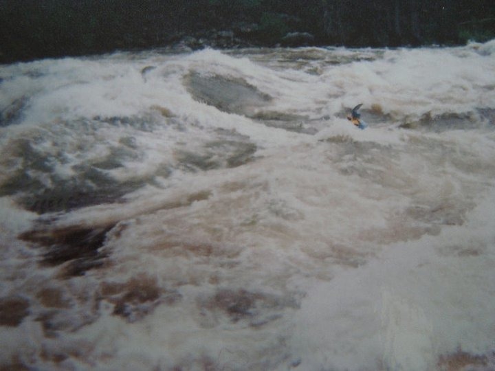
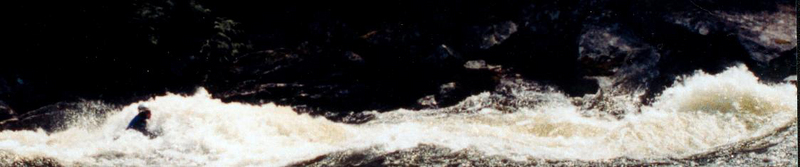
High water had just peaked for the year - the whole 18 miles was pretty much just like this...
Jan 1, 1900
Notice the 50+ ft. Ponderosa upstream violently thrashing about...lots of water!
Jan 1, 1900
Cold Storage to Lowell
Jan 1, 1900
Notice the lead-in rock (underwater) that usually is between 2 & 3 ft. above the surface.
YAHHOOO!!