Lolo Creek
2. Cottonwood Flats (near State Meadows) to Clearwater River
Jun 10, 2021
Our group of 4 did a run on 5/28/21. 2.75 on the put-in gauge. Could not find a takeout gauge. As none of us had done it previously, we estimated it was a good, low side of medium flow. It took us 7.5 hours, longer than normal due to us taking our time. None of the rapids were show stoppers. None of the wood was a showstopper ... but we probably portaged approx 8 times, ducked 2 or 3 logs, and did purposeful flips under 1. Great scenery, quality whitewater. We were all glad to get it.
Jun 9, 2019
We ran it yesterday. I have a few points people could find helpful. 1.) We had around 450 CFS. It was a great level for a low water run, I do not think I would run it much below 400. 2.) One of the guys had a Garmin tracking him and it showed the run was 18.8 miles. It is a long day. 3.) There is a new rapid below Land Slide. The new rapid is also caused by a landslide. Yesterday it is was a trashy class 3 drop. It has an overall drop of several feet and will be worth a look for a couple of years as I am sure it will be changing from year to year
May 31, 2017
Ran Lolo May 29, 2017 @ ~525 cfs on the new gauge. This was LOW. Might be considered a fine flow for southeast boaters but Idaho folk would want 800-1000 to consider it a worthy day out, and likely would want much more if you know the river. Occasional obvious wood in play but for Lolo i think it would be considered quite clean.
May 16, 2014
Youtube helicopter scout of Lolo posted by Clearwater County:
https://m.youtube.com/watch?v=-i1QpWiioGg
Apr 29, 2008
The old bridge has been replaced, and the river channel yunder it has slightly changed. The stick gages that were on river-left just under the bridge are now gone. They're working on a new gage rating, and hopefully they'll replace the stick gage.
Until then, be careful!
Feb 23, 2008
I just changed the rating on this stretch from III-IV to IV+.
Lolo Creek is long and remote. Stories of hike outs range from daunting to epic. Most of the rapids are not super hard, but they will definitely be a serious test to anyone who is not super comfortable running continuous and sometimes blind class IV boulder drops.
In addition, portaging these rapids is difficult. You should probably plan on running just about everything except for the Landslide Rapid (an easy portage...but the drop is also cleaning up lately). While Zig Zag and Big Schmidt are definitely portageable, portaging these two rapids could potentially add an hour to an already long day.
That said, this is an awesome run that should put a smile on the face of all but the most jaded gnarstar.
Mar 20, 2007
Paddled it last weekend on 3/18/07. It was at 11 Ft. Portaged 3 Logs. Check my website: www.infinitymountain.com for photos. Have fun.
Aug 11, 2006
As of June 2006 there was a big log jam after big schmit when the river turns....Must eddy hop close to it to portage...a member of our group was able to sneak it in his boat on the far right....The rest of the run was clear of logs
Jun 24, 2006
Lolo at this low level was all runnable, very beautiful, and still offered some fun creekboating.
Most of us ran this rapid. It was a fairly straight forward double drop at this level, and was a blast.
Jun 19, 2006
As of 6/17/05, there is a bunch of new wood from a windstorm in the canyon.
The worst is two river wide trees with branches in the lead in to Big Schmidt. The river makes a 90 degree turn to the right and the logs are parallel with the current when you first see them. Eddy hop down on the right and portage over the boulders at river level.
Below here, there are at least 4 river wide logs in class II water. The riverbanks are also full of poison ivy, so be careful portaging.
Jun 15, 2006
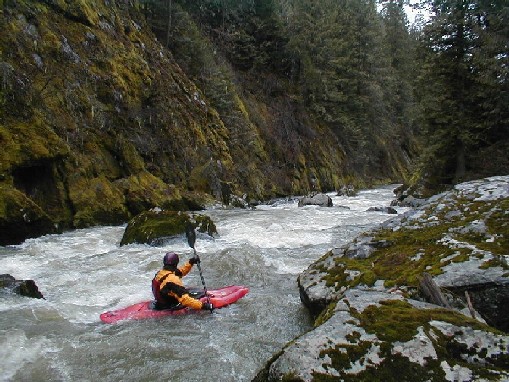
Tim eddyhopping down Big Schmidt making sure to stop before he gets washed into a huge river wide log jam just in front of him. Very fun run other than that rapid
Jan 1, 1900
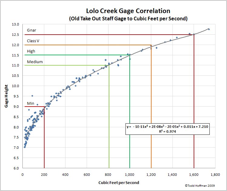
This correlation is to the old staff gage at the take out that was removed in 2007. I have placed it here for reference purposes, as a lot of people used to use the old staff gage as the primary indicator for Lolo Flows. I plan to develop a correlation to the new staff gage as more observations become available.
Jan 1, 1900
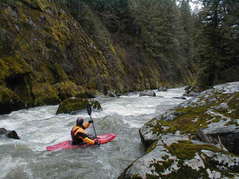
This is the first major rapid on Lolo. There's a large tangle of wood blocking the left 2/3 of the river at the top. Look carefully for wood every trip down. Scout and portage on river right.
At high water, the creek turns freight train and there aren't many eddies.
This is one of the stick gages on river left. There's another one, attached to the bridge support, which sticks up higher. If this one is under water, expect some stomp in the canyon.
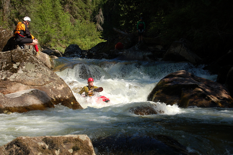
This is the steepest single rapid on the run. It's also considered the most significant. The lead-in is a long bolder garden that runs right into the ledge you can see at the top in this photo. The ledge creates a solid hole, but there's a good flake that boofs you right through.
This is taken from about halfway through the rapid.