Payette, S. Fork
2 - Deadwood River to Danskin Station (The Canyon)
| Difficulty | III-IV |
| Length | 12 mi |
| Avg Gradient | n/a |
| Gauge | Payette; South Fork Below Deadwood Confluence |
| Flow Rate as of 1 hour | 1381 cfslow runnable |
| Reach Info Last Updated | June 18, 2026 |
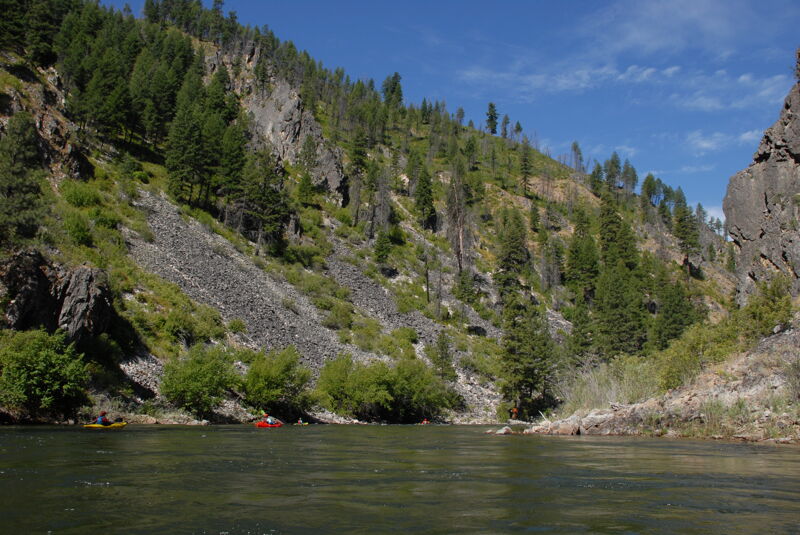
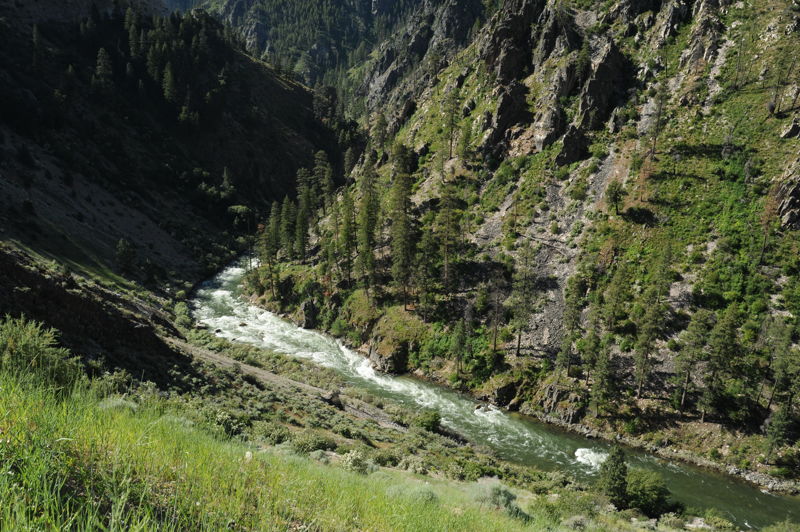
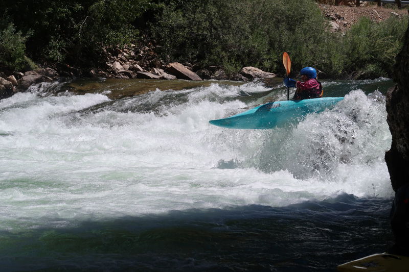
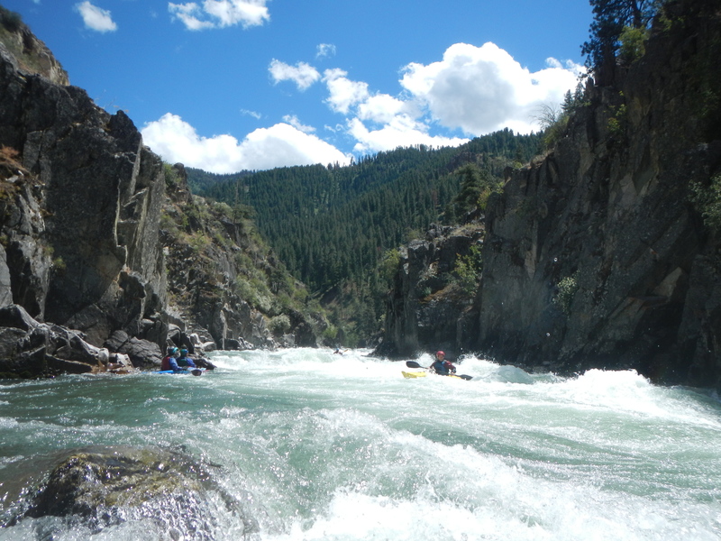
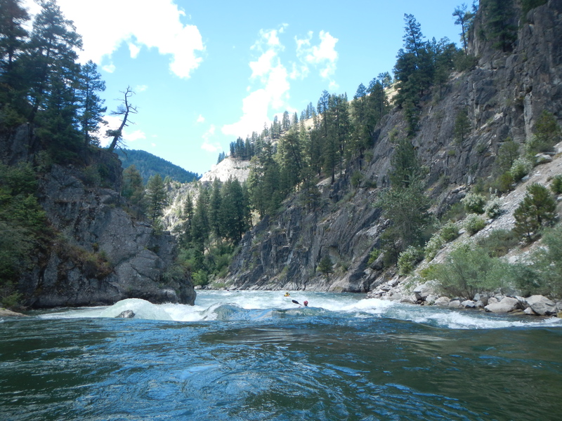
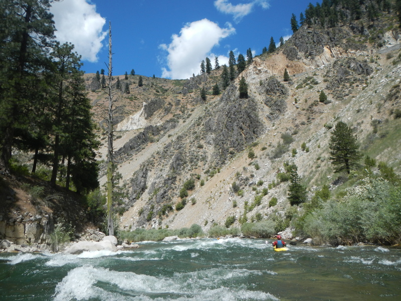
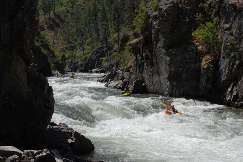
The canyon section of the South Fork Payette is an Idaho classic. It is a beautiful III-IV run, in a deep remote canyon. Best of all is its long season and clean, clear water.
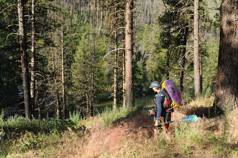
The standard put-in for this run is the Deadwood River Access. If you put in here it allows for a couple miles of warm up with good class II and a couple of class III rapids that are easy read and run. Some run this section as a continuation of a run that begins upstream at Mountain View.
You approach the 'point of no return' when passing Pine Flats Campground. There are excellent hot springs on river right and this is your last chance to easily abandon the run. After a long, calm stretch of flatwater you will enter Gateway (III+). Enter right of center and work your way to river right.
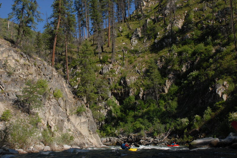
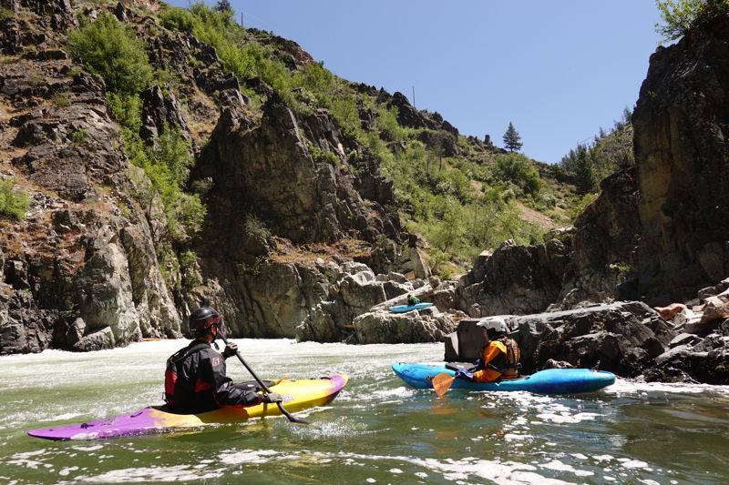
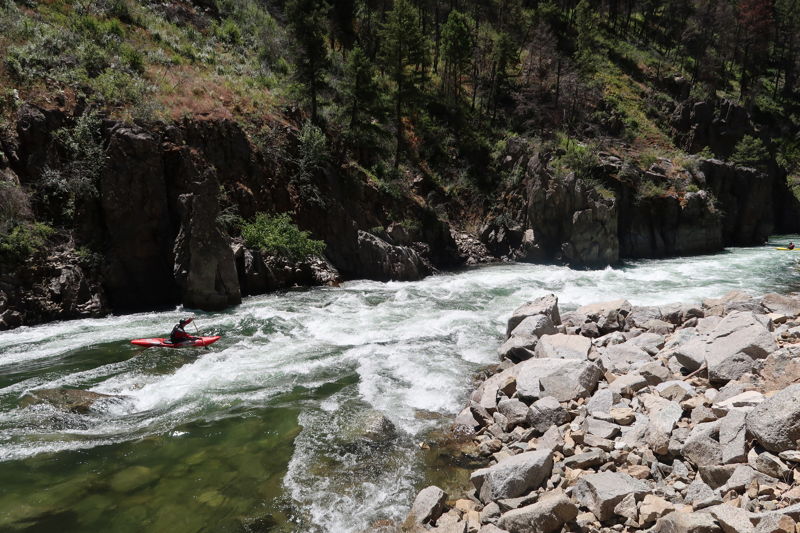
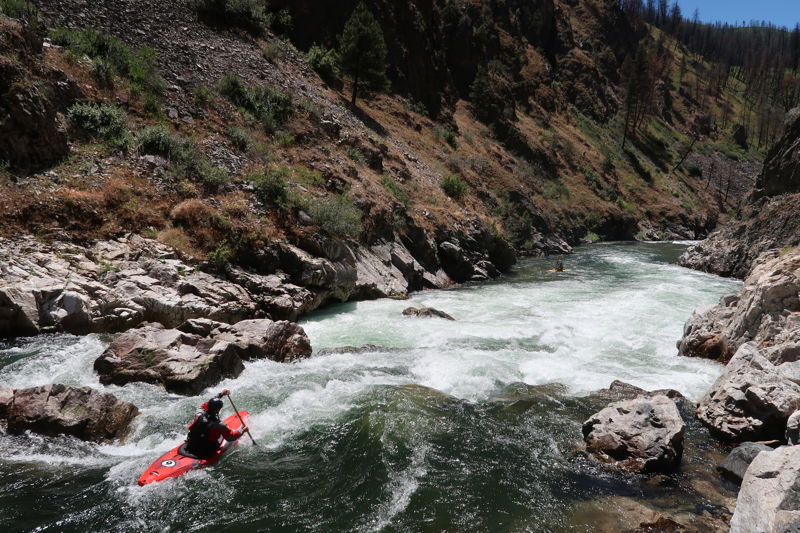
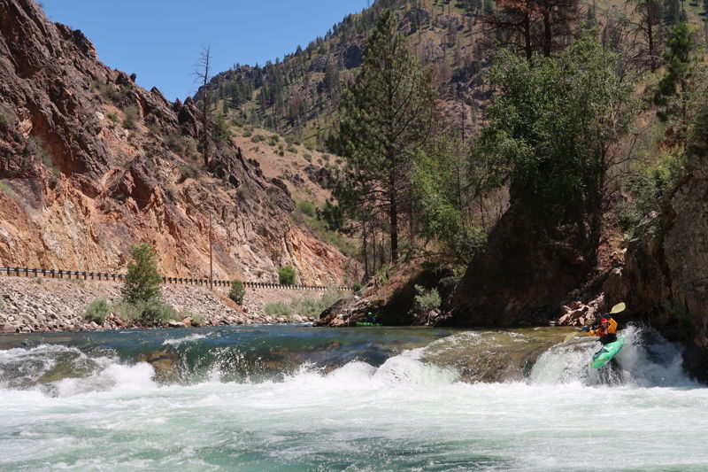
The real action begins soon enough as you enter S Turn, a big class IV read and run with lots of waves and a few holes to avoid including a big one at the bottom left.
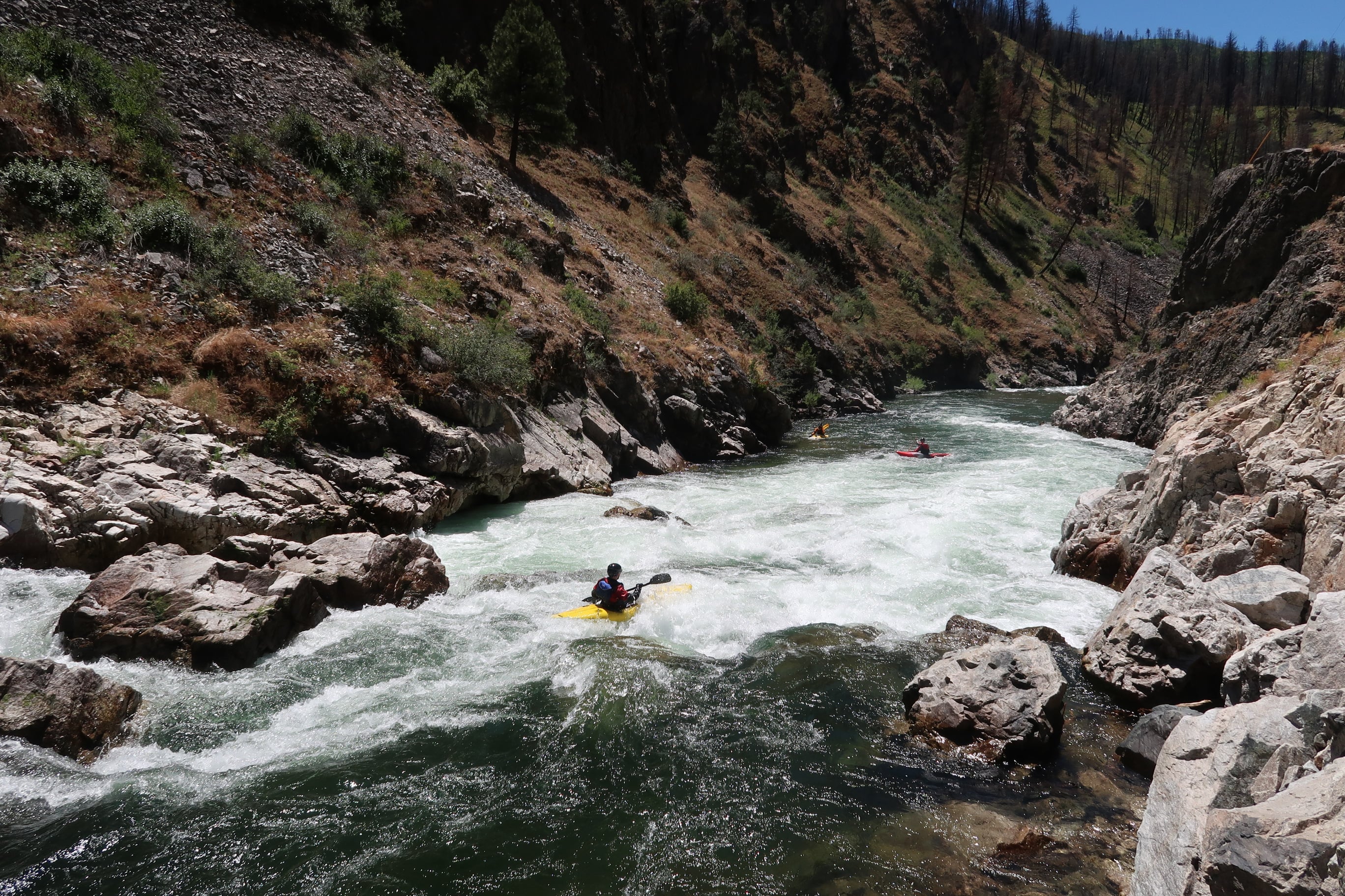
Some fun class II-III read-and-run follows, ending with Hard Hat, a big wave train and a large hole in river center.
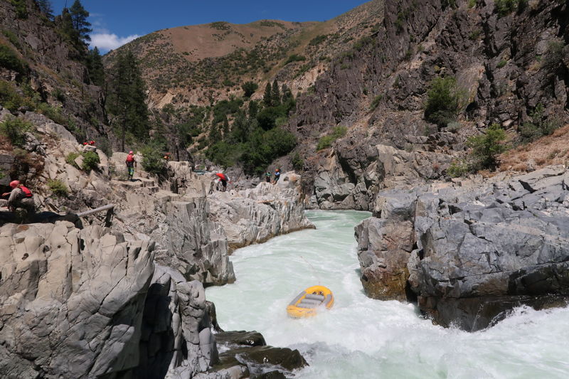
Next up is Big Falls, a class V to VI drop which is a portage for most. It has been run a few times (a couple times inadvertently), but at spring flows some enormous holes form in the bottom half of this intimidating drop. The rapid comes up quickly after Hard Hat and is marked by a couple of warning signs (the first on river right and then a second marking the start of the portage on river left). The lead in class II is not hard but be sure to make the eddy on river left just before the river drops off the edge into the abyss of Big Falls. Anyone who has the skills for this run should not have a problem making the move, but it can be a little intimidating as the consequences of missing the eddy would be severe.
The portage trail on river left is well worn and although it is not an easy portage for rafts, some people do it including outfitters who run trips on this section. A little scrambling
...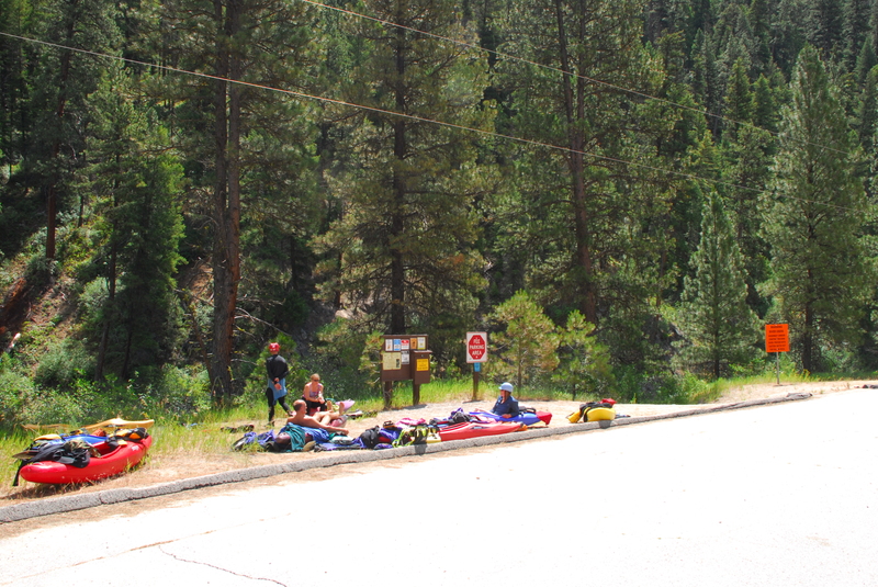
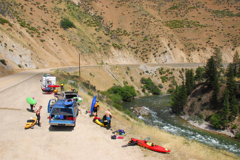
The Deadwood River Access at Highway 17 road mile 29.9 is the standard put-in for this run and provides for a class III warm up before you pass Pine Flats and enter The Canyon.
This Forest Service Pine Flats Camgpround at Highway 17 road mile 27.9 serves as an alternate access point for kayakers. It skips the class III warm up rapids and puts you in at the start of The Canyon. The campground is a great base area for kayakers planning to run multiple canyon trips over the course of a few days. Sites 5, 6, and 7 have trails that access the river. It's a climb from the bench where the campsites are located down to the river (i.e. not recommended for rafts). This campground can also be used as a take-out for kayakers looking for a class II-III run that begins at Mountain View and builds in difficulty as you approach Pine Flats. A parking area for day-use is also available for those not spending the night. As an added bonus a beautiful hot spring right along the river can be enjoyed from this campground.
First rapid below Pine Flat Hot Springs. Normally run down the middle.
Enter right of center to avoid the top hole and avoid the last big hole at the bottom left. You can view the rapid from high above at a pull out on the Banks-Lowman Road at Highway 17 mile 25.7. Just remember that things are much bigger when you are down at river level.
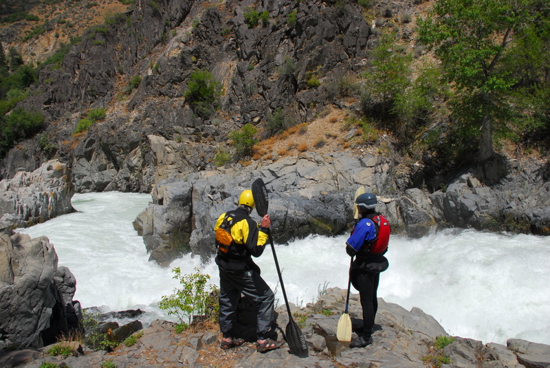
This rapid has been run a handful of times by expert paddlers, but for most it is a mandatory portage. A pair of signs on river right and river left mark the approach, and a third sign marks the preferred eddy for exiting the river (kayakers sometimes continue downstream to the eddy immediately above the drop). A well-worn trail climbs to a large rock outcrop at the base of Big Falls. The rock provides a good platform for a seal launch into the pool below, where the group can regroup before continuing downstream. For those driving up the canyon, Big Falls can be seen far below from the pullout at Highway 17 mile 25.0.
Enter left of center and paddle aggressively as you weave and crash a few big curlers.
This rapid changed in 2016 as a result of the forest fire. A boulder rolled into the river left side, and a difficult-to-avoid hole was created to the right of this boulder. Fight you way to river right or commit to crashing the curling hole.
When driving up, you can scout your line from the road pull-out just downstream. From the river, the rapid is recognized by the large concrete retaining wall along river right. The standard line is to catch the eddy on river right at the top of the drop and then peel out with a right to center move.
Never go center. Boof far left at normal levels or slide down the far right at high water. The highway is close to the river at this rapid making it the most obvious rapid you see on the shuttle. You can pull over and take a look at Highway 17 mile 22.7.
The 'Surprise' is a large hole at end of the rapid on river right. You can take the left line at the final drop (easiest), sneak right by hugging the cliff, or boof the pourover (hardest). This rapid is not readily visible from the highway.
The Kayaker Access which is an alternate take-out used by kayakers is at Highway 17 mile 21.9. It is an unmarked roadside pull-out with a decent trail down to the river. You can recognize it by the small bedrock island on the river right side of the channel that is just upstream of the access trail. Eddy out at the downstream end of this island and make the strong ferry across to river right to hit the take-out.
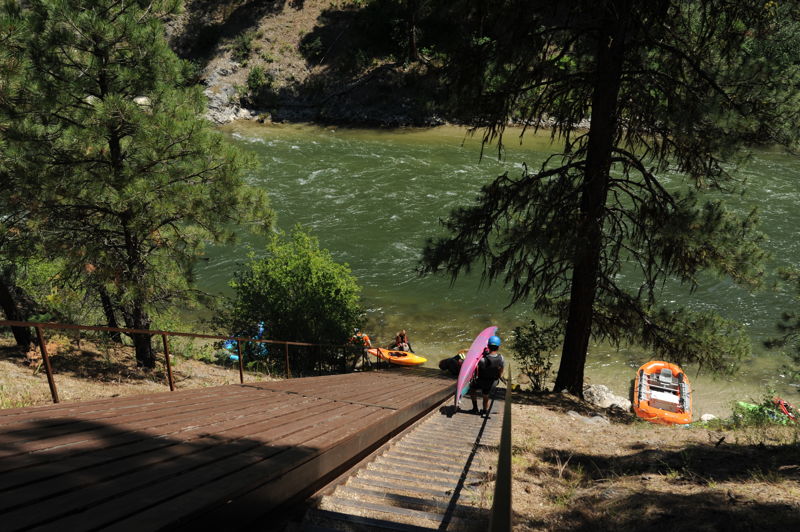
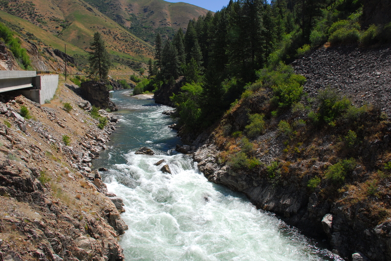
The primary take-out, and the one most commonly used by rafts, is located at the Danskin Station River Access (Highway 17, mile 19.5). This is a formal river access site with a steep set of stairs connecting the river to the parking area. For rafters, a wooden raft slide can be used to move boats uphill, but it remains a strenuous task requiring boats to be carried up the bank approximately 100 vertical feet. This is another good reason to pack rafts lightly for the trip.
The parking area is a fee site, with a cost of $3 per day or $20 for a Payette River system season pass. Season passes can be purchased at Forest Service offices and a number of local retail outlets. Day passes can be purchased at the access site.
May 18, 2026
5/17/26 riverwide wood in Blackadar rapid - check Facebook for up to date info
Jul 1, 2024
Fun trip with a small group from Pine Flats down to Danskin that then continued on through Swirly Canyon as we picked up more friends there. We launched at Pine Flats around 10:30 am and got to Big Falls around 11:00 am. We had some shenagins associated with a dropped paddle at the portage, chasing it down, and pulling out a breakdown in the meantime that ended up taking nearly 30 minutes. We were down to Lone Pine by noon and reached Danskin a bit before 1:00 pm. This was a good flow for those who are looking to step up for their first canyon run. The rapids are nicely filled in but without the push in between that comes at higher flows.