Little Eau Pleine
old RR right-of-way off Marsh Road to Mann/River Rd (9.3 or 3.4 mi)
April 13, 2011
| Reporter | Bryan Foster |
I would say that 5 ft would be on the lower end runnable. This is based on a run that was at about 6ft. I attached 2 photos of the hwy 97 bridge at about this level. It ain't a great visual gauge pic, but it was runnable at that level. We only ran hwy 97 to the takeout.
Ran again at 9.6ft (the peak flow) after a rain storm. Because of the location of the gauge downstream in a low gradient section (marshland) It would be wise to run this when the gauge is rising fastest.
Seeing as this is a new gauge, I suggest if you make a run at any other level to comment on it so the runnable range can be accurate with the gauge reading.
Ran at 8.5ft but with a +.02ft/hr rise and the level was considerable higher than the flow for 9.5ft. with 0.0 ft/hr.
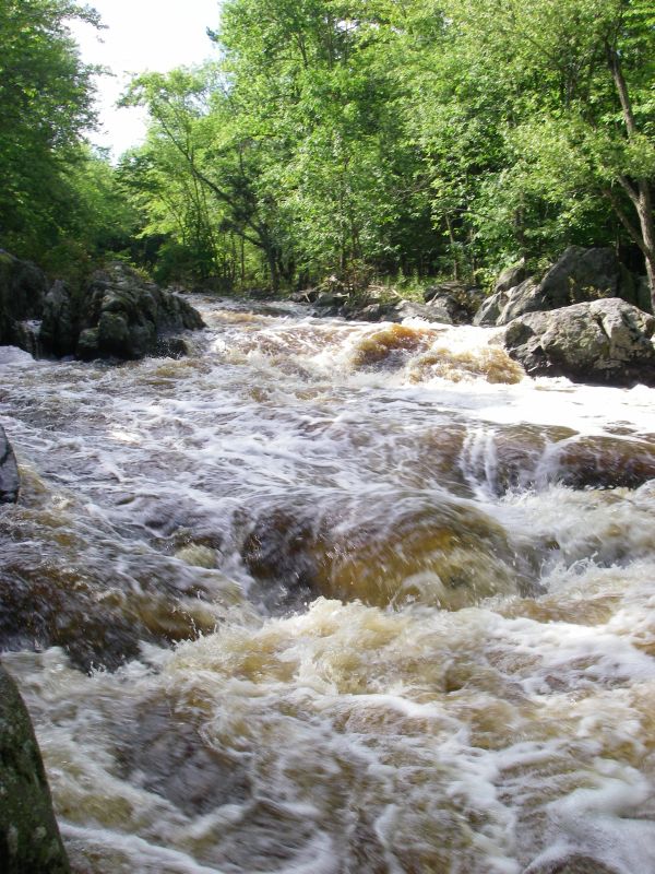
Ran this a 2890 cfs and falling, below 97 was huge. Know what you are doing at this level. The 1st rapid after the railroad put in was also great at this level. Even though the gauge reading indicated only 300 cfs less than the peak flow the banks showed a level 1 to 2 feet higher. Again indicating that his stretch should be run while the gauge is rising.
Feel free to email me if you are running this, it is a personal favorite.