Little Eau Pleine
old RR right-of-way off Marsh Road to Mann/River Rd (9.3 or 3.4 mi)
Apr 10, 2014
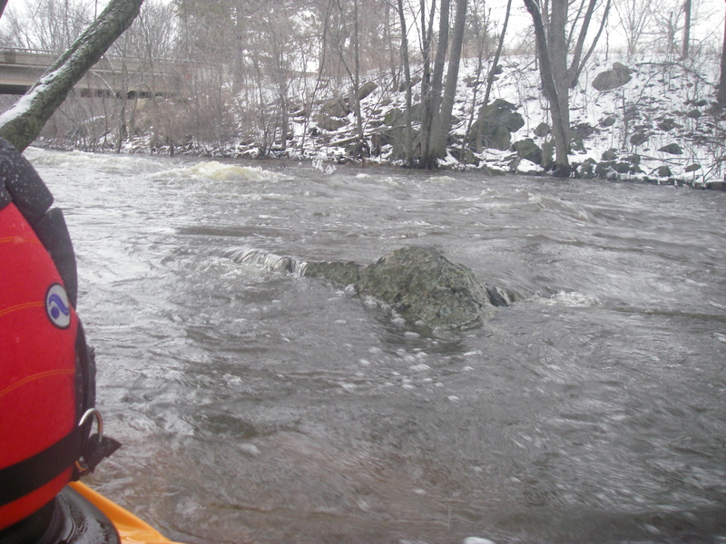
USGS gauge is now inactive as of December of 2013. The best visual is a rock near the hwy 97 put in down a path off hwy T just downstream of the 97 bridge. See photo in photo section.
Sep 13, 2013
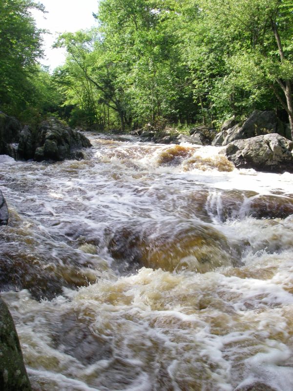
I put a video on youtube of the main drop at 1650cfs, see the photo of the gauge rock for a visual.
http://youtu.be/T8yNV0m5SzM
Mar 12, 2013
great level for whole run
May 11, 2012
We ran the 97 down to flat water at 500cfs (just before peak on the gauge) and the level was low and runnable based on the 97 visual rock gauge.
May 1, 2011
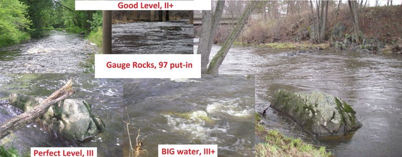
These are some levels that I have ran the river at. Good level (right pic is 400cfs and dropping)- be ready for rock dodging, but still fun. Perfect level (675cfs)- Rock dodging minimal except in the gorge. Big water was ~2800cfs. This was non stop waves and action.
May 1, 2011
Well, I finally did the whole run. (based on higher flows)
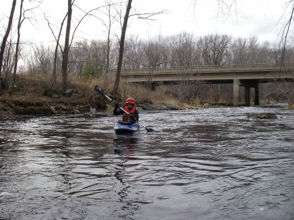
The Marsh Road put-in is from an old railroad bed that is now a trail with a nice parking lot. At the now nonexistent railroad bridge there is a nice slope to put in from.
The paddle starts out flat, really flat until a house on the right signals the beginning of a continuous 0.5 mile stretch of boulder beds and ledges. At higher flows this becomes a solid class II with boulders becoming poor overs and water running through trees in the flood plain. The end of this rapid is marked by a sharp right turn with a ledge drop.
After a few light riffles you will pass under CTH E. After about a mile the river constricts and drops over a ledge that forms a fair sized hole with good line down the right side to avoid it. Strong eddy lines formed after this feature, opening the possibility for squirt play.
The action subsides and only a few riffles and a few miles of paddling bring you under Galvin road and Stadt road bridges.
The pace begins to build at the Hwy 97 bridge until “the gorge”. Scouting is usually done on the river right shore to get a good view of the main drop. Carry up is easier on the left shore. The first drop is usually run at a diagonal from left to right and lead out has a variety of lines, but usually focusing down the right half of the river. At high water waves get large and the speed is fast, but no sticky holes were observed to form.
A few more wave train rapids leads up to a small concrete road and bridge, both of which are submerged for most boatable levels. This however does form a weak low head dam, and an undercurrent on the right side by the bridge. It would be wise to stay left to miss these two features.
A couple more wave trains and you have hit flat water, which leads through a swampy forest to your Mann road bridge takeout.
Apr 13, 2011
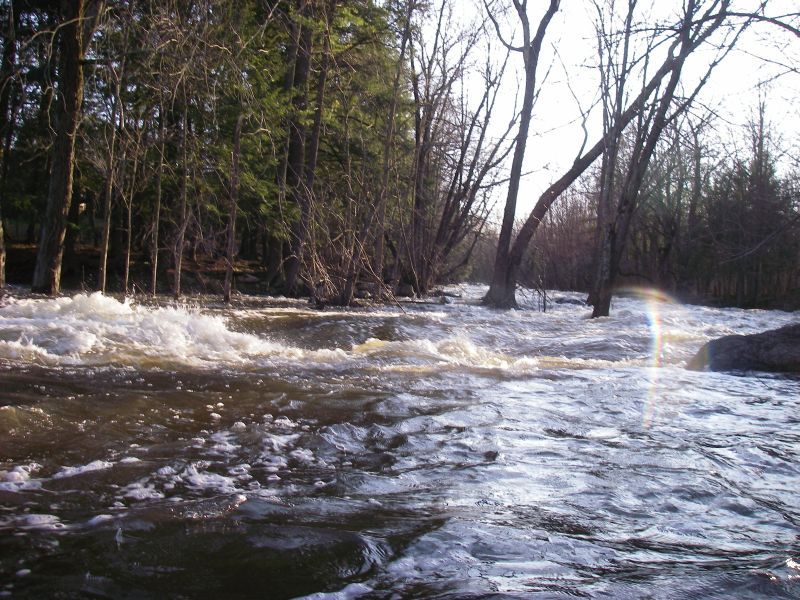
I would say that 5 ft would be on the lower end runnable. This is based on a run that was at about 6ft. I attached 2 photos of the hwy 97 bridge at about this level. It ain't a great visual gauge pic, but it was runnable at that level. We only ran hwy 97 to the takeout.
Ran again at 9.6ft (the peak flow) after a rain storm. Because of the location of the gauge downstream in a low gradient section (marshland) It would be wise to run this when the gauge is rising fastest.
Seeing as this is a new gauge, I suggest if you make a run at any other level to comment on it so the runnable range can be accurate with the gauge reading.
Ran at 8.5ft but with a +.02ft/hr rise and the level was considerable higher than the flow for 9.5ft. with 0.0 ft/hr.
Ran this a 2890 cfs and falling, below 97 was huge. Know what you are doing at this level. The 1st rapid after the railroad put in was also great at this level. Even though the gauge reading indicated only 300 cfs less than the peak flow the banks showed a level 1 to 2 feet higher. Again indicating that his stretch should be run while the gauge is rising.
Feel free to email me if you are running this, it is a personal favorite.
Apr 12, 2011
Did this at a higher flow, was a blast
Jul 24, 2010
There was 3in of rain the week before and then another 1+ the following so we hit this the day after the rain.
Jul 17, 2010
Forgot my camera
Apr 2, 2009
hwy 97 putin visual