Mineral Springs Creek
S.Ravine St. to S.Milwaukee St. (0.5 mile)
Nov 27, 2017
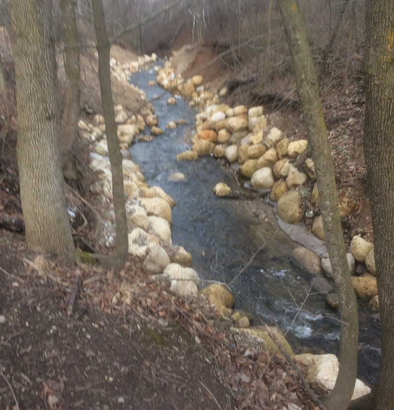
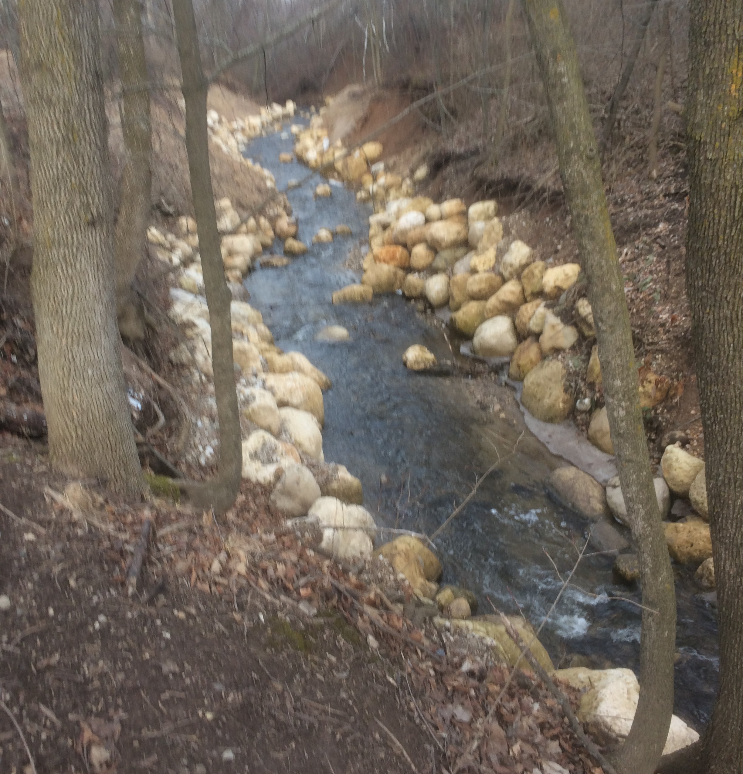
The 5' dam which had been on this micro-creek has been removed (as of winter, 2016/2017). The (likely to be covered at 'boatable' flows) lower stream banks have been lined with large boulders, with burlap pegged into dirt higher up (to minimize erosion while awaiting vegetation becoming established).
Nov 27, 2017
The 5' dam which had been on this micro-creek has been removed (as of winter, 2016/2017). The (likely to be covered at 'boatable' flows) lower stream banks have been lined with large boulders, with burlap pegged into dirt higher up (to minimize erosion while awaiting vegetation becoming established).
Feb 23, 2017
Removal of a 4-5' dam at this location of this tiny stream involved lining the banks with boulders (in attempt to stabilize the steep banks).
Feb 23, 2017
The 5' dam which had been on this micro-creek has been removed (as of winter, 2016/2017). The (likely to be covered at 'boatable' flows) lower stream banks have been lined with large boulders, with burlap pegged into dirt higher up (to minimize erosion while awaiting vegetation becoming established).
Jan 1, 1900
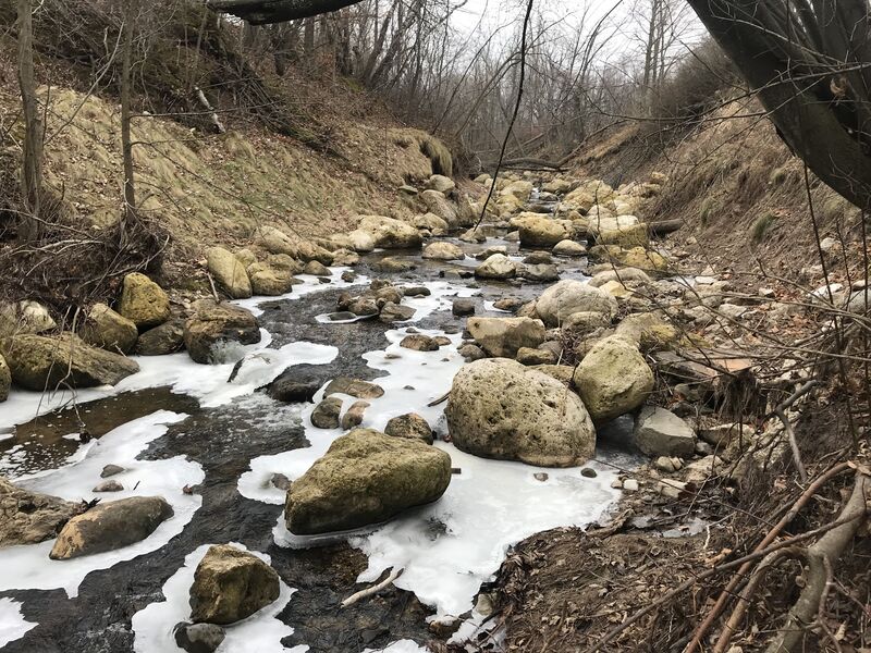
Large rocks (which had been intended as 'shoreline stabilization') lie rather randomly in the streambed. At some high flow, this could be navigable, but at most times these will provide major piton opportunities!
Jan 1, 1900
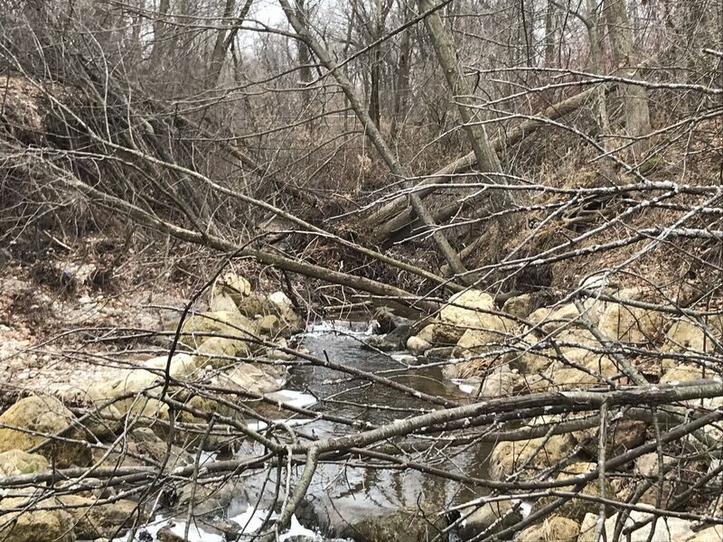
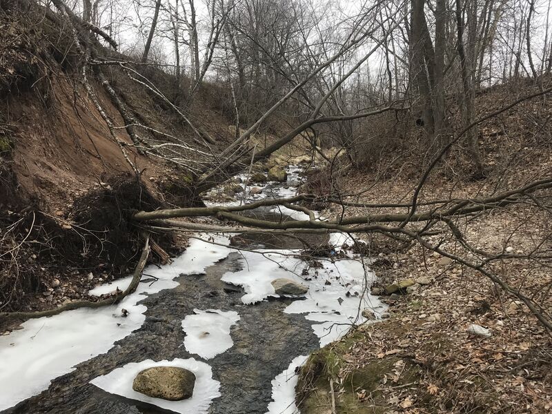
Just downstream of S.Ravine Street there is a MAJOR BLOCKAGE, consisting of large trees which have slid into the stream as the banks have collapsed.
Jan 1, 1900
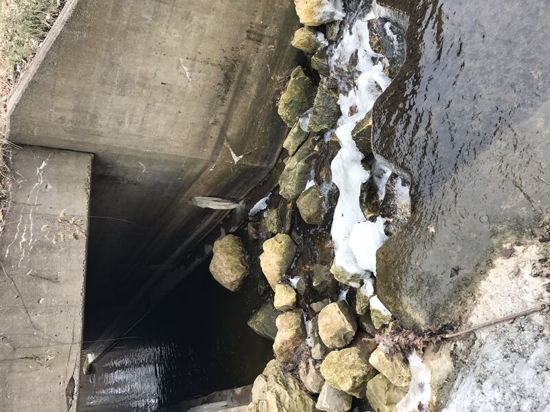
There is a cement and iron 'ledge' immediately before entering the culvert for S.Ravine Street. Unfortunately, there is a heap of quarried rock in the landing area. Perhaps with enough flow these may be covered, but more likely they will be barely under (or not even covered by) the water, waiting to rake the bottom of your boat.
Jan 1, 1900
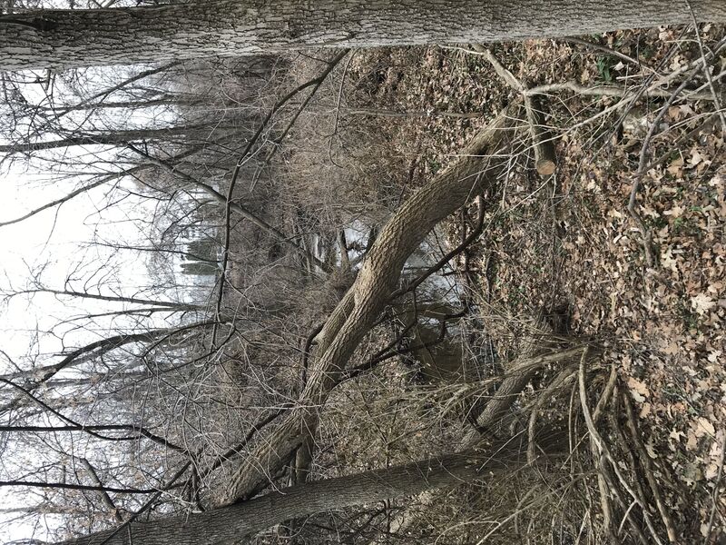
Upstream of S.Ravine Street the creek is an absolute nightmare of fallen trees blocking passage on the stream.
Jan 1, 1900
Downstream of the former dam site (and 'shoreline stabilization' rocks), more deadfall awaits.