Elkhorn Creek
Forks of Elkhorn, Church lot below US460 Bridge to Knight's Bridge on KY1900 (6 miles)(Elkhorn Gorge)
December 8, 2007
| Reporter | chris stoops |
At 2000 CFS it is allot more pushy; filled with lots more and bigger rapids, and 2 things I didn't normally see were waves throughout almost the whole trip (even in the woods sometimes), and big whirlpools behind the bridge pillars. At 2000 CFS I thought portaging the dam was simple, and I watched two guys in a canoe do it quite simply, but I also watched the canoe sink after S-turn's insane rapids. I saw plenty of canoes make it past S-turn just fine, but they all had extra flotation in their canoes.
I think the minimum posted CFS of 500 is the perfect minimum, because I live in Louisville 50 miles away, and I am not driving out there unless it's at least 500 CFS and I’m really bored that day. At 500 CFS there were 4 hydraulics total (none capable of holding a raft), the surf section wasn't really in at all and it was almost a scrape in are rafts. We were able to portage on the island and walk up to the other rapid on the other side, which is this big drop. We re-ran it over and over, and my brother even ran it sitting on a giant log. When we ran this creek at 900 CFS it was completely different; instead of a kiddy park it is actually scary sometimes.
WARNING: S-Turn can be dangerous:
At 900 CFS the top of S-turn on the left; there was a 15 foot long sideways wave(it wasn't from left to right, take a normal rapid and turn it 90 degrees so that it runs from the top of the slope 15 feet all the way to the bottom of the slope) that goes in to a giant 3 foot tall mound, and my brother would disappear behind it for a couple of seconds the drop was so big(about 4-5 feet). Then there was another 2 foot tall mound right after it, and every time I ran the second one it threw me in to the island where the creek forked. One kayaker I saw got tipped over because of the sideways wave, and that section washed up on a very shallow area in both directions, but he climbed out just in the nick of time. I realized how dangerous the creek can be and still headed no warning. I go to jump in my raft and miss, even with a life jacket on I was swept to the very bottom of the creek and held there for many seconds, heading for the huge mound. I thought maybe a huge boulder was there and it was going to smash my head, and so I punched the creek with both my fists, skin scraping off my knuckles, I flew to the surface and my raft was right in front of me. I jumped in it with the quickness right before the 15 foot long sideways little curler wave. There are no mounds at all at 500 CFS. There is no 15 foot long sideways wave at 700 CFS, but the 2 large mounds are there. I think that they are only formed as a wavetrain, and I don't think a huge boulder is there anymore, because of what I have seen at 500 CFS: nothing.
At 2000 CFS S-Turn is allot more dangerous because of how much water is flowing over the island where the creek forks. I saw a kayaker get hurt and he even carried out. He got pinned on the island, then went left, and then fell and got all banged up. S-turn is very shallow, rocky, and pushy if you go left. Also where it forks it washes up on an island very hard at 2000 CFS, and pretty hard still at 900 CFS. At 2000 CFS I recommend running the right side where I found 4 back to back large hydraulics, and you won't have to worry about that island. The 15 foot long sideways wave was much larger and more powerfull at this level and it almost tipped my brother's raft. The two large mounds also greatly grew in size and even had big whitecaps on top of them.
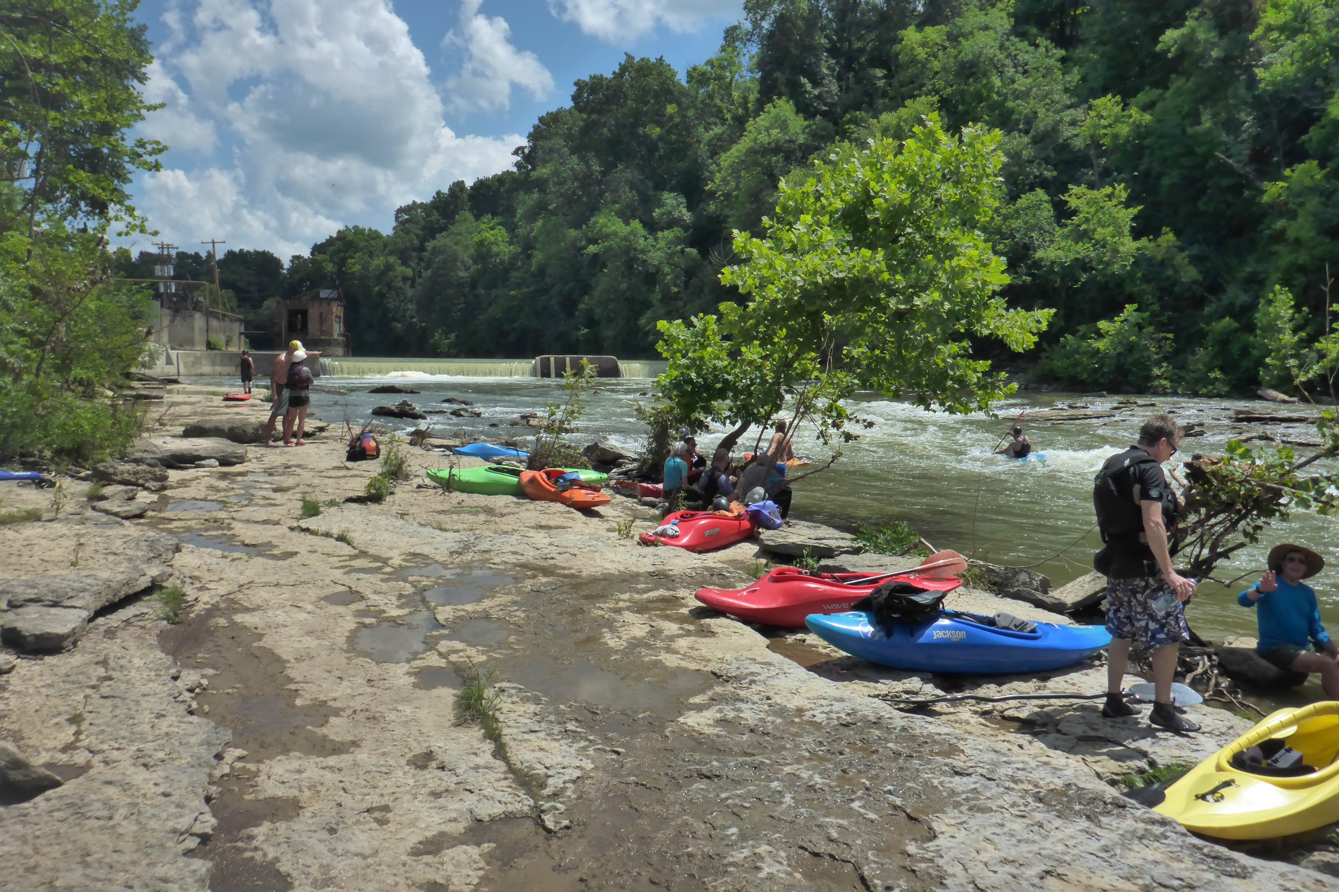
The whole entire S-turn rapid is re-runnable at 2200 CFS, and there is two different eddies you can catch on the left to do this. There is an awesome limestone ledge that we walk along, and we have spent hours and hours re-running this rapid, because it's so fun and convenient to re-run (in a raft). I have seen kayakers re-run it also.
I love this creek because of it's watershed:
South fork: 179 square miles
North fork: 276 square miles
Elkhorn: 38 square miles (only about 10 would apply to the gorge section).
So that's a total of 465 square miles of watershed that contributes to the gorge section of Elkhorn. Another reason I love this creek is because it has a good lag time; after it rains all night it's ready to run the next day even in the late afternoon.